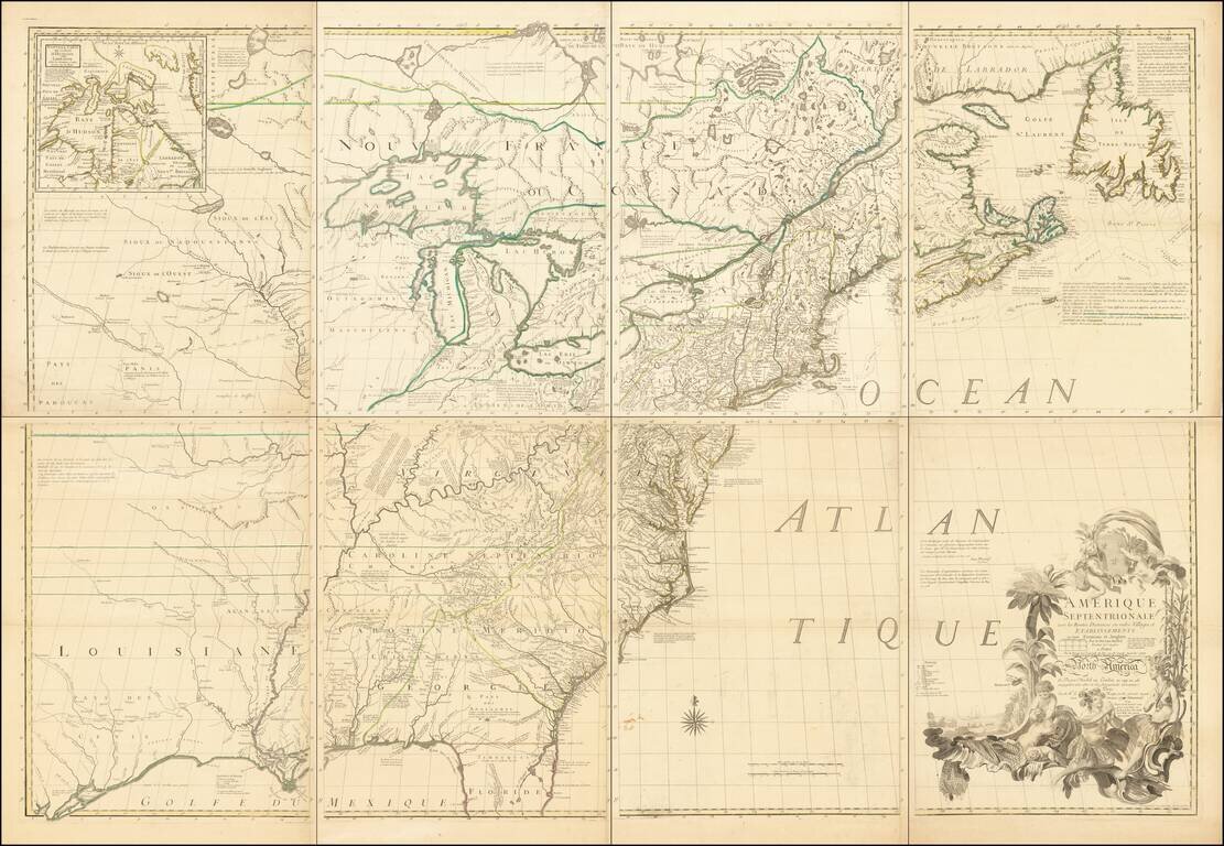
The Most Important American Map of the 18th Century Fine example of the French edition of Mitchell's seminal map of the Eastern part of North America. Mitchell's is regarded as perhaps the single most important American map of the 18th Century, and...
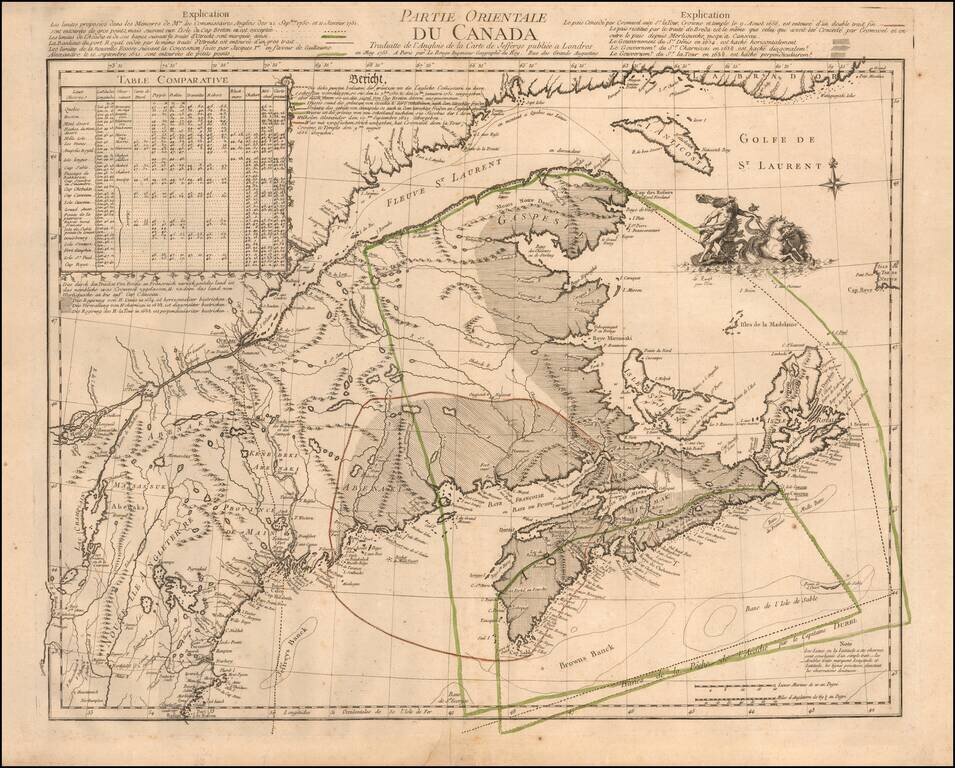
The French and British Historical Claims to Territory in the Canadian Maritimes and Maine, published in Paris on the eve of the Seven Years' War (1756-63). This truly fascinating and historically important map details the Acadia Boundary Dispute...
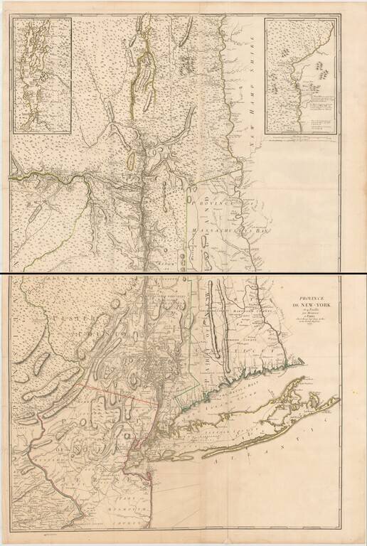
The Most Important Map of The British Colony of New York on the Eve of the American Revolution, With Revisions Added By The French For Use During the American Revolution. Fine example of the George Louis Le Rouge edition of John Montressor's...
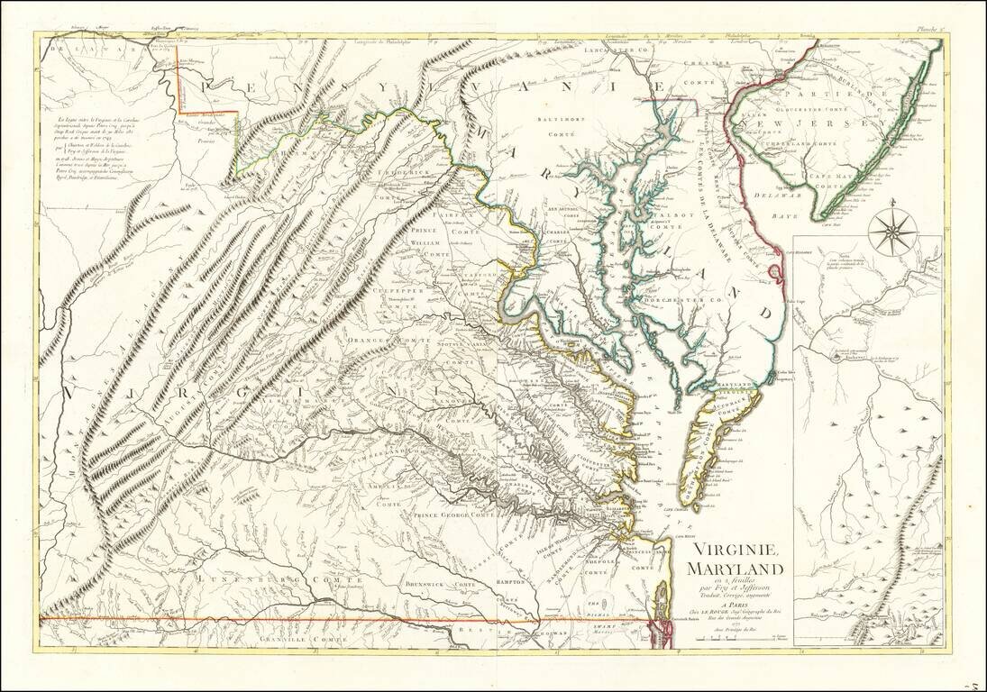
Rare Revolutionary War period map of Virginia & Maryland, published by Le Rouge. Le Rouge's 2 sheet edition is based upon the Fry Jefferson map, but covers only Virginia, Maryland & Delaware, plus the southern portions of New Jersey and...
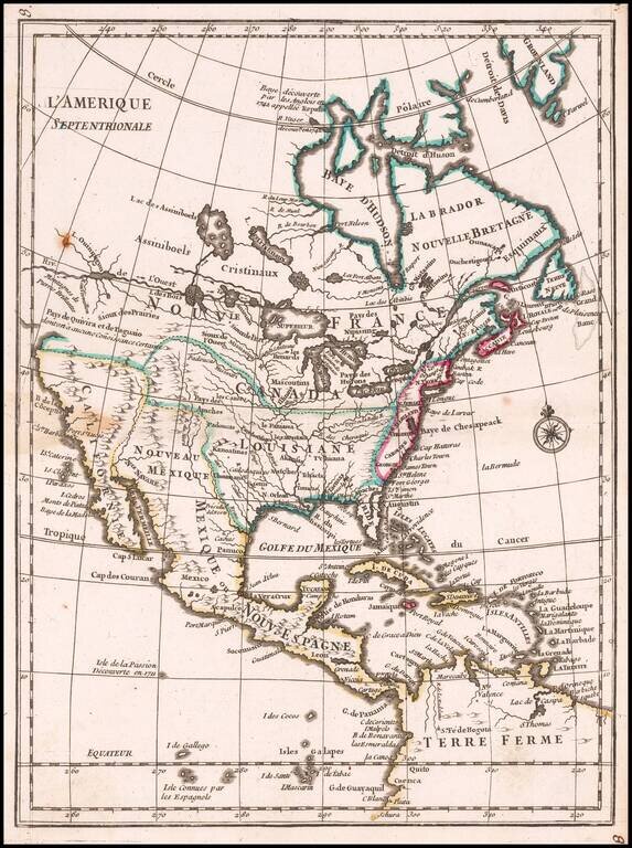
Scarce map of North America, with an early example of the Bay of the West from Le Rouge's Atlas nouveau portatif à l'usage des militaires et du voyageur, published in Paris in 1748. The map shows both the Bay of the West and River connecting Hudson's...
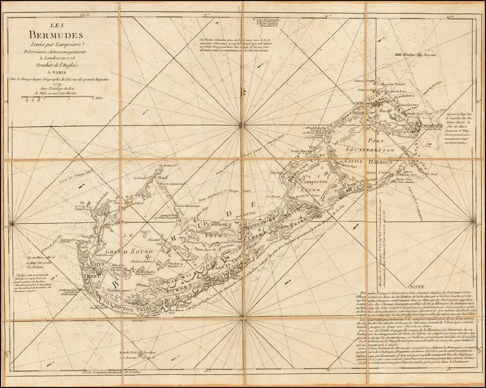
Rare French map of Bermuda, incorporating the surveys of Captain Clement Lempriere (Lempriere's name being spelled incorrectly in the title). Clement Lempriere (1683-1746) published his map of Bermuda in 1738, the first significant cartographic...
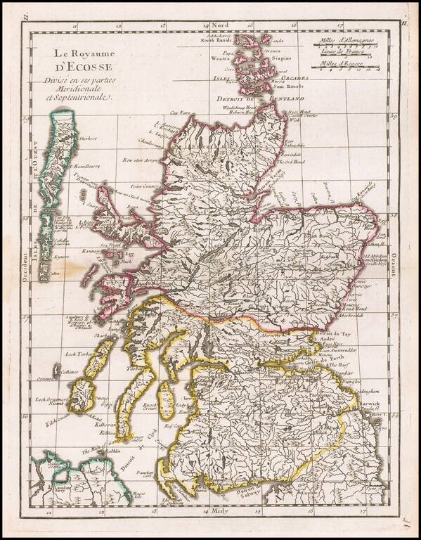
Detailed map of Scotland, showing towns, rivers, lakes, islands, bays, etc. Fine dark impression.
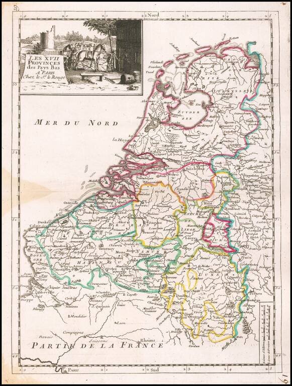
Detailed map of the Low Countries, from Le Rouge's scarce Atlas Nouveau Portatif, published in Paris in 1748.
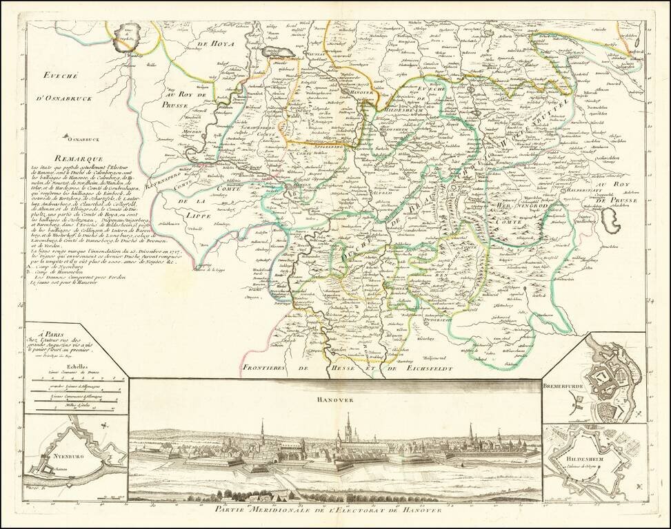
Southern half of this attractive map of the Electorate of Hanover, with a large view of Hanover at the bottom. Includes smaller plans of Nyenburg, Bremerfurde and Hildesheim.
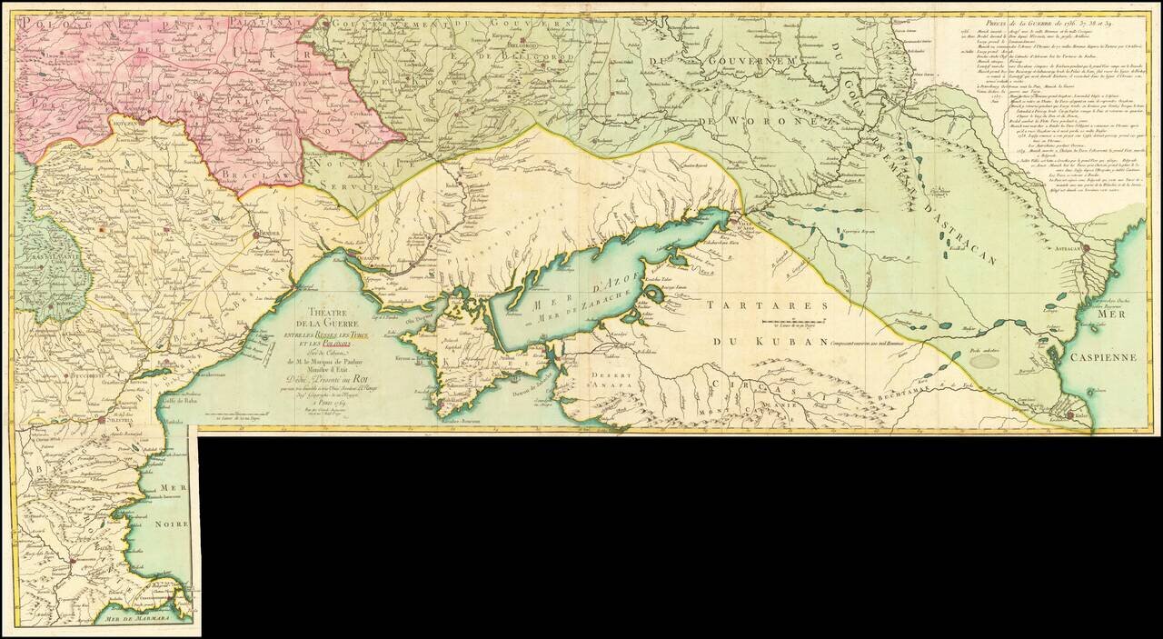
Fine old color example of this rare map illustrating the Theater of Russo-Turkish War (1768-1774). The map emphasizes the territories located on the north and west coasts of the Sea of Azov and the Black Sea and Crimea, namely Bulgaria, Romania,...
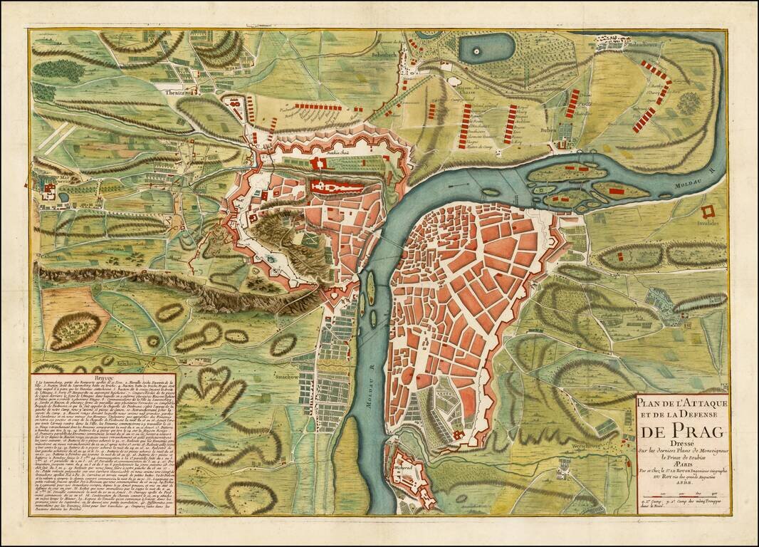
Finely executed battle plan, showing the Siege of Prague in 1742. French forces first under the command of de Broglie were surrounded by a large Austrian army in June 1742. A French relief column forced the Austrians to partially lift the siege in...
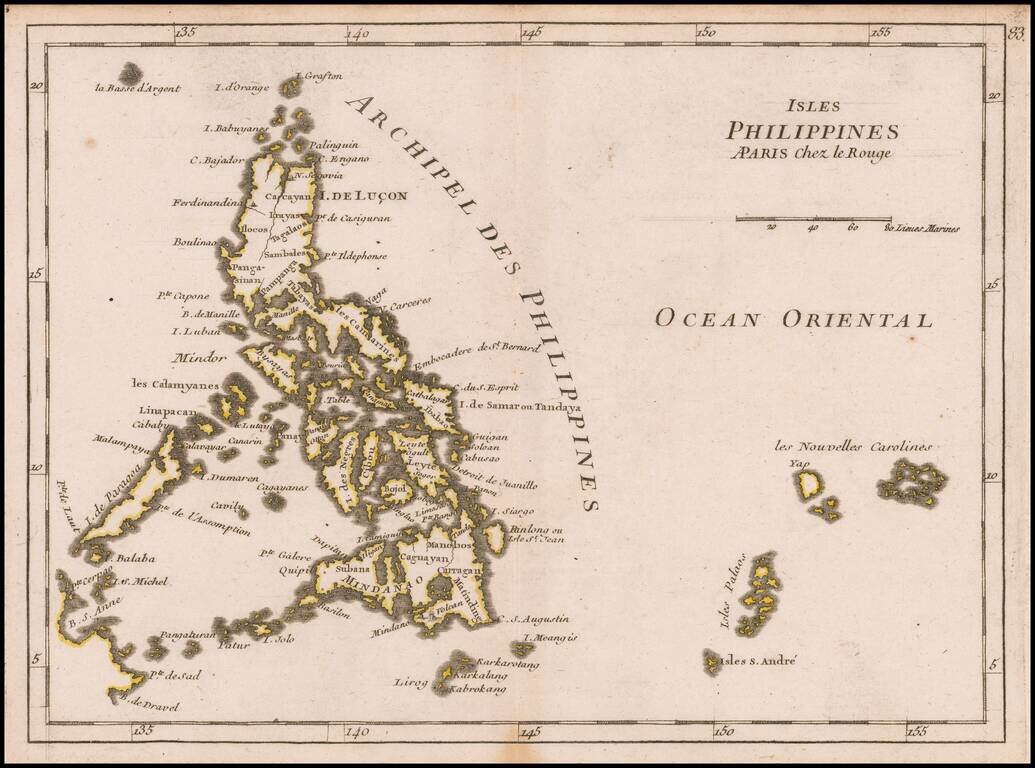
Detailed map the Philippines, from Le Rouge's scarce Atlas Nouveau Portatif, published in Paris in 1748. One of the earliest obtainable separately published maps of the Philippines.