Map size in jpg-format: 77.8336MiB
Click to open in high resolution (open in new tab).
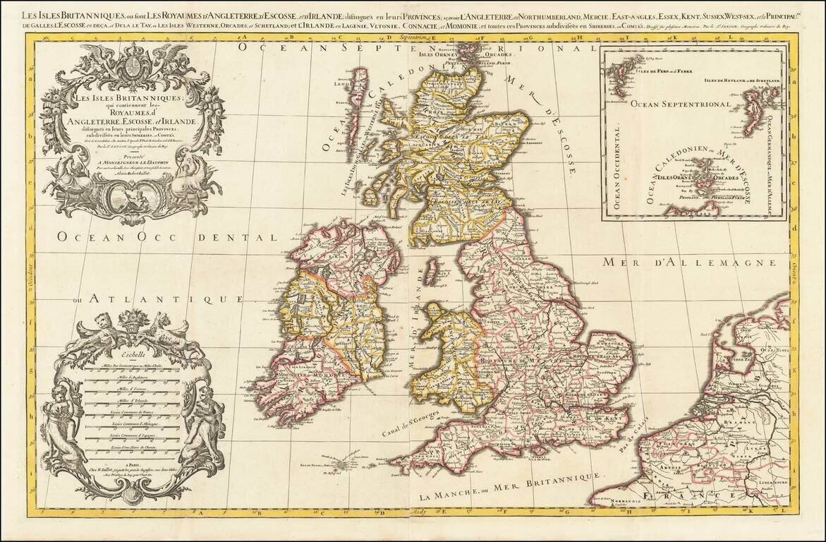
Fine, Detailed Map of the British Isles
Decorative, large-format map of the British Isles by Jaillot.
Portions of France, Belgium, and the Netherlands are included to the east, separated from England by the Pas de Calais. The Western Isles and the Orkneys are off of Scotland, while the Scilly Islands are just west of Cornwall. In the upper right corner is an inset of the Upper Orkneys with the Faroes and Shetlands northwest and northeast respectively.
The British Isles are divided into nations and counties, with towns, cities, and rivers highlighted. Hadrian’s Wall is prominently shown. The wall was built by the Romans in 122 CE to protect their settlements in the south. London and Westminster are marked as close, yet separate cities.
The western portion of the map is filled with decorative elements. In the upper left is an elaborate floral motif flanked by rearing horses. Poseidon is sunning himself in a frame at the base. In the lower left corner is an impressive scale bar characteristic of Jaillot.
If you are a student, write to us in telegram: @antiquemaps and indicate what material you need and for what work you need a map in high detail. We are ready to provide material on special terms. For students only!


