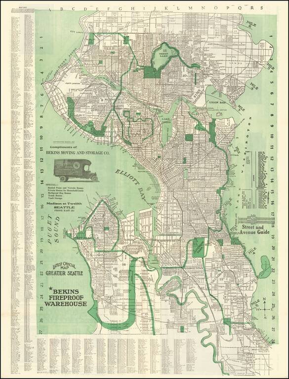
Fine early map of Seattle, originally copyrighted by Kroll in 1913. The map extends north to the City limits beyond Green Lake and east to Lake Washington, with 6 mile radius illustrated from the center point at the Bekins Warehouse. The map includes...
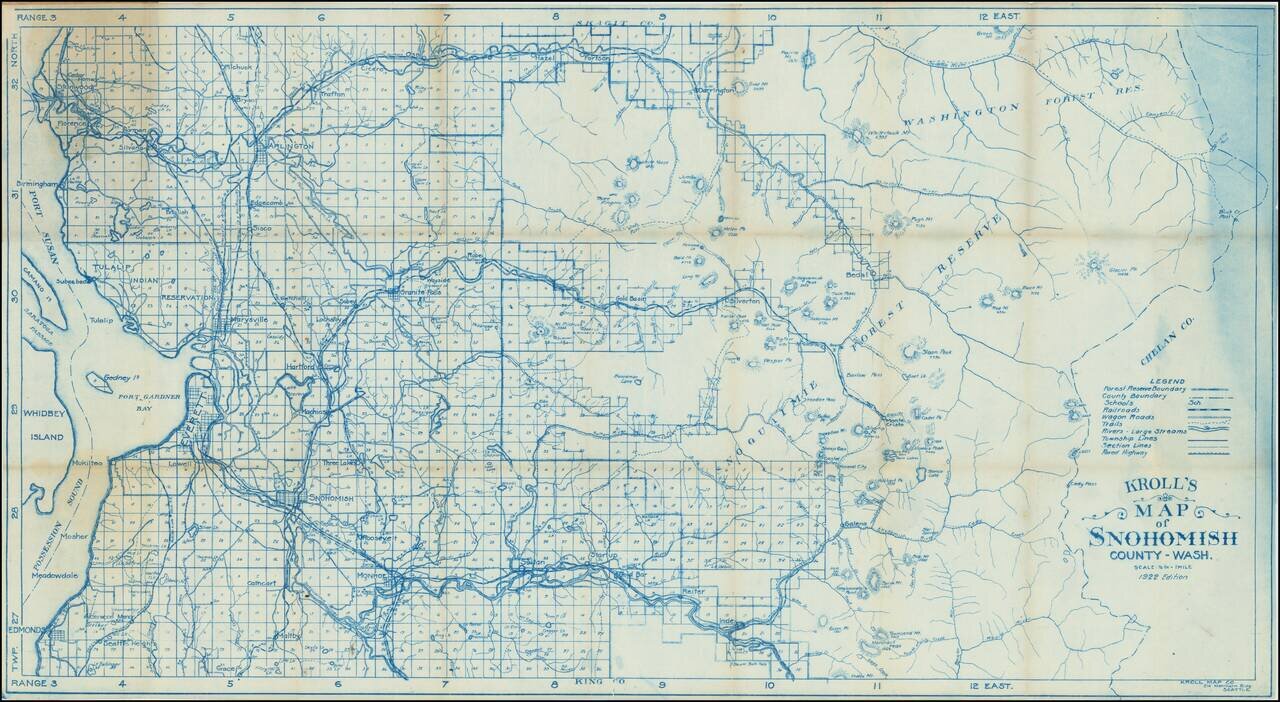
This is a vintage survey map of Snohomish county, stretching in scope from the shores of Puget Sound to the Cascades. Detail is extensive, with rivers, roads, railway lines, lakes, mountains, and more all demarcated. Towns in the region, still small,...
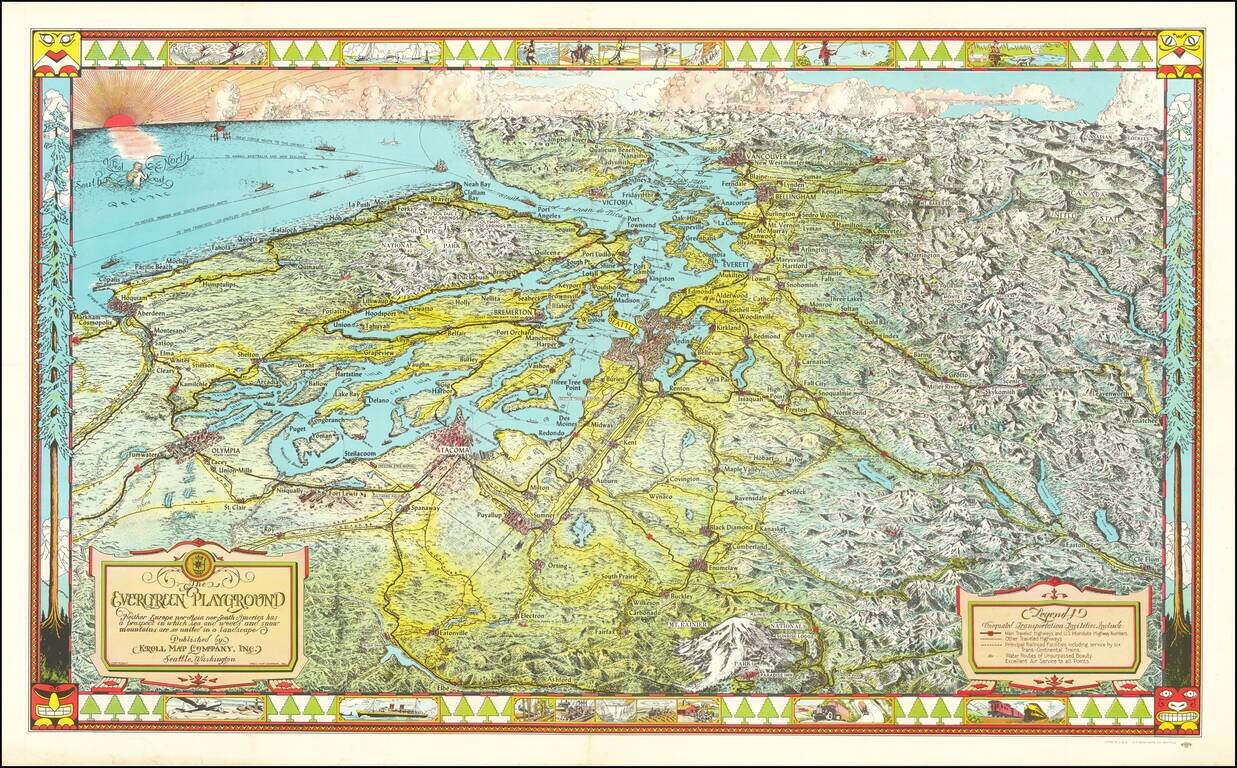
Fine large pictorial map of Puget Sound and the Northwestern Part of Washington State. The Evergreen Playground map was originally drawn during the Great Depression by Ed Poland, cartographer of many years at Kroll Map Company in Seattle, and changed...
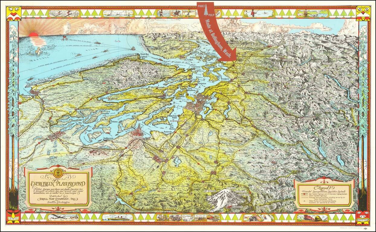
Fine large pictorial map of Puget Sound and the Northwestern Part of Washington State, which was included with a book on the history of paper pulp entitled Making Puget Pulp--A Pictorial Tour of Puget Sound Pulp & Timber's Plant At Bellingham,...