Map size in jpg-format: 21.6154MiB
Click to open in high resolution (open in new tab).
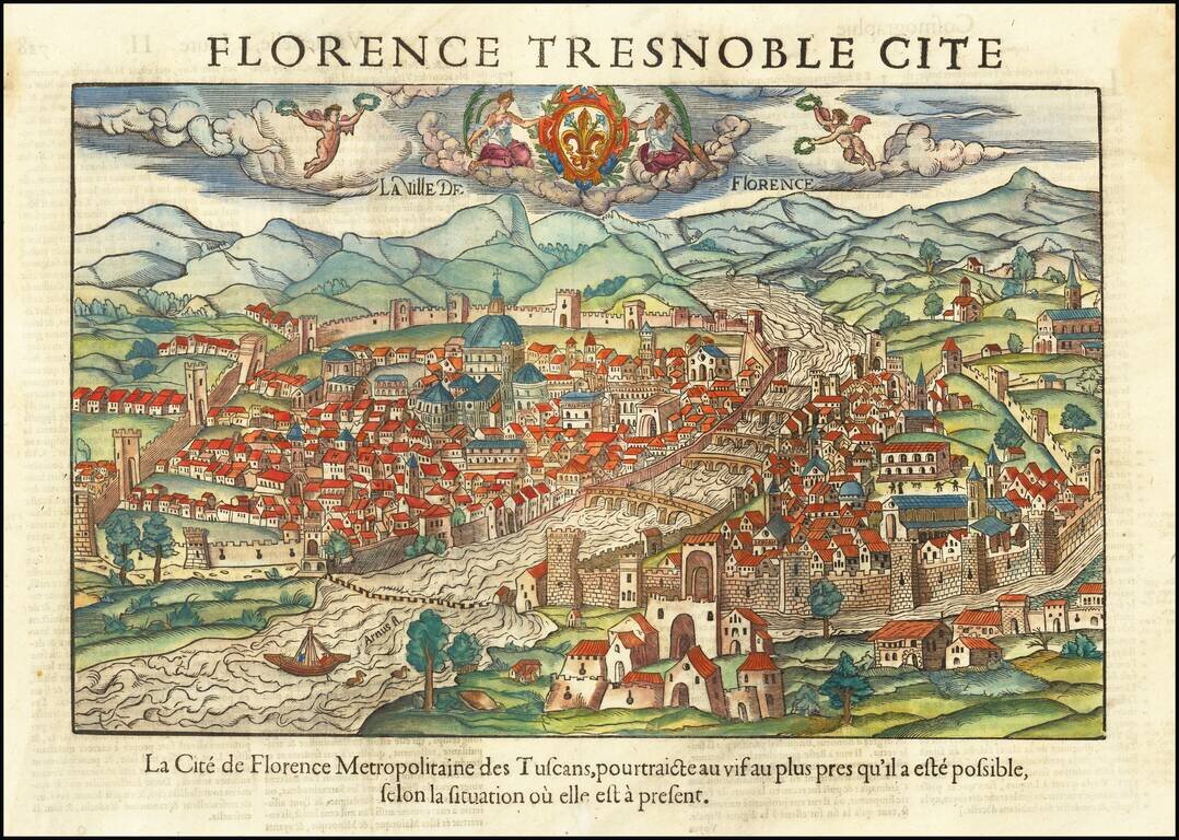
Scarce early plan of Florence, published in Paris by De Belleforest.
In 1544, the scholar and geographer Sebastian Munster published his Cosmographia, one of the most important an influential works of its type in the16th century In 1575, the Paris publisher Francois de Belleforest issued a French edition of the work which included this spectacular woodcut view of Florence.
Rather than reproducing Munster's view, Belleforest compiled and engraved this much larger scale, more detailed and embellished version, based on his own knowledge of the city, its layout and monuments.
One of the best obtainable 16th-century plans of Florence.
If you are a student, write to us in telegram: @antiquemaps and indicate what material you need and for what work you need a map in high detail. We are ready to provide material on special terms. For students only!
![Genua Ligurum domina . . . [and] Florentia urbs est Insignis Hetruariae, olim Fluentia dicta . . . (Genoa & Florence)](/map/small/67437.jpg)