
![L'Europe en Plusierus Cartes Nouvelles et Exactes [bound with] L'Asie en Plusieurs Cartes Nouvelles et Exactes [and] L'Afrique en Plusieurs Cartes Nouvelles et Exactses [and] L'Amerique en Plusieurs Nouvelles et Exactes](/map/small/69477.jpg)
All Maps in Original Outline Hand-Color. A handsome example of the 1683 Dutch pirated edition of Nicholas Sanson's four continental atlases, of Europe, Asia, Africa, and the Americas. These are the books with which Nicholas Sanson started his career...
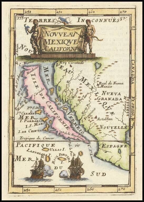
Fine, Distinct Map of the Island of California Striking and exciting map of California as an island, one of the few maps to focus so closely on the California region. First published in Paris in 1683, Mallet’s map is notable because it follows...
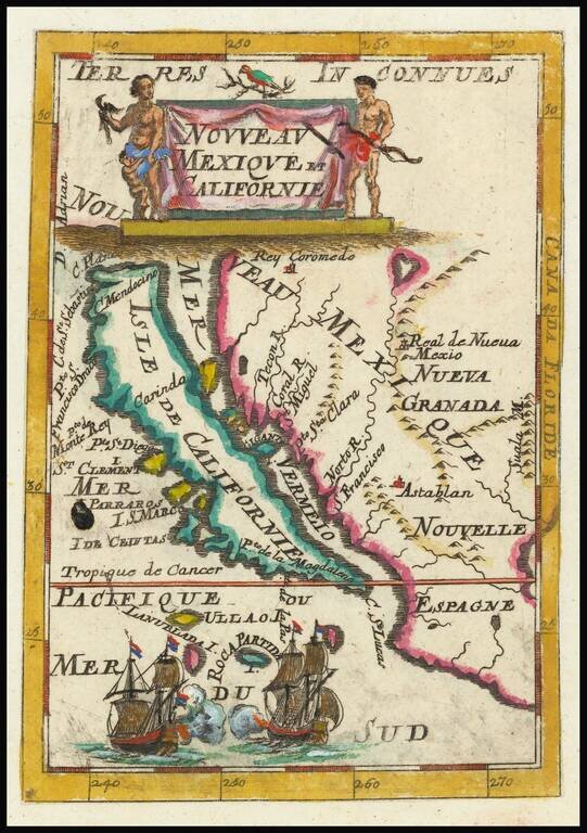
Fine, Distinct Map of the Island of California Striking and exciting map of California as an island, one of the few maps to focus closely on the California region exclusively. First published in Paris in 1683, Mallet’s map is notable because it...
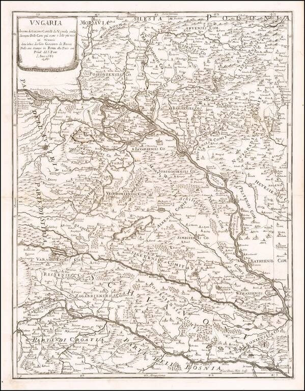
Scarce map of Hungary, Slovenia and part of Croatia and Bosnia, first published by Rossi in 1683. The map extends from the Saw River and Tributaries to the area to the north of the Danube.
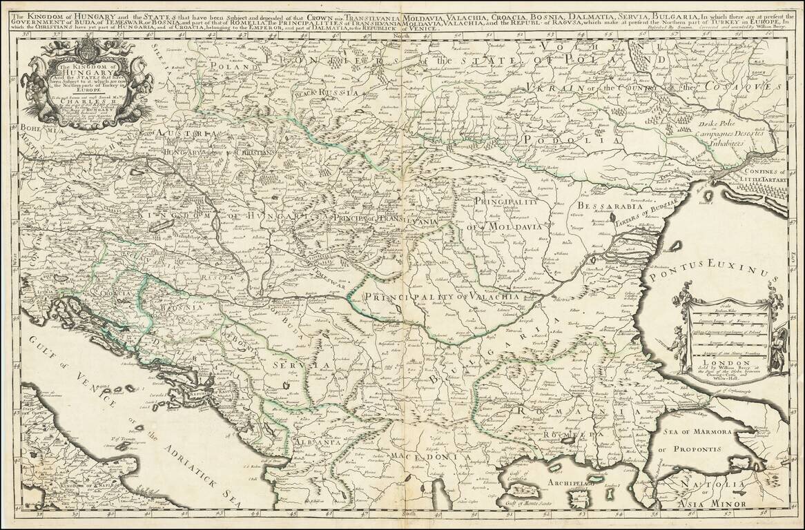
First State, from 1683, the Year of the Siege of Vienna. Rare, large engraved map of southeastern Europe, published by William Berry in London in 1683. The map was published at a pivotal point in the history of the region; in 1683, the Ottoman Empire...

Decorative map of the islands of Lero, Calamo, and Lango. Also shown are Scogli, Lepida, Capra, Caprone, Zechigni and Iali. A number of place names appear on the larger islands. A number of sailing vessels shown in the foreground, etc. From Mallet's...
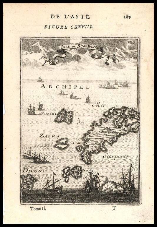
Decorative map of the Greek Islands of Scarpanto and smaller neighboring islands, from Mallet's Description de L'Univers, first published in Paris in 1683.
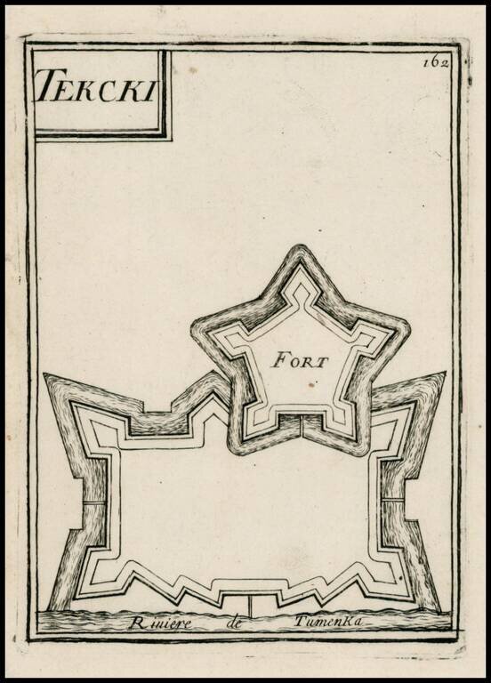
Map of the Terki fortress in the modern day Saratov Oblast, north of the Caspian Sea on the Volga River. From Mallet's monumental Description de l' Univers, first published in Paris in 1683, perhaps the greatest work of its kind in the 17th Century.
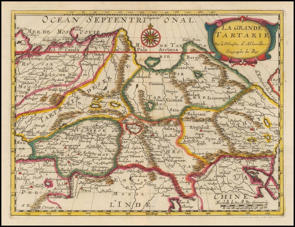
Fine old color example of this fine 17th Century map of Grand Tartaie by Nicolas Sanson. The map extends from the Tartarie Desert and Usbekistan in the west to Corea and Northeastern China.
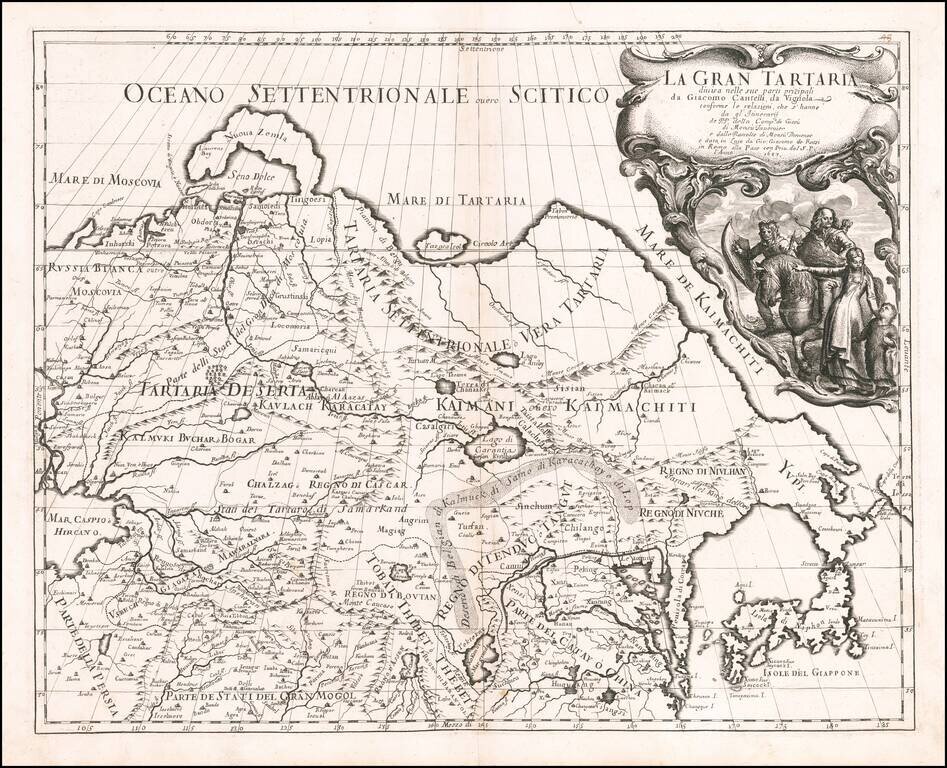
First edition of The Cantelli-Rossi map of Grand Tartary, extending from the Caspian to Japan and the Pacific and from Tibet to the Arctic. The Great Wall is shown, along with the Gobi Desert, Tibet, Korea and elongated peninsula, curiously shaped...
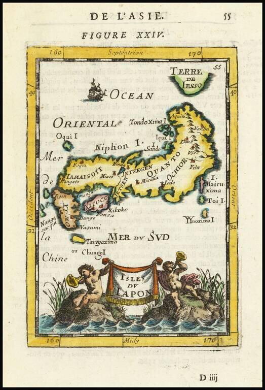
Decorative miniature map of Japan, from the first edition of Mallet's monumental work. Includes decorative cartouche, sailing ships and an early interesting projection of Japan.
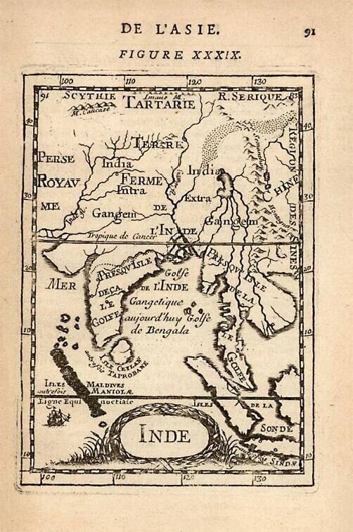
A detailed map of the Indian subcontinent and surrounding islands, also includes portions of Southeast and Central Asia. From Mallet's monumental Description de l' Univers, first published in Paris in 1683, perhaps the greatest work of its kind in the...
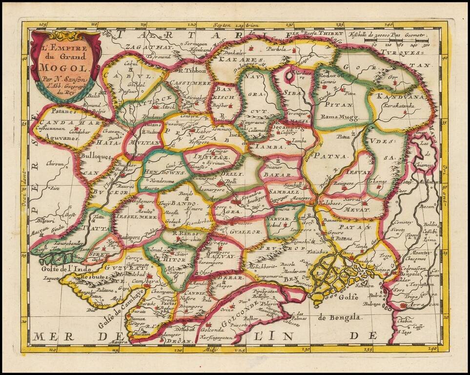
Fine old color example of this fine 17th Century map of India and Central Asia by Nicolas Sanson. The map extends from Persia in the West to Lake Chimay and the Bay of Bengal, with the Himalaya Mountains in the north.
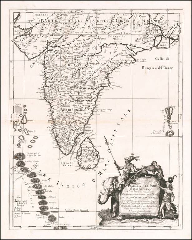
Scarce decorative map India, Ceylon, the Maldives and neighboring regions by Cantelli da Vignola and published in Rome by Rossi. The map provides one of the most detailed and up to date treatments of the region. Includes an ornate cartouche,...