Map size in jpg-format: 704818B
Click to open in high resolution (open in new tab).
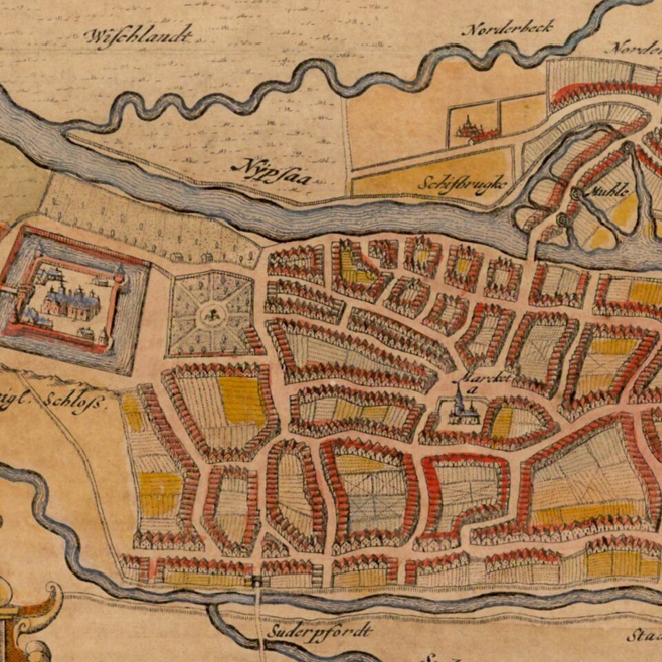
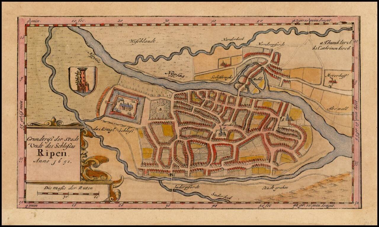
Detailed town plan of Ribe (Ripen) in Denmark, by Johannes Mejer, published in Husum.
Ribe is Denmark's oldest city. Established in the early 8th Century AD, the earliest surviving documents naming the city date to 854. When Ansgar the Archbishop of Hamburg-Bremen, set out on the "Mission to bring Christianity to the North", he made a request in about 860, to King Horik II of Denmark, that the first Scandinavian church be built in Ribe, which was then one of the most important trade cities in Scandinavia. However the presence of a bishop, and thus a cathedral, in Ribe can only be confirmed from the year 948 AD.
Johannes Meier (1606-1674), cartographer from Husum in Schleswig. In the period 1638-1648 he surveyed Schleswig and Holstein. A number of his original maps were reproduced in the book Newe Landesbeschreibung there zwey Herzogthümer Sleswich und Holstein, with text by Caspar Danckwerth.
In 1656 Johannes Blaeu, in Amsterdam, acquired copper plates, and he used them a few years later in his great atlas publications in Latin, French, Dutch, German and Spanish. In Blaeu editions, Johannes Meier's maps were titled in Latin, instead of German.
If you are a student, write to us in telegram: @antiquemaps and indicate what material you need and for what work you need a map in high detail. We are ready to provide material on special terms. For students only!