O. W. Gray was a publishing firm based in Philadelphia. Later, they published as O. W. Gray & Son. They published atlases in the late nineteenth century. Gray's National Atlas was one of the most successful commercial ventures of the 1870s and one of the last to employ hand coloring on maps.
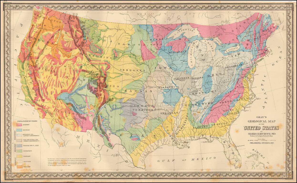
Colorful map of the United States, exhibiting the geological regions, including Ecozoic, Silurian, Devonian and Lower Carboniferous, Coal Measures and Permo-Carboniferous, Triassic and Jurassic, Cretaceous, Tertiary, Alluvium and Volcanic, each coded...
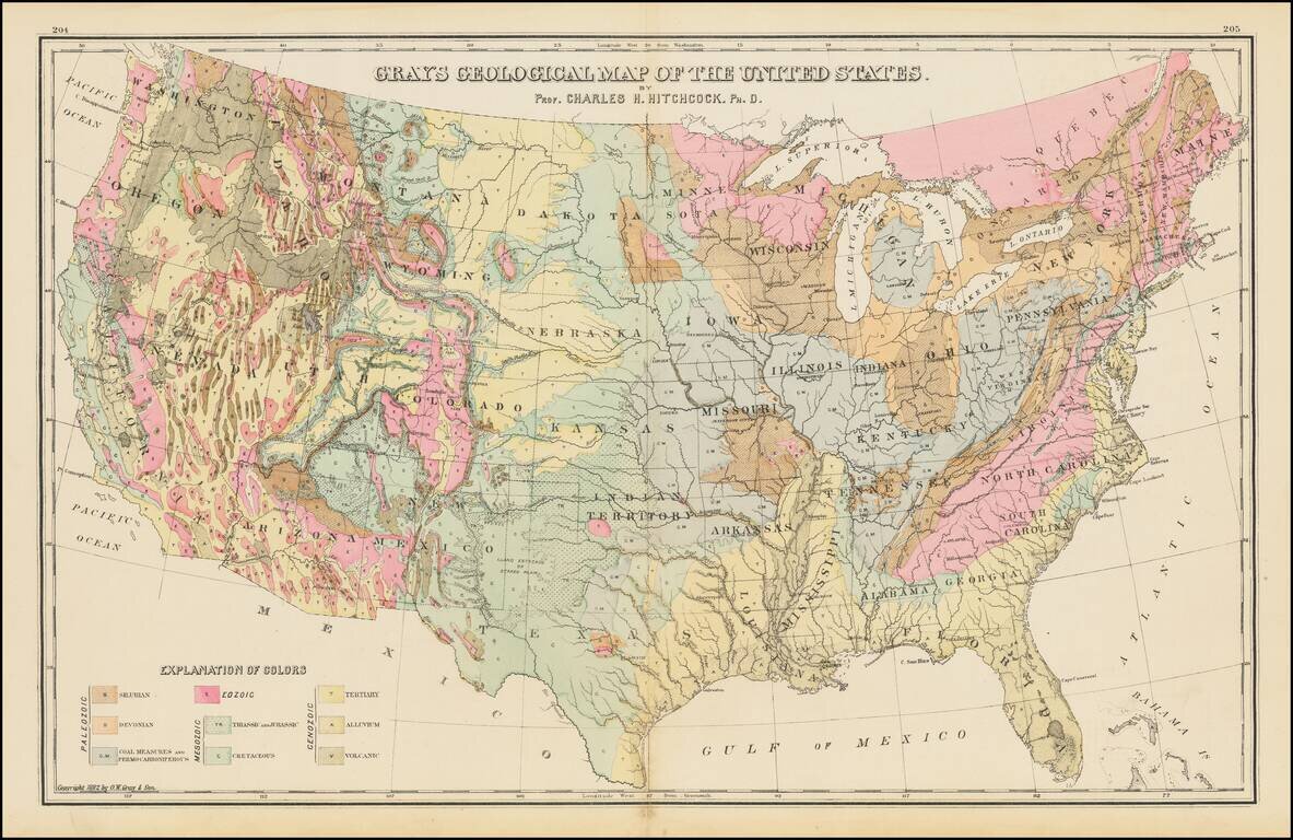
Geological map of the United States, published by O.W. Gray. The map exhibits the geological regions, including Eozoic, Silurian, Deonian and Lower Carboniferous, Coal Measures and Permo-Carboniferous, Triassic and Jurassic, Cretaceous, Tertiary,...
![California and Nevada [Yosemite, Sacremento and SF Vicinity Insets]](/map/small/63484.jpg)
Highly detailed map of California and Nevada, with insets of the Yosemite Valley, Sacramento and SF Bay Vicinity. One of the earliest atlas maps to include an inset map of Yosemite and a plan of Sacramento. Many interesting early details, including...