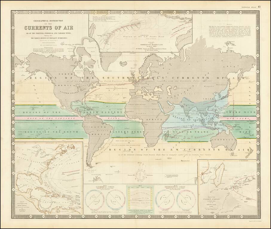
Fascinating map of the world, focused on hurricanes, air currents and other details. At the lower left is a model illustrating Hurricanes in the West Indian regions. At the top center is a model of the Rodriguez Hurricane of April 1843, the lower...
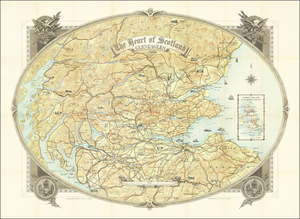
Promoting Gleneagles Hotel & Golf Courses Fine large map of southern Scotland, published to promote Gleneagles Hotel and the London Midland and Scottish Railway, whose emblem appears on the cover, with an inset map of the route of the LMS at the...
![[Northern Nigeria Protectorate]](/map/small/70705.jpg)
A Map Prepared for the British Conquest of Northern Nigeria. Detailed map of Nigeria and vicinity, published by W. and A.K. Johnston for the Intelligence Division, of the War Office (UK). The map is framed by the Niger River, Benue River, and Lake...
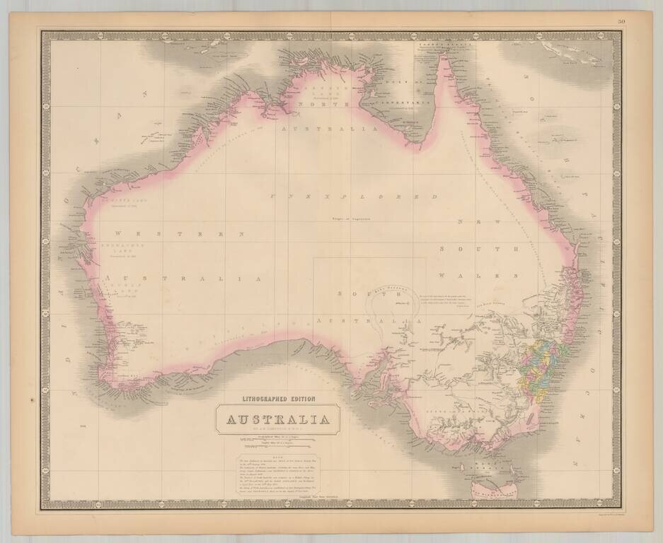
Highly detailed map of Australia. A few early counties shown in NSW and Western Australia. Laken Torens is shown, with other details in South Australia and New South Wales added from prior editions of the map. Includes a key with historical notes on...
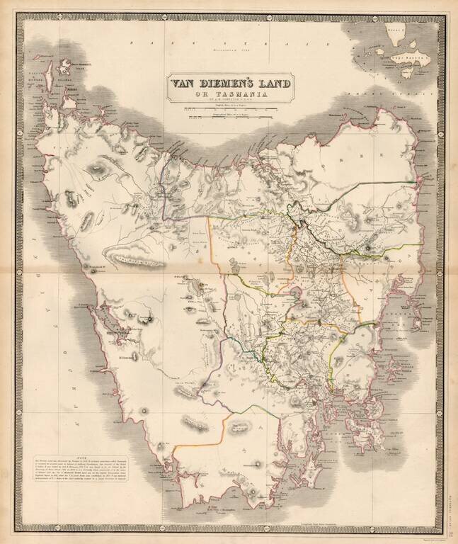
Highly detailed map of Tasmania, including provinces and land owners. Historical notes discuss the discovery of the island in 1642 by Abel Tasman, the remaining of the island to honor Anthony Vandiemen, Cook's visit, the discovery of Bass Strait in...
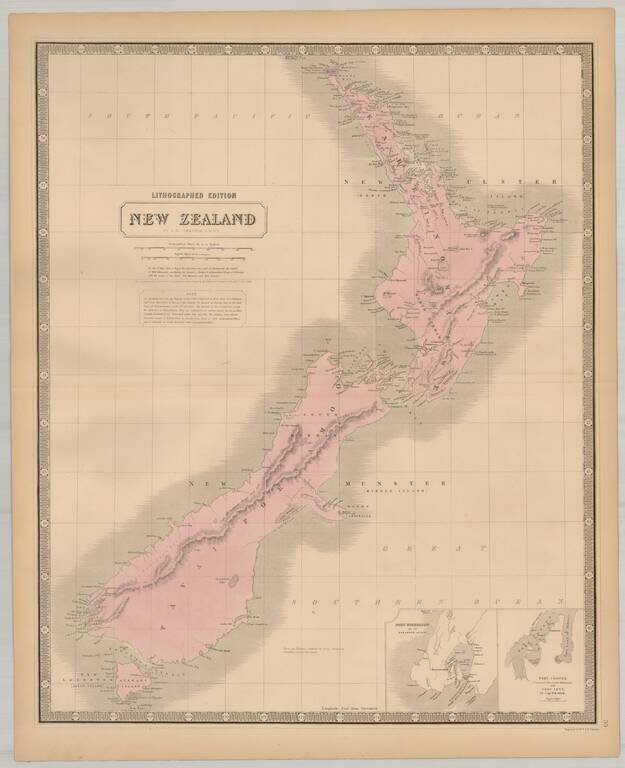
Excellent large map of New Zealand, which is now beginning to include some interior detail. One of the largest maps of New Zealand to appear in a commercial atlas in the 19th Century. Decorative Piano Key border. Fine example, on thick heavy paper.