Polish Propaganda During World War II
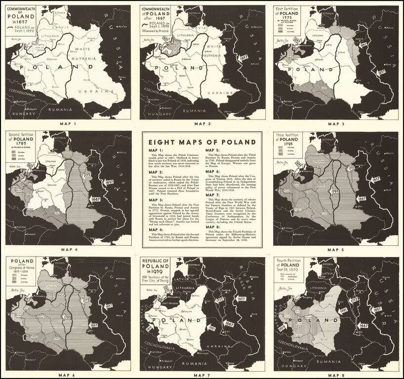
Interesting set of maps of Poland, illustrating the changing boundaries of Poland from 1657 through 1939, with a short explanation explaining each of the maps.
On the verso, a set of 7 images of major Polish...
antiquemaps.ru is sale. 12,000+ superb pieces of vintage collectible printable 300dpi maps - total 300GB high resolution rare and antique old map archive!
antiquemaps.ru website use cookies, local storage and other similar technologies. This is necessary to ensure the full functionality of our services. Using our services and sites after reading this notice means that you have given your consent to their use in your browser. Click "OK" to confirm your agreement