Map size in jpg-format: 1.58082MiB
Click to open in high resolution (open in new tab).
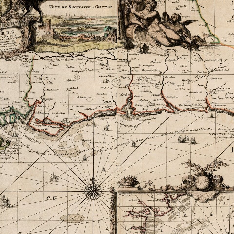
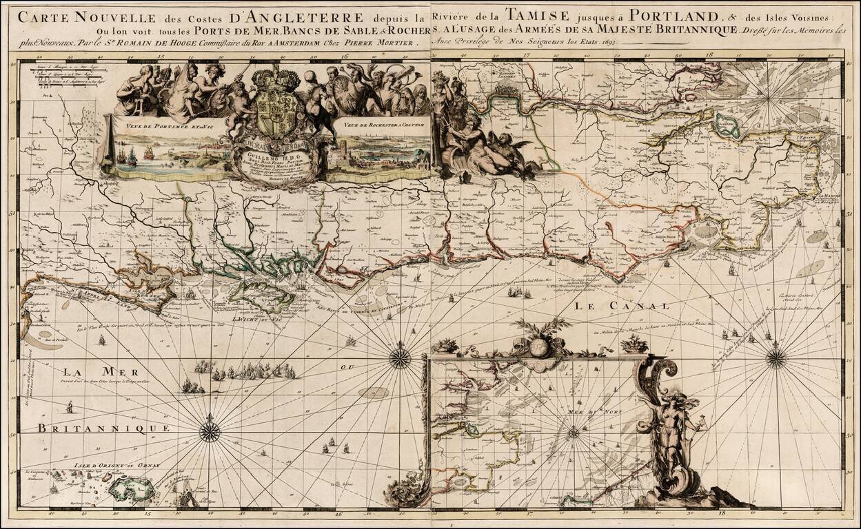
Nice old color example of Romain De Hooghe's regional chart of the southern coast of England, including the Thames and London.
Includes large views of Portsmouth and Chatham.
The chart is richly embellished with rhumblines, compass roses, sailing ships, decorative cartouches and other embellishments. De Hooghe was a famous Dutch Artist, employed by King William III. This is one of a group of 9 charts which he executed and were published by Mortier and which are widely regarded as the most decorative sea charts of the 17th Century.
If you are a student, write to us in telegram: @antiquemaps and indicate what material you need and for what work you need a map in high detail. We are ready to provide material on special terms. For students only!


