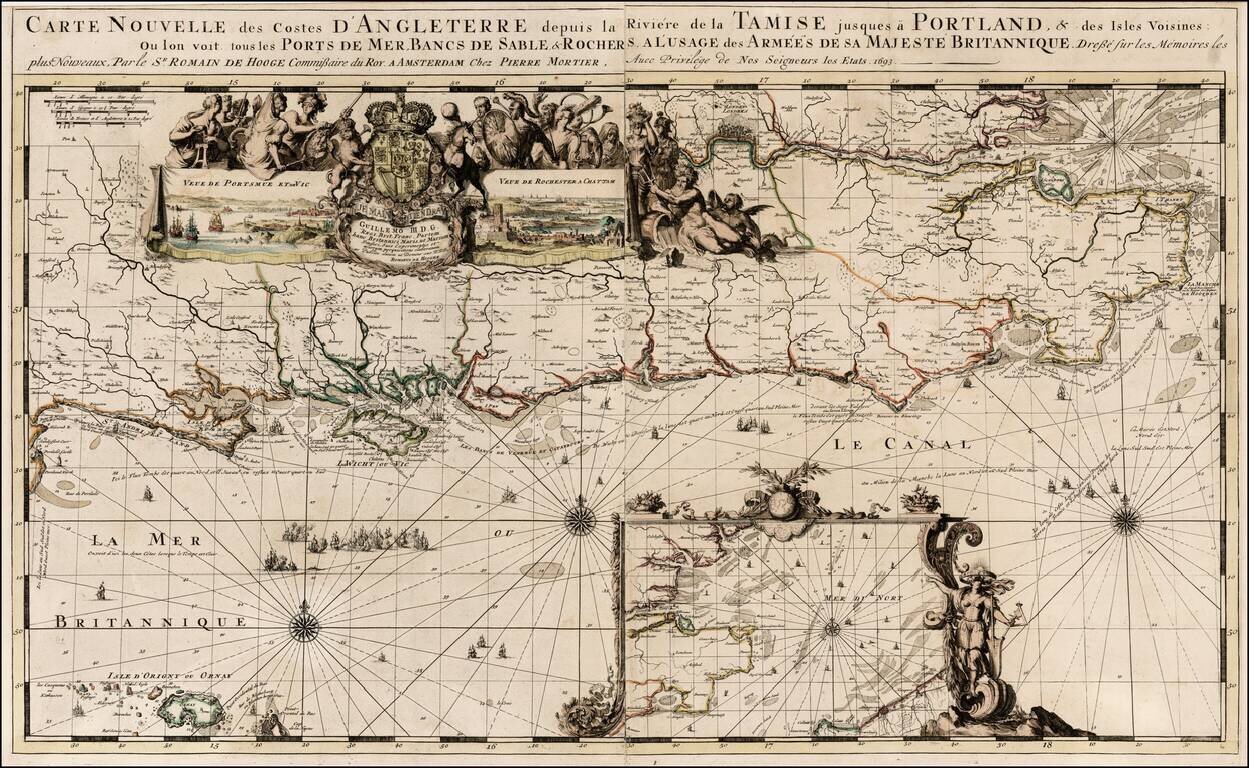
Nice old color example of Romain De Hooghe's regional chart of the southern coast of England, including the Thames and London. Includes large views of Portsmouth and Chatham. The chart is richly embellished with rhumblines, compass roses, sailing...
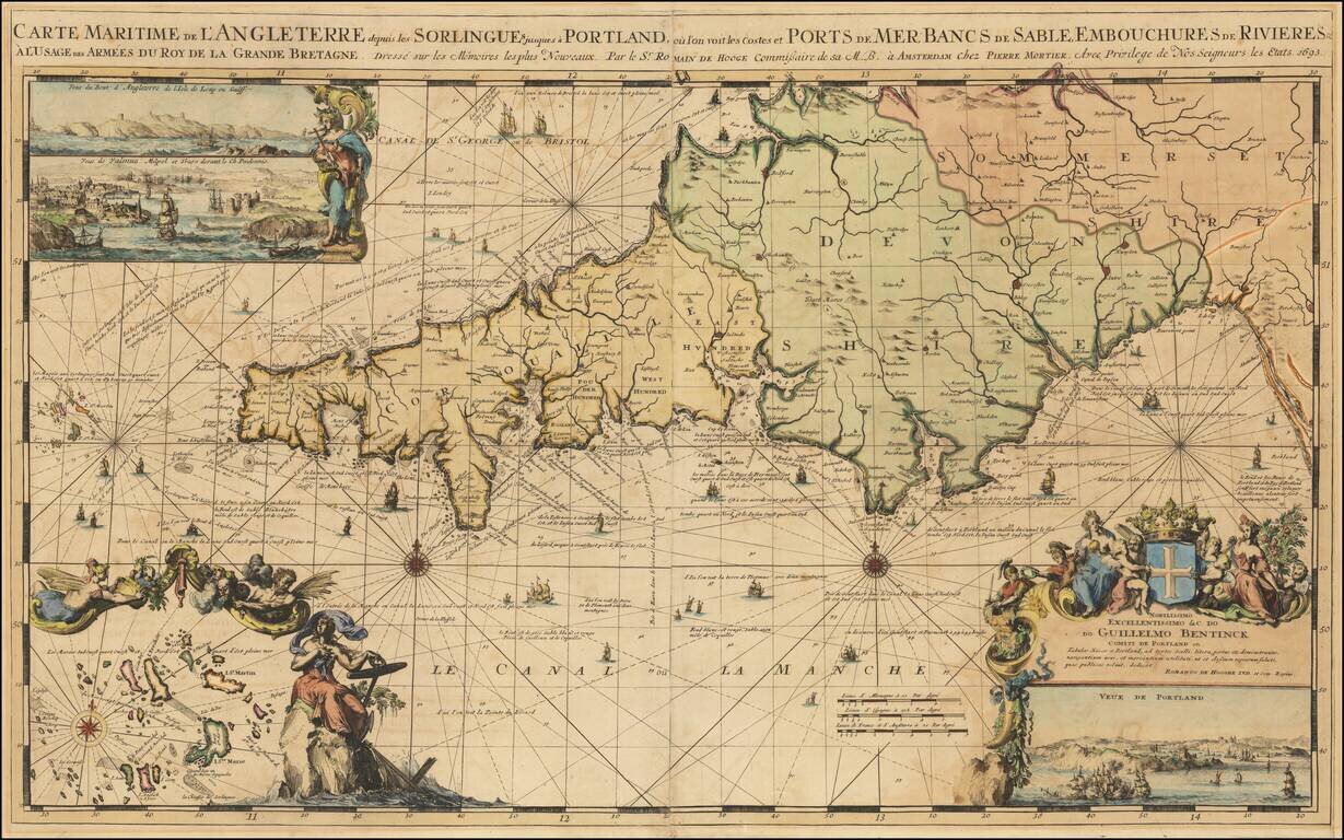
Striking large format map of the southwestern part of England, including Cornwall, Devon and part of Somerset, engraved by Romain De Hooge. The map includes a large view of Portland and two smaller views in the top left corner, an inset of the islands...
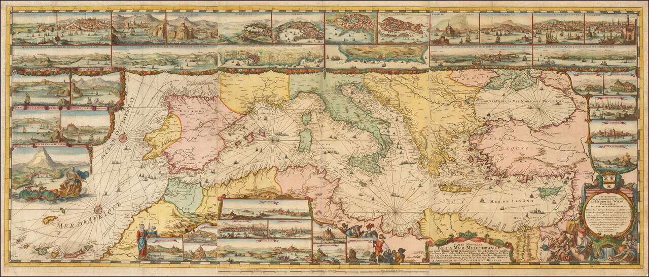
The Most Lavishly Illustrated Map of the Mediterranean of the 17th Century Covens & Mortier edition of Romeyn De Hooghe map of the Mediterranean, embellished with 38 inset maps and views of the major ports and harbors of the Mediterranean. Fine...