Louis Brion de la Tour (ca. 1743-1803) was a French geographer and demographer. Little is known about Louis’ early life, but some glimpses of his professional life survive. He did achieve the title of Ingénieur Géographe du Roi. Much of his work was done in partnership with Louis Charles Desnos, who was bookseller and geographical engineer for globes to the Danish Crown. He worked on the Indicateur fidèle ou guide des voyageurs, qui enseigne toutes les routes royales between 1762 and 1785. During his career he also worked on several atlases. By 1795, he had gained a pension from the National Assembly. Perhaps this pension was granted in part because his son, also Louis Brion de la Tour (1763-1823), was an engraver who made Revolutionary prints, as well as maps.
![Globe Terrestre [and] Globe Celeste](/map/small/62556.jpg)
Attractive pair of engraved globes, illustrating the Terrestrial World and Celestial World. The Terrestrial Globe is oriented to show the Eastern Hemisphere, including a wild mid-18th Century illustration of Australia. The Celestial Globe is oriented...
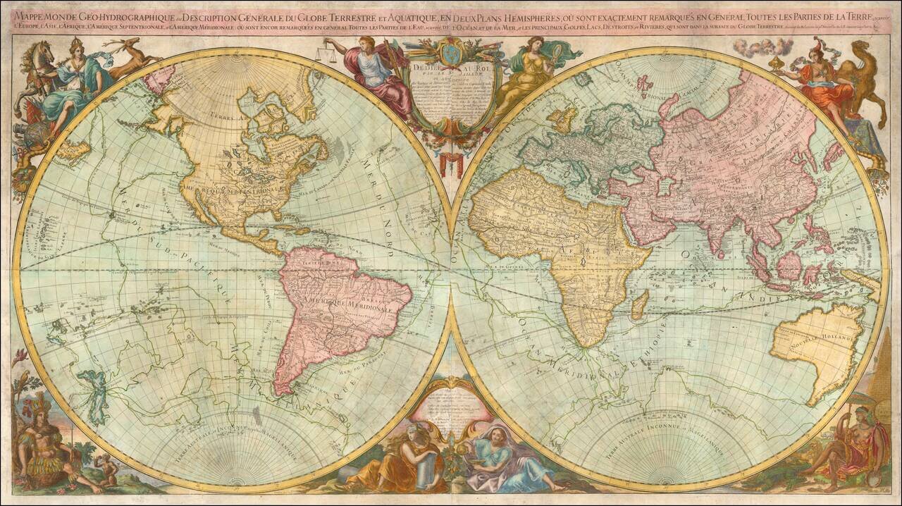
Rare, Double-Hemisphere Wall Map Exhibiting the Recent Discoveries of Captain James Cook Fine, large, double-hemisphere world map, originally published by Alexis-Hubert Jaillot and revised by Louis Brion de La Tour and Louis Charles Desnos, following...
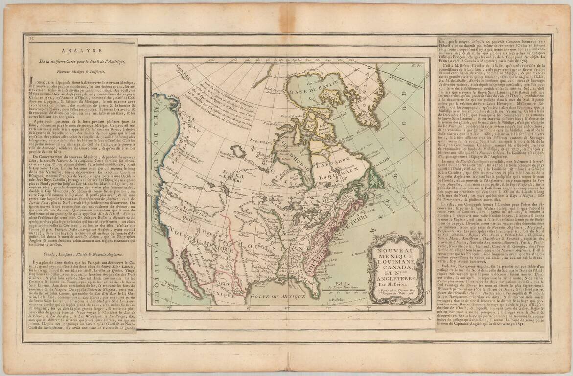
Fine example of the 1766 edition of Brion De La Tour's map of most of North America. A fascinating map of most of North America, exhibiting the extent of discoveries in the Southwest, Alaska and the Arctic Regions. Two long rivers run from California...
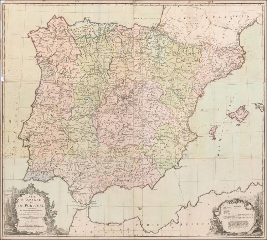
Rare Six-Sheet Postal Map of Spain and Portugal Finely executed map of the Iberian Peninsula, focusing on the postal routes throughout the region. The key at the bottom right identifies the various types of cities, towns and regions, along with...
![Sphere Droite [and] Sphere Parallele](/map/small/18779.jpg)
A striking pair of engraved armillary spheres projecting models of the Solar System, surrounded by a decorative architectural frame, embellished with cherubs and cartographic symbols. Attractive wash colors and illustrations of the signs of the zodiac...