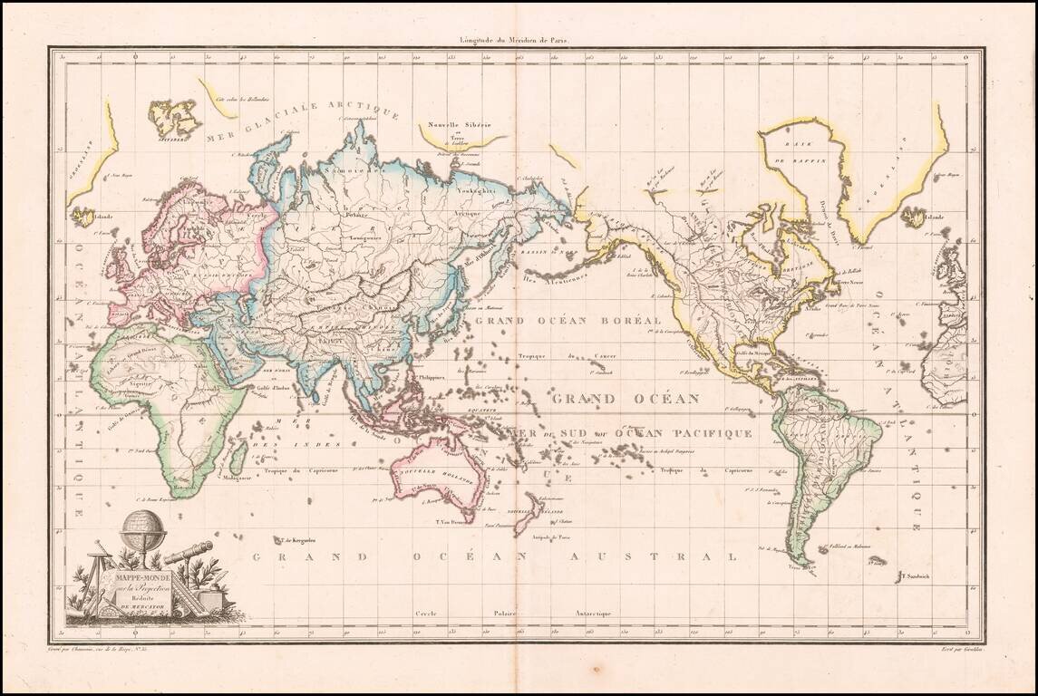
Antique Map of the World on Mercator's Projection Highly detailed large format map of the World, centered on Australia, with the Americas in the east. Antarctica is just beginning to take shape south of Tierra del Fuego, with the naming of Terre de...
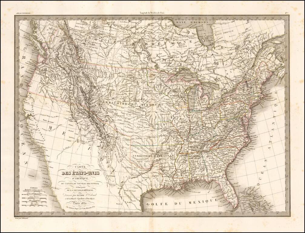
Highly detailed map of the United States from coast to coast. Includes an excellent 54-40 or fight Oregon Territorial Border, terrific post-Lewis & Clark, post-Zebulon Pike view of the Rocky Mountains and excellent treatment of the Southwest and...
![[Republic of Texas] Carte Des Etats-Unis D'Amerique. . . .1838](/map/small/70864.jpg)
An Early Coast To Coast Map of the United States -- Republic of Texas Fine map of the United States from Coast to Coast, also showing the Republic of Texas just two years after its declaration of independence in 1836. During the 1820s to 1840s, the...
![Carte Des Etats-Unis Du Mexique…1838 [Republic of Texas]](/map/small/70909.jpg)
Fine example of Alexandre Emile Lapie's map of the Republic of Texas, New Mexico, Upper California and Mexico. One of the best large format maps of Mexico, Texas and Upper California to appear in a commercial atlas in the 1830s. Texas is clearly...
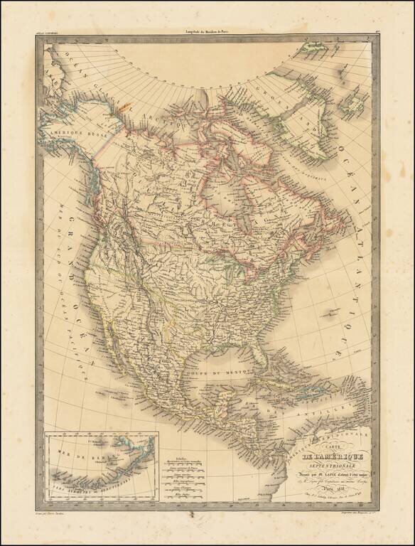
Highly detailed map of North America, with marvelous post Lewis & Clark pre-Fremont cartography. The 54-40 or Fight border of Oregon Territory is shown, with a number of early forts and Hudson Bay Company posts shown in the Northwest. The course...