Melchior Tavernier was a member of a large family involved in the publishing trade in Paris in the early years of the seventeenth century. Early in his career, he apparently collaborated with Henricus Hondius, as at least one of his early maps references Tavernier as the seller of a map engraved in Amsterdam, by Hondius. He is probably best known for his publication of a map of the Post Roads of France, which was copied many times until the end of the century. He also issued an atlas under the same title as J. le Clerc's Theatre Geographique, using many of Le Clerc's maps, but incorporating others from different sources. He published composite atlases and also published works for other cartographers, including N. Sanson, N. Tassin, and P. Bertius. He is not to be confused with his nephew of the same name (1594-1665), who also engraved maps for Nicolas Sanson.
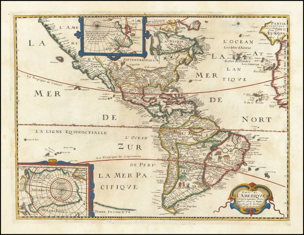
Rare separately published map of America, based upon Jodocus Hondius' map of 1618. The map is a reduced edition of the Bertius/ Tavnernier Map of 1627, without embellishments. A definite northwest coast of America is shown, unlike the Hondius...
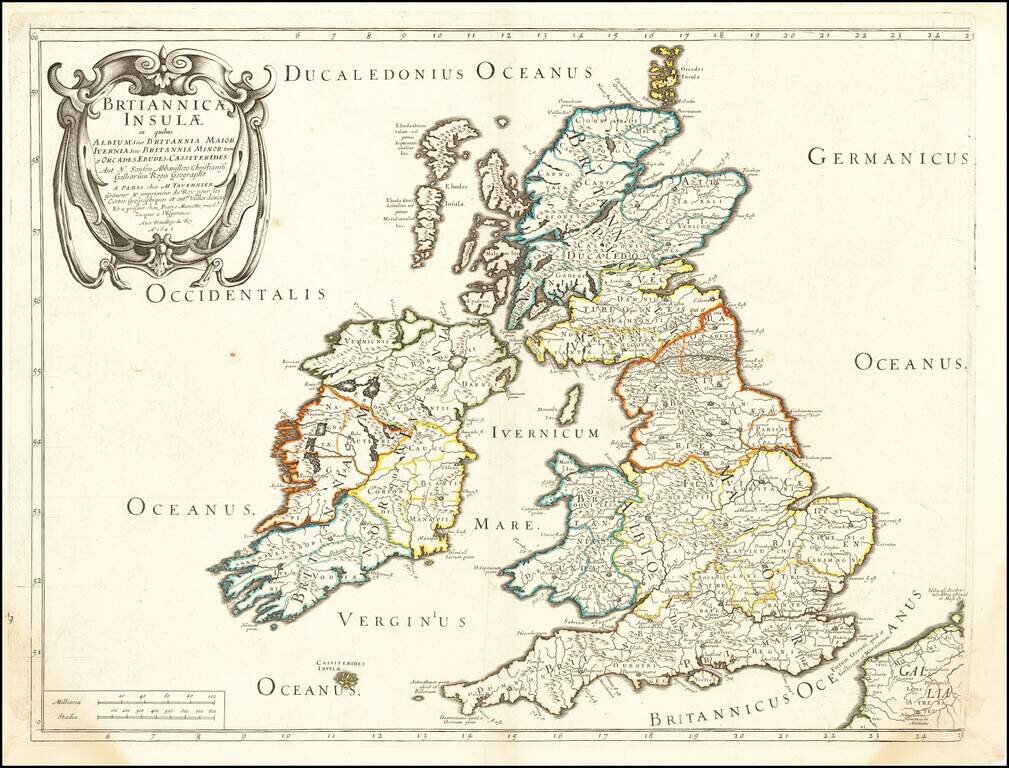
The British Isles in Roman Times Nice example of the Tavernier-Sanson map of the British Isles, published in Paris. The map illustrates the British Isles during the Romano-British Period, prior to the decline of Rome's control over the region.
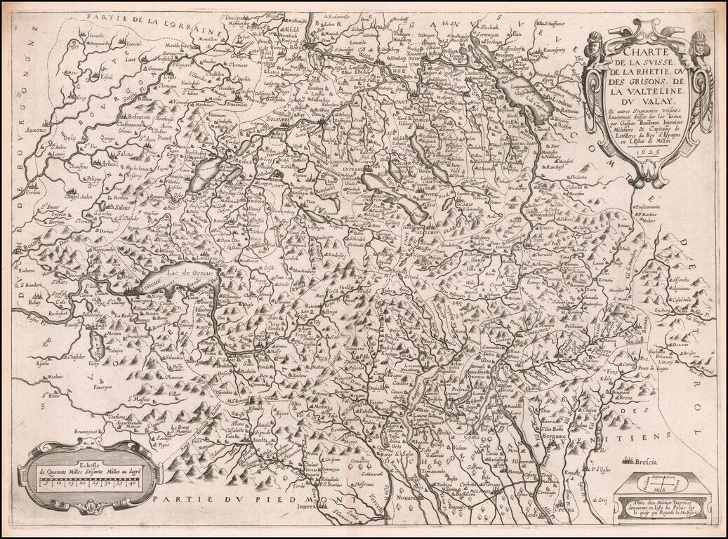
Rare early Tavernier map of Switzerland and part of Italy, based upon the surveys of Gaspard Baudouin, illustrating the region of Switzerland and Northern Italy which was the scene of military action during the reign of Louis XIII. The map extends...
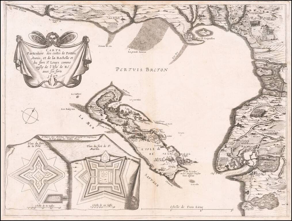
Very rare map of Poitou-Charentes with Île de Ré and the French coast with La Rochelle, oriented to the Northwest, with two inset fortification plans: Fort de la Pree and Fort de St Martin, published in 1627 by Melchior Tavernier. The map shows the...
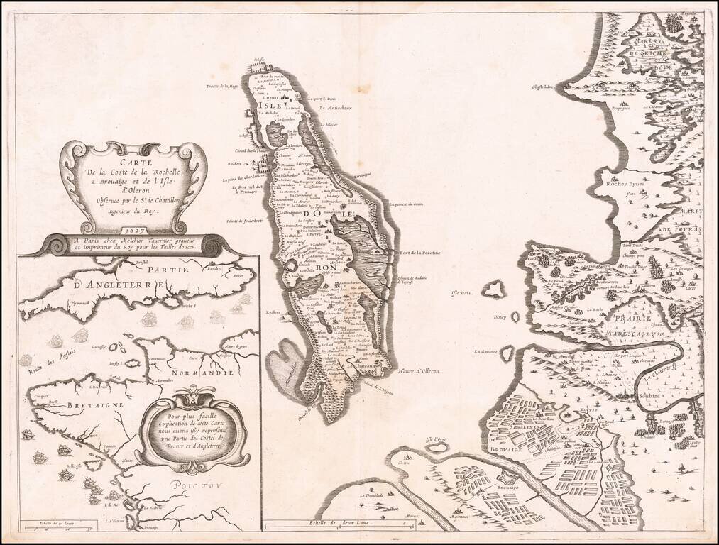
Contemporary Map of the Siege of La Rochelle Detailed map of the area around La Rochelle and the Isle of Olearon, published in Paris in 1627, illustrating both the Hugenot stronghold of La Rochelle and the Catholic stronghold of Brouage, which was...
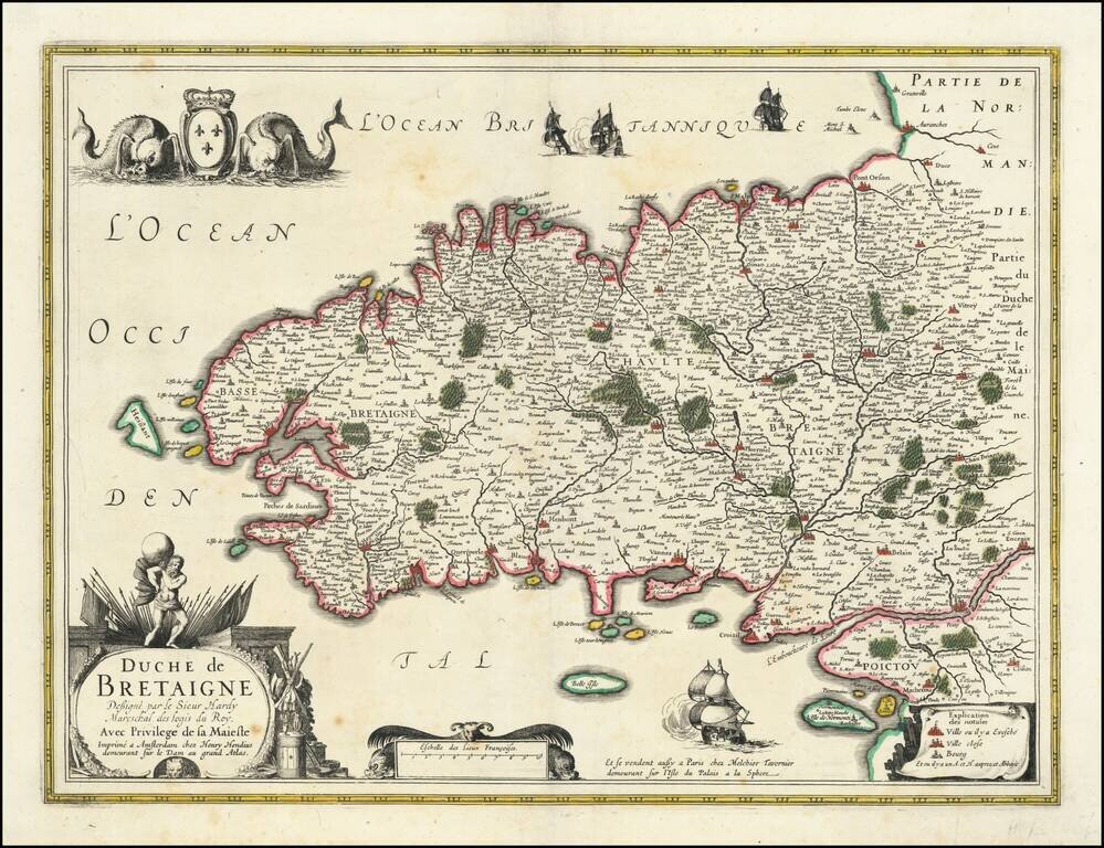
Detailed early map of Bretagne, sold in Paris by Melchior Tavernier.
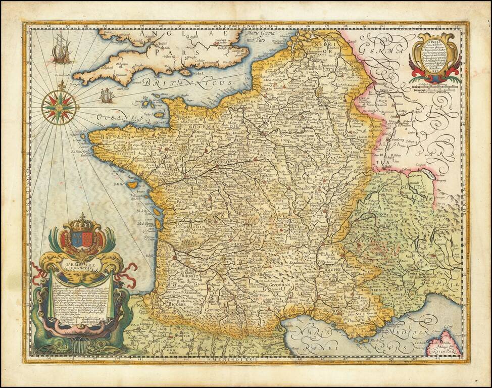
The French Empire in 1637 Fine early map of France, published by Melchior Tavernier. The use of the title L'Empire Francois is quite unusual, given that France was, at the time, a Kingdom and would not use the term "Empire" until Napoleon.
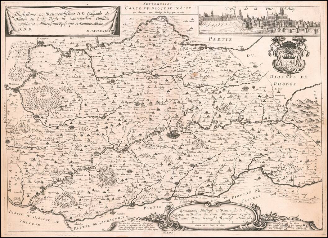
Rare map of the city of Albi on the Tarn River, with a large profile view of the city, several cartouches and a coat of arms. The map is very rare on the market. This is only the second example we have offered in over 20 years.
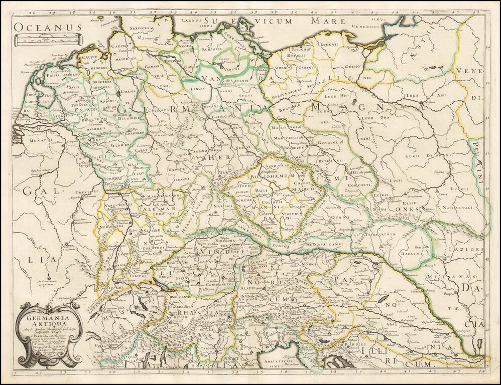
Tavernier and Sanson's rare 1641 double-page engraved map of classical Germany.
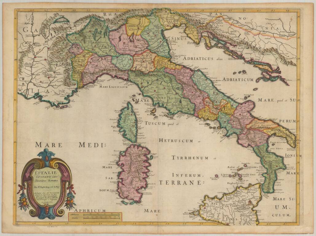
Rare map of Italy, first published by Melchior Tavernier and later re-issued with the new title pasted over the old title by a Nicolas Sanson. The original title of the map was Italia Antiqua Cum Insulis Sicilia, Sardinia & Corsica . . . This...
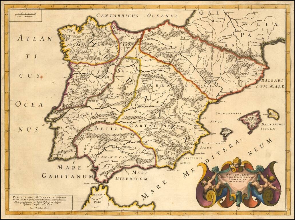
Striking example of Tavernier's map of the Iberian Peninsula, showing the divisions or the region during the times of the Roman Empire. The map is elegantly engraved with a beautiful cartouche.
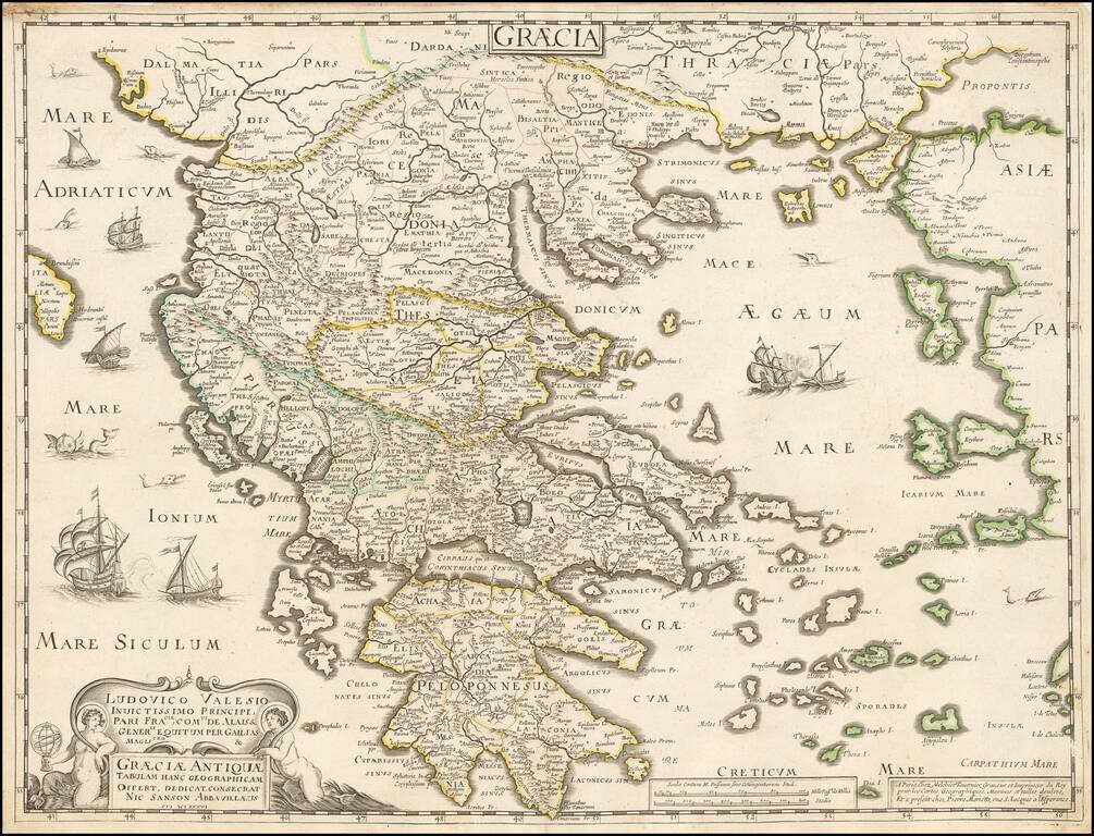
Tavernier and Sanson double-page engraved map of ancient Greece.
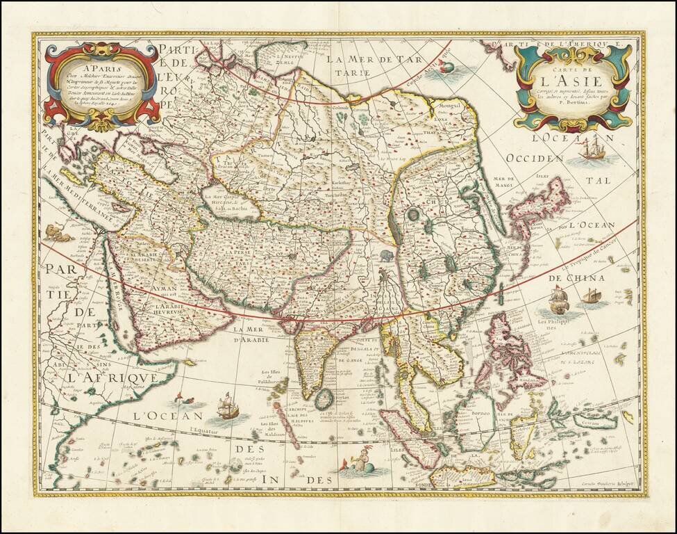
Rare map of Asia, likely drawn from an earlier map by Melchior Tavernier. Extremely detailed throughout. Shows the Great wall, oddly projected Korea, Japan and China and elephant just about the source of the Ganges. Writing about the America map from...