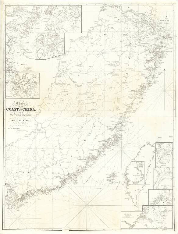
Rare 2 sheet map of Southwestern China, from Shanghai to Hong Kong, Macao and Canton, published in London by William Allen. The map includes a number of smaller insets, including: Hong Kong and its Anchorage River Woo-sung to Shang-Hae Mouth of...
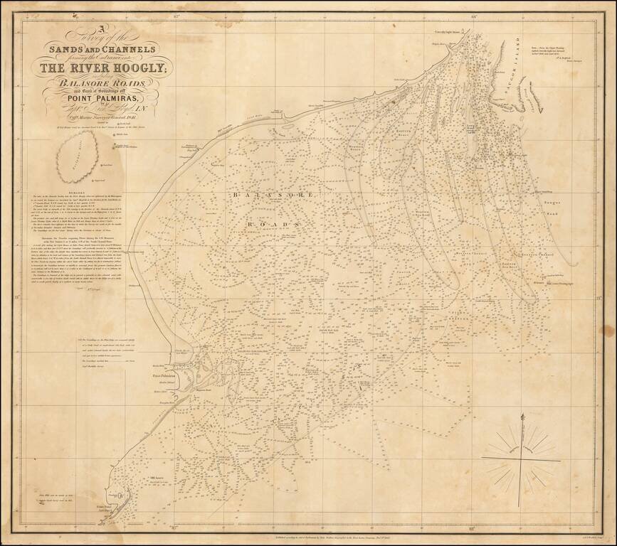
Rare sea chart of the mouth of the Hoogly River, published by John Walker, Geographer of the East India Company. The chart is based upon a rare chart by Richard Lloyd, originally lithographed by T. Black in Calcutta. The chart shows the area just...