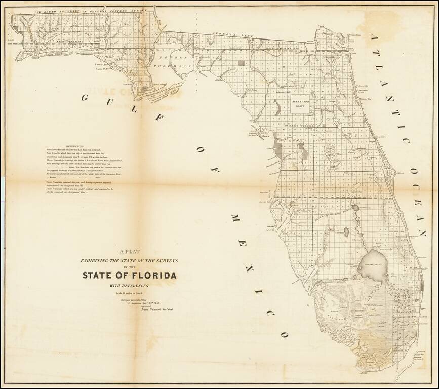
Fine example of this large format map of Florida, showing the extent of the surveys in the state of Florida. Shows extensive detail throughout Florida, including towns, forts, lakes, rivers, the Arredondo Grant, swamps, lighthouses, landings, etc....
![[Maricopa County, Arizona Territory] Mineral Survey No. 1568 -- Gila Land District -- Plat of the Claim of I. Parker Lawton . . . In Superstition Mining District, Maricopa Counbty Arizona . . . 1902 [2 sheets]](/map/small/16562.jpg)
Two sheet plat map showing Lawton's claims located in the Fairstake, Sun Set, Black Hawk, May Day, and Queen Lil, in Maricopa County, Arizona Territory. Includes notes on the dates the original mining claims were established, details on the number of...
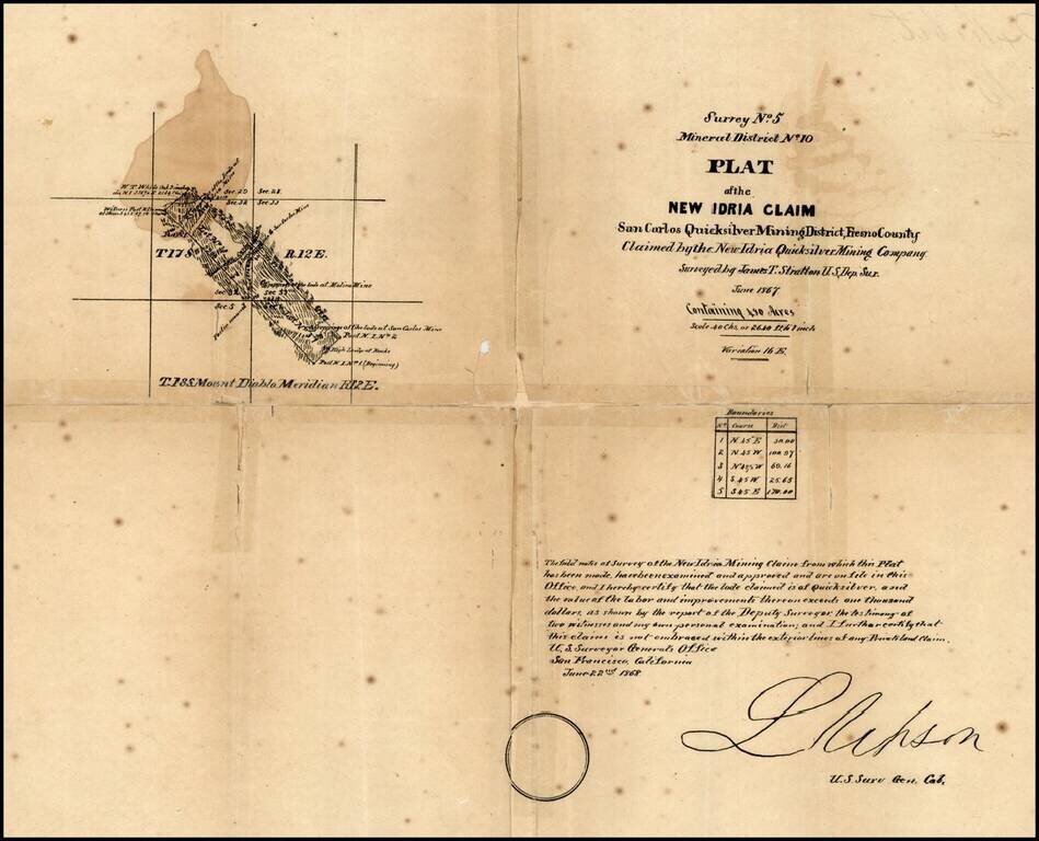
New Idria is an unincorporated town in San Benito County, California, which was named for a quicksilver (cinnabar) mine of the same name. The mine itself was named in honor of the world's second largest quicksilver mine in Idrija, Slovenia. The...