Samuel Dunn (bap. 1723-1794) was a teacher of mathematics and navigation who published, among other things, maps and charts. Although information about his early education is lacking, by age nineteen he was leading his own school and teaching writing, accounting, navigation, and mathematics in Devon. In 1751, he moved to London, where he taught in several schools and tutored privately.
By the 1760s, Dunn was known as a respected astronomer and had published a range of textbooks on math, navigation, and astronomy. After the publication of the Nautical Almanac, Dunn acted as a certifier of ships’ masters under the new system, on behalf of the Board of Longitude. He performed similar work for the East India Company, as well as made charts of the East Indies. In 1776 he published A New Variation Atlas and, in 1777, A New Epitome of Practical Navigation, or, Guide to the Indian Seas. By 1780, he was named editor of the New Directory for the East Indies, which included his own charts. In 1786, he released a pioneering study, Theory and Practice of Longitude at Sea. He also designed several instruments for navigation.
Dunn died at his home in Fleet Street in January 1794. His books and maps were auctioned at Sothebys in a sale of over 1,000 lots. Many of these were bought by Alexander Dalrymple, hydrographer of the East India Company and soon-to-be-named first head of the Hydrography Office.
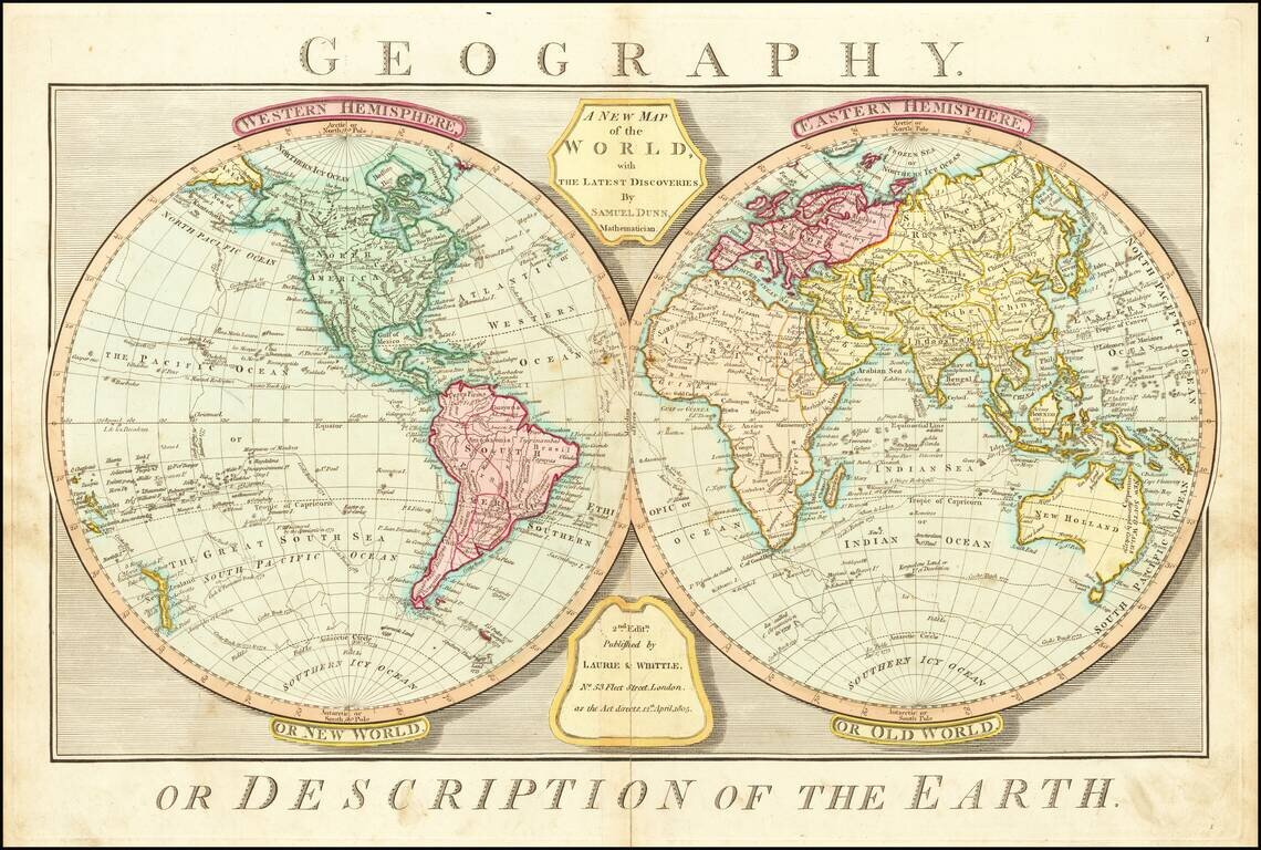
Rare Late Edition Showing Matthew Flinder's Discoveries in Australia Detailed double hemisphere map of the World, showing tracks of some of the contemporary explorers, including James Cook and George Anson. The map shows the "Corean Sea," along with...
![[The centre of this Slider is to be placed by a Thread or Pin over the centre of the respective Planisphere for any Operation]](/map/small/65557.jpg)
Rare overlay "slider" device, which was to be placed over the terrestrial and celestial planishere maps which were published by Dunn & Owen in their Description and Use of the Universal Planispheres. Dunn's Universal Planisphere work was published...
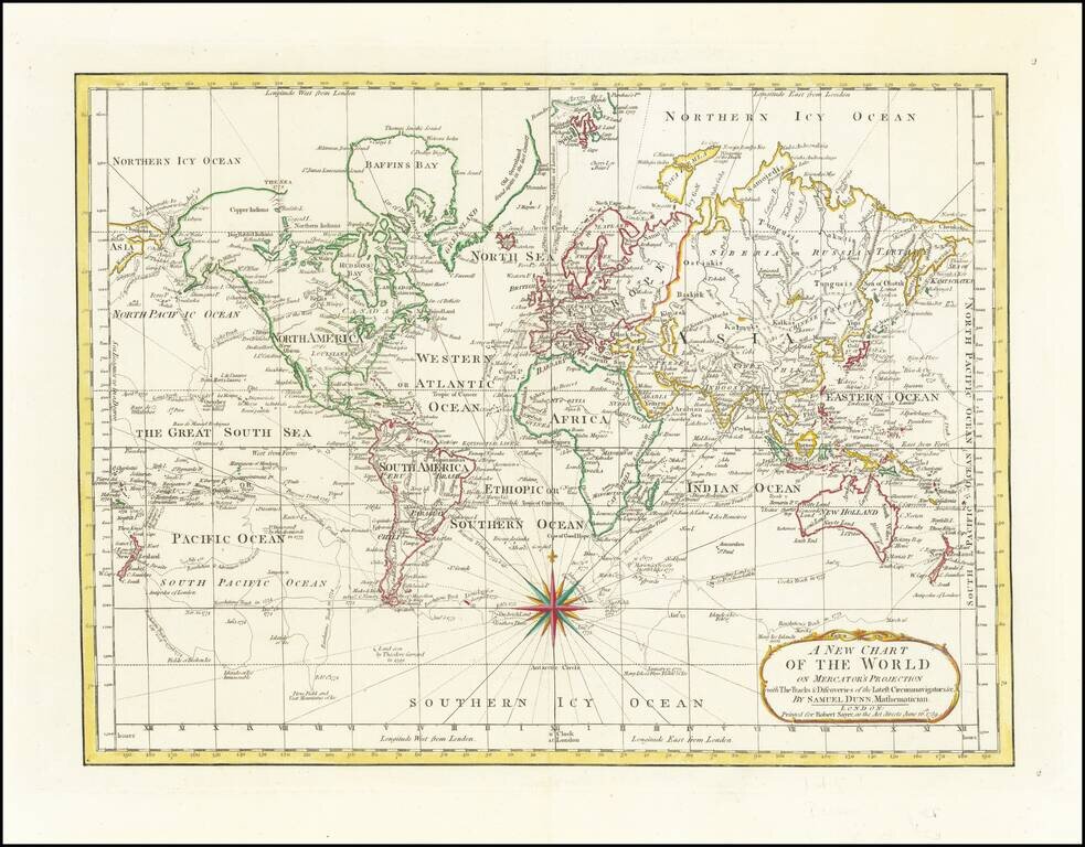
18th Century English Antique Map of the World Detailed map of the world, illustrating the tracks of the latest explorers to circumnavigate the world. The tracks shown includes the three Cook voyages, and those of Byron, Bougainville, Bouvet, etc....
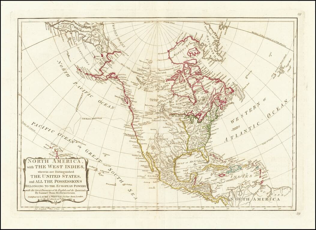
The River of the West According to Some 1794 edition of Samuel Dunn's map of North America. The map provides an interesting depiction of North America, shortly after the close of the American Revolution. The US is colored in Green. To the west, the...
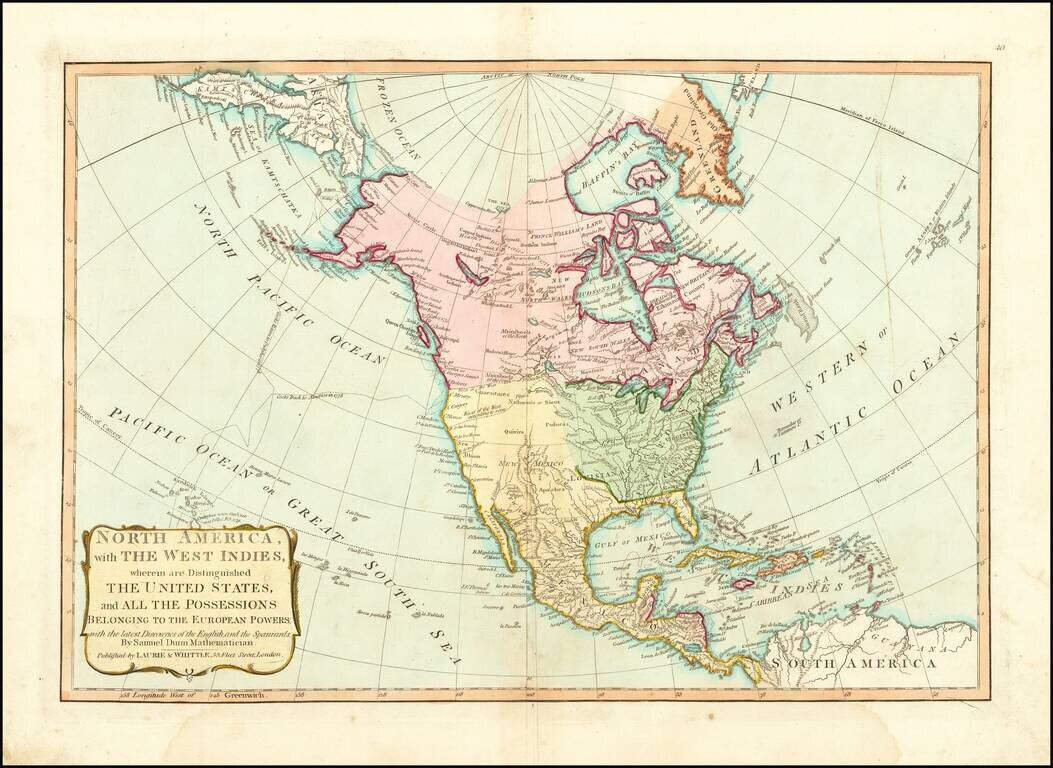
Striking example Samuel Dunn's map of North America. The map provides an interesting depiction of North America, shortly after the close of the American Revolution. The US is colored in Green. To the west, the vast unknown regions of Louisiana, New...
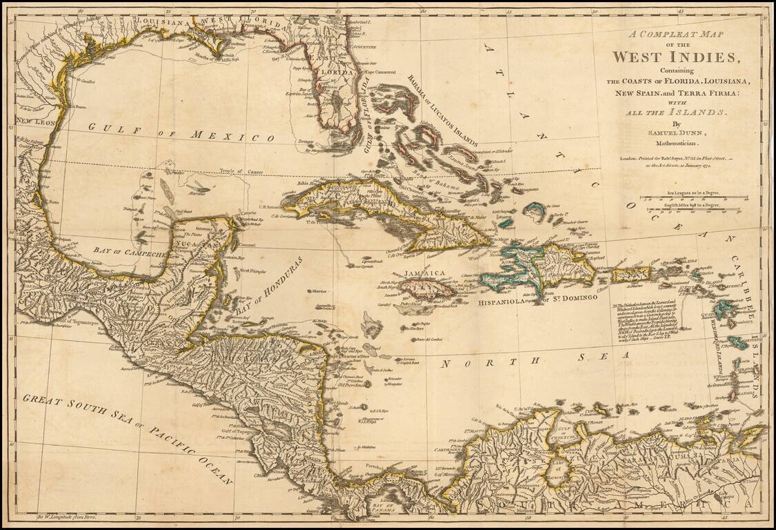
Detailed map of the West Indies, Florida, the Gulf Coast, Central America and part of Meixco.
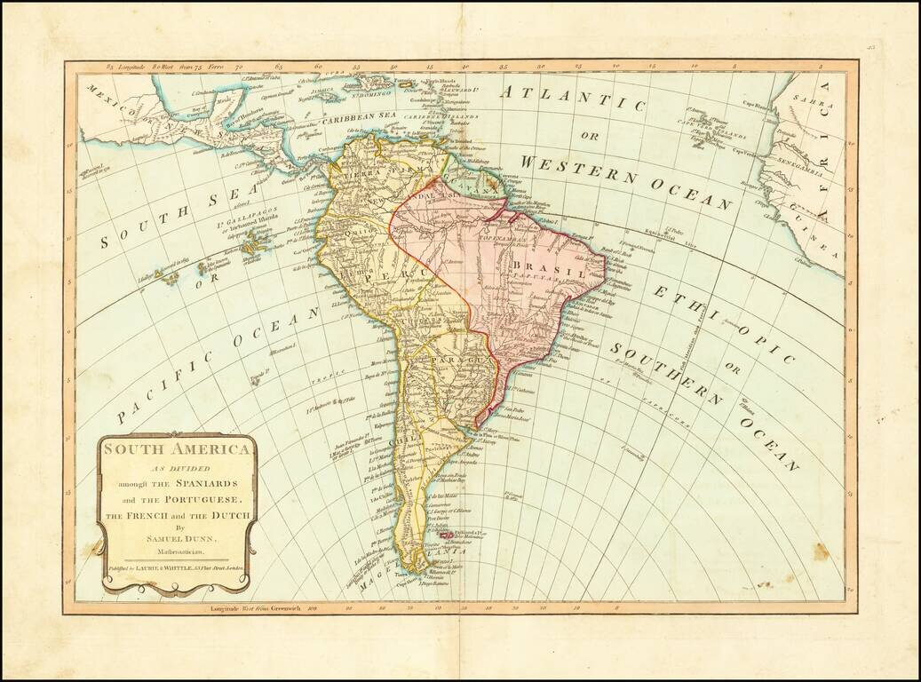
From Dunn's New Atlas or Mundane System of Geography, published by Laurie & Whittle. The map shows South America on the eve of several decades of Revolution and Independence from Spain and Portugal.
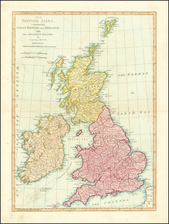
Nice detailed map of the British Isles, colored by counties. Includes towns, roads, mountains, rivers, lakes, islands, etc. From Dunn's New Atlas or Mundane System of Geography.
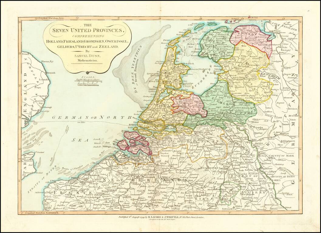
Nice detailed map of the Low Countries, colored by provinces. From Dunn's New Atlas or Mundane System of Geography.
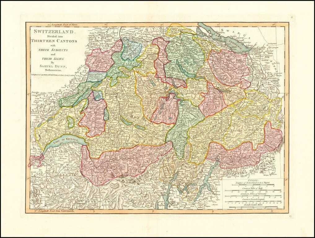
Detailed double-page engraved map of Switzerland, divided into Cantons, etc.
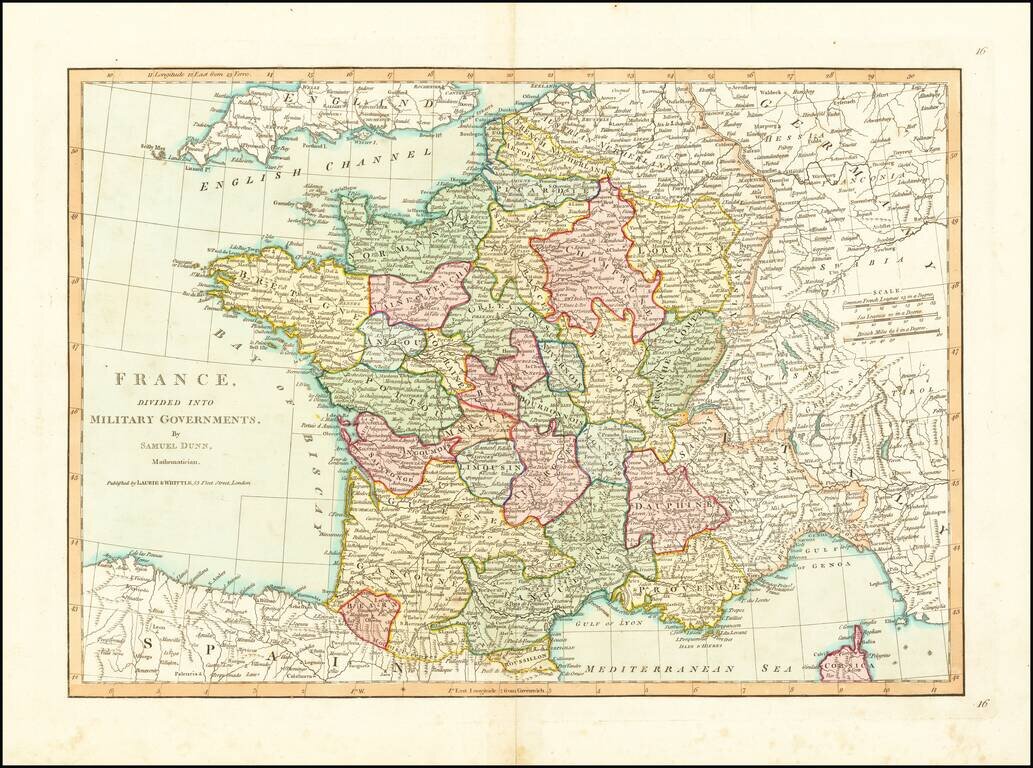
Detailed map of France, divided into its provinces. From Dunn's New Atlas or Mundane System of Geography.
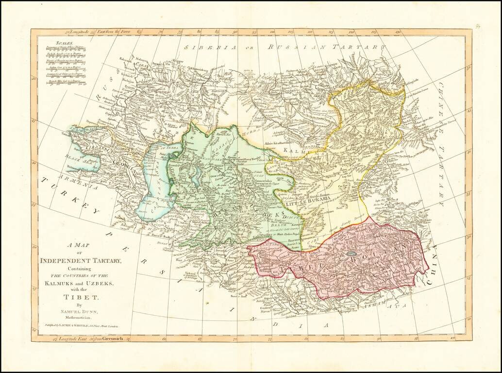
Detailed regional map, extending from European Russia and the Caspian Sea to Chinese Tartary. Nice detail in Tibet, Bukaria, and the Mountainous regions of western China. From Dunn's New Atlas or Mundane System of Geography.
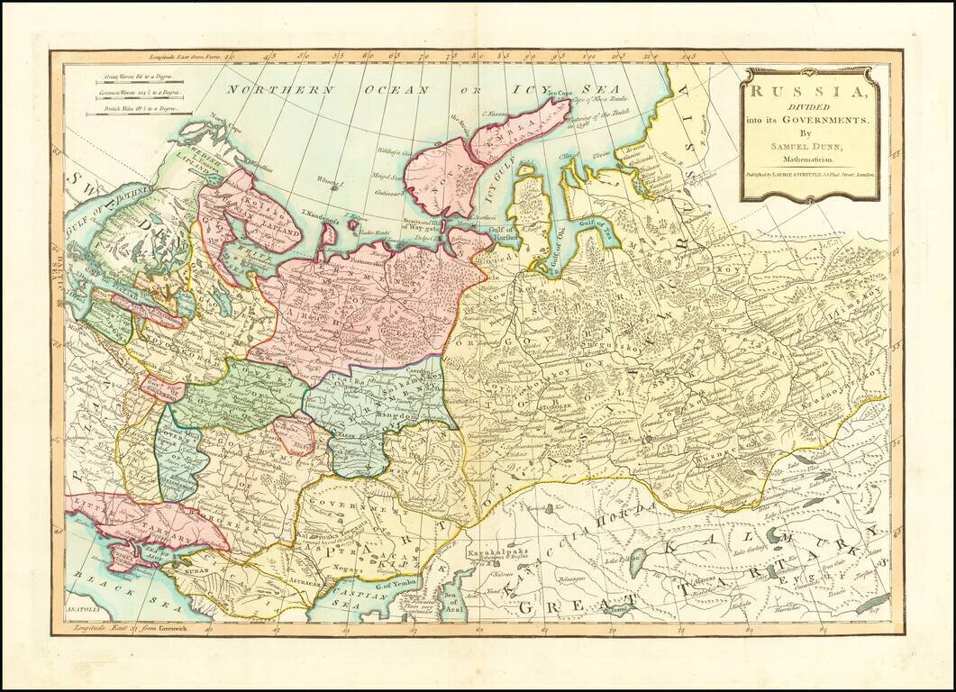
Finely colored map of Russia and its political divisions. Includes towns, mountains, rivers, lakes, islands, etc. From Dunn's New Atlas or Mundane System of Geography.
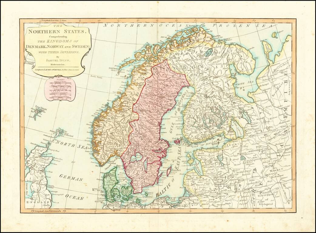
Detailed regional map of Scandinavia and the Baltic Sea, colored by Political divisions. Includes towns, mountains, rivers, lakes, islands, etc. From Dunn's New Atlas or Mundane System of Geography.
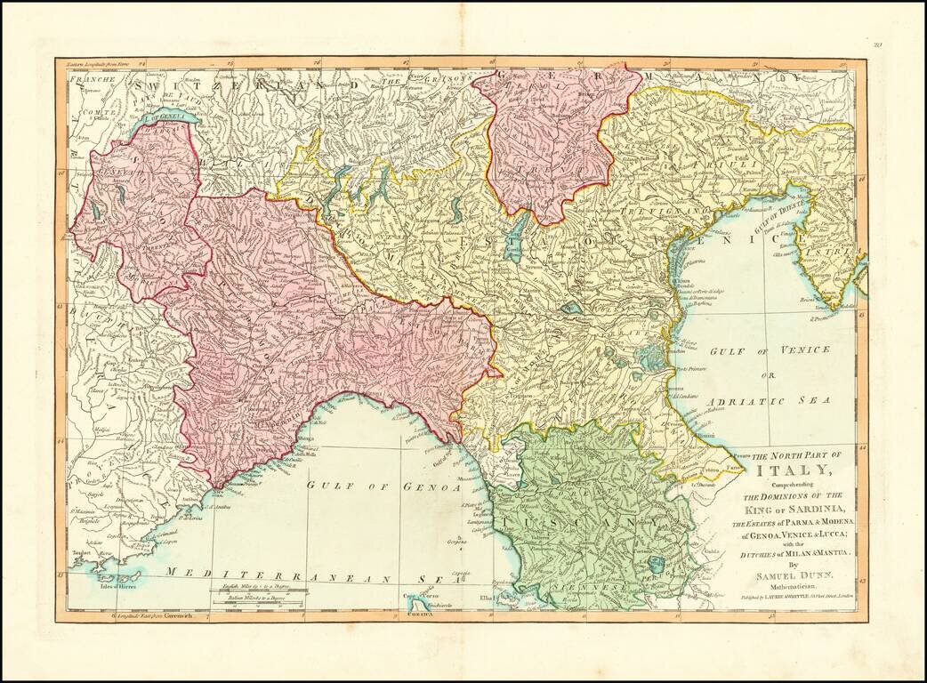
Detailed regional map of Northern Italy. Excellent detail. From Dunn's New Atlas or Mundane System of Geography.
![Spain and Portugal, with Their General Divisions . . . [Balaeric Islands]](/map/small/65193.jpg)
Detailed late 18th Century map of the Iberian Peninsula and contiguous islands. Scarce English language map of the region. From Dunn's New Atlas or Mundane System of Geography.