
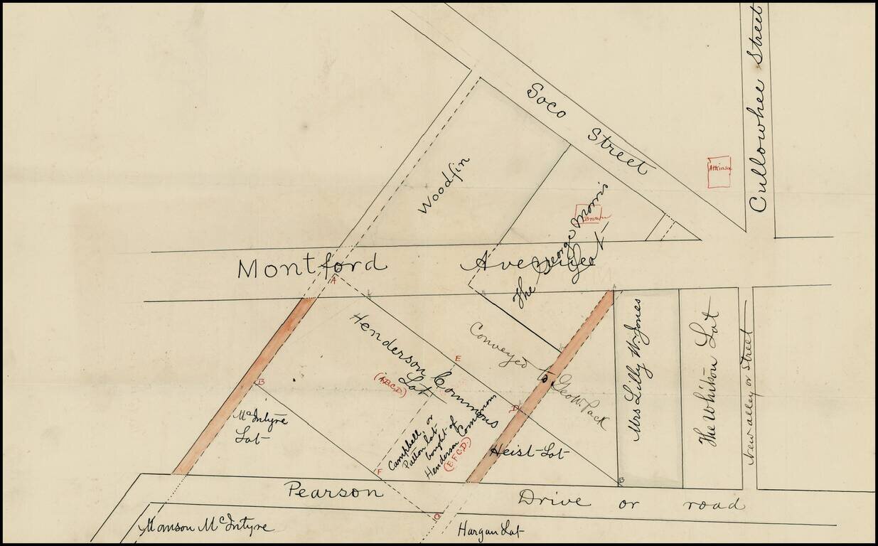
Early cadastral map of part Asheville, North Carolina, just south of the University of North Carolina, Asheville, identifying the land owners in a section of town including Pearson Drive, Montford Avenue, Soco Street and Cullowhee Street, just...
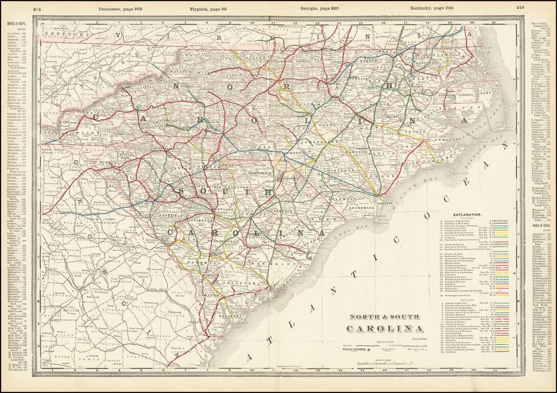
A fabulously detailed railroad map of the Carolinas, from Cram's scarce Standard American Railway Atlas. Shows over 60 different railroads, stations, and numerous other details. The best atlas railroad map of the time period.
![Western Part of North and South Carolina [and] Eastern Part of North and South Carolina](/map/small/69547.jpg)
A fabulously detailed railroad map of the Carolinas, from Cram's scarce Standard American Railway Atlas. Shows over 60 different railroads, stations, and numerous other details. The best atlas railroad map of the time period.
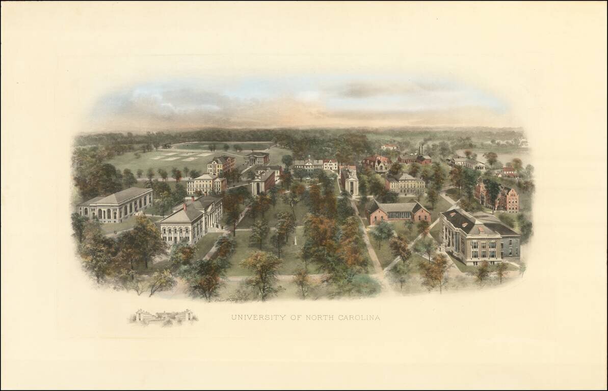
Fine example of this marvelous early birdseye view of the University of North Carolina, Chapel Hill. At the turn of the century, Littig & Company commissioned a number of artists, including the accomplished artist Richard Rummell (1848-1924), to...
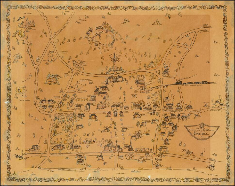
Impressive manuscript pictorial map of the University of North Carolina at Chapel Hill, drawn by Mary C. Dirnberger in 1933. The view is oriented with south at the top, at the bottom of the map it is bounded by Rosemary Street, at the top (south) of...