
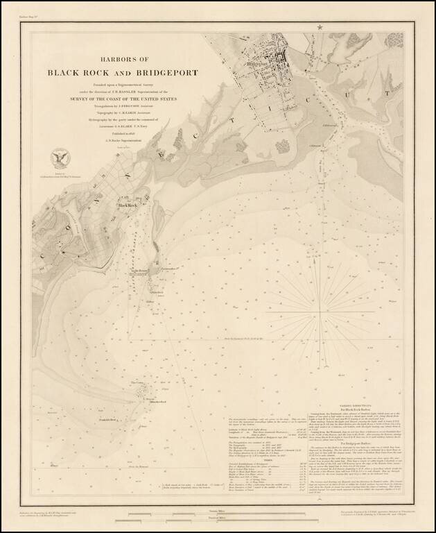
Fine example of this rare edition of the US Coast Survey map of Harbors of Black Rock and Bridgeport, Connecticut, published separately on thick paper. The chart provides fine topographical and geographical details of the two harbors, including...
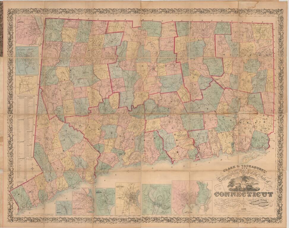
One of the Most Impressive and Decorative Maps of Connecticut, Here in the Desirable Folding Map Format. Hand-colored lithographed folding map of Connecticut, the most detailed and authoritative map of the state of its time. It includes topographical...
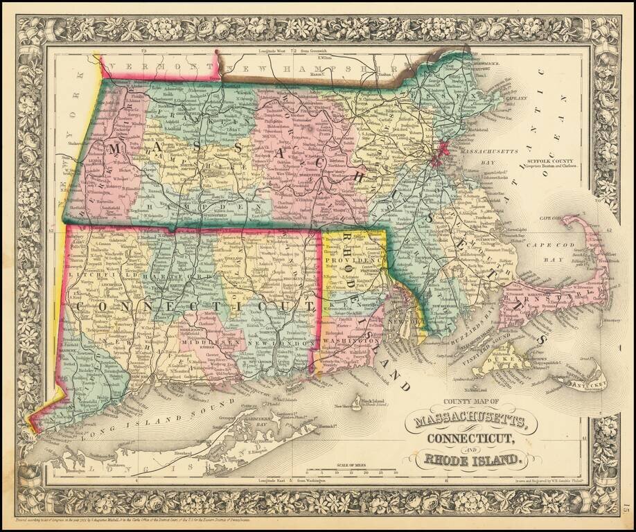
Detailed map of Southern New England, colored by counties and showing towns, railroads, rivers and other details. SA Mitchell Jr. acquired his father's former business from DeSilver in 1860 and relaunched a very successful atlas publishing business...
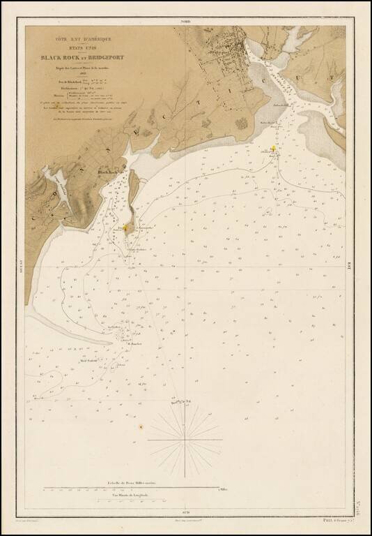
Fine example of this rare French edition of Hassler's chart of the Harbors of Black Rock and Bridgeport, Connecticut, originally published for the United States Coast Survey. Striking example, published in Paris by Lemercier and priced at 75 French...
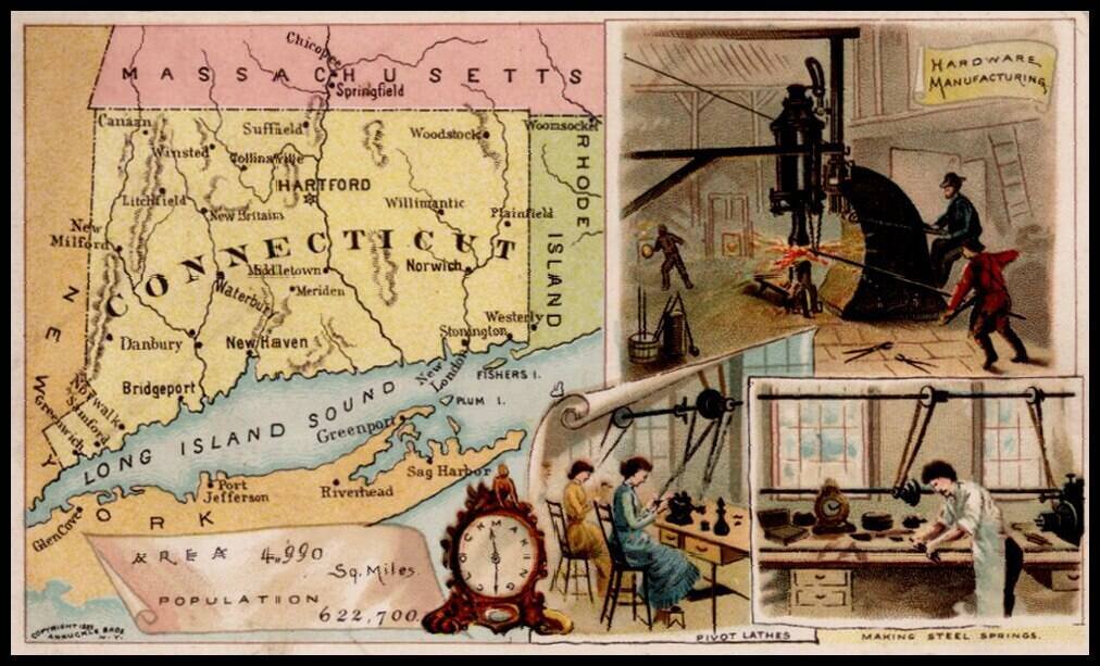
Decorative and unusual trading card map of Connecticut from this famous series. The map is surrounded by decorative vignette, showing Hardware Manufacturing, Pivot lathes and making steel springs. Includes population statistics.
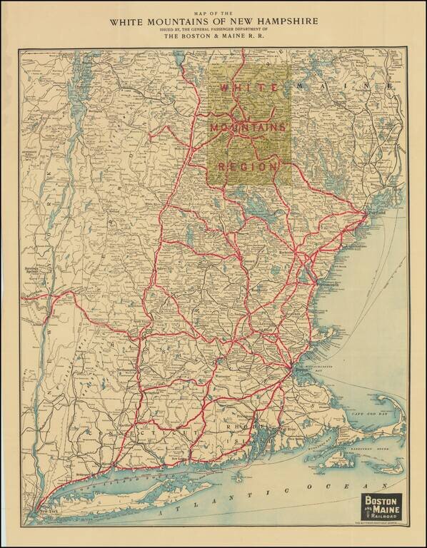
Attractive color-lithographed map of New England, issued by the Boston and Maine Rail Road to promote regional tourist travel to the White Mountains. The map extends from New York City in the far southwest to the New Hampshire border with Canada in...