
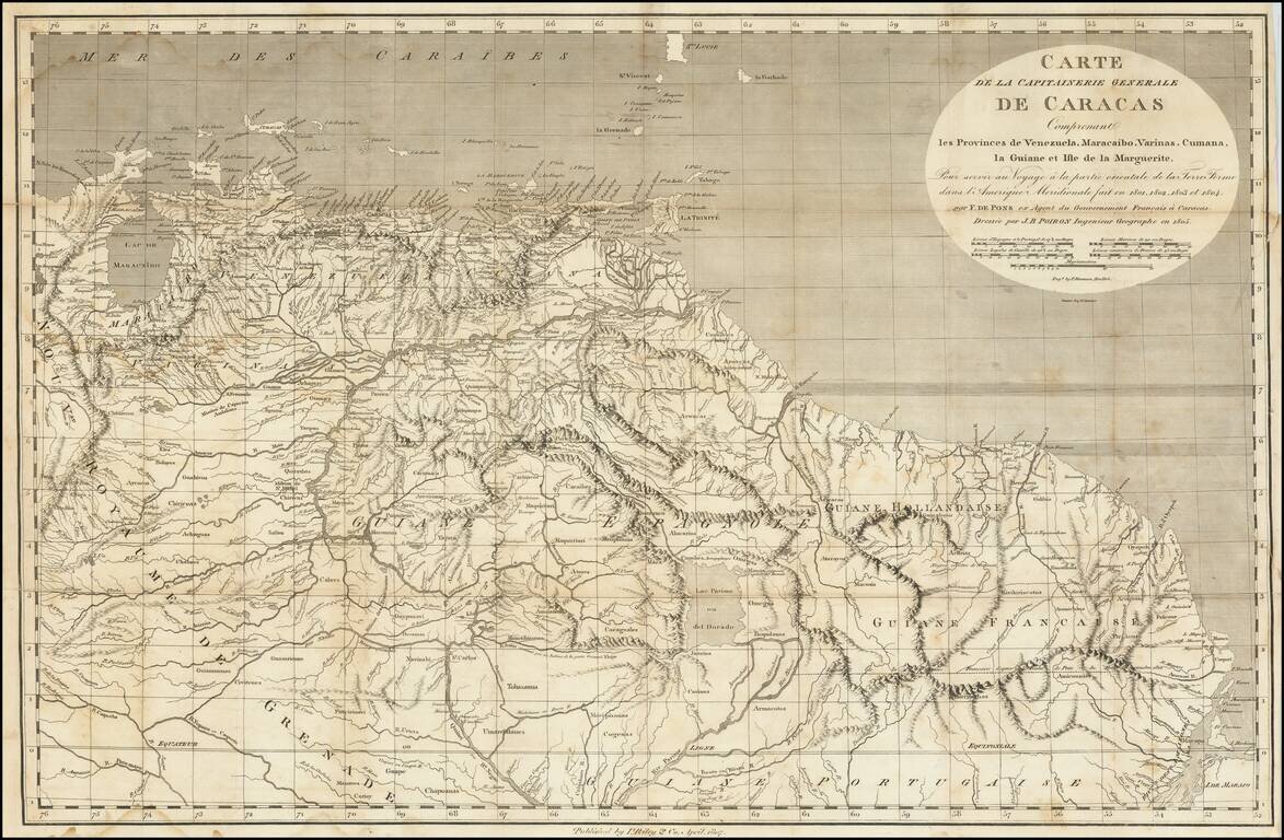
A Rare Early New York Imprint -- Includes A Reference To El Dorado Scarce and highly detailed map of the Captaincy of Caracas, published by I Riley & Co, April 1807. The map covers the area from Maracaibo and Curacao to the mouth of the Amazon...
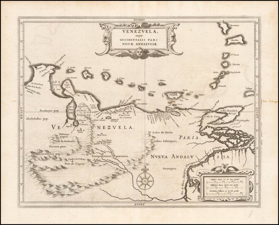
An Early Example of Hessel Gerritsz's Map of Venezuela Detailed map of Venezuela, extending to the mouth of the Orinoco River. Gerritsz' map of Venezuela served as a model for other cartographers throughout the rest of the century. Gerritsz was...

Finely colored example of Blaeu's map of Venezuela and the Northeastern part of South America. Includes 2 decorative cartouches, vignettes of various indigenous animals, a compass rose and rhumb lines, etc.
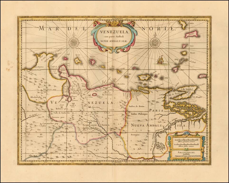
Nice example of this well executed late 17th Century map of Venezuela and the northeastern part of South America. Includes 2 decorative cartouches, vignettes of various indigenous animals, a compass rose and rhumb lines, etc. Originally engraved by...
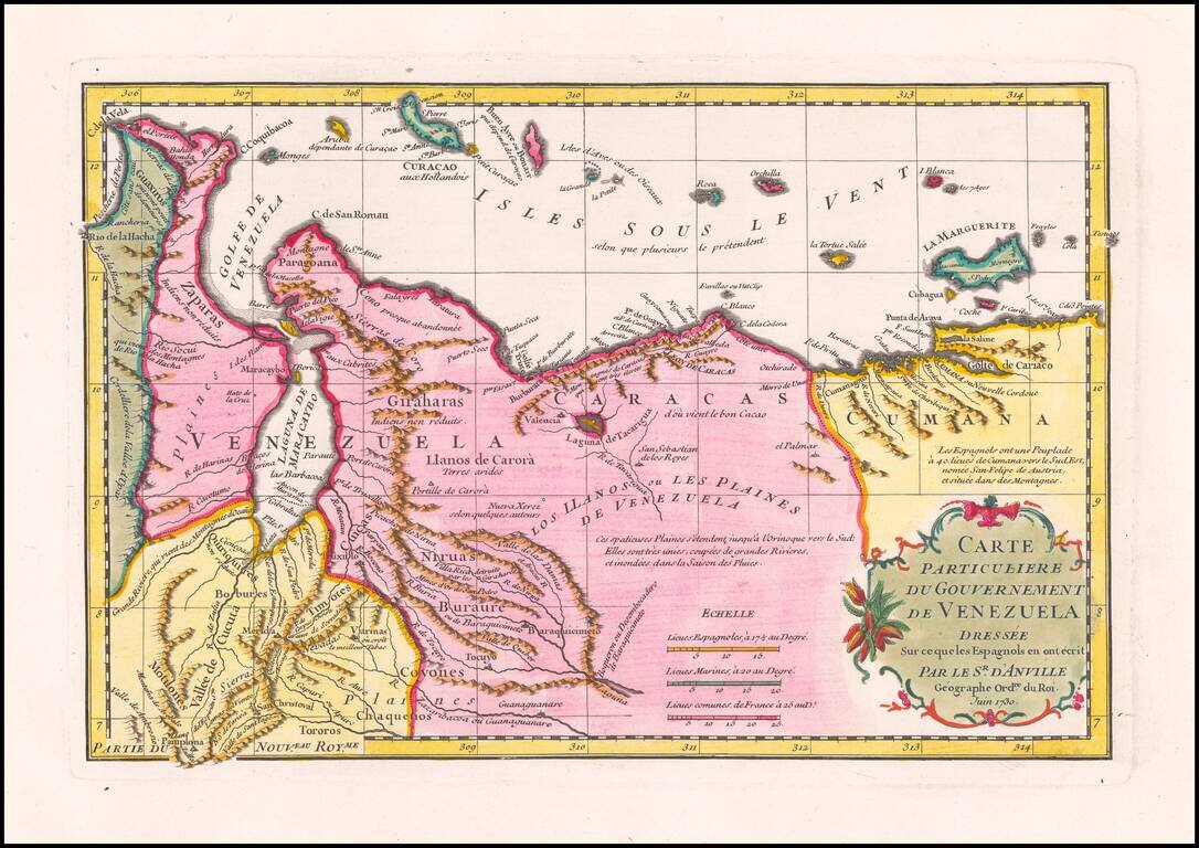
Striking D’Anville Map of Venezuela Fine example of D’Anville’s map of Venezuela, which features much of the northern part of what is today the country of Venezuela and the Leeward Antilles. The map shows the mountainous terrain in detail, with...
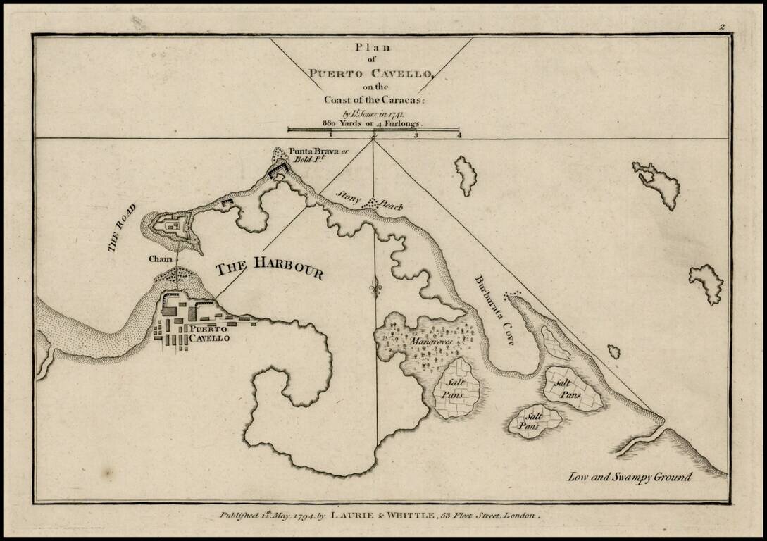
Rare plan of Puerto Cavello, Venezuela, first published by Sayer & Bennett. Includes a town plan, detailed charting of the harbor, with soundings and anchorages, forts, islands and other details. One of the earliest obtainable English language...

Rare Spanish Sea Chart of the Coast of Venezuela and Trinidad Rare first state of the edition of this rare Spanish sea chart of the coastline of Venezuela and neighboring islands, including Trinidad and Margarita. The present chart represents the...