
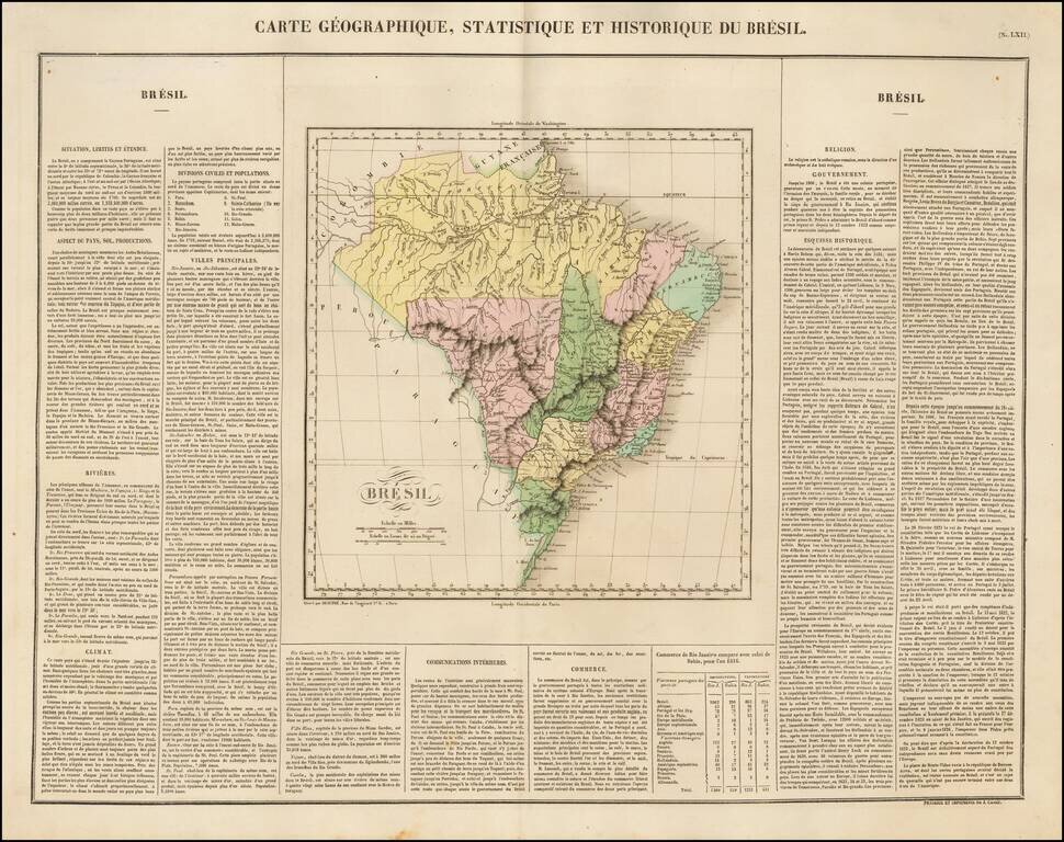
Nice example of Buchon's map of Brazil, published in Paris in 1825. The map is divided by regions. The map is exceptionally detailed, with forts, towns, villages, mountains, rivers, etc. Overall plate size is 24 x 17 inches, surrounded by text...
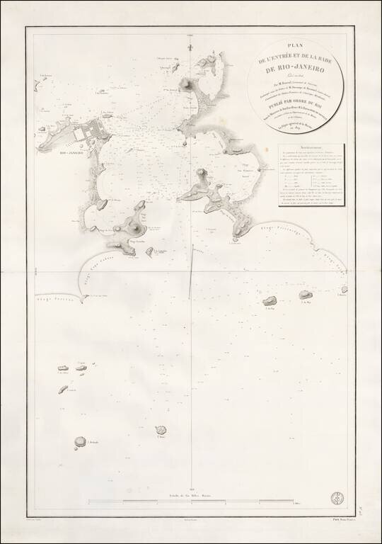
Rare French plan of the Harbor of Rio De Janeiro, engraved by Caplin and drafted by Besancon for the Depot General de La Marine in 1829. The plan is based upon the surveys of Jean Augustine Barral in 1826 and shows the entrance to the Rio de...
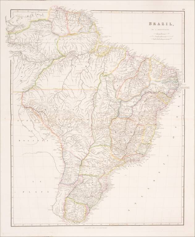
Brazil During The Regency of Emperor Pedro II A marvelous highly detailed map of Brazil, colored by regions, published in London by John Arrowsmith. The map shows more detail than any contemporary commercial atlas map of the region. This is the...
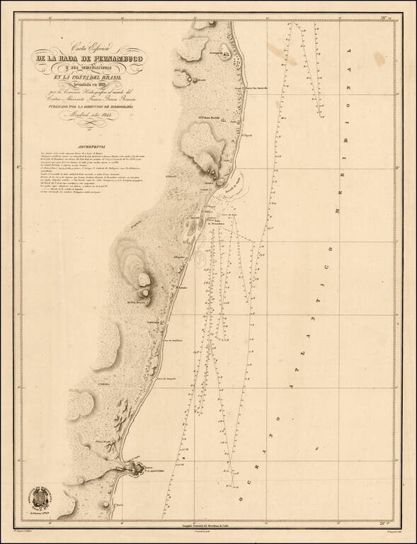
Scarce chart of the coast of Brazil, from Cape St. Agostinho to Gurparim, along the Pernambuco Coast. The charts produced by the 'Direccion de Hydrografica' were detailed surveys meant for marine use. Not unlike the well known blue-back charts of the...
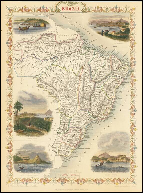
Gorgeous full color example of this decorative map of Brazil, with colorful vignettes showing Monte Video, Cape St. Antonio Bahia, Rio De Janeiro and St. Catharina. Engraved for R. Montgomery Martin's Illustrated Atlas. Tallis was one of the last...
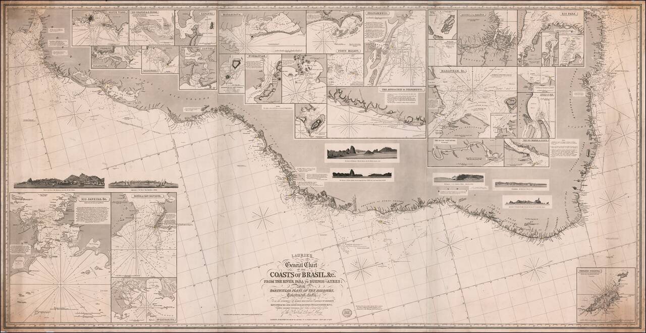
Fine large format sea chart of the coast of Brazil and Paraguay, published by Richard Laurie in London. The map includes inset plans of a number of Brazilian and other harbors, including: Rio de Janeiro Bahia San Salvador Montevideo Rio Grande...
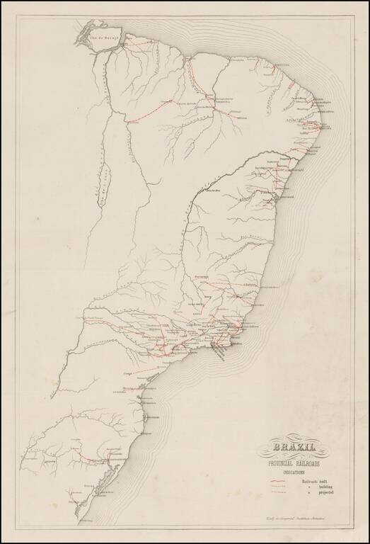
Rare railroad map of Brazil, published by the Brazilian Government for distribution at the Philadelphia Centennial Exhibition in 1876. Shows Railroads built, Railroads under Construction and Railroads projected, within Brazil. One of the earliest...
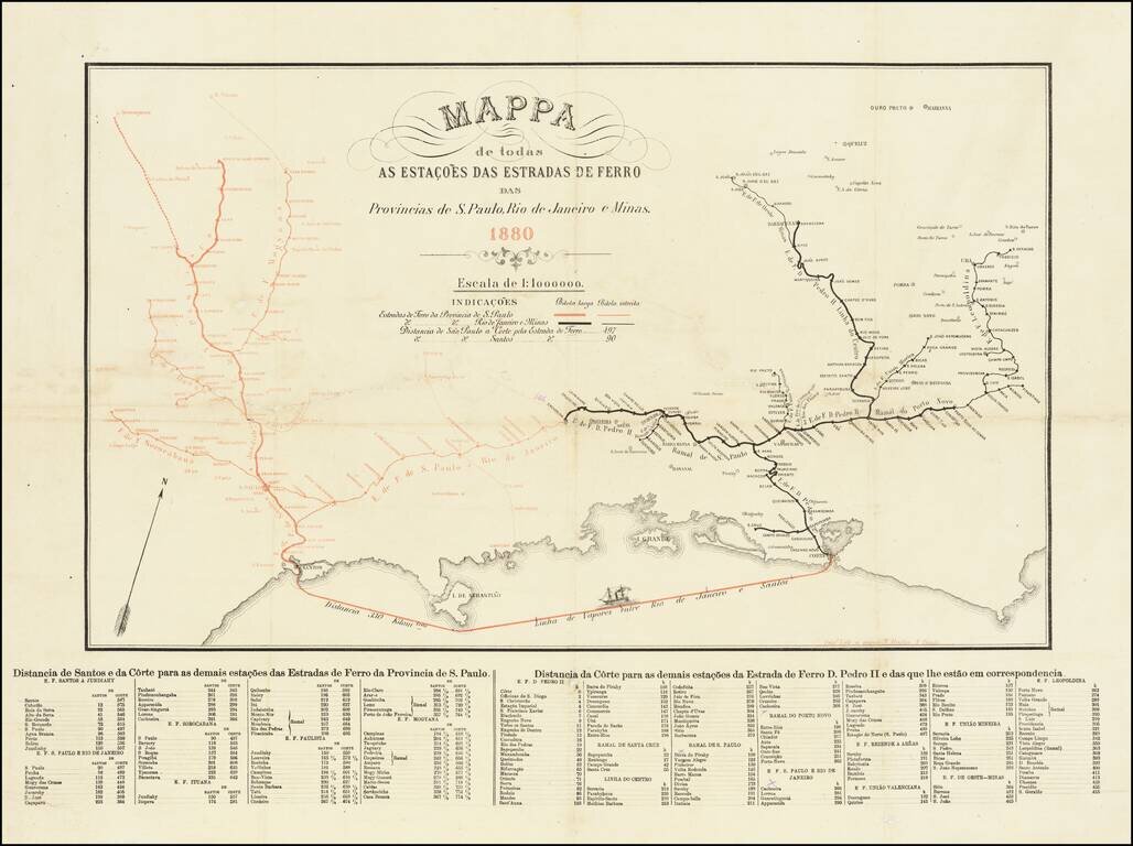
Rare separately published Railroad map, published in Sao Paulo in 1880. The map illustrates the railroad lines in the provinces of Sao Paolo (in red) and Rio de Janeiro e Minas (in black). The shipping line from Rio to Santos is also shown (330...
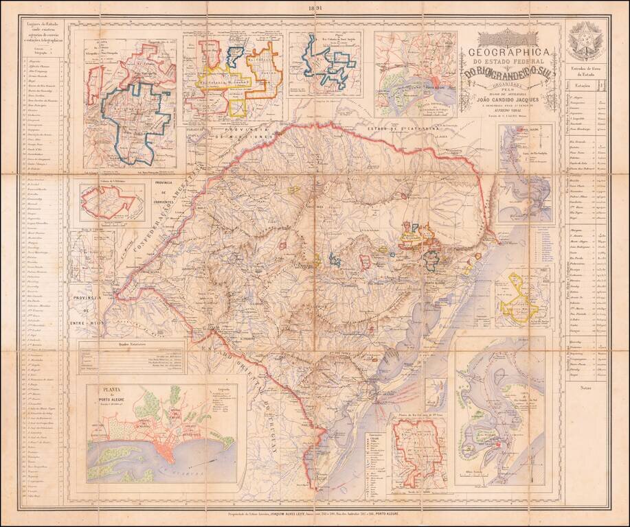
The German Colonies of Rio Grande Do Sul Rare separately published map of the Brazilian State of Rio Grande do Sul, published in Porto Alegre by the firm of Joaquim Alves Leite. The map includes inset maps of the following regions, primarily early...
![[Para] Estados Unidos do Brasil -- Mappa do Estado Do Para Mandado organisar pelo Exmo. Snr. Dor. Augusto Montenegro Governador do Estado 1908](/map/small/62471.jpg)
Rare Map of the Brazilian State of Pará, Including the Mouth of the Amazon River Rare, separately-published map of what are today the Brazilian states of Pará and Amapá in northern Brazil. The map, which is the only example we could locate, offers...
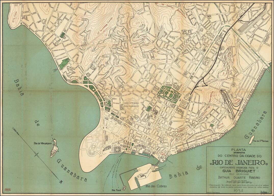
Detailed City Plan of Rio de Janeiro from a Popular Travel Guide Series Rare, thorough and accessible plan of the city center of Rio de Janeiro, made to feature alongside the well-known Guia Briguiet travel guides. From a golden age in Rio’s...