
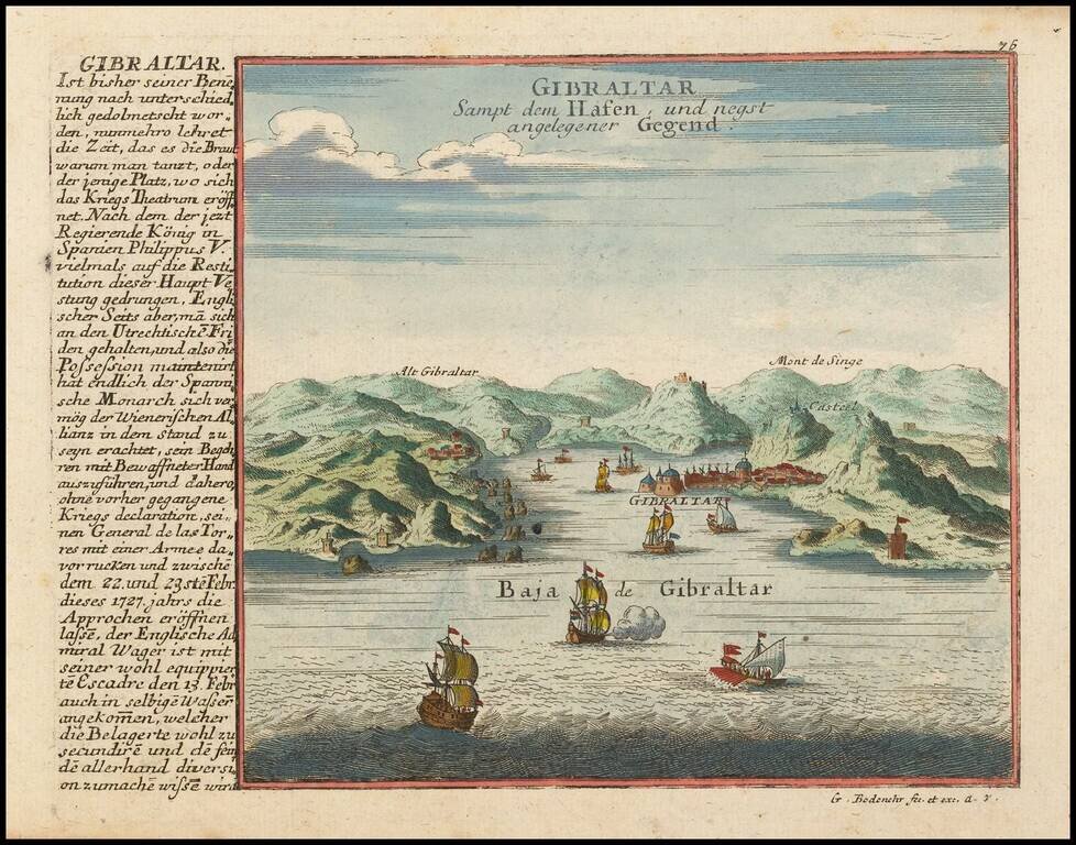
Detailed view and plan of the the Harbor and Fortifications at Gibraltar, published by Gabriel Bodenehr.
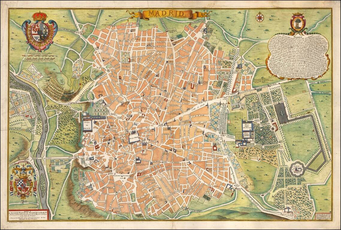
Rare first edition of Nicolas De Fer's plan of Madrid, with a key showing 26 places of interest. Early 18th Century plans of Madrid are relatively uncommon. Nice dark impression. From the first edition of De Fer's Atlas Curieux.
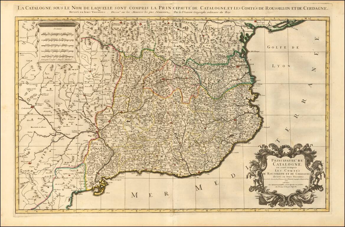
Striking large and highly detailed map of Catalonia, with a large decorative cartouche and a scale of distance. In addition, there are 4 separate sheets, each with an accompanying set 8 town plans and birdseye views, including Roussilon, Perpignan...
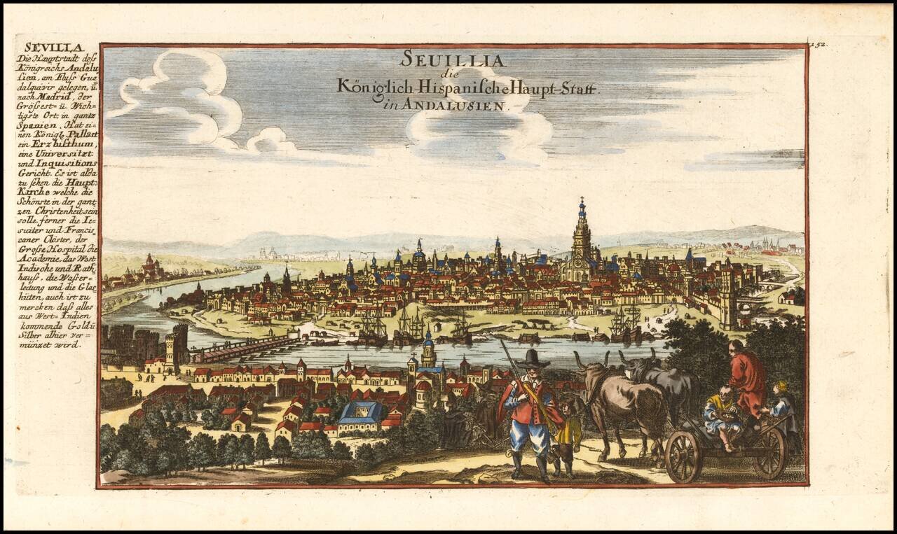
Decorative view of the city of Sevilla in Andalucia, published by Gabriel Bodenehr.
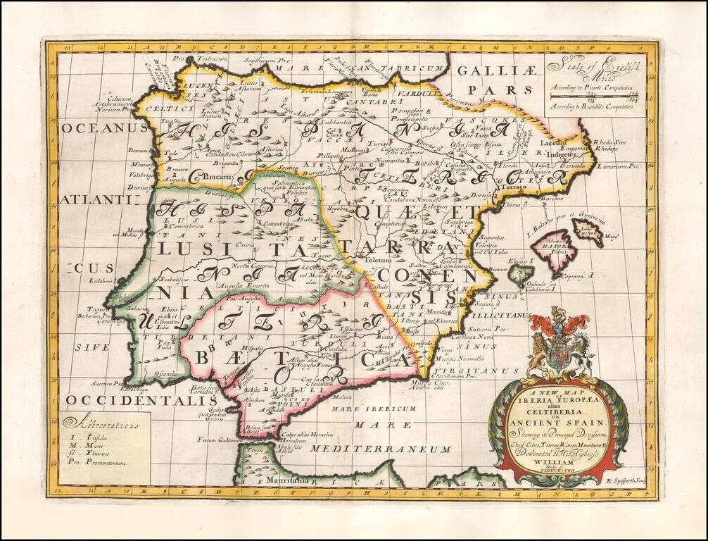
Decorative map of the Iberian Peninsula, colored by regions. This decorative map was part of a set of 22 maps dedicated to William, Duke of Glouchester, who was then an 11 year old student at Oxford.
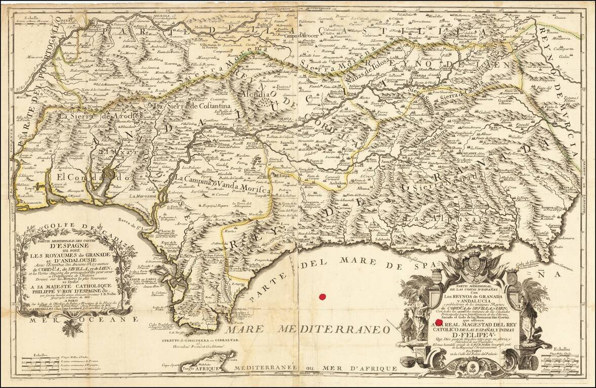
Rare early edition of Jean Baptiste Nolin's map of southern Spain, centered on Andalusia and Granada, published in Paris by Nolin, with a second address in Brussels (Jean Leonard). The map is exceptionally detailed and includes extensive topographical...
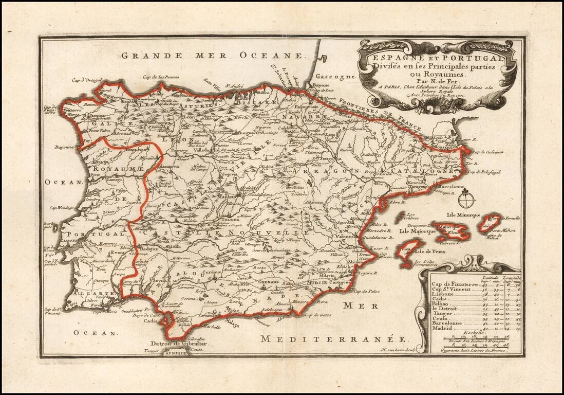
Scarce first state of this detailed map of Spain and Portugal, with decorative cartouche. Includes the Balaeric Islands.
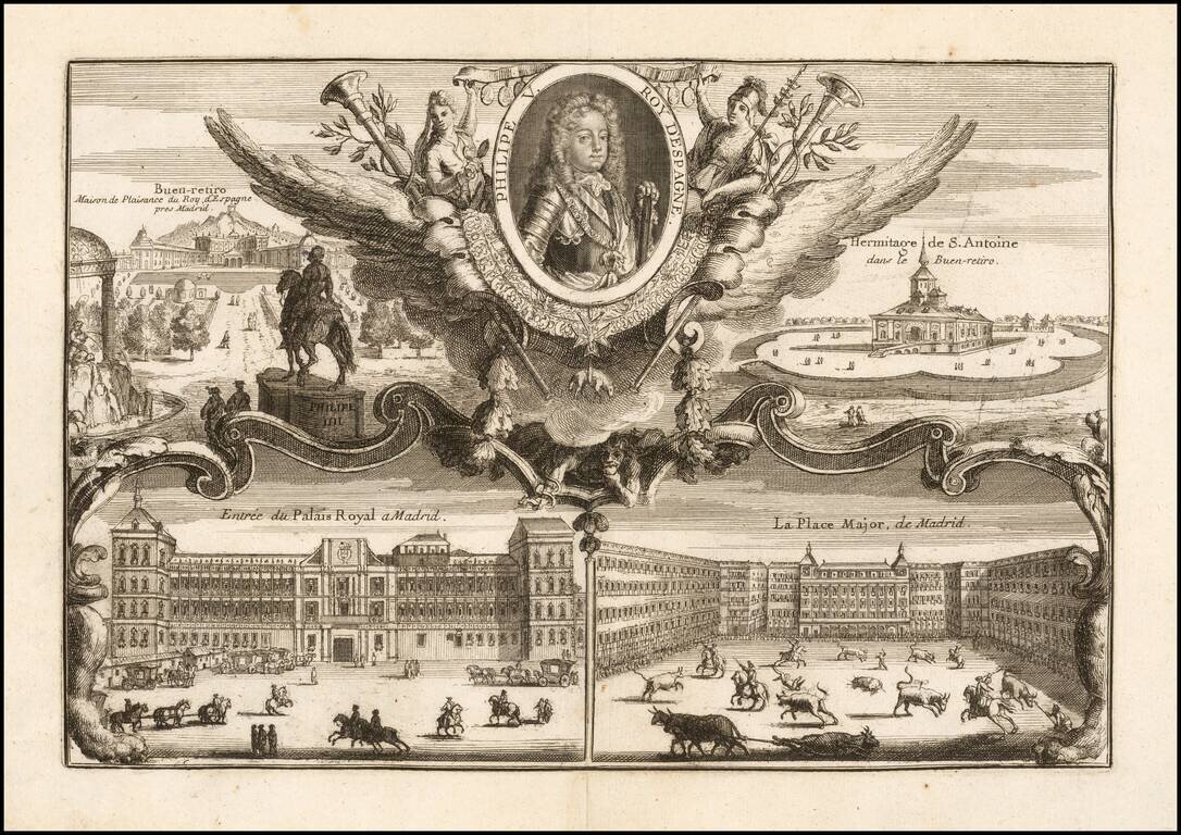
Decorative portrait of the King of Spain, with 4 decorative scenes of early 18th Century Madrid.

Rare 2-sheet map of Galicia, Asturias, etc., engraved by T. Rousseau for J.B. Nolin in Paris. The map extends from Santillana del Mar in Cantabria to Galicia. The text inset provides information on Galicia, Asturias and Biscaya. A fine large format...
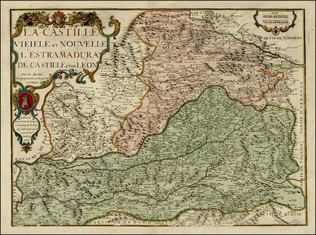
Detailed map of Castille, Estremadura and Leon. Includes a coats of arms in the title cartouche. Includes excellent detail. The map is apparently quite rare on the market. No examples listed on AMPR at auction or in dealer catalogues in the past 30...
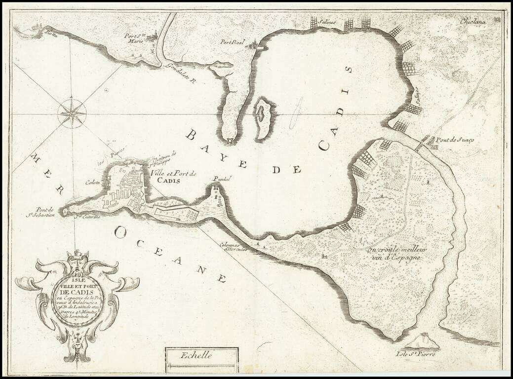
Scarce map of the the city and harbor of Cádiz, which appeared in Nicolas de Fer's book "Introduction de fortification". Includes a baroque cartouche. Cádiz is shown within a walled enclosure, with other cities arrayed around the bay.
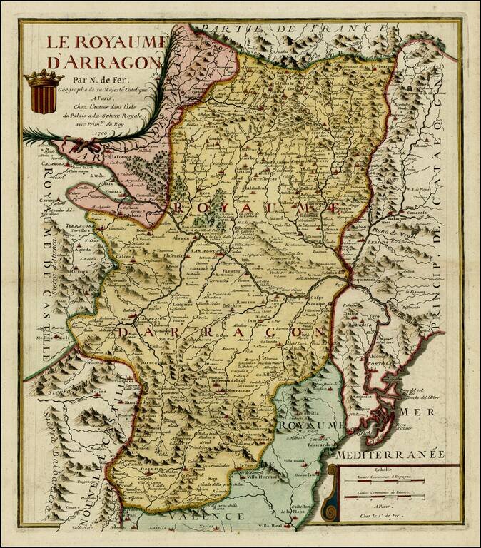
Detailed map of Aragon, with a coat of arms in the title. The map is centered on Zaragoza and shows the Kingdom in fine detail.
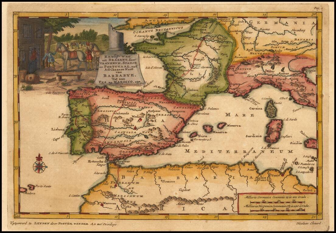
Detailed map of Spain, France and the Western Mediterranean. Francis Brooks was an Englishman who was enslaved by the Moors at the end of the 17th Century. After his escape, he wrote a narrative of his captivity, which detailed the practices of the...
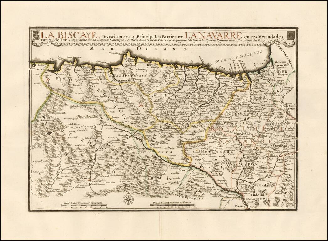
Large detailed map of the Basque region of Spain. The map extends from the San Sebastian Region to Santander in Cantabria and south to Pamplona, etc. The map is centered on Bilbao and Vitoria along the coastline and extending south to Burgos. Two...
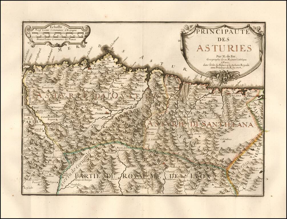
Rare map of the Asturias, published in Paris by Nicholas De Fer. Includes a coats of arms in the title cartouche. Includes excellent detail. The map is apparently quite rare on the market. No examples listed on AMPR at auction or in dealer catalogues...
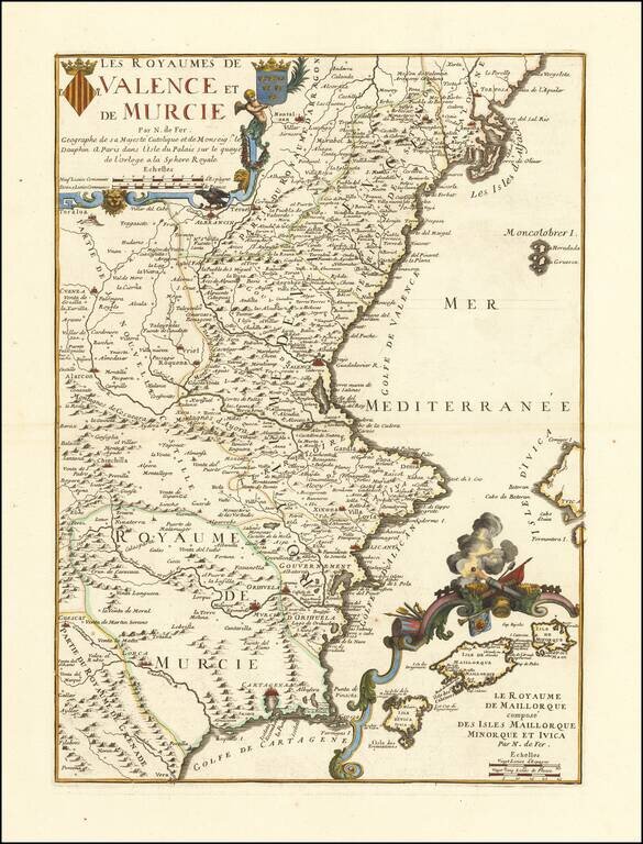
Detailed map of Valencia and Murcia, with a large decorative inset of the Balearic Islands. Includes 2 coats of arms in the title cartouche. Includes excellent detail, including the inset of the Balearic islands, which shows many place names and a...