
![Les Isles Philippines Molucques et de La Sonde [Japan inset]](/map/small/51609.jpg)
Detailed map of part of Southeast Asia and the Philippines, with a large inset of Japan.
The First Printed Map Based Upon the Projections of the Ancient Greek Geographer, Marinus of Tyre Nice example of Francesco Berlingheri's map Cyprus, the Holy Land and Middle East, from his Septe Giornate della Geographia di Francesco Berlinghieri...
![[India] and [Java Maior]](/map/small/59059.jpg)
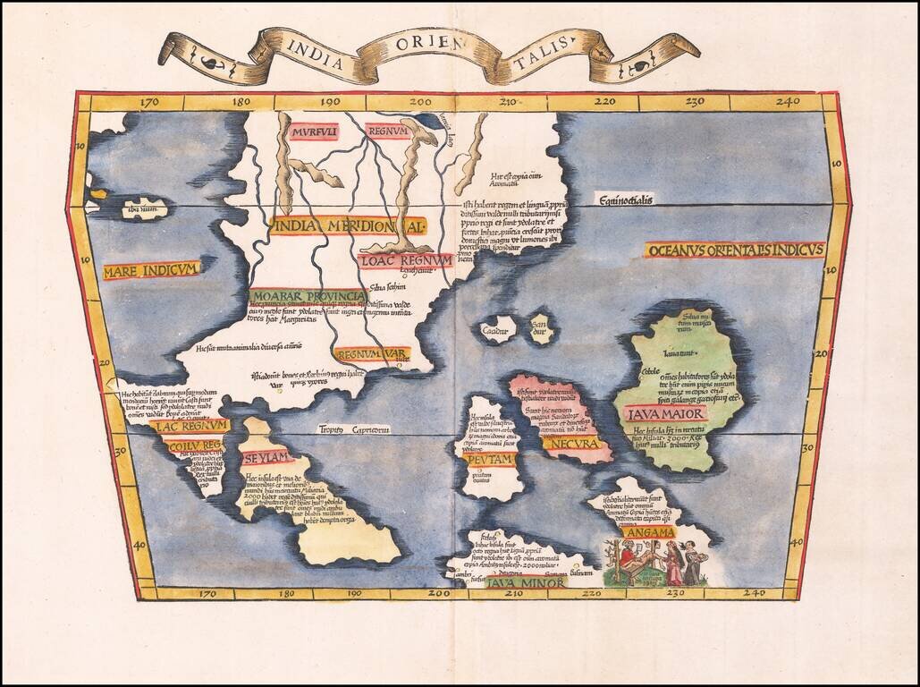
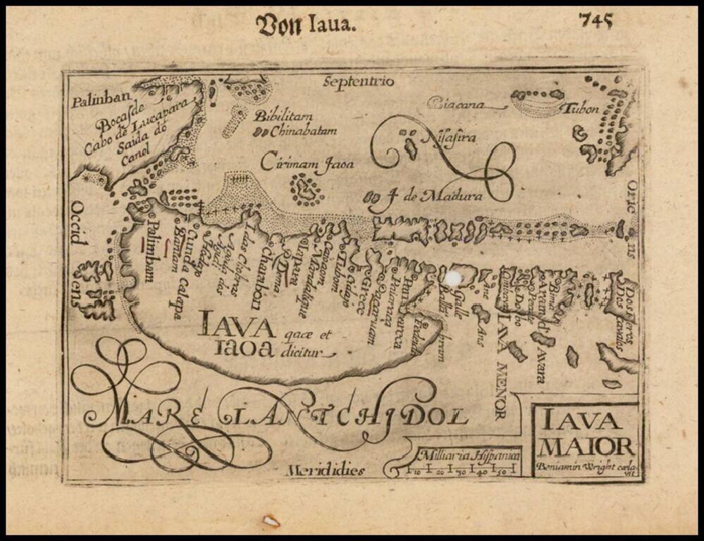
Fascinating map of India and map of Java Maior, from Honter's 1561 De Cosmographiae Rudimentis. Honter's maps are based upon modern sources and are among the earliest modern printed maps of the regions shown.
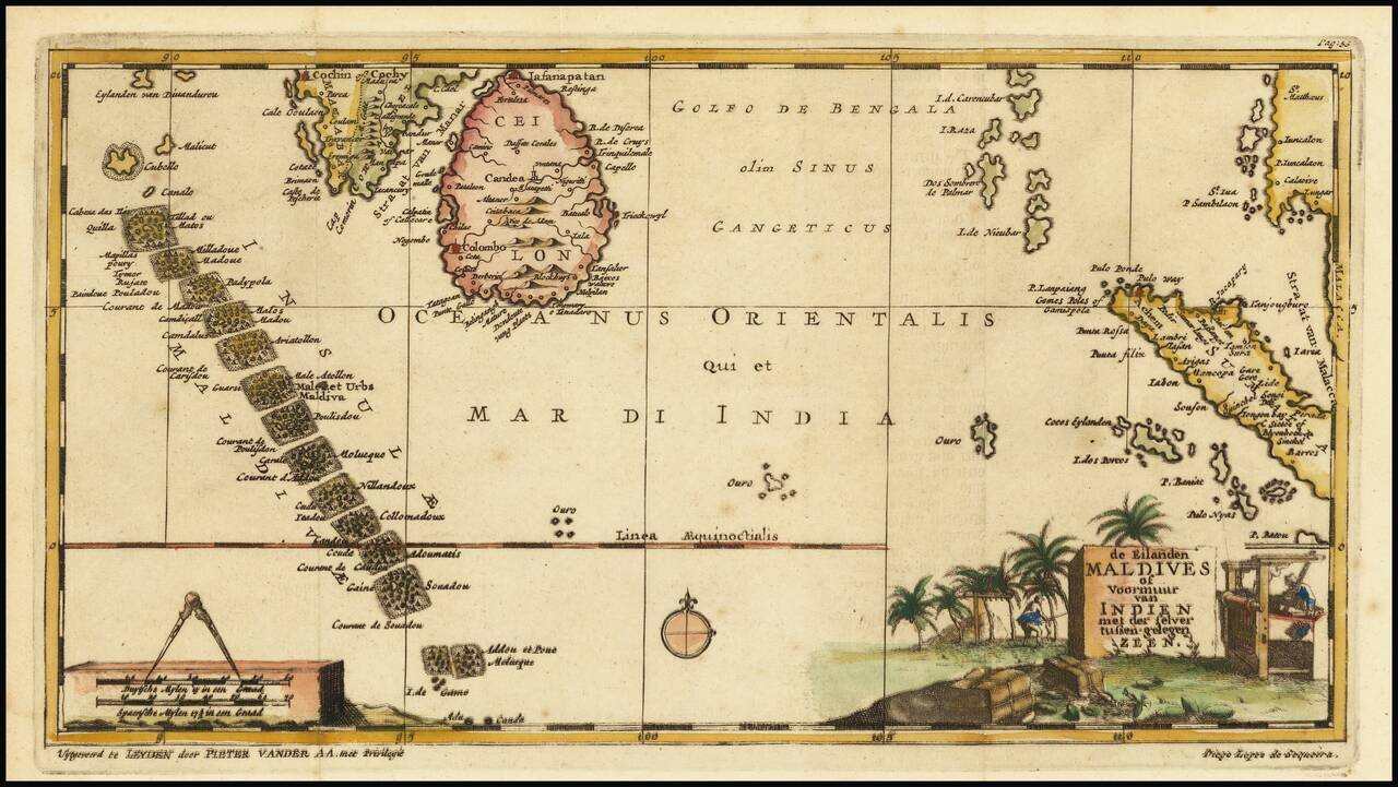
Interesting early map of the Maldives, Ceylon and parts of Malaysia and Sumatra, illustrating the travels of Diego Lopez de Sequeira. In the early 18th Century, Vander Aa reproduced a number of rare manuscript and printed accounts of 16th Century...
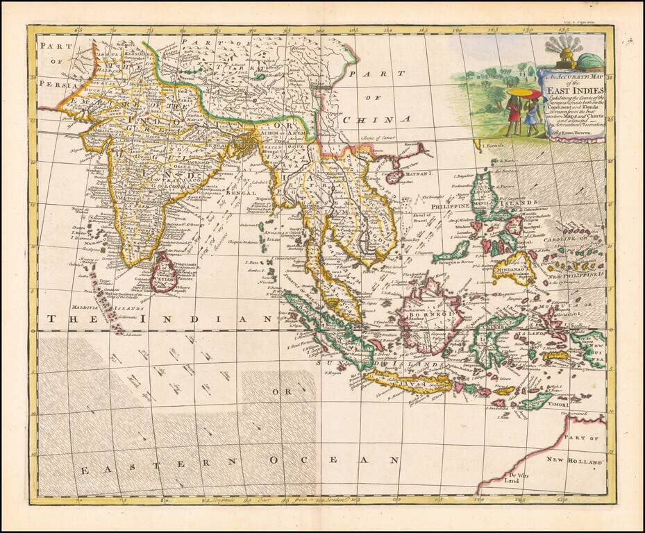
A decorative and highly detailed map, extending from Australia, the Philippines and the Carolines in the east to India, the Maldives and Afghanistan in the west. Includes information regarding the course of the flow of the Ocean in the Indian Ocean...
Scarce map of Southeast Asia, the Straits of Malacca, Philippines, Sumatra, Java, India etc., extending north to Canton and Macao, from Jean Lattre's Atlas Moderne. Includes a decorative allegorical cartouche showing the region as a place of commerce.
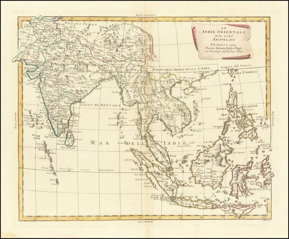
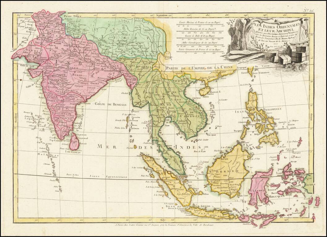
Early edition of Zatta's map of the Philippines, Indian and Southeast Asia. Striking regional map of Southeast Asia, extending from the Philippines and Moluccas to India and the Maldives, and north to Tibet. Decorative scroll title cartouche. This...
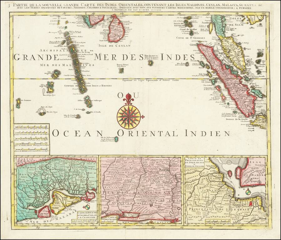
Finely detailed regional map depicting Singapore, Ceylon, the Maldive Islands, Sumatra, Southern Malaysia, etc. Remarkably detailed this map is highly decorative as well.
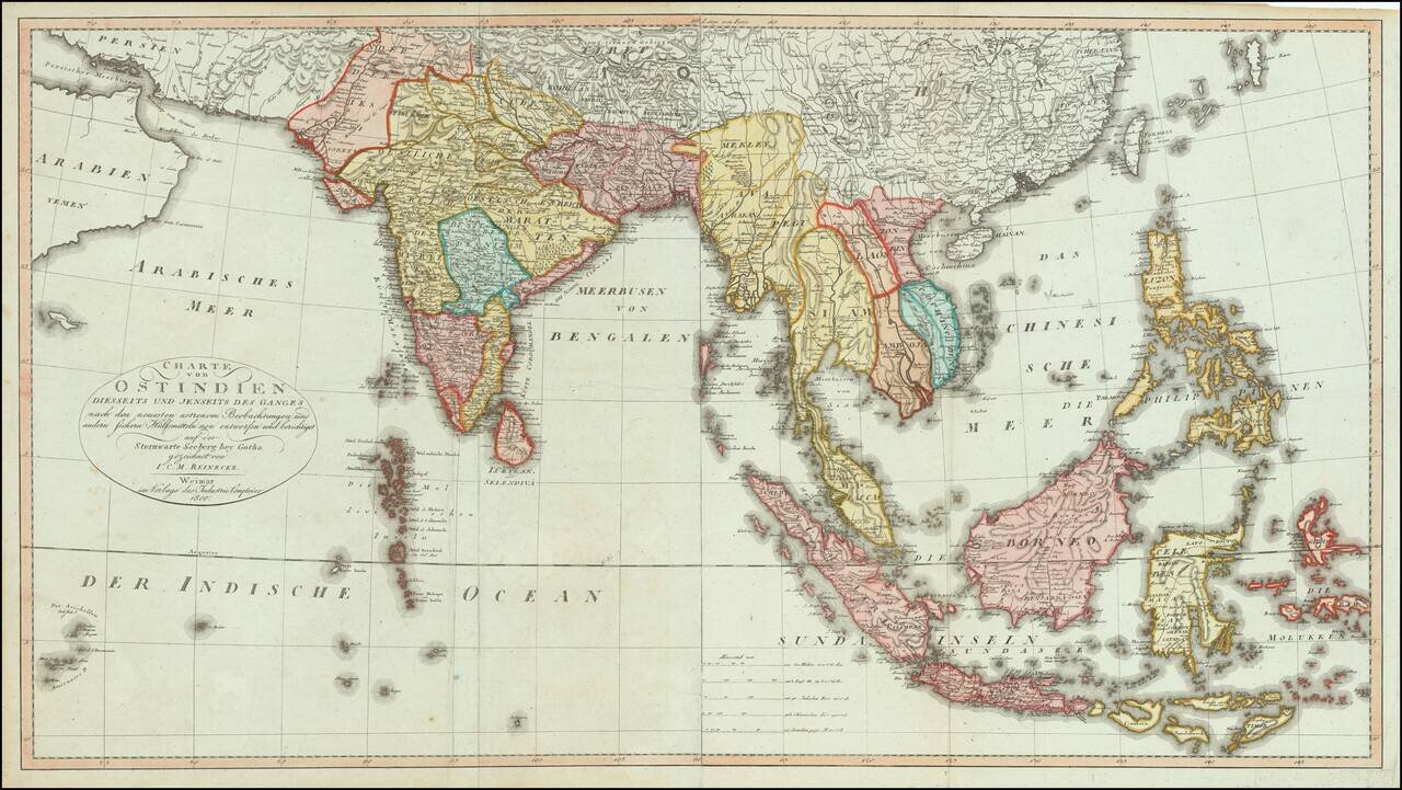
Fine, Rare German Map of South and Southeast Asia Sharply-executed map of the Indian Ocean and Western Pacific regions, encompassing the Indian subcontinent, Mainland Southeast Asia, Indonesia, Malaysia, the Moluccas, and the Philippines. The map is...
![[Southeast Asia] Tabu. Mo. In. Orig. (First Modern Map of Southeast Asia -- Old Color)](/map/small/41330.jpg)
Old color gold heightened (on verso) example of the rare 1522 edition of the first printed map to focus on the Southeast Asian islands and indeed, the only map to focus on this area in the first half of the 16th Century. Fries map was a significant...
Early Antique Map of Southeast Asia Finely colored example of the first printed map to focus on Southeast Asia and the only map to focus on this area in the first half of the 16th century. Fries' map was a significant milestone in the Mapping of...
![[The Spice Map] Insulae Moluccae celeberrimae sunt ob Maximam aromatum copiam quam totu terrarum orbem mittunt harum praecipue sunt Ternate, Tidoris, Motir Machion et Bachion, his quidam adiungunt Gilolum, Celebiam, Borneonem, Amboinum et Bandam, Ex Insu](/map/small/70838.jpg)
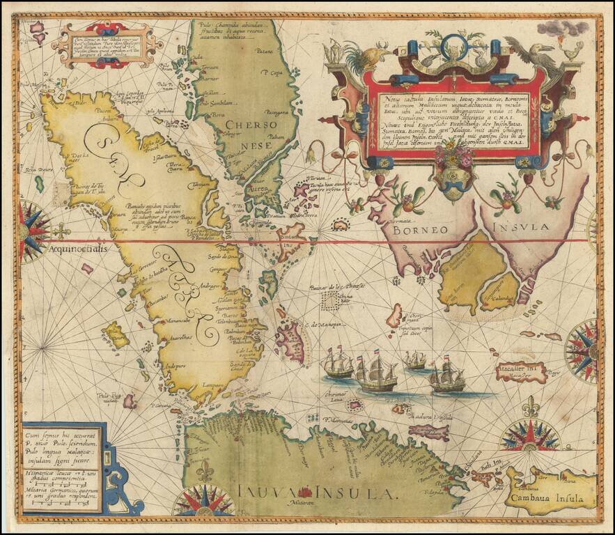
The Spice Map—Rare, Striking Map of Southeast Asia Rare English edition of Petrus Plancius's "Spice Map," first published in 1594, covering the Philippines and Maritime Southeast Asia, including the famed Spice Islands. Plancius based his map on...
Theodore De Bry's Edition of The Most Important Map of the Straits of Malacca and Vicinity published in the 16th Century Fine example of Willem Lodewijcksz's suppressed map of the region centered on the Straits of Malacca, from Part II of Theodor De...
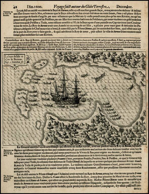
Rare early map of Borneo and neighboring islands, from Olivier Van Noort's Description du Penible Voyage Faict entour de l'Univers ou Globe Terrestre, published by Cornelis Claes in 1602, the first printed account of Van Noort's voyage, which would...
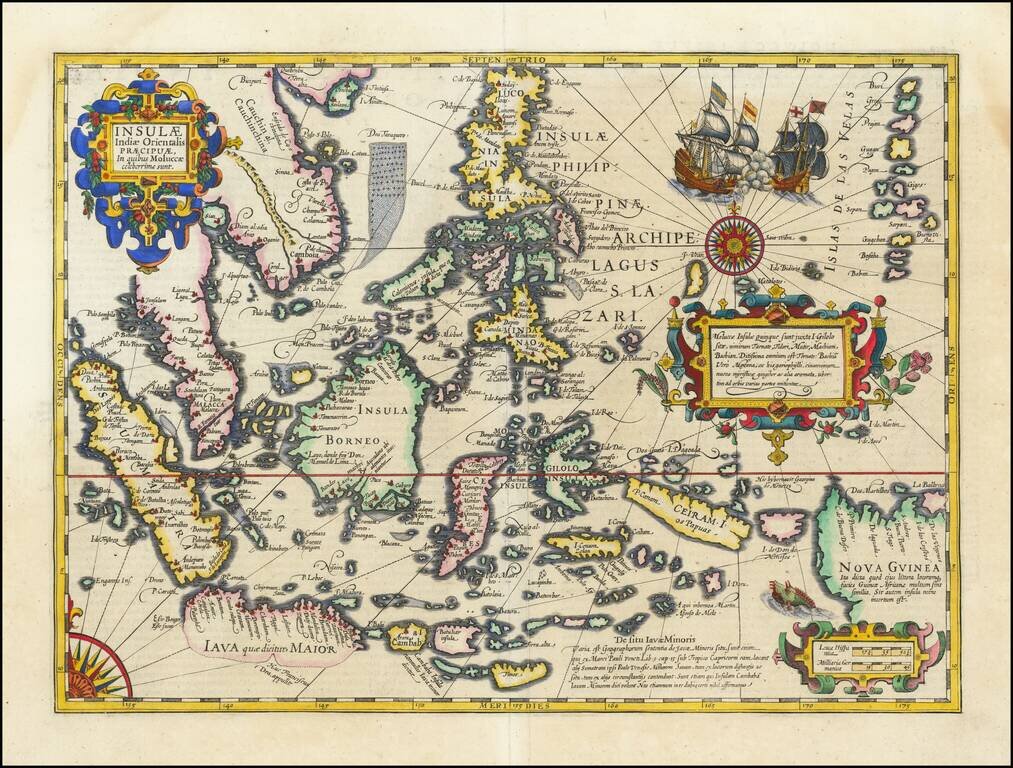
Fine Example of Decorative Map of the East Indies from the Mercator-Hondius Atlas This map showcases European knowledge of the East Indies, an area of increasing importance to Europe from the early-sixteenth century onwards. The focus is on the...
Nice example of this early state of Barent Langenes, map of Java and neighboring Islands, which first appeared in the 1598 edition of Langenes Caert-Thresoor, published in Middelburg. The present map is one of the earliest obtainable maps of Java,...