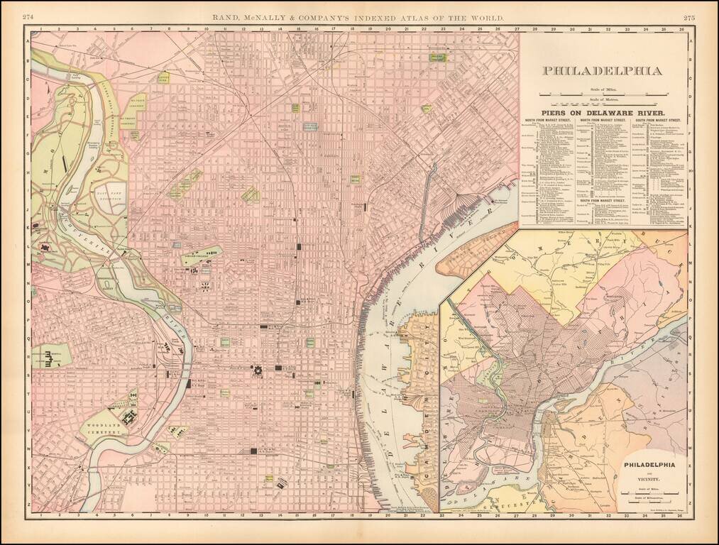
Highly detailed map of Philadelphia, extending west of the Schuylkill River. Shows roads, streets, buildings, piers, ferry's, railroads and depots, colleges, reservoirs, etc. Beautiful large format with inset of Philadelphia and neighboring counties.
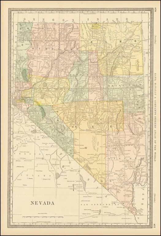
Including Roop County Fine early map of Nevada, colored by counties, and showing the extent of the township surveys to date, including the now extinct Roop County, which was the subject of a major boundary dispute. The year 1882 is an historically...
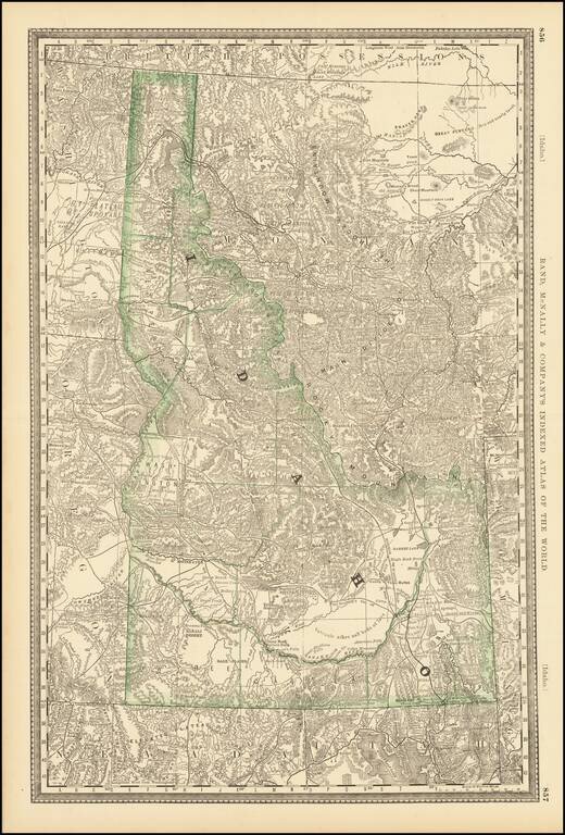
Early separate map of Idaho Territory. Highly detailed, showing towns, mines, roads, railroads, mountains, rivers, Indian Reservations, military reserves, post offices, forts, lakes, etc.
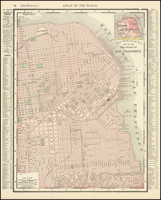
Detailed map of San Francisco, showing towns, wharfs, rail lines, street car lines, roads, buildings, etc. Includes a key with points of Interest, Streets, etc.
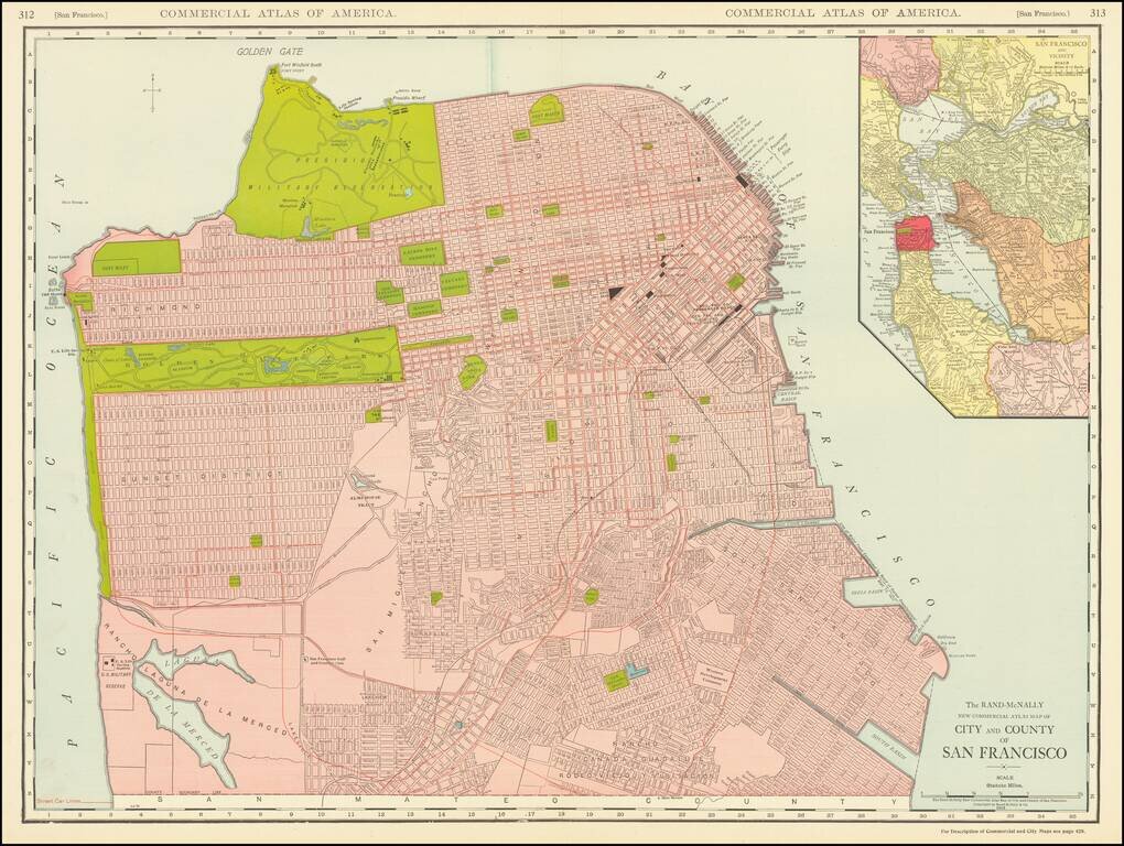
This is a great large-format, highly detailed map of San Francisco, showing towns, wharfs, rail lines, street car lines, roads, buildings, and more. The map includes a large inset of San Francisco Bay, attractively colored according to the county....