Guillaume De L'Isle (1675-1726) is probably the greatest figure in French cartography. Having learned geography from his father Claude, by the age of eight or nine he could draw maps to demonstrate ancient history. He studied mathematics and astronomy under Cassini, from whom he received a superb grounding in scientific cartography—the hallmark of his work. His first atlas was published in ca. 1700. In 1702 he was elected a member of the Academie Royale des Sciences and in 1718 he became Premier Geographe du Roi.
De L'Isle's work was important as marking a transition from the maps of the Dutch school, which were highly decorative and artistically-orientated, to a more scientific approach. He reduced the importance given to the decorative elements in maps, and emphasized the scientific base on which they were constructed. His maps of the newly explored parts of the world reflect the most up-to-date information available and did not contain fanciful detail in the absence of solid information. It can be fairly said that he was truly the father of the modern school of cartography at the commercial level.
De L’Isle also played a prominent part in the recalculation of latitude and longitude, based on the most recent celestial observations. His major contribution was in collating and incorporating this latitudinal and longitudinal information in his maps, setting a new standard of accuracy, quickly followed by many of his contemporaries. Guillaume De L’Isle’s work was widely copied by other mapmakers of the period, including Chatelain, Covens & Mortier, and Albrizzi.
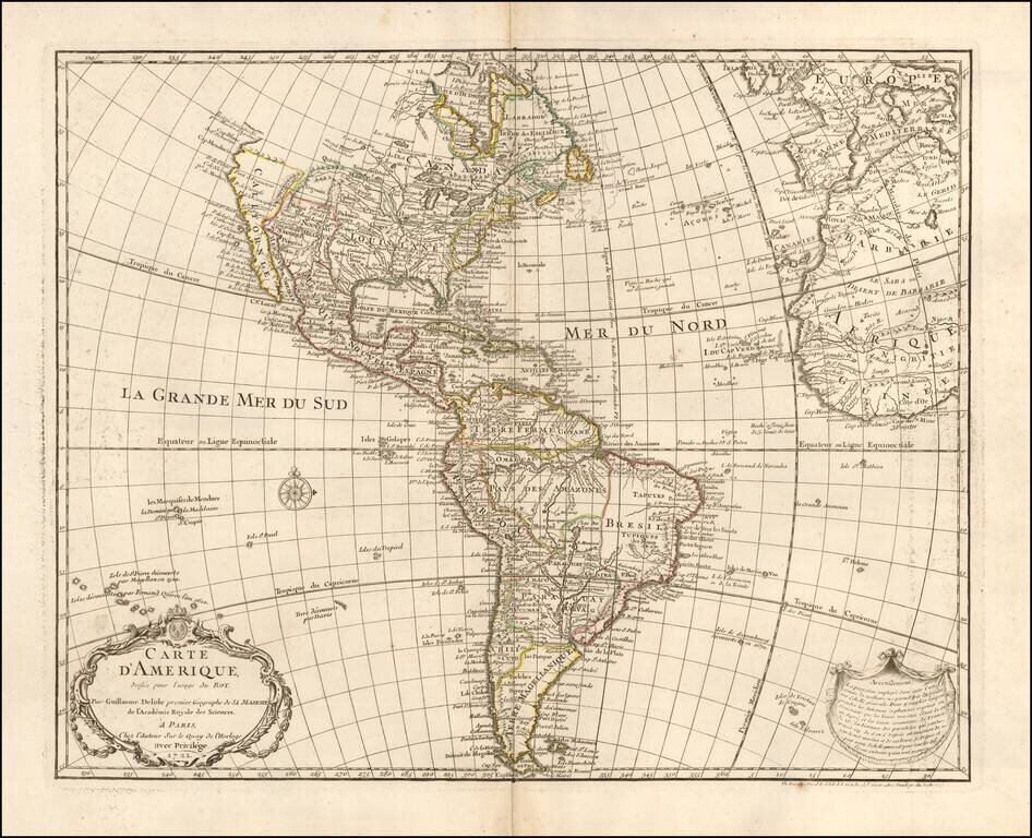
1745 state of this finely engraved map of America, published by Guillaume De L'Isle in Paris. De L'Isle's map of America was compiled from the best available source and includes significant modern cartographic detail for the period. California is...

Fine example of Buache's map of America, recently updates and improved to remove the sea of the west, based upon the discoveries of Cook and Russian explorers. This map gives extraordinary treatment to the region, although there is curiously no...
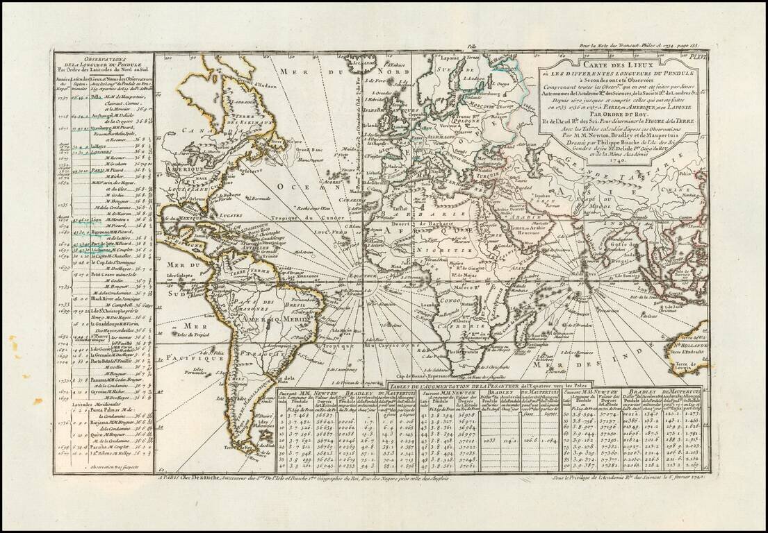
Comparing the Observations of Newton, Bradley and Maupetius Rare map centered on Europe, without the western part of North America or the Pacific. The map includes tables showing variations in longitude and latitude, as calculated by Newton, Bradley...
![Planisphere Physique ou l'on voit du Pole Septentrional ce que l'on connoit de Terres et de Mers Avec les Grandges Chaines de Montagnes . . . [Bay or Sea of the West]](/map/small/70578.jpg)
Scarce Buache Map of the World's Watersheds, One of the First Thematic Maps Fine example of Buache's watershed map of the world, on a North Polar projection. The map shows how mountain chains affect the flow of water into the various oceans. The map...

Scarce late state of Guillaume De L'Isle's map of the Western Hemisphere, updated to include the 3 voyages of Captain James Cook. Dezauche also shows the route of the voyages of Abel Tasman (1642), Quiros, Magellan (1520), Le Maire (1616), Mendana...
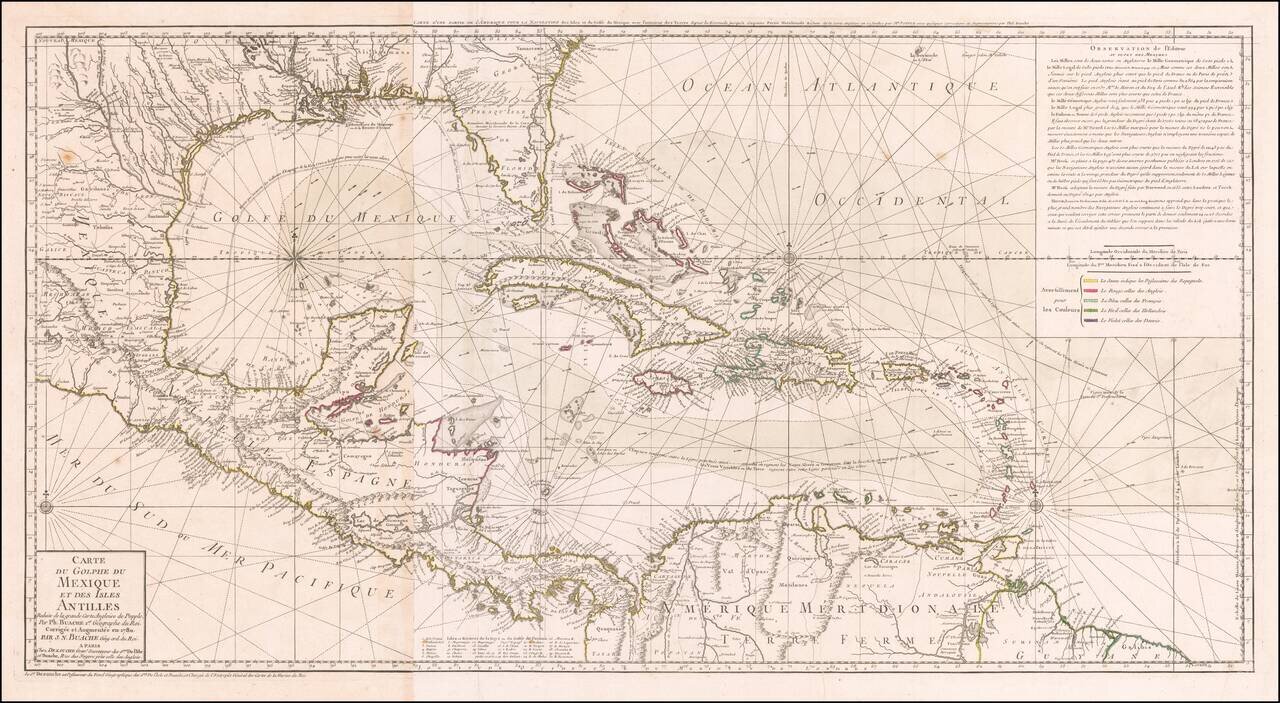
Striking, Intricate Map of the Caribbean Region Scarce and highly-detailed map of the Gulf Coast, Florida, Central America and the Caribbean from J.A. Dezauche, successor to Philippe Buache and Guillaume De L'Isle. The map is incredibly detailed, not...
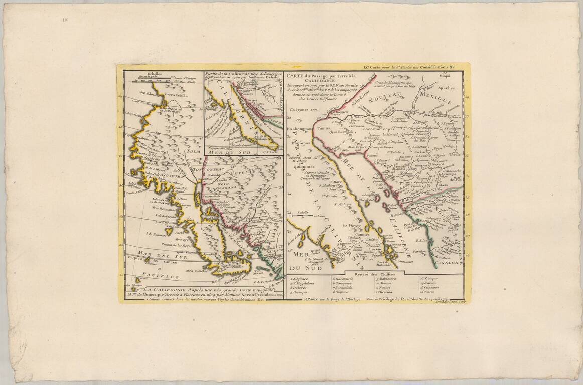
Truly beautiful example of a historically important 18th century map of California. Bauche's mapsheet comprises three mappings of California as a peninsula, following the discoveries of Eusebio Kino, the Italian Jesuit missionary. Bauche includes the...
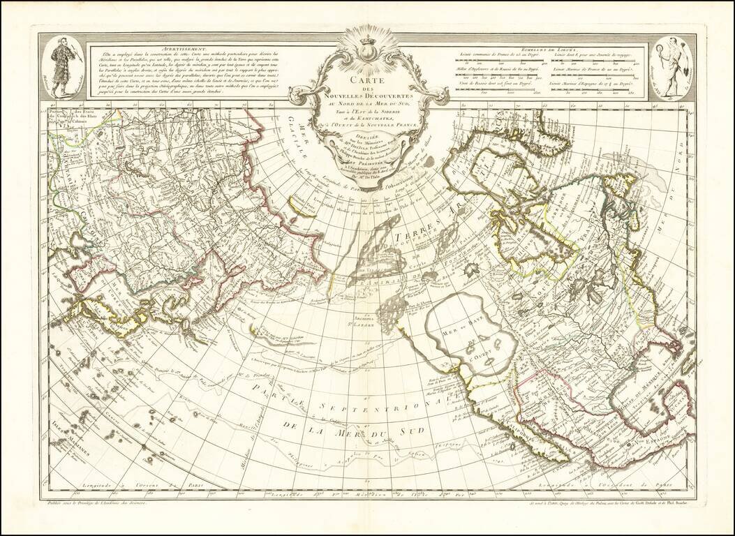
A Cartographic Landmark - The Most Complete Map of the North Pacific to Date and the Beginning of the Scientific Debate of the Sea of the West and Northwest Passage This is a fine example of a first edition of the landmark De L'Isle-Buache map of the...
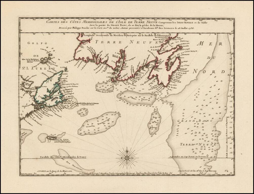
Philippe Buache Responds To Errors In Popple's Map of the British Colonies. Scarce map of the coast of Southern Newfoundland and part of Nova Scotia by Philippe Buache in 1736, as part of his critique of the accuracy of Henry Popple's map of 1733....
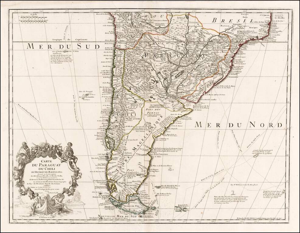
Nice example of Philippe Buache's edition of De L'Isle's map of the southern part of South America. The map shows the routes of a number of 17th century explorers in both the Atlantic and Pacific Oceans, as well as a marvelous and highly annotated...

Detailed map of Peru, pubished in Paris by a young Philippe Buache, who would go on to become the pre-eminent French mapmaker of the middle of the 18th Century, along with J.B.B. D'Anville.
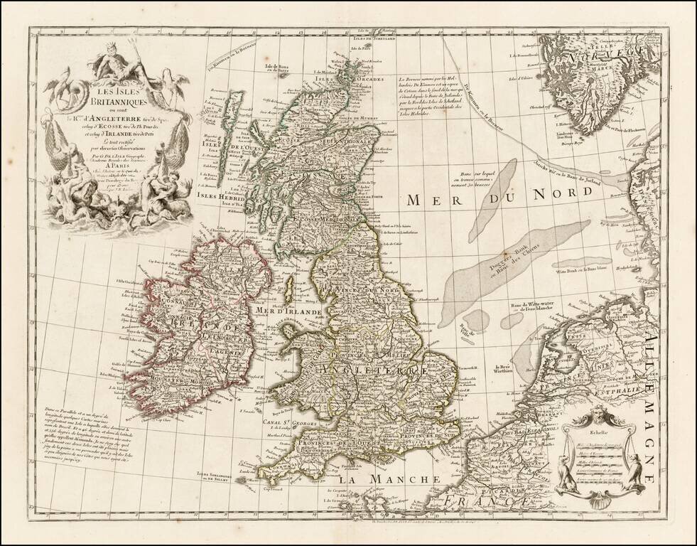
Nice example of one of Buache's editions of Guillaume De L'Isle's map of the British Isles. The map incorporates John Speed's information on England, Timothy Pont's mapping of Scotland and Petty's mapping of Ireland, as noted in the title.
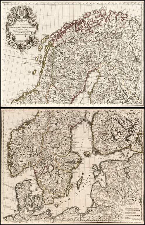
Large format 2-sheet map of the region from Scandinavia to the Baltic and part of Poland, originally issued by De L'Isle in 1708.
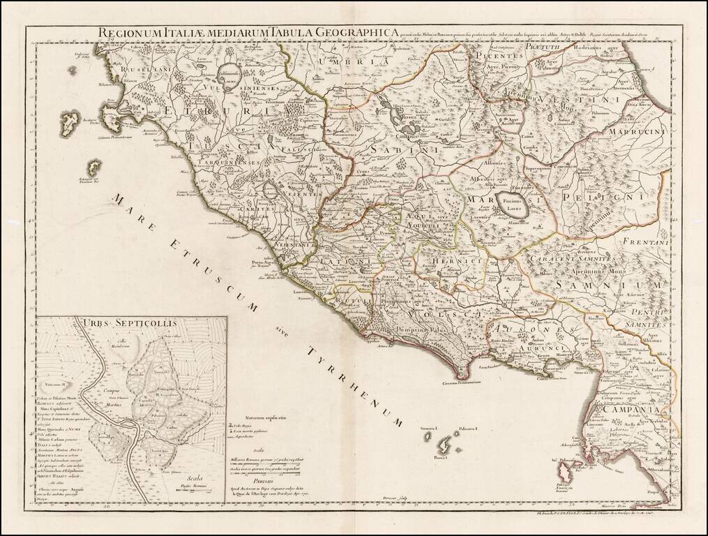
Detailed map of a portion of Italy, showing the regions in ancient times, including Etruscan Tuscany, Sabini, Vestini, Marruncini, Peligni, Latini, Henrici, Samnium, Volsci, Ausones and part of Ubria and Picentes. Many early towns, roads, rivers,...
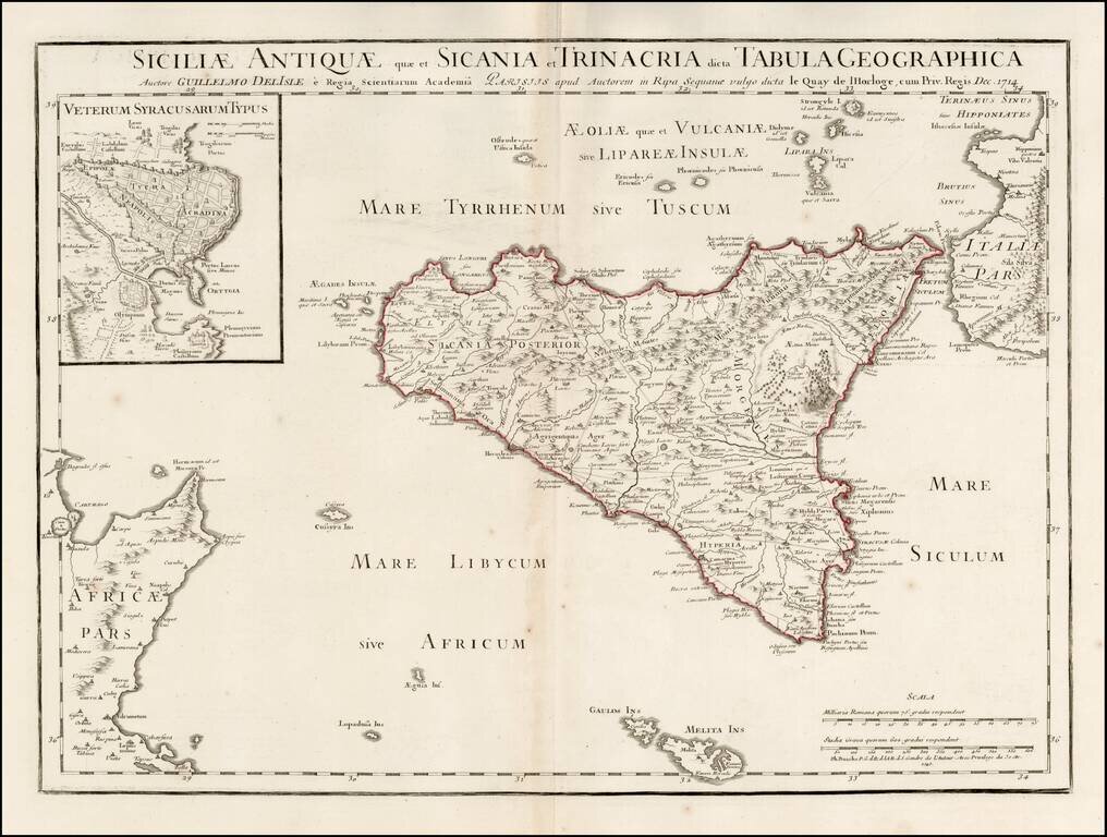
Scarce map of Ancient Sicily, with a large inset of Syracuse, originally published by Guillaume De L'Isle in 1714. Detailed map of ancient Sicily, showing roads, mountains, rivers, towns, harbors, smaller islands, etc. Extends south to Malta. Shows...
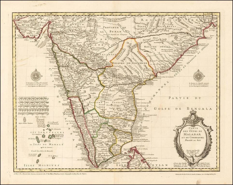
Finely Detailed Map of Southern India Emphasizing Trade Finely engraved map of the southern part of India, first issued in 1723 by acclaimed French mapmaker Guillaume De L’Isle. It focuses on trade routes within India, as well as the Coromandel and...