Rigobert Bonne (1727-1794) was an influential French cartographer of the late-eighteenth century. Born in the Lorraine region of France, Bonne came to Paris to study and practice cartography. He was a skilled cartographer and hydrographer and succeeded Jacques Nicolas Bellin as Royal Hydrographer at the Depot de la Marine in 1773. He published many charts for the Depot, including some of those for the Atlas Maritime of 1762. In addition to his work at the Depot, he is best known for his work on the maps of the Atlas Encyclopedique (1788) which he did with Nicholas Desmarest. He also made the maps for the Abbe Raynals’ famous Atlas de Toutes Les Parties Connues du Globe Terrestre (1780).
More than his individual works, Bonne is also important for the history of cartography because of the larger trends exemplified by his work. In Bonne’s maps, it is possible to see the decisive shift from the elaborate decorations of the seventeenth century and the less ornate, yet still prominent embellishments of the early to mid-eighteenth century. By contrast, Bonne’s work was simple, unadorned, and practical. This aesthetic shift, and the detail and precision of his geography, make Bonne an important figure in mapping history.
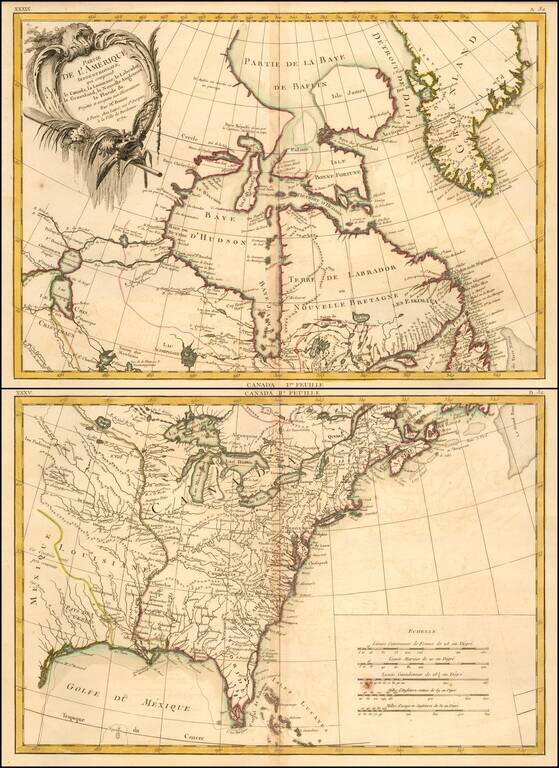
Detailed 2 sheet map of the British and Spanish colonies in North America, which appeared in Lattre's Atlas Moderne, published in Paris. The map extends north to Baffin's Bay and west to Lake Ouinipigon (Winnipeg), the known course of the Missouri...
![[Untitled Map of the United States] Canada IIe Feuille](/map/small/61191.jpg)
Detailed map of the United States and French Louisiana, west to the region of the Padouca Indians along the Upper Missouri and covering most of Texas. Nice detail in the Missouri and Mississippi River Valleys, indicative of the French activity in the...
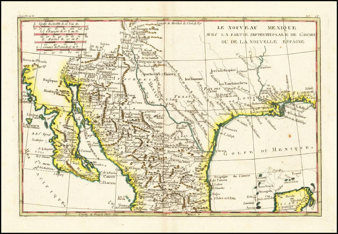
Fascinating map, showing excellent detail in Texas, Arizona and New Mexico. Includes a badly misprojected Baja California, as was normally the case with French maps of the period. Missions and settlements shown in the Texas interior. Indian tribes...
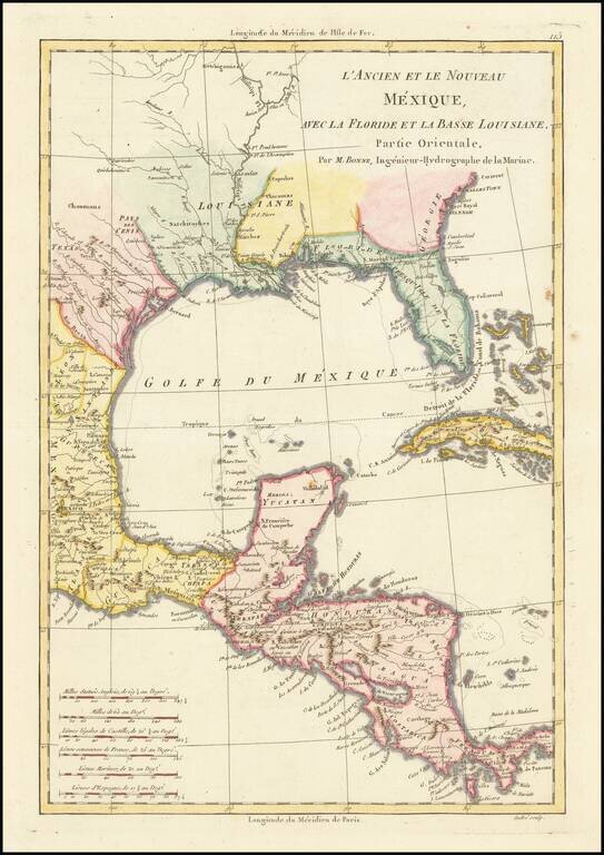
Excellent colonial era map of the Gulf Coast, Florida, Texas and Central America, with the Western part of the Caribbean. Nice detail in Florida and Texas. Attractive wash colors. From Bonne's Atlas Supplement, published in Paris in 1787.
Decorative map of North America, published in 1774. The map extends west to include Texas and much of the supposed course of the Missouri, north to a mythical set of lakes referenced as the supposed location of the Sea of the West. Includes Indian...
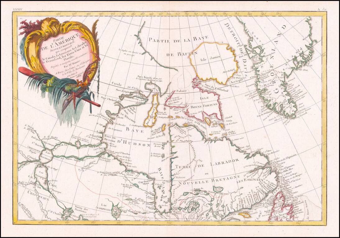
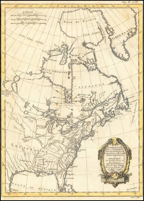
Detailed map of Canada and Hudson's Bay. Includes decorative cartouche and excellent detail throughout. Extends from Lake Winnipeg to the Eastern Seaboard.
![[Virgin Islands, etc] Supplément pour les Isles Antilles, extrait des cartes Angloises](/map/small/69592.jpg)
Interesting hand-colored engraved map of the Virgin Islands, with insets of Barbuda, St. Kits, Antigua, Dominica, St. Lucia, Barbados, St. Vincent, Grenada, and Tobago. The main map covers the region from St. Thomas and St. Croix to St. Martin and...
![[Virgin Islands] Cartes De Supplement Pour Les Isles Antilles](/map/small/70820.jpg)
Excellent map of the Virgin Islands from Puerto Rico to Barbuda, centered on the American and British V.I., extending from Crab Island, St. Thomas and St. Croix to Sable Island, Sombrero Island, St. Barts, St. Martin and Anguilla. Includes 8 large...
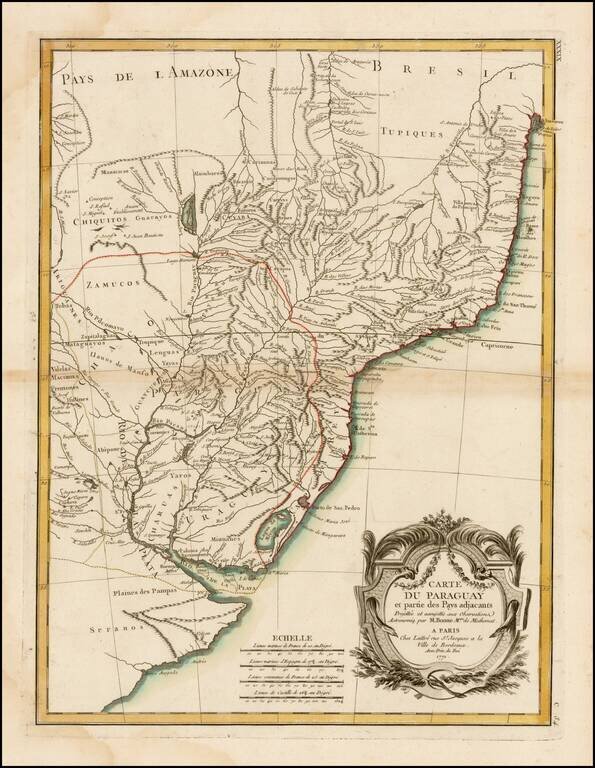
A detailed and attractive regional map of Brazil and Paraguay with a decorative cartouche. Rigobert Bonne served as the map maker to the King of France.
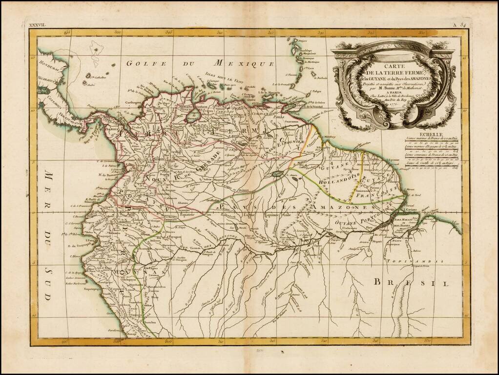
Striking 18th Century map of the northern portion of South America, including, Columbia, Venezuela, Ecuador, Guyana and the northen part of Brazil, on the eve of their independence from Spain. The map is divded into Spanish intendencies, with the...
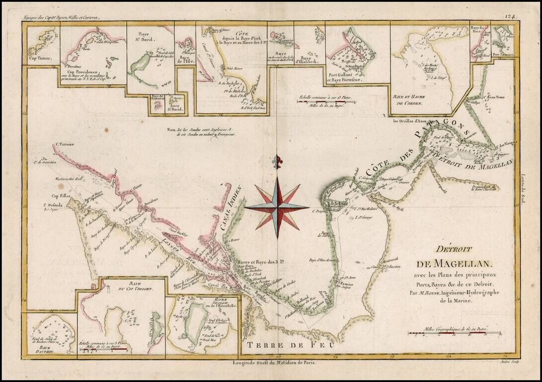
Detailed map of the Straits of Magellan from Bonne's Atlas Supplement. Shows the direction of the currents, bays, points, soundings, harbors, islands, shoals, etc. Includes the best route through the straits as known at the end of 18th century....
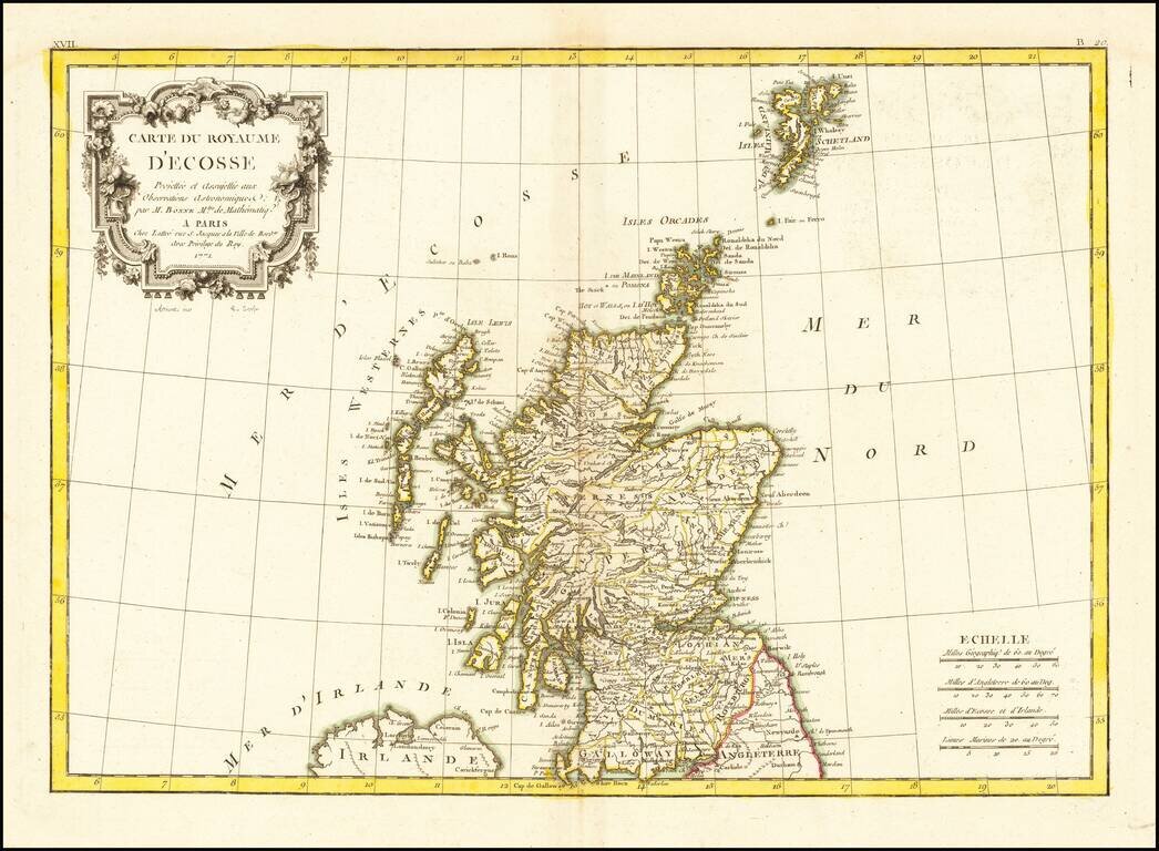
Decorative map of Scotland, with an elaborate title cartouche. From Bonne's Atlas Moderne.

Very attractive engraved double-page sea chart of the Mediterranean Sea, with publisher's hand color in outline. Jean Lattre was one of the premier French mapmakers of the last quarter of the 18th century. This map features his characteristic vignette...
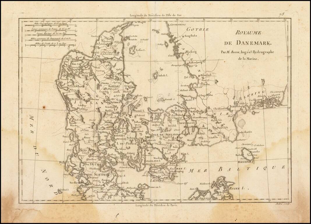
Attractive map of Denmark, with details of cities, rivers, land masses, and oceans. Rigobert Bonne was the official Hydrographer to the King of France.
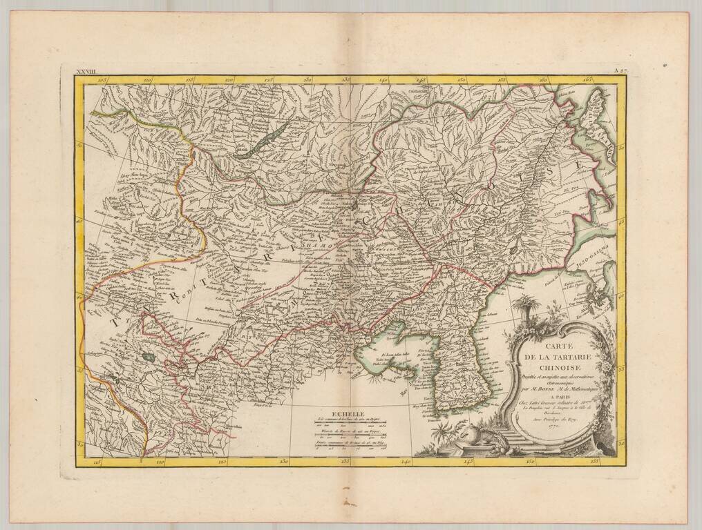
Fascinating map of northeastern Asia by Rigobert Bonne. The map is bounded by Siberia and Korea in the east and extending to Central Asia and Chinese Tartarie. Highly detailed and attractive.
![Plan du Typa ou de Macao [with] Plan De La Baye D'Awatwska…Du Kamtschatka [with] Parti Du Japon ou Nipon](/map/small/36150.jpg)
Detailed maps of Macao, Awatska Island and part of Japan (Nihon), which appeared in the French edition of the Official Account of Cook's Voyages. Includes soundings and other details of each of the Bays.