Willem Janszoon Blaeu (1571-1638) was a prominent Dutch geographer and publisher. Born the son of a herring merchant, Blaeu chose not fish but mathematics and astronomy for his focus. He studied with the famous Danish astronomer Tycho Brahe, with whom he honed his instrument and globe making skills. Blaeu set up shop in Amsterdam, where he sold instruments and globes, published maps, and edited the works of intellectuals like Descartes and Hugo Grotius. In 1635, he released his atlas, Theatrum Orbis Terrarum, sive, Atlas novus.
Willem died in 1638. He had two sons, Cornelis (1610-1648) and Joan (1596-1673). Joan trained as a lawyer, but joined his father’s business rather than practice. After his father’s death, the brothers took over their father’s shop and Joan took on his work as hydrographer to the Dutch East India Company. Later in life, Joan would modify and greatly expand his father’s Atlas novus, eventually releasing his masterpiece, the Atlas maior, between 1662 and 1672.

Blaeu’s Influential Map of Tierra del Fuego Showing the Important Strait of Le Maire Fine example of Willem Janszoon Blaeu's map of the Straits of Magellan and Tierra del Fuego (Magellanica)—the gateway to the Pacific during the seventeenth and...
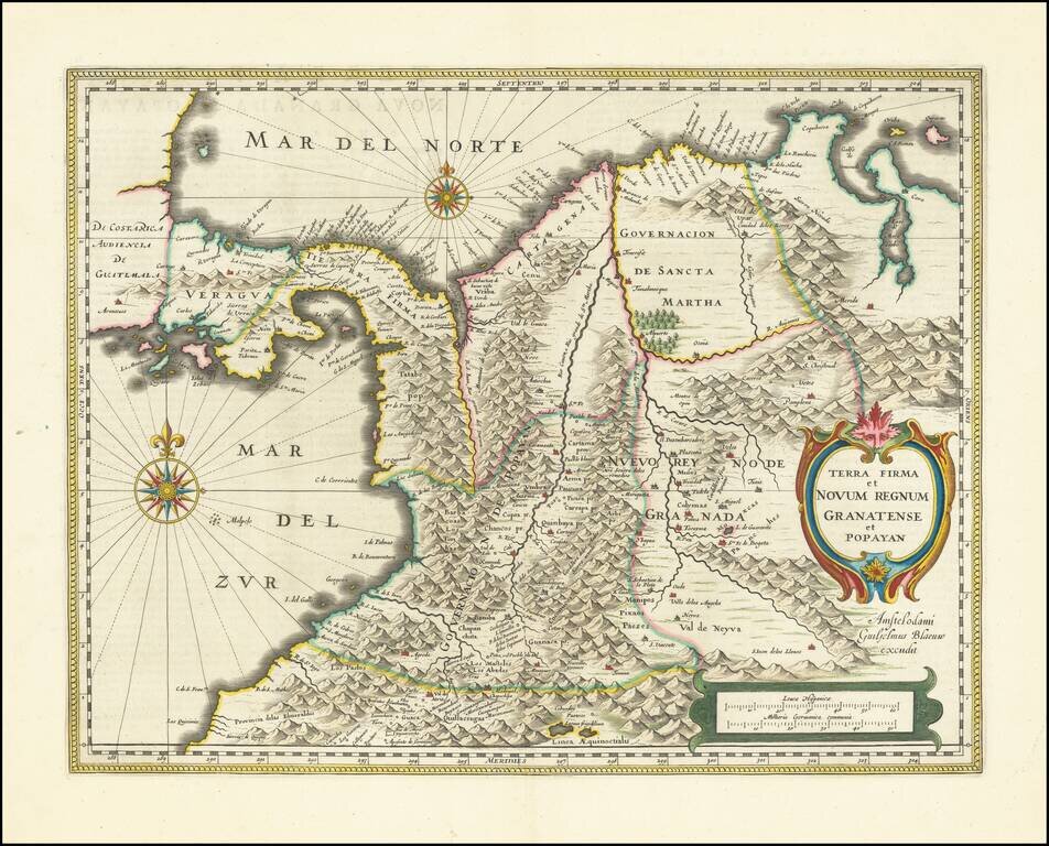
Fine example of Blaeu's map of Colombia, part of Ecuador extending south to Esmereldas, and Venezuela extending east nearly to Caracas. Includes 2 large compass roses, and two large cartouches. Provides an excellent view of mid-17th Century Columbia,...
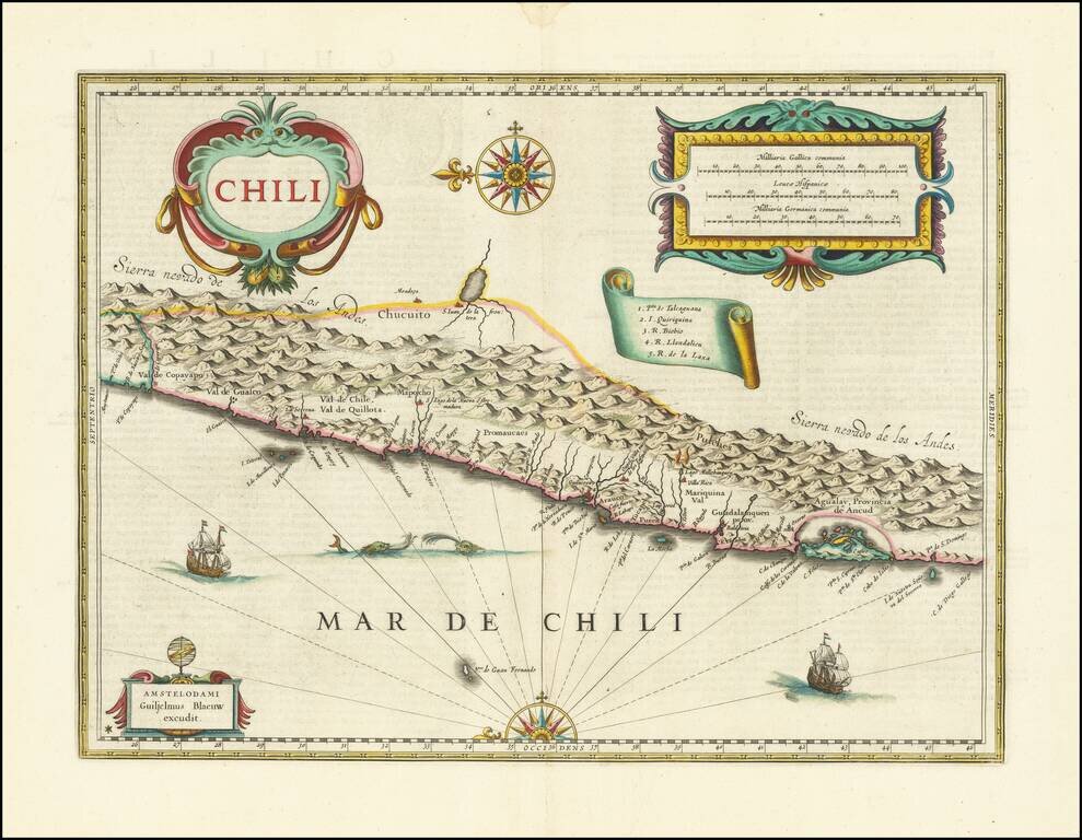
The First Large Atlas Map of Chile, from the Dutch Golden Age Nice old color example of Blaeu's map of Chile. This is the first large atlas map of the Spanish colony, although it also shows land controlled by the Mapuche and never conquered by the...
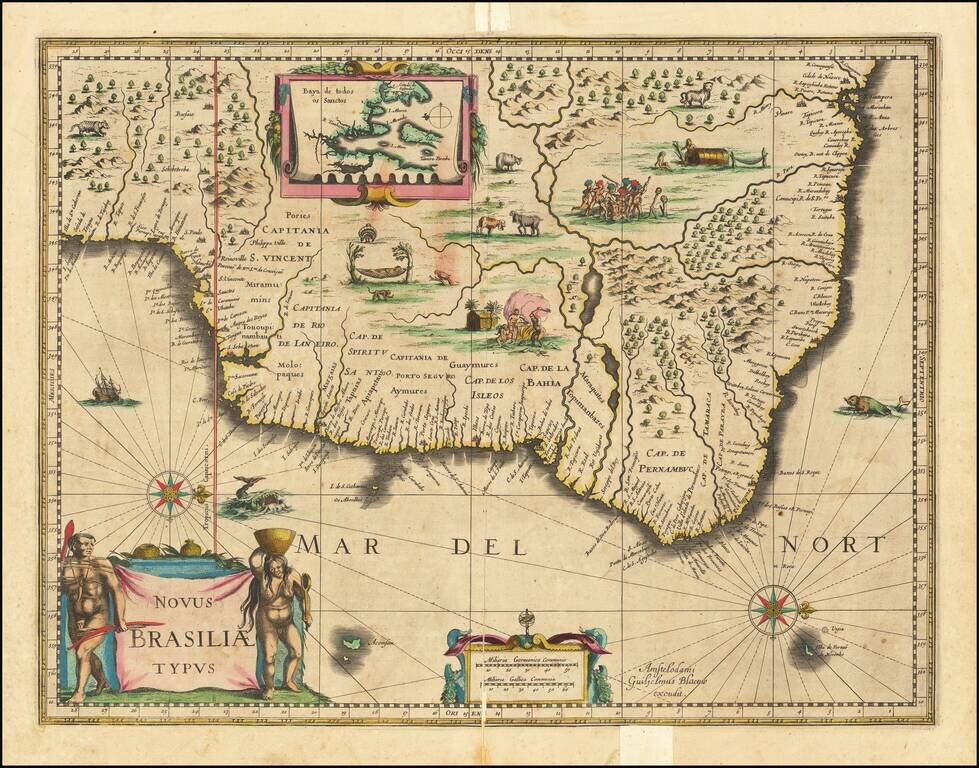
Fine old color example of Blaeu's first map of Brazil, with north oriented to the right. Includes inset map of Baya de todos Santos, elaborate cartouche, 2 compass roses and richly embellished vignettes of native Brazilian life and animals. The...
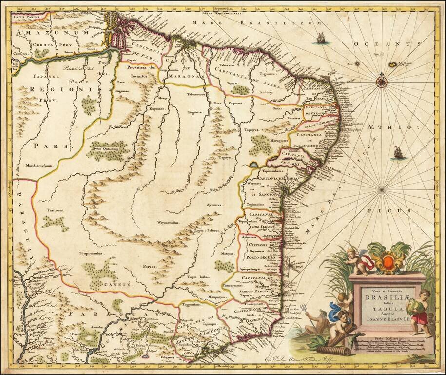
Gorgeous full color example of Blaeu's scarce map of Brasil, which first appeared in late editions of Blaeu's Atlas Maior and was later reissued by Pieter Schen, after Schenk acquired what was left of the Blaeu inventory of copper plates. An nice old...
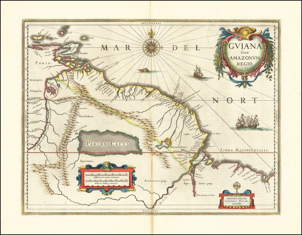
El Dorado on Lake Parimus -- The Fabled City of Gold Nice hand-colored example of Blaeu's decorative map of the coast between the Orinoco River and the Amazon, centered on Parime Lacus. The map tracks the Amazon River into the interior and, most...
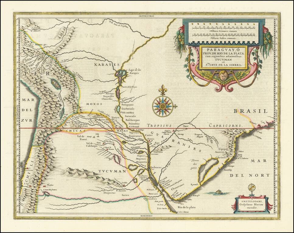
A Decorative Map of Central South America from the Golden Age of Dutch Cartography. A fine example of Blaeu’s atlas map of Paraguay, the Rio de la Plata region, and the surrounding area. The principal focus of this double-page map is the river...
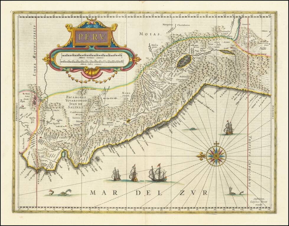
Striking, Early Map of Peru from the Dutch Golden Age Fine old-color example of Blaeu's map of Peru, one of the best early decorative maps of the region. This is one of the two earliest atlas maps to focus on Peru, along with the map by Henricus...

Finely colored example of Blaeu's map of Venezuela and the Northeastern part of South America. Includes 2 decorative cartouches, vignettes of various indigenous animals, a compass rose and rhumb lines, etc.
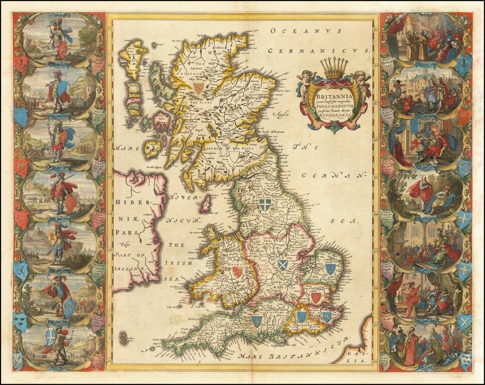
Spectacular Blaeu map showing the Saxon Kingdoms of Britain. The map includes two sets of vignettes on either side of the map, which were first incorporated by Speed in his Heptarchy map of 1611, and show historical scenes in Saxon history between 456...
![[East Coast of England - Great Yarmouth to Newcastle] Eijgentlijck ontwerp vande Noortcuste van Engelandt, tuschen Iarmunen en het Coggen eijlandt...](/map/small/62061.jpg)
Early Sailing Chart of the East Coast of England. Rare sea chart of the east coast of England, with Great Yarmouth at the far left (i.e., south) of the chart, stretching through The Wash, and mouth of the Humber, to Newcastle. The chart appeared in J...
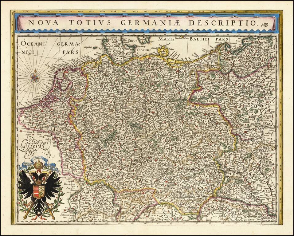
No Text on Verso! Rare edition of Blaeu's map of the German Empire, lacking text on the verso. The map includes the Netherlands, Germany, Switzerland, Austria, Bohemia, Moravia and Poland. This map is scarce, more so without text on the verso.
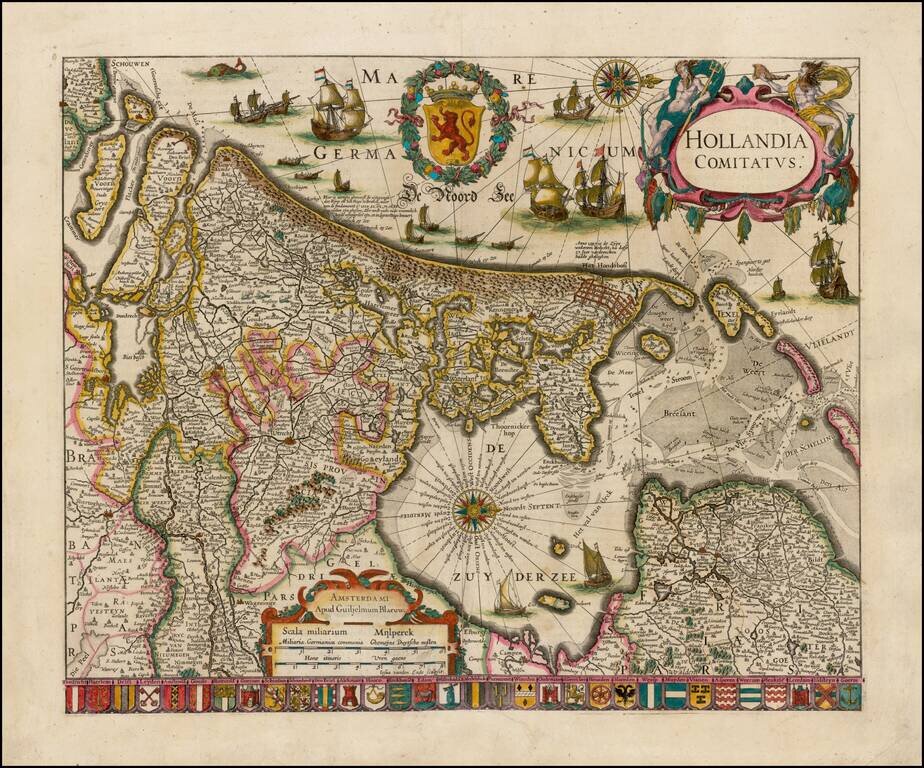
Striking example of Blaeu's rare early map of Holland, oriented with west at the top. The title cartouche is flanked by two sea gods, with 32 coats of arms of the major cities of the Netherlands along the bottom. The present map is known in 4 states,...
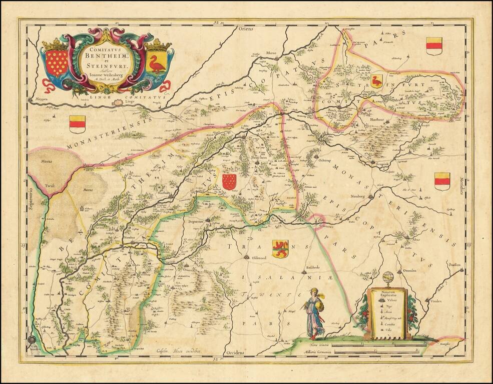
Gorgeous regional map of a portion of the Netherlands. The map shows Meppen, Linge, Rhene, Borchstenfort, Scopink, Nienborg, Ochtrup, Horstmar, Seuttorp, Benthem, Northorn, Degnecam, Oldenzeel, Enschede, Ottensen, Stadlon, Vreden, Otmarsch, Nienhus,...
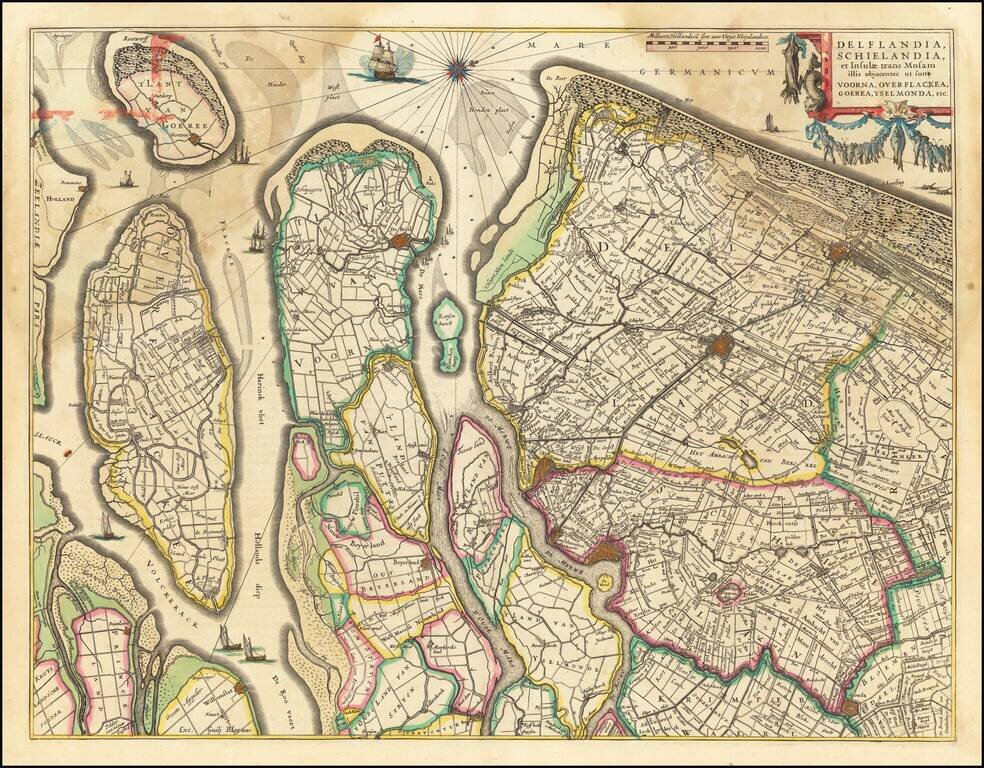
Nice old color example of Blaeu's regional map of Southern Holland. The map shows the estuary of the River Maas and extends from 's-Gravenhage to Gouda in the north and from Ouddorp to Steenbergen in the south. Cities, such as Rotterdam, Delft, and...
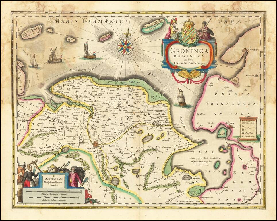
Old color example of Blaeu's map of Groningen. Includes two large cartouches, coat of arms, four sailing ships, compass rose and rhumb lines.