Jodocus Hondius the Elder (1563-1612), or Joost de Hondt, was one of the most prominent geographers and engravers of his time. His work did much to establish Amsterdam as the center of cartographic publishing in the seventeenth century. Born in Wakken but raised in Ghent, the young Jodocus worked as an engraver, instrument maker, and globe maker.
Hondius moved to London in 1584, fleeing religious persecution in Flanders. There, he worked for Richard Hakluyt and Edward Wright, among others. Hondius also engraved the globe gores for Emery Molyneux’s pair of globes in 1592; Wright plotted the coastlines. His engraving and nautical painting skills introduced him to an elite group of geographic knowledge seekers and producers, including the navigators Drake, Thomas Cavendish, and Walter Raleigh, as well as engravers like Theodor De Bry and Augustine Ryther. This network gave Hondius access to manuscript charts and descriptions which he then translated into engraved maps.
In 1593 Hondius returned to Amsterdam, where he lived for the rest of his life. Hondius worked in partnership with Cornelis Claesz, a publisher, and maintained his ties to contacts in Europe and England. For example, from 1605 to 1610, Hondius engraved the plates for John Speed’s Theatre of the Empire of Great Britaine.
One of Hondius’ most successful commercial ventures was the reprinting of Mercator’s atlas. When he acquired the Mercator plates, he added 36 maps, many engraved by him, and released the atlas under Mercator’s name, helping to solidify Mercator’s reputation posthumously. Hondius died in 1612, at only 48 years of age, after which time his son of the same name and another son, Henricus, took over the business, including the reissuing of the Mercator atlas. After 1633, Hondius the Elder’s son-in-law, Johannes Janssonius, was also listed as a co-publisher for the atlas.
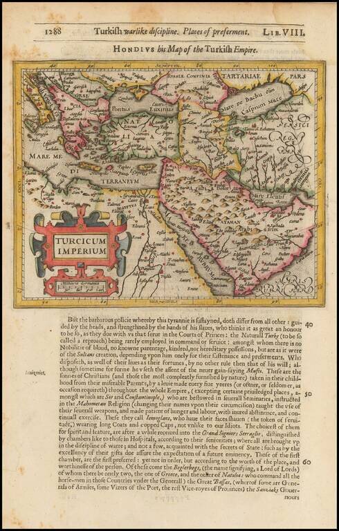
Striking map of the region bounded by the Mediterranean, Greece and Itay in the west and Saudi Arabia, the Persian Gulf and Caspian Sea in the east and centered on Turkey and Cyprus. Includes English text on both sides. From the 1625-26 edition of...
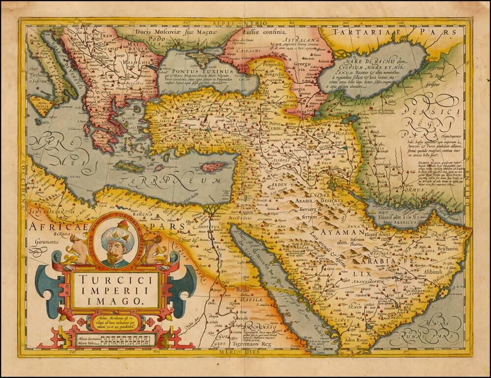
Fine Map of the Ottoman Empire from the Mercator-Hondius Atlas Striking example of this map of the Ottoman Empire, showing their territories in the Balkans, Anatolia, the Levant, the Arabian Peninsula, and North Africa. It was published by Henricus...
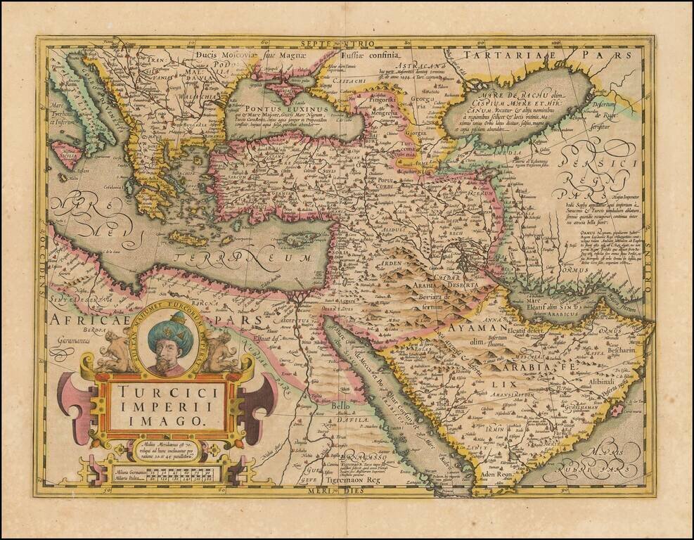
Fine Map of the Ottoman Empire from the Mercator-Hondius Atlas Striking example of this map of the Ottoman Empire, showing their territories in the Balkans, Anatolia, the Levant, the Arabian Peninsula, and North Africa. It was published by Henricus...
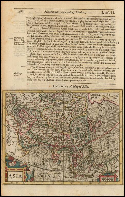
Excellent early map of Asia, extending south to include Nova Guinea and Java Major and east to the South Pacific. Includes the NW Coast of America, with a narrow Fretum Anian seperating the continents. and marvelous detail in the NE coast of Asia,...
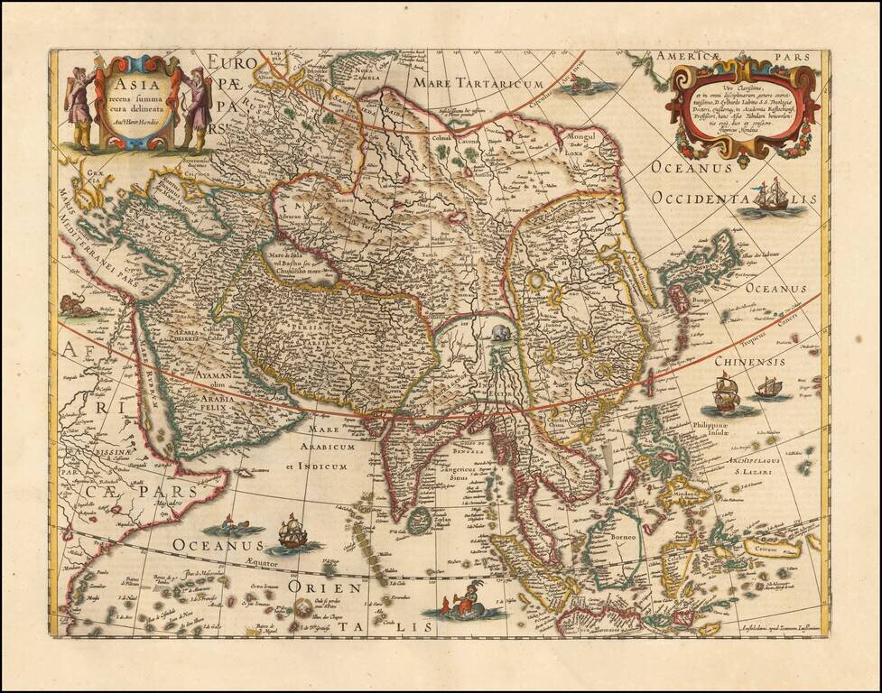
Striking Map of Asia from the Dutch Golden Age of Cartography Fine example of Henricus Hondius’ map of Asia, which appeared in the distinguished Mercator-Hondius atlas. The map encompasses the entirety of the continent, including the Arabian...
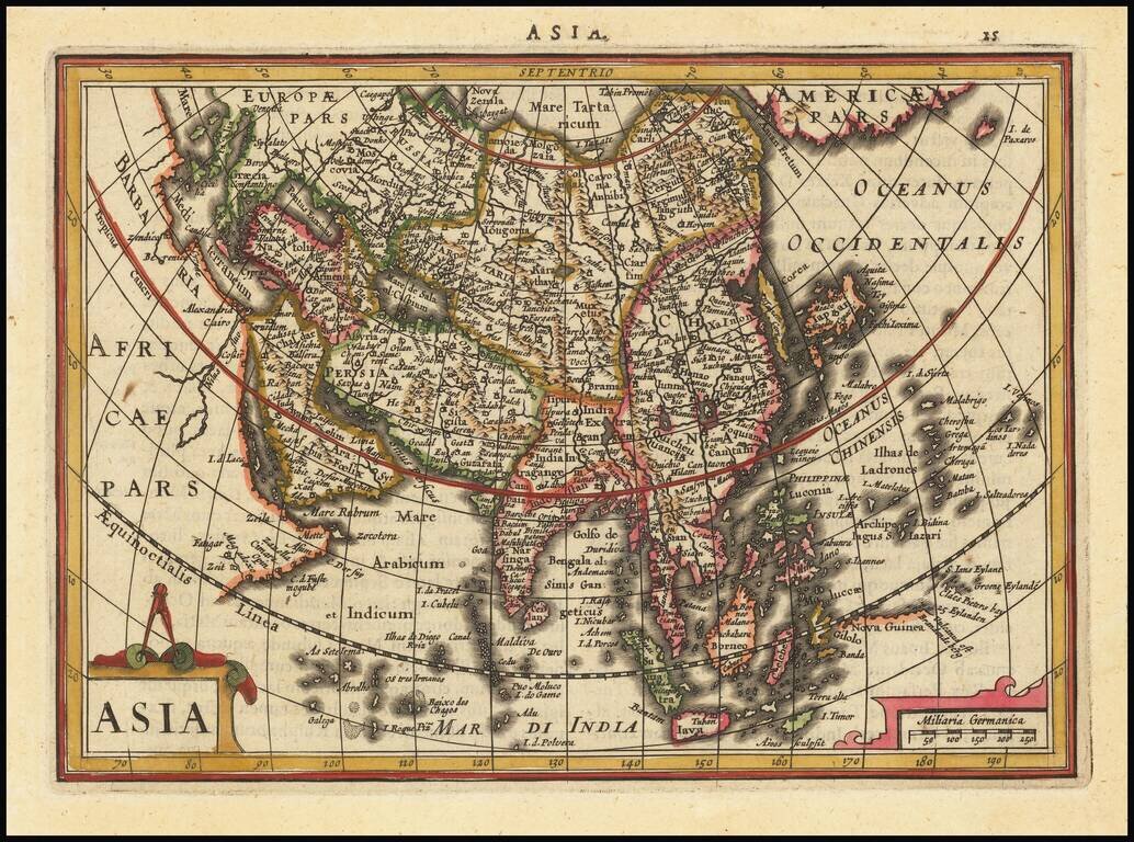
Striking example of this interesting map of Asia, from the Mercator-Hondius Atlas Minor. Includes Corea as an island, early depiction of the Philippines Islands and the land bridge to North America.
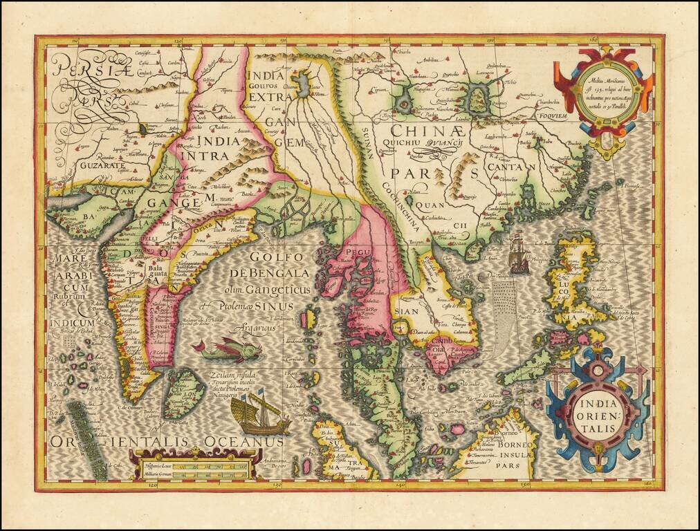
Fine example of Hondius' map of China and Southeast Asia, from a French edition of the Mercator-Hondius Atlas. One of the finest early Dutch maps of the region, first published in 1606 as one of the 37 new maps engraved for Jodocus Hondius' expanded...
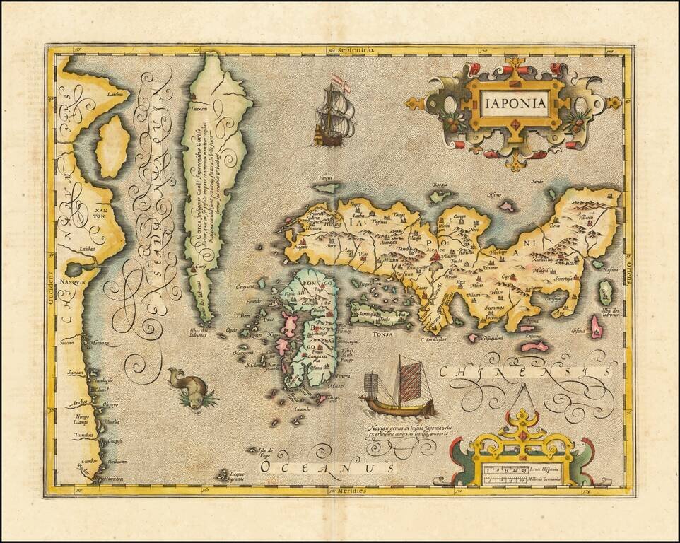
Fine full example of Hondius' map of Japan & Korea. One of the finest early Dutch maps of the region, first published in 1606 as one of the 37 new maps engraved for Jodocus Hondius' expanded Dutch edition of the Mercator Atlas. The map is based...
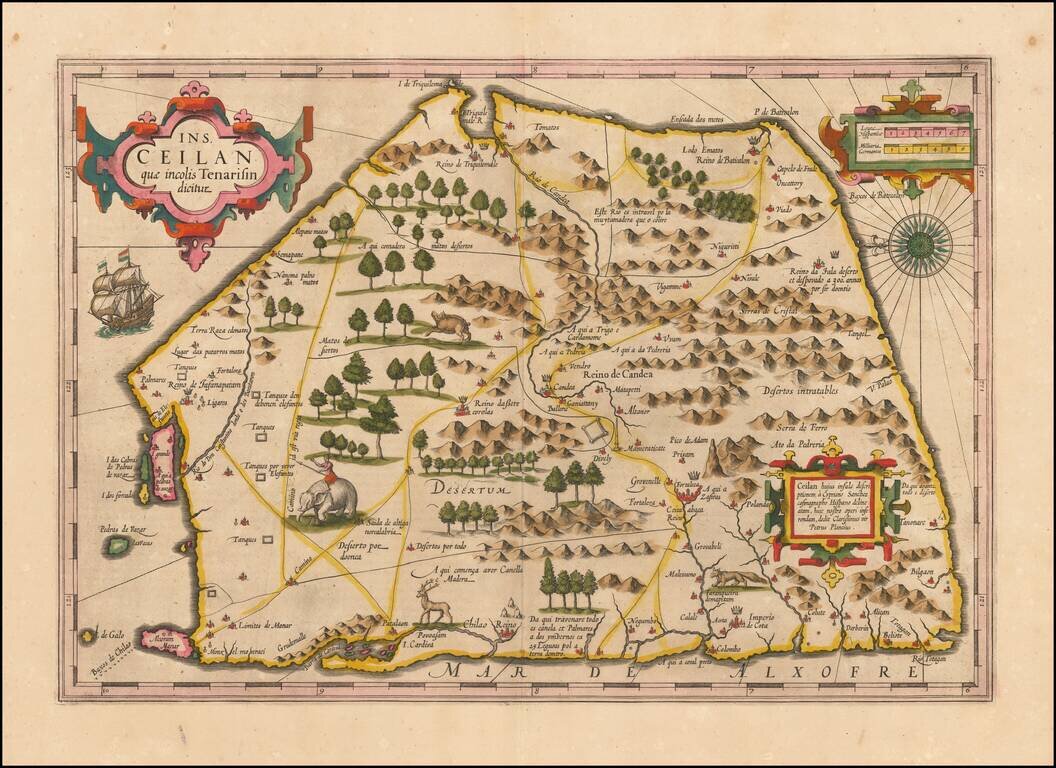
Finely colored example of Ceylon (Sri Lanka), from an early edition of the Mercator Hondius Atlas. The map is oriented with east at the top and includes elephants, gazelles and other animals, sailing ships, compass roses and 3 cartouches. The map...
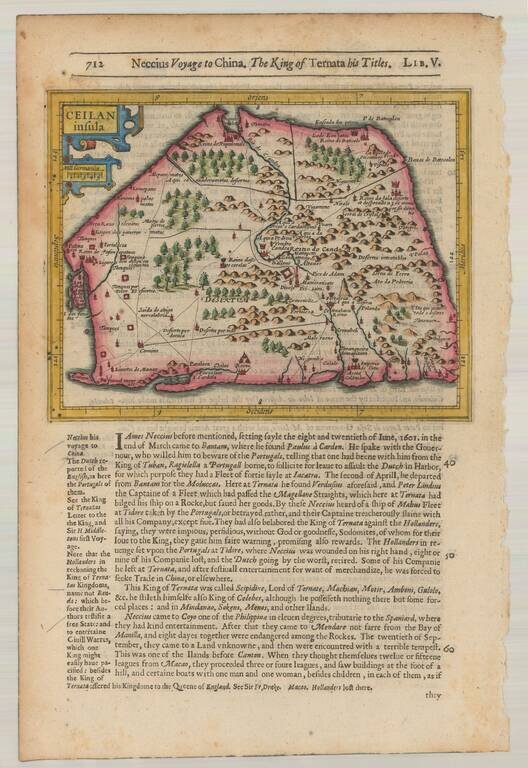
Striking early map of Ceylan with decorative cartouche. From the 1625-26 edition of Purchas His Pilgrims, one of the seminal early 17th Century English Language travel works. On a 13 x 9 inch sheet with English text, front and back.
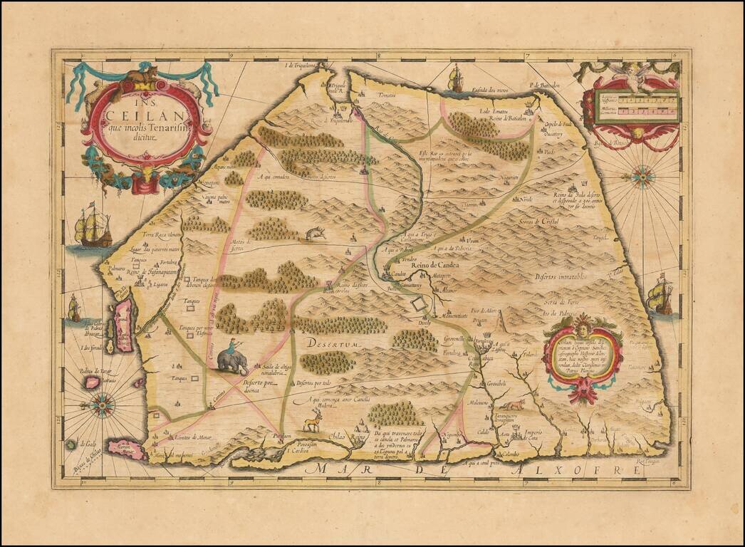
Nice example of Hondius's double-page engraved map of Ceylon (Sri Lanka), from the Mercator Hondius Atlas. The map is oriented with east at the top and includes elephants, gazelles and other animals, sailing ships, compass roses and 3 cartouches. A...
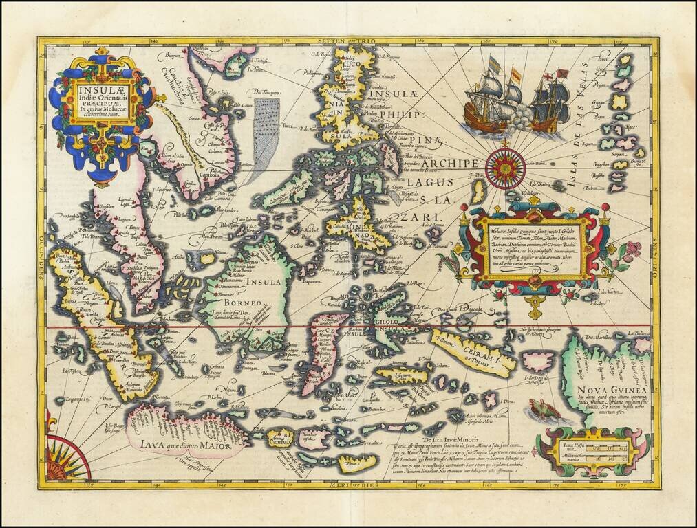
Fine Example of Decorative Map of the East Indies from the Mercator-Hondius Atlas This map showcases European knowledge of the East Indies, an area of increasing importance to Europe from the early-sixteenth century onwards. The focus is on the...
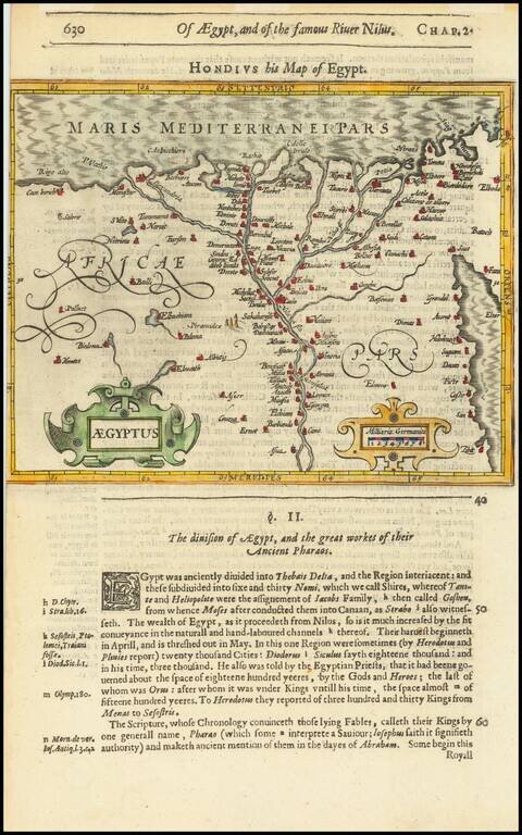
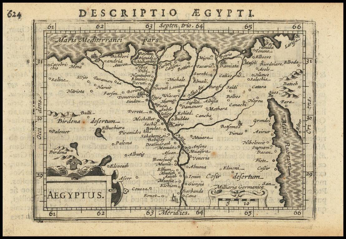
Attractive map of Egypt tracking the Nile from Aswan to the Mediterranean and extending East to the Red Sea, based upon a larger map by Hondius. Includes two cartouches. From the 1625-26 edition of Purchas His Pilgrims, one of the seminal early 17th...
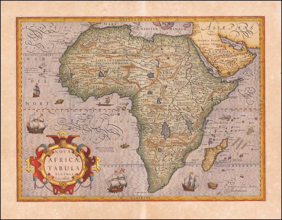
Antique Map of Africa Heightened in Gold Leaf Striking example of Hondius' map of Africa, first issued in 1606. This was Hondius' second map of Africa, and reflects considerable improvements in the geography of the interior. Cape Horn is more rounded...
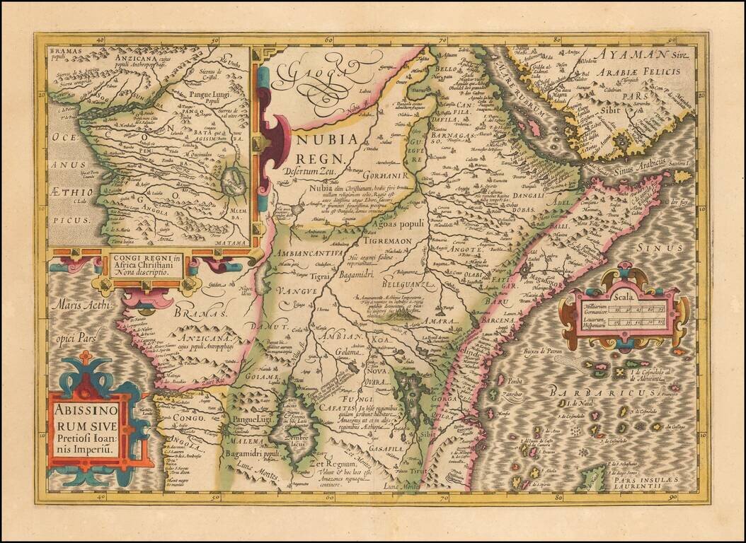
The Kingdom of Prester John Large format map of the Kingdom of Prester John, the mythical African King whom the Crusaders believed had converted to Christianity. While Prester John and his Kingdom were mythical, it did not stop the major European...