Henricus Hondius (1597-1651) was a Dutch engraver and mapmaker, a member of a prominent cartographic family. His father, Jodocus Hondius, was also an engraver and geographer. While working with his father, Henricus was instrumental in the expansion and republishing of Mercator’s atlas, first published in 1595 and republished by Hondius in 1606.
Upon his father’s death in 1612, Henricus and his brother, Jodocus the Younger, took over the business. He set up his own shop in 1621, where he continued to release new editions of the Mercator atlas. Later, he partnered with his brother-in-law, Jan Janssonius, in continuing to expand and publish Mercator’s atlas, which would become known as the Mercator-Hondius-Janssonius atlas. Born and based in Amsterdam, he died there in 1651.
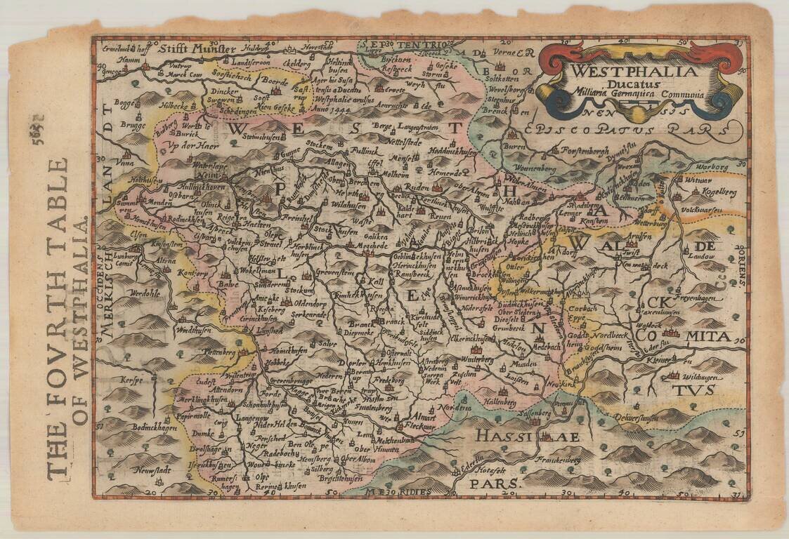
Decorative regional map of Germany. Includes decorative cartouche. From an English Edition of the Mercator-Hondius Atlas. Nice full color example.
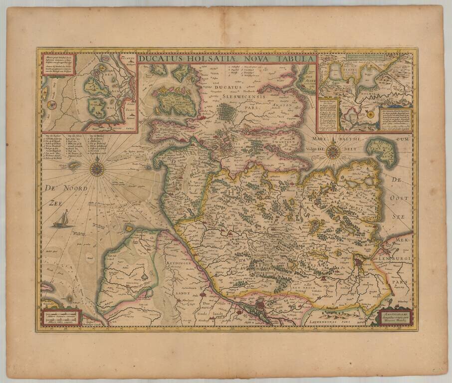
Old color example of Henricus Hondius' map of the Duchy of Holstein. Includes 2 large inset maps. Extends to Hamburg, Lubeck, Kiel, etc.
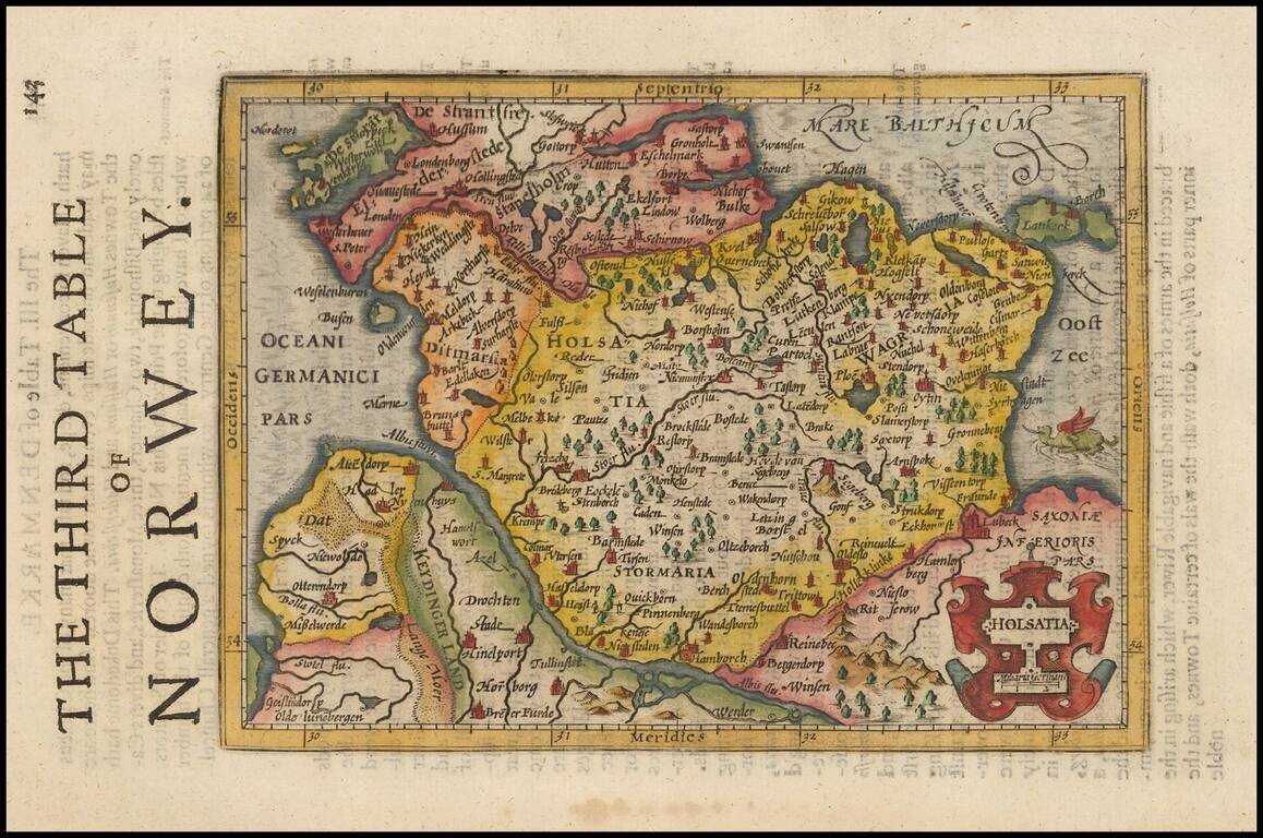
Decorative regional map of Northern Germany and part of Denmark (then Norway), showing Hamburg, Lubeck, etc. Decorative cartouche and a sea monster in the Baltic. From an English Edition of the Mercator-Hondius Atlas.
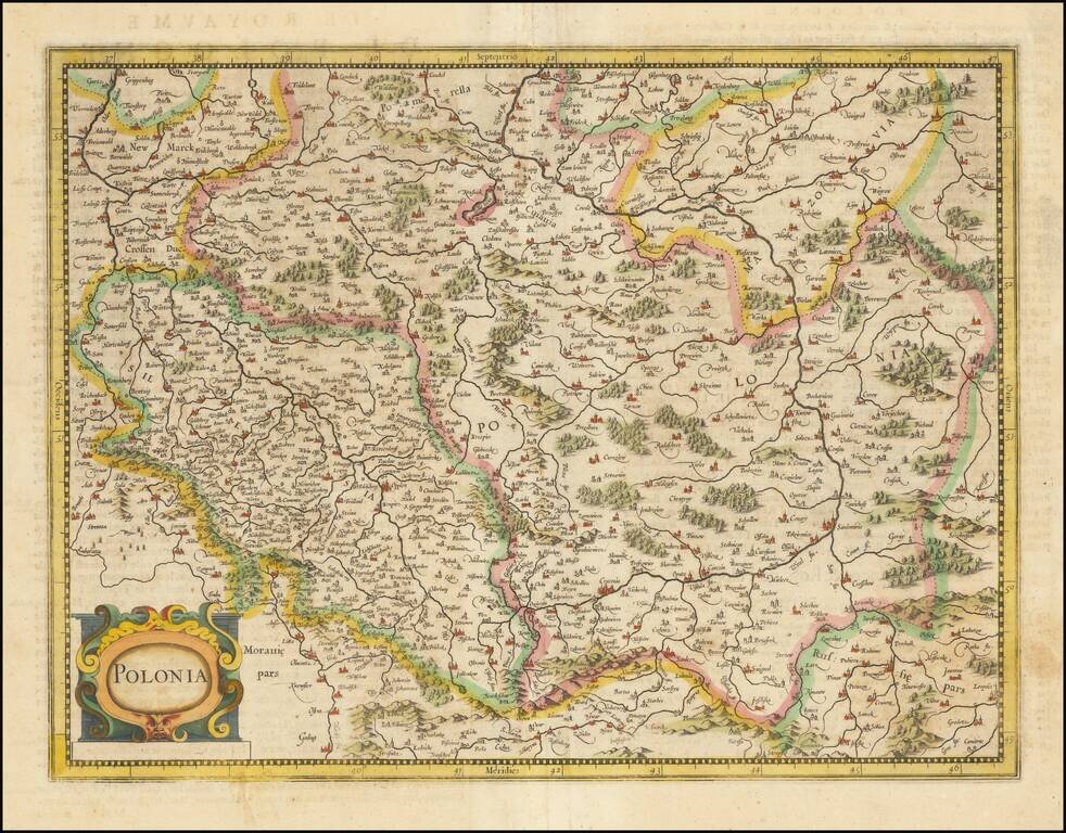
Fine early map of Poland, published by Henricus Hondius in Amsterdam. Originally issued by Mercator, the map depicts most of present-day Poland and Lithuania (including Vilna) and a the eastern part of Czechia. Among the major cities to appear are...
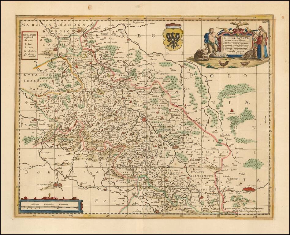
Scarce Moses Pitt map map of Silesia, centered on Breslau. Shows Cracow in the southeast, Prague in the southwest, and Posen in the North. Follows the course of the Oder from Ratisbone to beyond Frankfurt am Oder. Two cartouches and coat of arms....
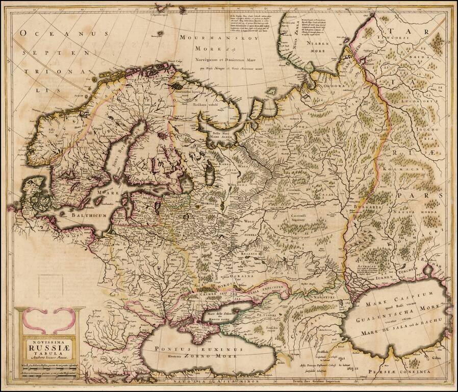
Old color example of the rare English language edition of the Mercator-Hondius map of the Russian Empire and Scandinavia . The present example of the map is a proof state. In the following year, the map would be finished, with 5 costumed figures and a...
![Tarvisina Marchia et Triolis Comitatus [Venice & Lago Di Garda]](/map/small/47111.jpg)
Decorative regional map, extending from the Gulf of Venice to Tirolia, centered on Lago di Guardia and Verona. Shows Venice, Padua, Ferrara, Crema, etc. Nice full color example.
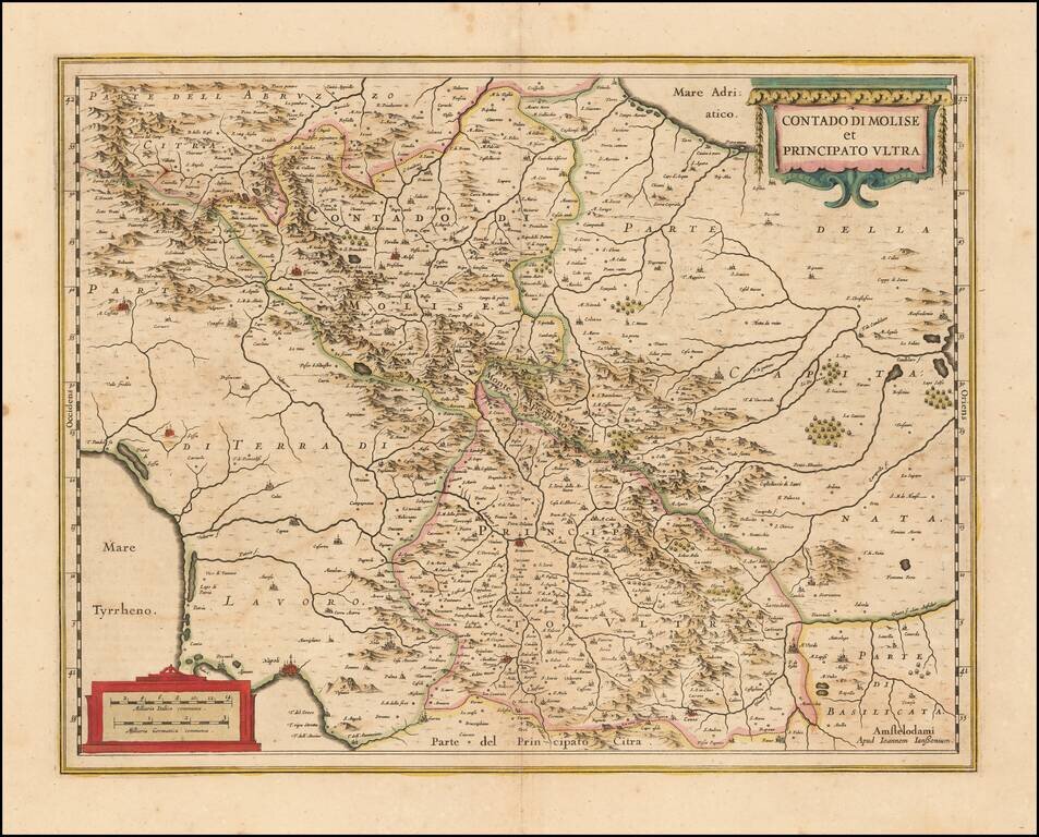
Decorative regional map of Southern Italy, engraved by Jansson. Larger cities include Benevento, Ariano, Avellino, Conza, Troia and Lucera. Napoli appears at the far southwest corner of the map.
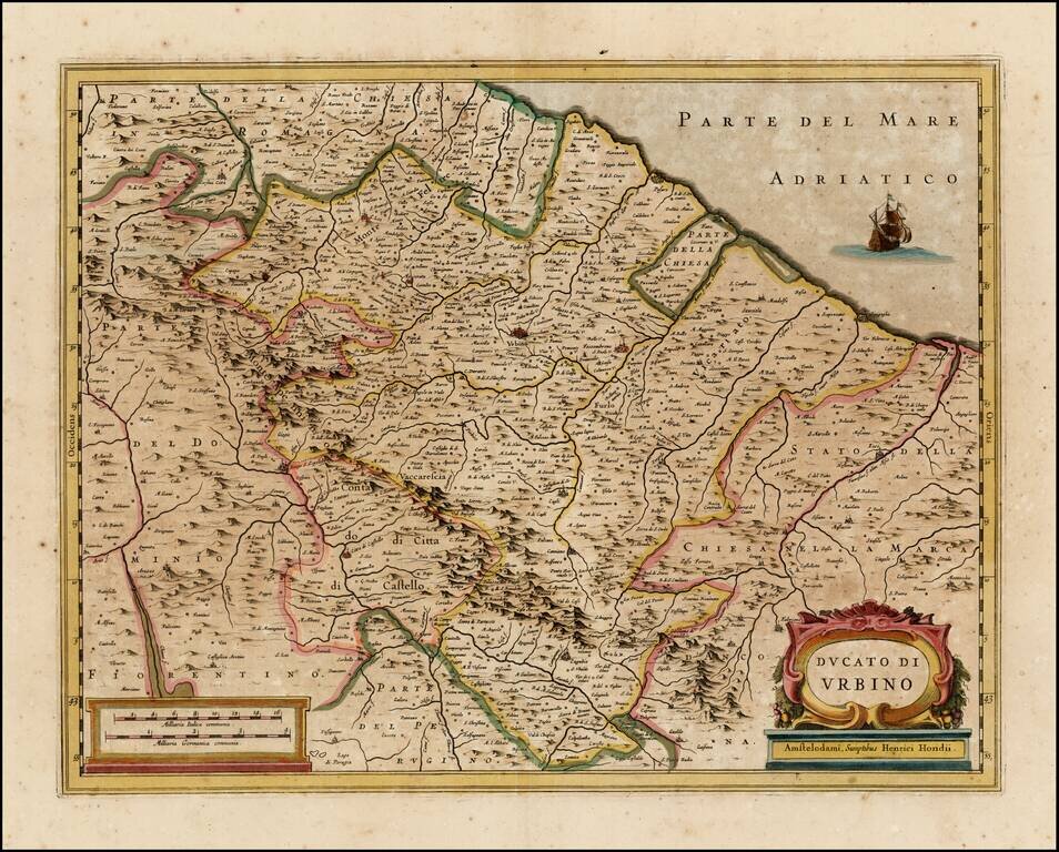
Nice old color example of Hondius' map of the Urbino region. Includes a decorative cartouche.
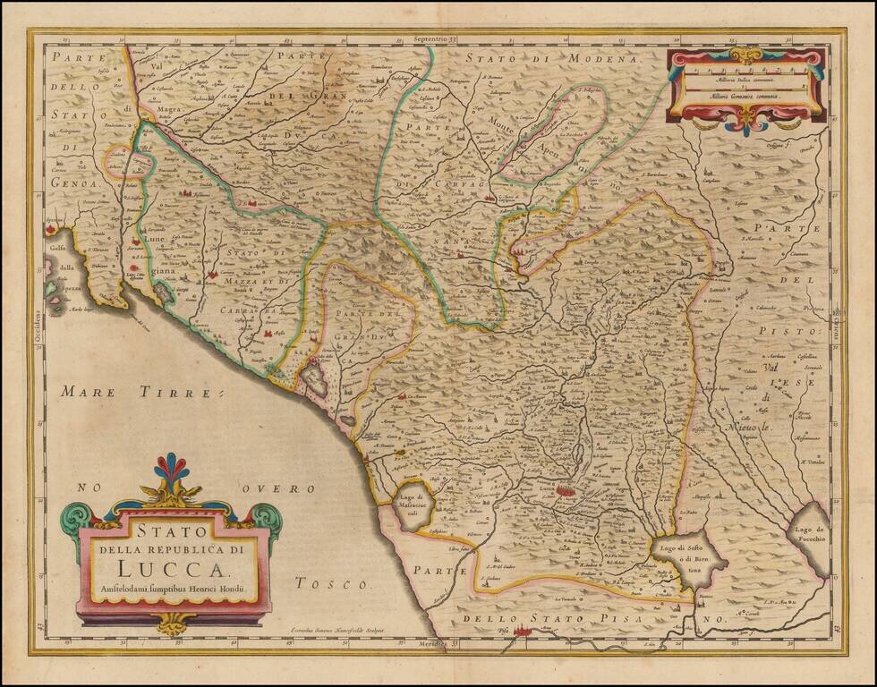
Nice old color example of Hondius' map of the Republic of Lucca. The map covers part of Tuscany and the Italian Coast from Spezia to the Pisa area. Includes a decorative cartouche.
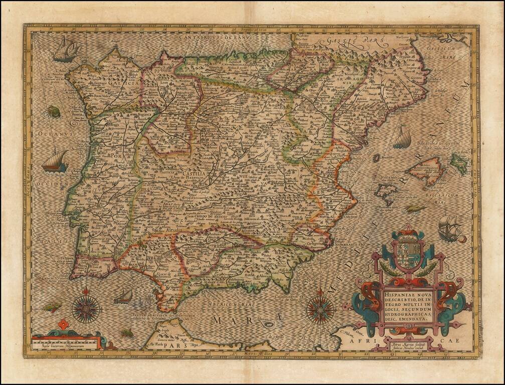
Striking example of the Kaerius-Hondius map of Spain and Portugal. The map includes a striking coat of arms, 2 compass roses, sailing ships and sea monsters, along with Hondius' unique style for engraving the ocean. A gorgeous dark impression of this...
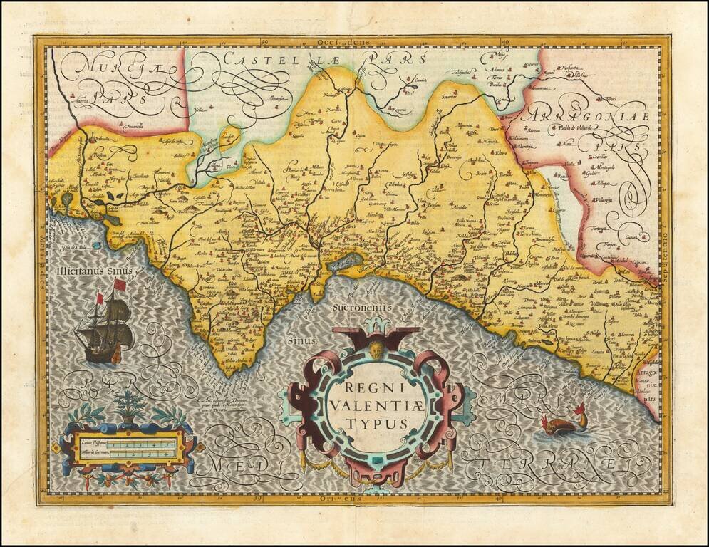
Fine old color example of Hondius' map of the Valencia, from his Atlas Sive Cosmographia. . . . Includes a decorative cartouche, scale of miles, sailing ship and sea monster.
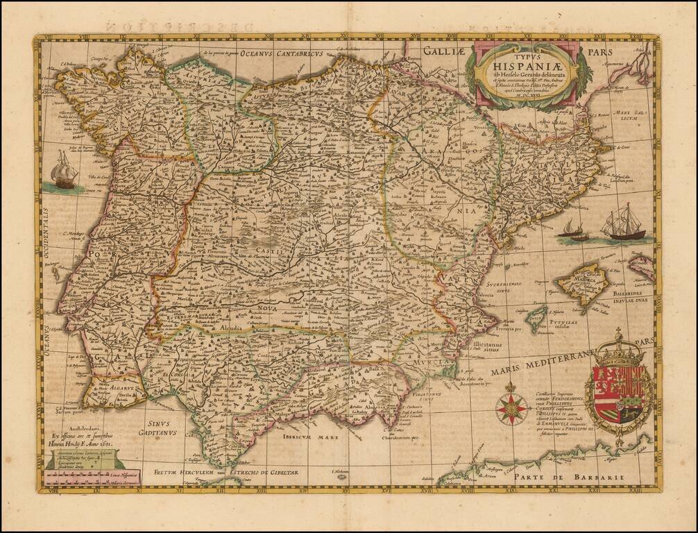
Nice example of Hondius' map of Spain, first issued in 1631. This map replaced the prior Mercator-Hondius map, which was first issued about 1606. The map includes 4 sailing ships, a compass rose, decorative cartouche and ornate coat of arms.
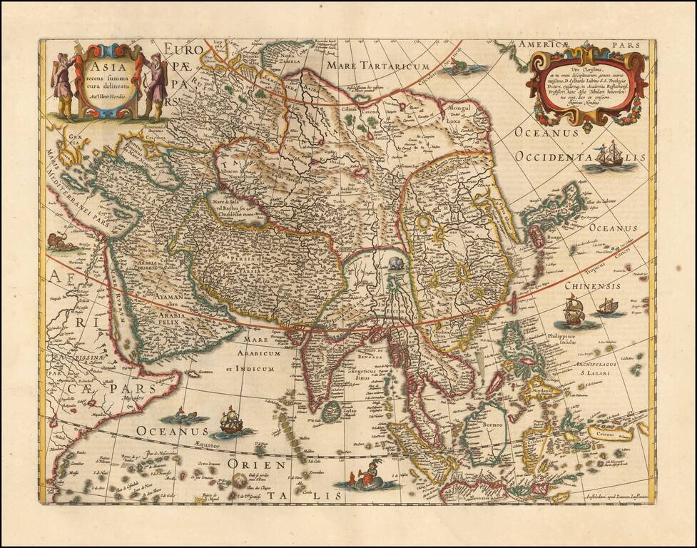
Striking Map of Asia from the Dutch Golden Age of Cartography Fine example of Henricus Hondius’ map of Asia, which appeared in the distinguished Mercator-Hondius atlas. The map encompasses the entirety of the continent, including the Arabian...
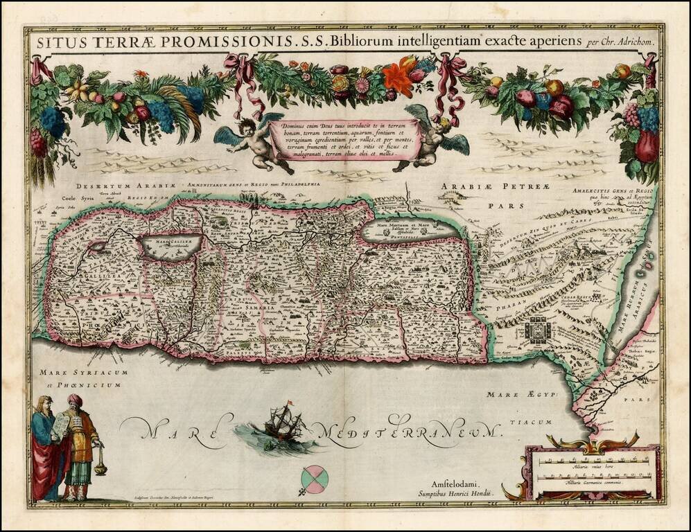
Early edition of Hondius' map of the Holy Land, based upon the report of Christian Van Andrichom, then the most influential holy land cartographer. The map was subsequently copied by Janssonius, who adds his imprint to the map sometime around 1645.
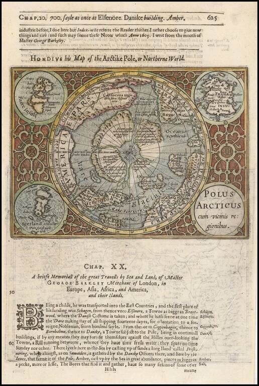
Excellent early map of the North Polar regions, based upon early maps by Mercator and Hondius. Shows the mythical land masses near the pole, the clearly navigable NW and NE passages, a massive California, as discovered by the Spanish, the Davis...