Jean-Baptiste-Nicolas-Denis d'Après de Mannevillette (1707–1780) was a French sailor and hydrographer.
D'Après de Mannevillette was a captain for the Compagnie des Indes, and in this position, he charted the coasts of the East Indies and China. He published the Neptune Oriental for the first time in 1745. It was a major cartographical achievement and a practical resource for navigators sailing to the Indian Ocean and Asia. The 1775 edition encompassed the majority of the known world.
D'Après de Mannevillette's access to up-to-date sources of information – such as explorer´s narratives - and his eagerness to constantly update the cartography of his maps, enabled him to produce some of the most accurate charts of the 18th century.
![[Sea Atlas -- Coasts of Asia] Supplement au Neptune Oriental.](/map/small/55699.jpg)
From the Library of the Baron Reille. Including Charts of Jeddah, Saigon, and Manilla. A rare collection of charts from the Neptune Oriental, including maps of the Middle East and South East Asia. The volume comprises the following charts: Carte...
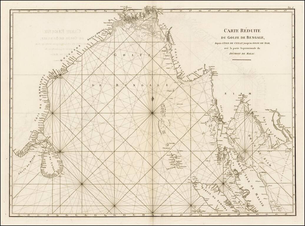
Fine sea chart from Mannevillette's Le Neptune Oriental, first published in 1775. Important early sea chart showing the coastlines of India, Ceylan, Thailand, Malaysia, Sumatra, Cambodia and Vietnam. Jean Baptiste Nicolas Denis D'Apres de...
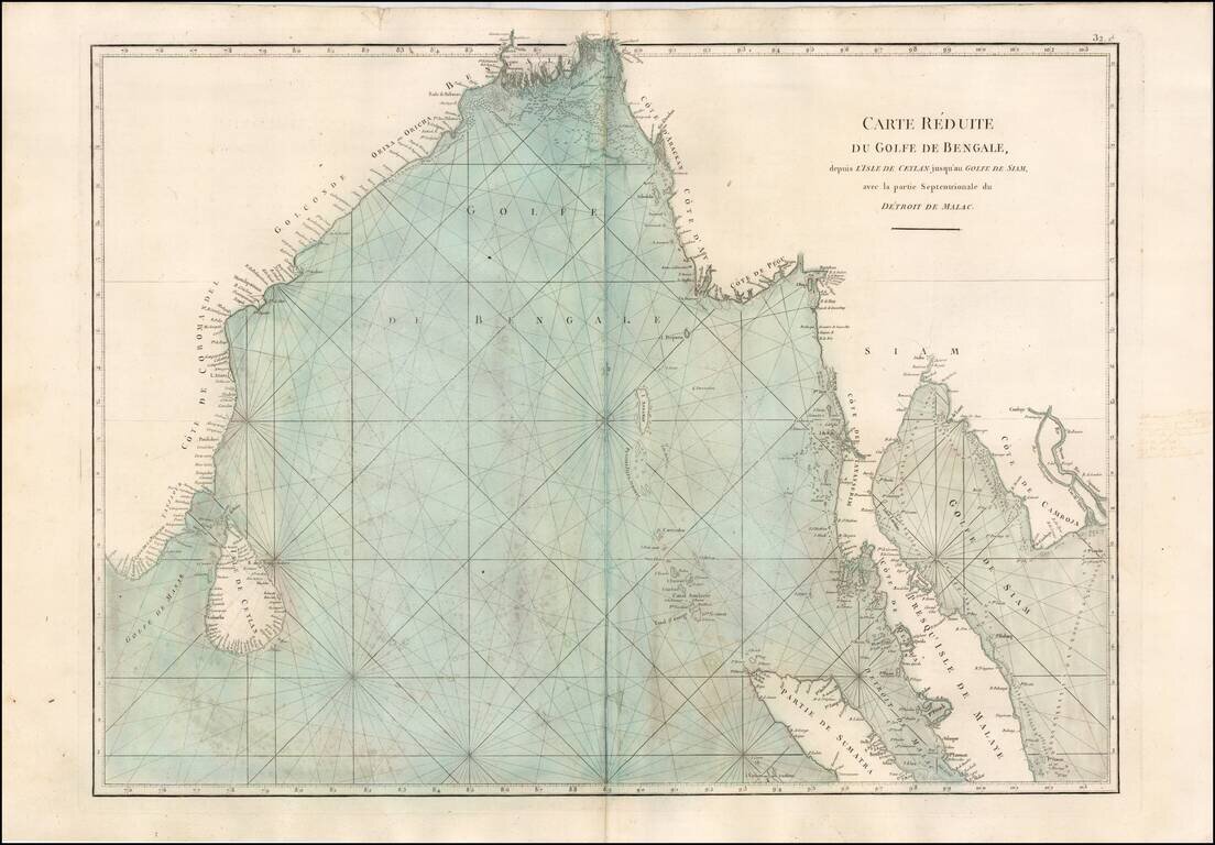
Fine sea chart from Mannevillette's Le Neptune Oriental, first published in 1775. Important early sea chart showing the coastlines of India, Ceylan, Thailand, Malaysia, Sumatra, Cambodia and Vietnam. Jean Baptiste Nicolas Denis D'Apres de...
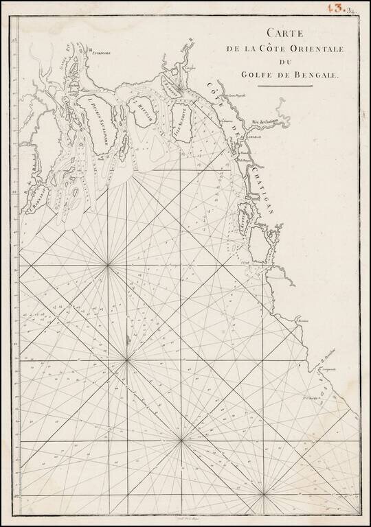
Detailed sea chart of the Bay of Bengal, engraved by De La Haye and published in the Neptune Orientale.
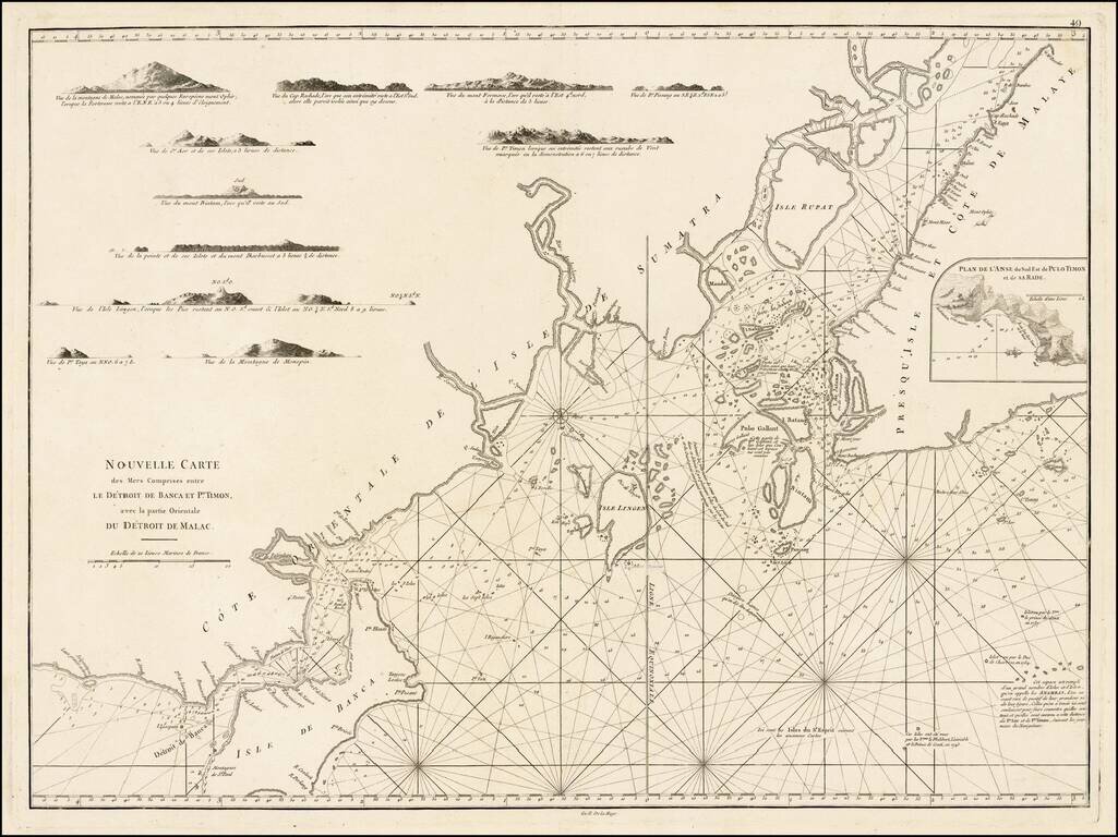
A rare sea chart, including a map of Singapore and the Straits of Malacca and Banca, which appeared only in the second and enlarged edition of Mannevillette's Le Neptune Oriental. Important early chart of the East Coast of Sumatra, the eastern portion...
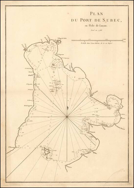
A rare sea chart of Subic Bay in the Philippines, which appeared in the second edition of Mannetvillette's Le Neptune Oriental, published in 1775. The chart is one of the earliest obtainable detail charts of Subic Bay. Subic Bay was discovered by the...
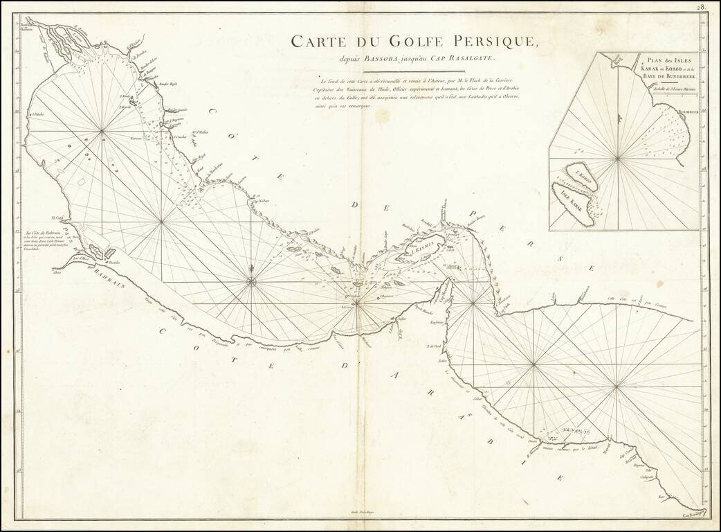
A rare antique map of the Persian Gulf and Gulf of Oman. Designed for navigational use by the French East India Company, this map is neatly designed and shows rhumb lines, bathymetric soundings, prevailing currents, and shoals. This chart is designed...