Henry Charles Carey (1793-1879) was an American geography publisher and businessman. He was the son of Mathew Carey and carried on the family publishing company in partnership with his brother-in-law, Isaac Lea. Henry worked in his father’s business from a young age. At twelve, he managed a store selling his father’s publications. At fifteen, he was the firm’s financial manager. In 1817, he became a junior partner, which changed the company’s name to Carey & Son.
In 1822, Mathew Carey brought in a new junior partner, Isaac Lea, who had married Henry’s sister, Frances Anne. In the same year, Mathew Carey left the business, with Henry buying out his father’s share. His younger brother briefly joined the business, but left by 1829, when the firm was named Carey & Lea. William A. Blanchard joined the firm in 1833, causing another name change to Carey, Lea & Blanchard. Henry retired in 1835, leaving the firm as Lea & Blanchard.
Henry had outside interests, including political economy. He published Principles of Political Economy in 1837. He also wrote Past, Present, and Future (1848), Principles of Social Science (1858-1860), and The Unity of Law (1872). In the 1850s, he was very active in organizing the nascent Republican Party. He died in 1879.
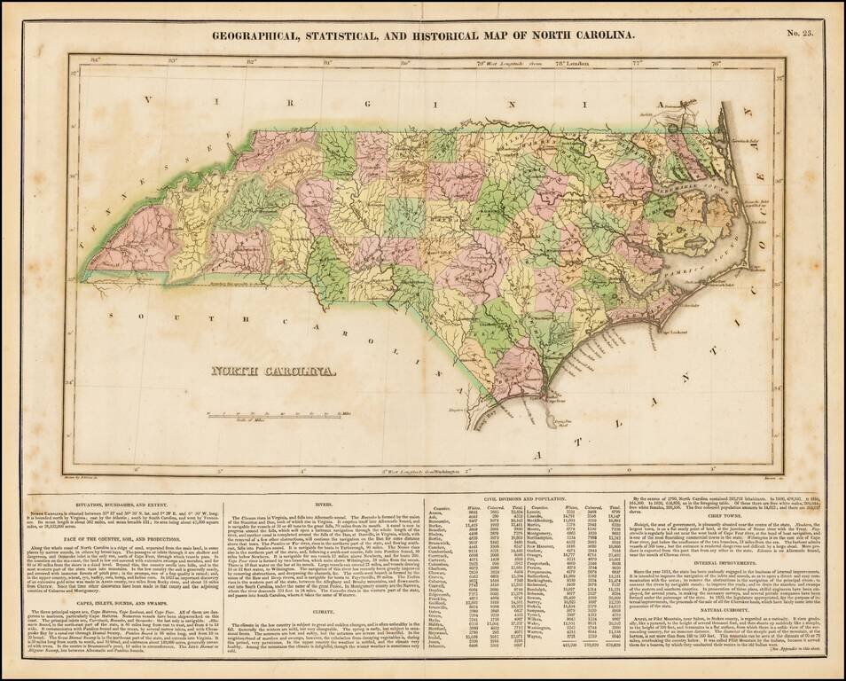
Detailed map of North Carolina, from the first edition of Carey & Lea's Atlas. Many counties still not formed. Size includes text below map, which includes wonderful contemporary details concerning the topography, indigenous lands, rivers,...
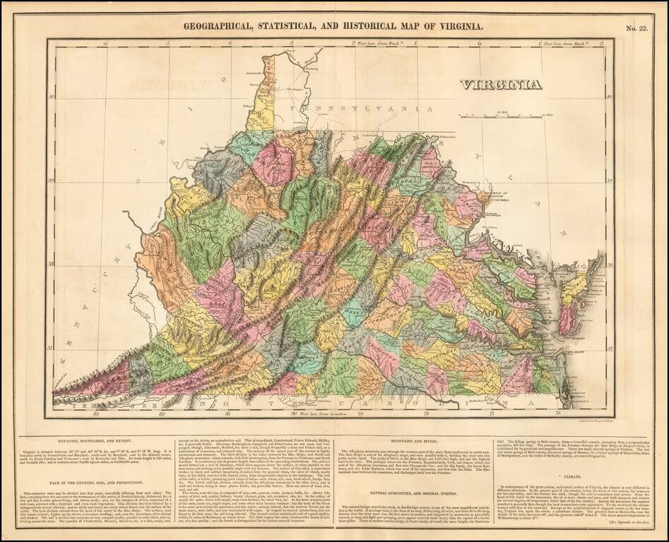
Striking example of this finely executed map of Virginia, from the first edition of Carey & Lea's Atlas. The map includes contemporary details concerning the topography, indigenous lands, rivers, climate, towns, manufacturing, commerce, and other...
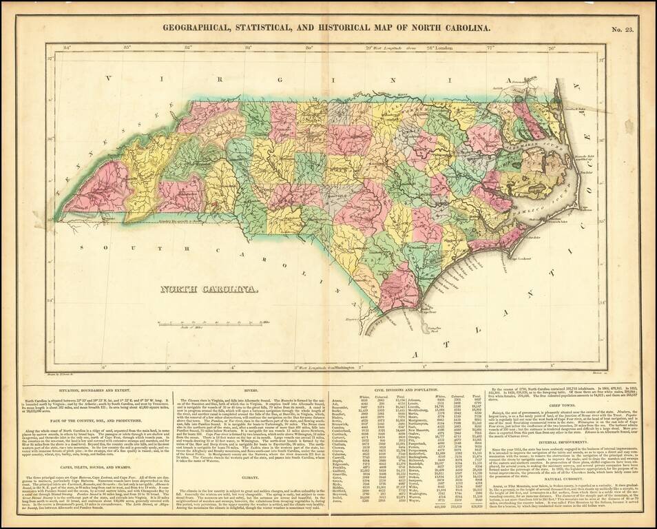
Detailed map of North Carolina, from the first edition of Carey & Lea's Atlas. Many counties still not formed. Size includes text below map, which includes wonderful contemporary details concerning the topography, indigenous lands, rivers,...
![South Carolina [Pocket Map!]](/map/small/24952.jpg)
Extremely rare Carey & Lea Pocket Map of South Carolina in original covers. The map is hand colored by counties and shows towns, rivers, roads, court houses, meeting houses, post offices and other details. This is the earliest pocket maps of...
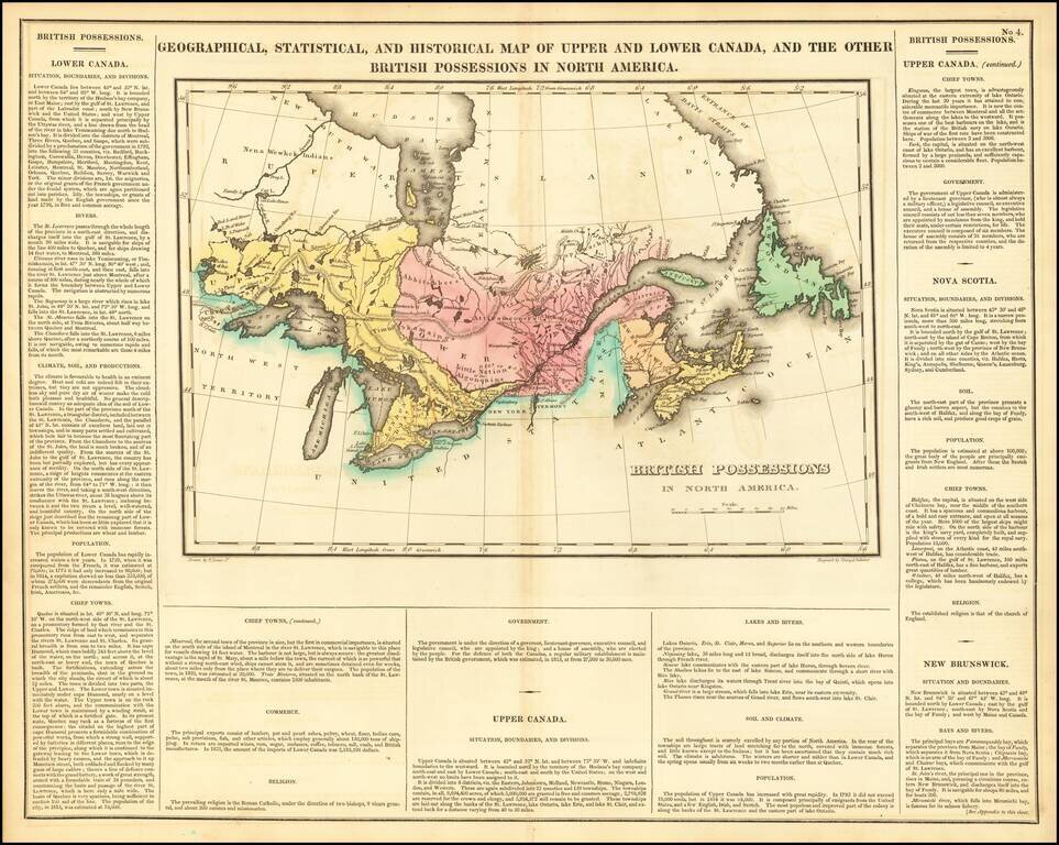
Nice example of Carey & Lea's map of Canada and the Great Lakes. The map covers Upper and Lower Canada and the Great Lakes, extending west to the Lake of the Woods and Red Land House and the Severn River, showing nice Indian details. The map is...
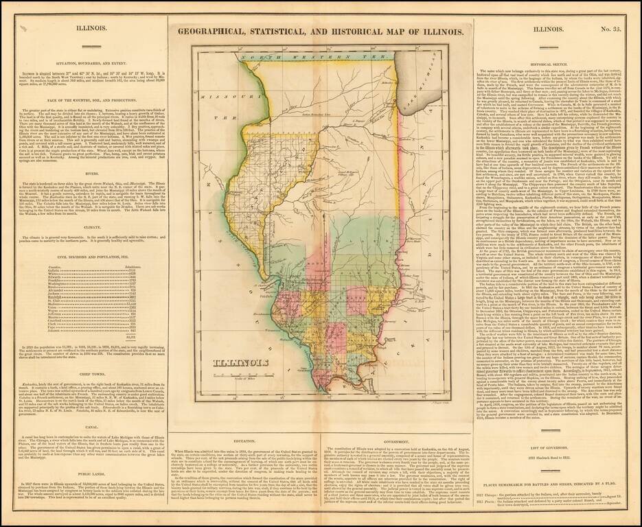
Nice example of this important early map of Illinois from Carey & Lea's Geographical, Statistical and Historical Atlas of North America. Carey & Lea's map of Illinois is one of the earliest obtainable maps of Illinois. This important and...
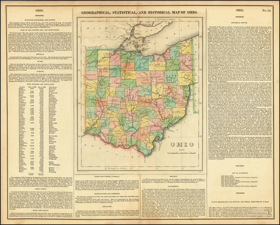
Striking old color example of the first edition of Carey & Lea's map of Ohio. Includes wonderful contemporary details concerning the topography, indigenous lands, rivers, climate, towns, manufacturing, commerce, education, history, population by...
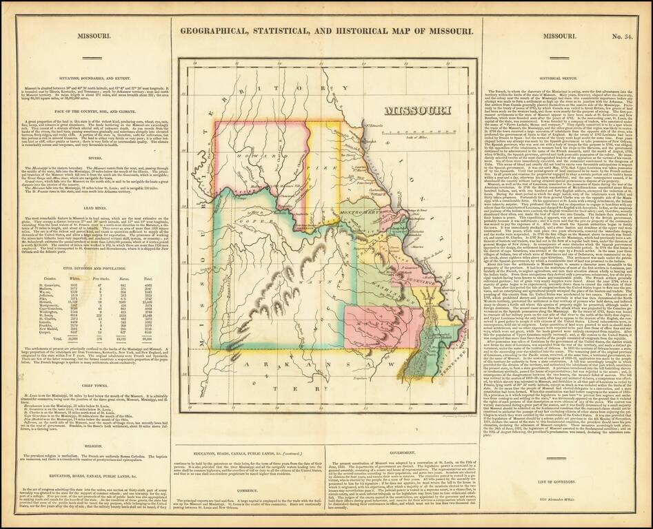
Nice example of the first printed map of Missouri as a state from the first edition of Carey & Lea's Atlas. Size includes text below map, which contains details concerning the topography, indigenous lands, rivers, chief towns, commerce,...
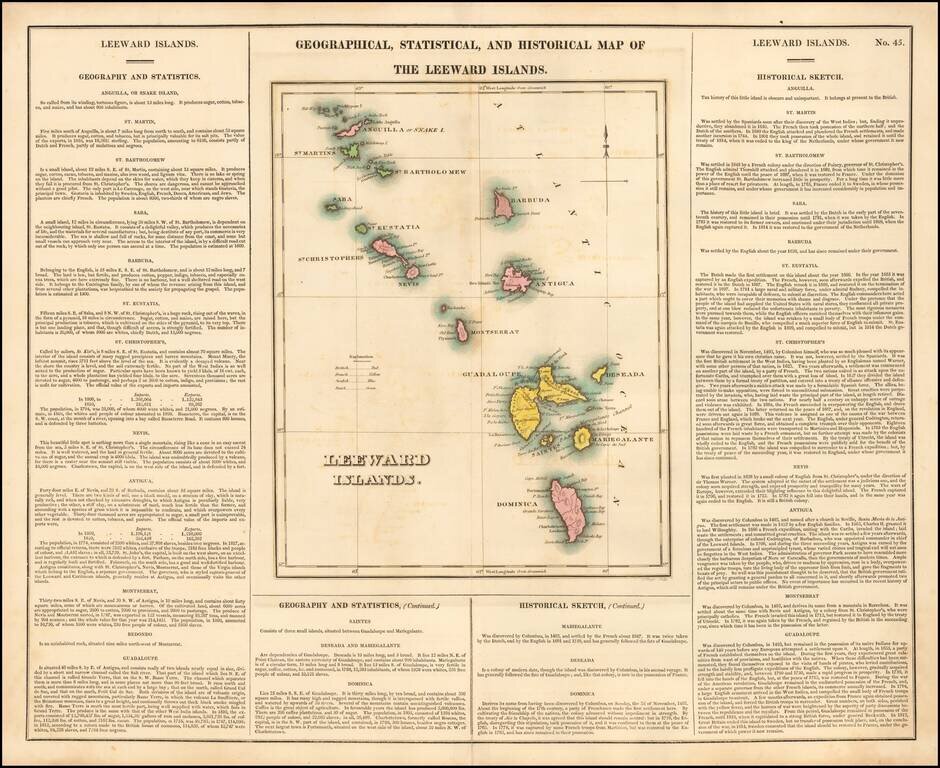
Nice example of this detailed map of the Leeward Islands, from the first edition of Carey & Lea's Atlas. One of the most detailed maps of the region to appear in an early American Atlas. Lengthy narrative text below includes details about the...
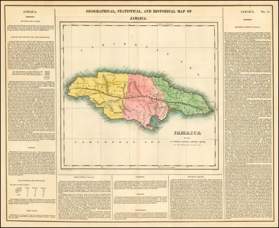
Nice detailed map of Jamaica from the second edition of Carey & Lea's Atlas. One of the most detailed maps of the Bahama Islands to appear in a commercial atlas. Lengthy narrative text below includes details about the islands, climates, towns,...
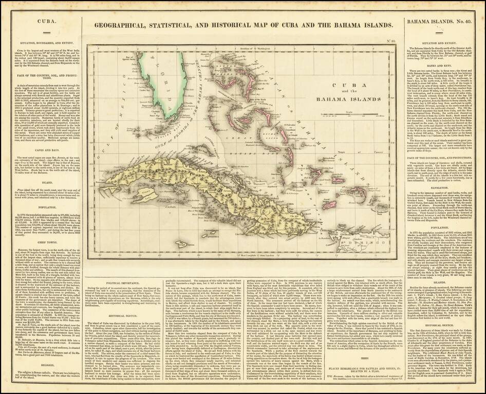
A nice detailed map of the Bahamas, South Florida, and Cuba, from the first edition of Carey & Lea's American Atlas. This is one of the most detailed maps of the Bahama Islands to appear in a commercial atlas. The lengthy narrative text below...
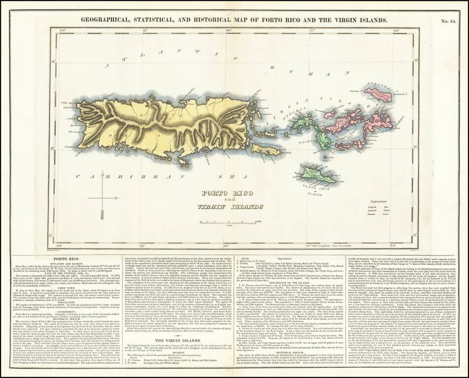
A nice detailed map of Puerto Rico and the Virgin Islands, from the first edition of Carey & Lea's American Atlas. This is one of the most detailed maps of the Virgin Islands to appear in a commercial atlas. The lengthy narrative text below...
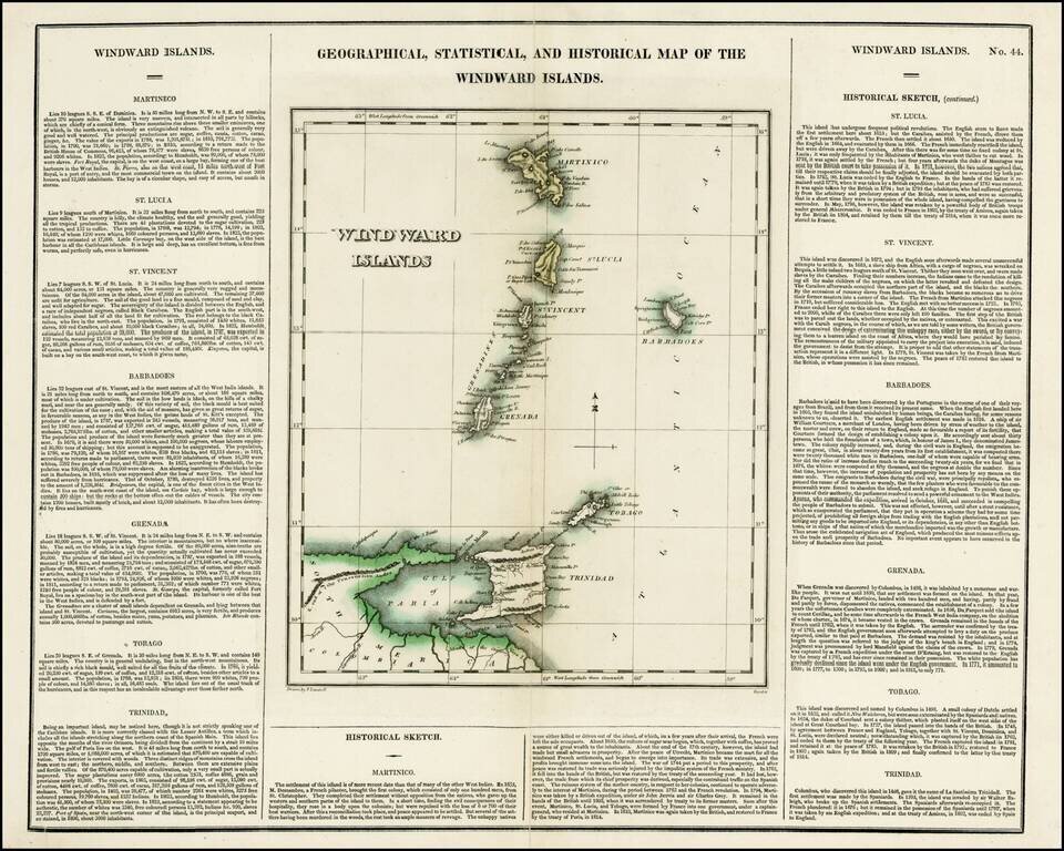
Detailed map of the Windward Islands, from Carey & Lea's rare American Atlas. The text surrounding the map is of particular note. Includes the region from Martinique to Trinidad & Tobago. Carey & Lea's Atlas is highly prized not only for...
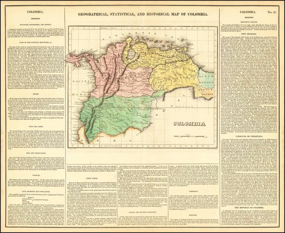
One of the first separate maps of the newly independent Colombia and Venezuela, which was still steeped in Revolution under the irrepressible work of Simon Bolivar. The map is surrounded by details on the country, its soil, climate, history,...
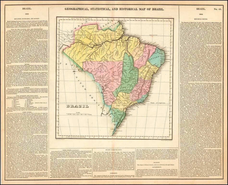
Rich full color example of this interesting map of Brazil, from Carey & Lea's Atlas. One of the first separate maps of the newly independent Brazil, shortly after the return of the King of Portugal to Brazil, leaving his son to rule the country....
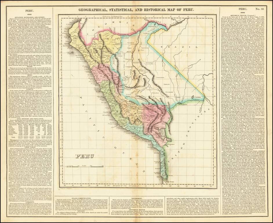
Full color example of this interesting map of Peru, from the second edition of Carey & Lea's Atlas. One of the first separate maps of the newly independent Peru, which was still steeped in Revolution under the irrepressible work of San Martin. The...