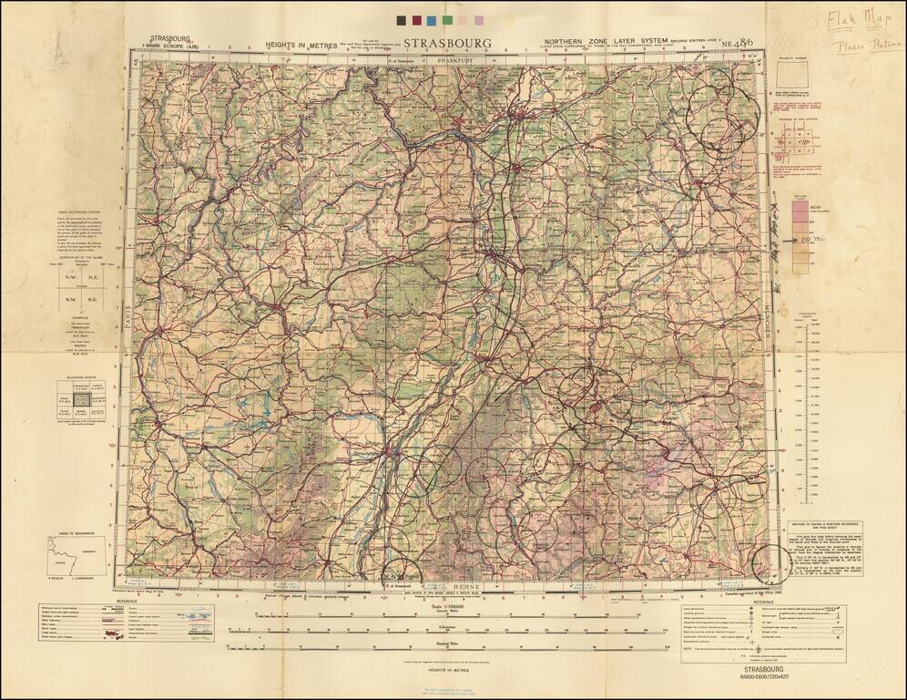
A Wall of Flak Batteries Leading into Germany. Detailed WWII air navigation map of the area around Strasbourg, published by the British War Office. The map is noteworthy for the manuscript circles highlighting the flak batteries stationed in major...
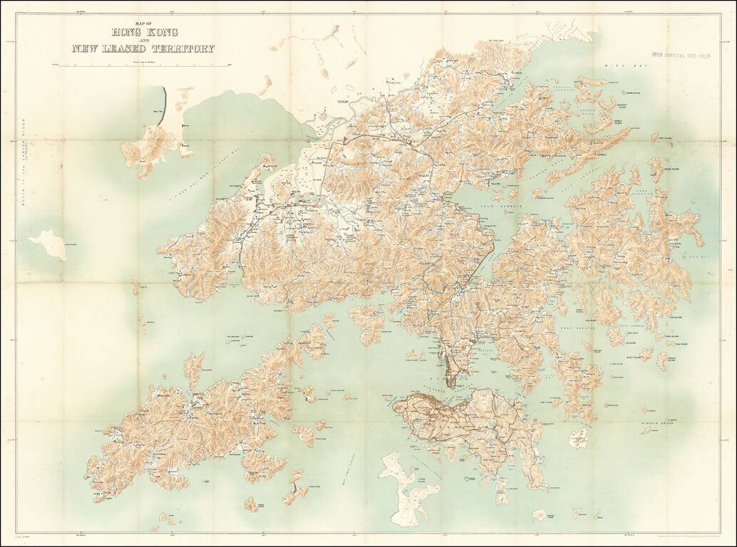
For Official Use Only. A Large Map of Hong Kong During the 1911 Revolution. Large antique map of Hong Kong Island and the region north to the Sham Chun River. The map was prepared by the Royal School of Military Engineering in concert with the...
![[Qatar and Bahrain] Hofuf](/map/small/67330.jpg)
Detailed World War Two-ear War Office map of Qatar and Bahrain. This is one of the most detailed maps available from this era. It includes oil wells and oil pipelines, which were barely beginning to be built when this map was made. This map is...
![(Second World War - Normandy Campaign) Cherbourg - Rennes | Adm. Map A To Accompany Administrative Instructions No 1 Hq. Normandy Base Section Hqs. Com[munication] Z[one], E[uropean] T[heater] [of] O[perations] U[nited] S[tates] A[rmy]](/map/small/61727.jpg)
Rare Normandy Campaign Overprint Map Showing The Development of Allied Control of the Area Early in the August 1944 Breakout From Normandy. United States Army map of the Cotentin Peninsula illustrating the military administration of the area, in the...