David H. Burr studied law, passing the New York Bar Exam, and then surveying under Simeon DeWitt in New York. His first atlas was an atlas of New York State (1829), the second state atlas to be issued in the US (after Mills’ Atlas of South Carolina in 1826). In the 1830s, he served as the official topographer for the US Post Office, producing a series of rare and highly sought-after large-format state maps. He also created a map of the country’s postal routes, which features roads, canals, and railroads. Burr traveled to London to work with John Arrowsmith; together, they produced the American Atlas in 1839.
Upon his return to the States, Burr was appointed as a draftsman for the House of Representatives, where he worked until ca. 1841. He later worked for the Louisiana Survey and the Florida Survey. By 1850, he was back in Washington D. C., working on the census. In 1852, the Senate named Burr as the draftsman to compile maps from the Federal Surveys. In 1853, Burr traveled to San Francisco, perhaps as part of his work for the Senate. He was then named as the Surveyor General of Utah in 1855. However, he was unpopular there and returned to Washington D. C. by 1870. Burr is widely regarded as one of the most important names in the nineteenth-century American history of cartography.
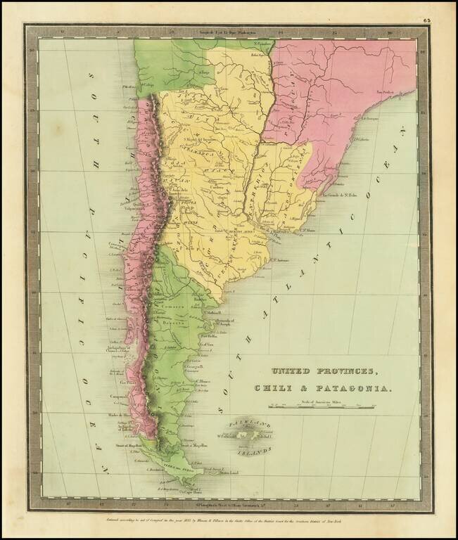
Striking map of the southern portion of South America, colored by provinces.
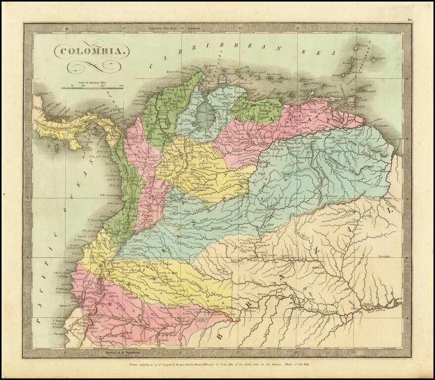
Striking map of Colombia, hand colored by provinces. Includes excellent detail on the River Systems, and shows towns, mountains, lakes, islands, etc. From David Burr's rare Universal Atlas.

Striking full color example of David Burr's map of Peru and Bolivia, which first appeared in David Burr's Universal Atlas, in 1836. Burr's Atlas was perhaps the most elegant American commercially published atlas of its time, utilizing wonderful wash...
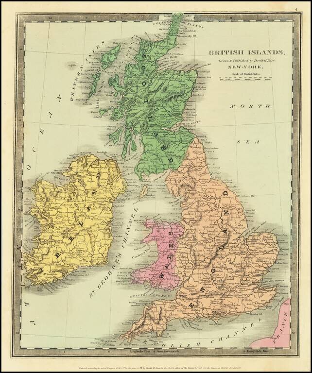
Scarce map of the British Isles, published in New York by David Burr. Burr would go on to become the Topographer of the United States and one of the most important 19th Century American mapmakers.
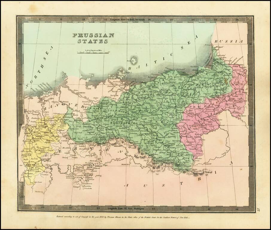
Attractive engraved antique map of Prussia (part of modern-day Poland and Germany), published by David Burr in New York in 1836. The map extends from the Lower Rhine in the west to central Poland in the east. Numerous towns are named, such as Leipzig,...
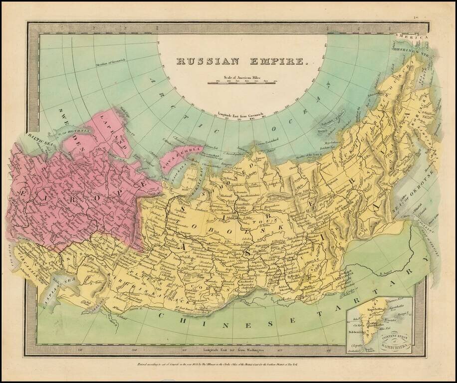
Full color example of the first edition of David Burr's map of the Russian Empire, which appeared in his Universal Atlas, first issued in 1836. Burr's Atlas was perhaps the most elegant American commercially published atlas of its time, utilizing...
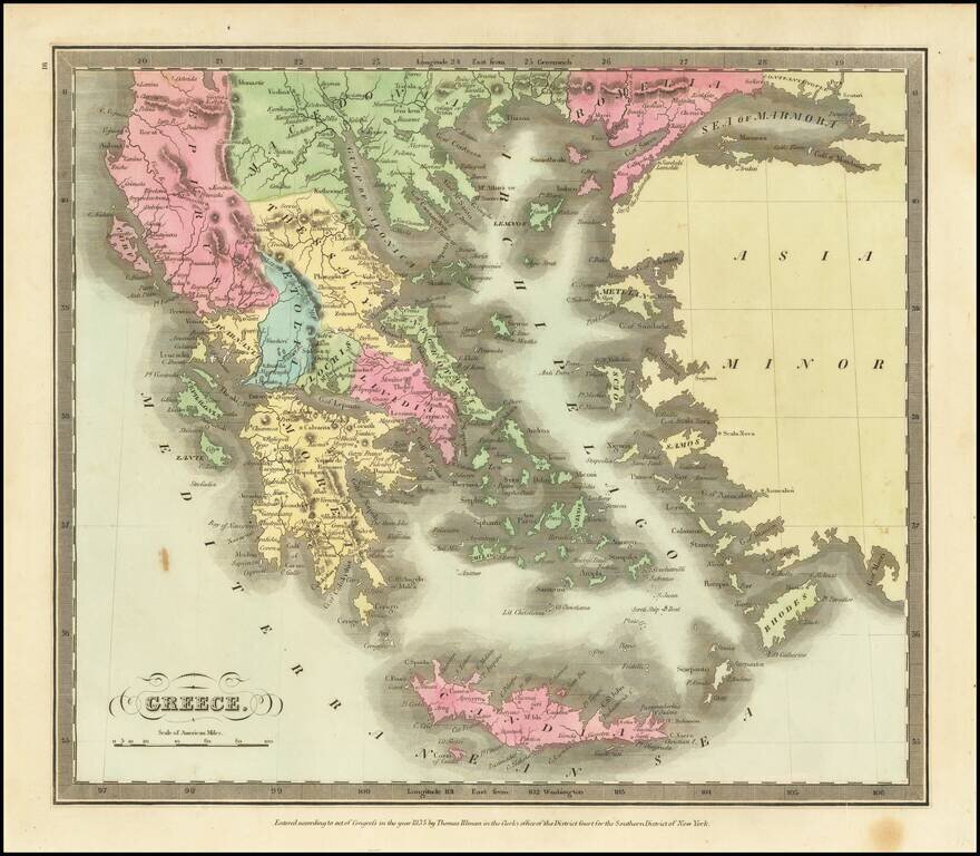
Marvelous detailed map of Greece, Turkey, Macedonia, Crete, and surrounding islands from this scarce American atlas.
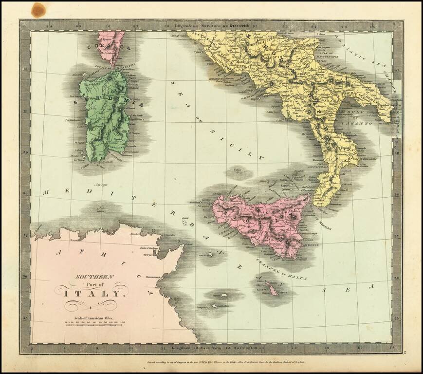
Striking full hand-color engraved map of Italy (with Sicily, Sardinia, Malta and Part of Corsica), which appeared in David Burr's Universal Atlas, in 1836. Burr's Atlas was perhaps the most elegant American commercially published atlas of its time,...
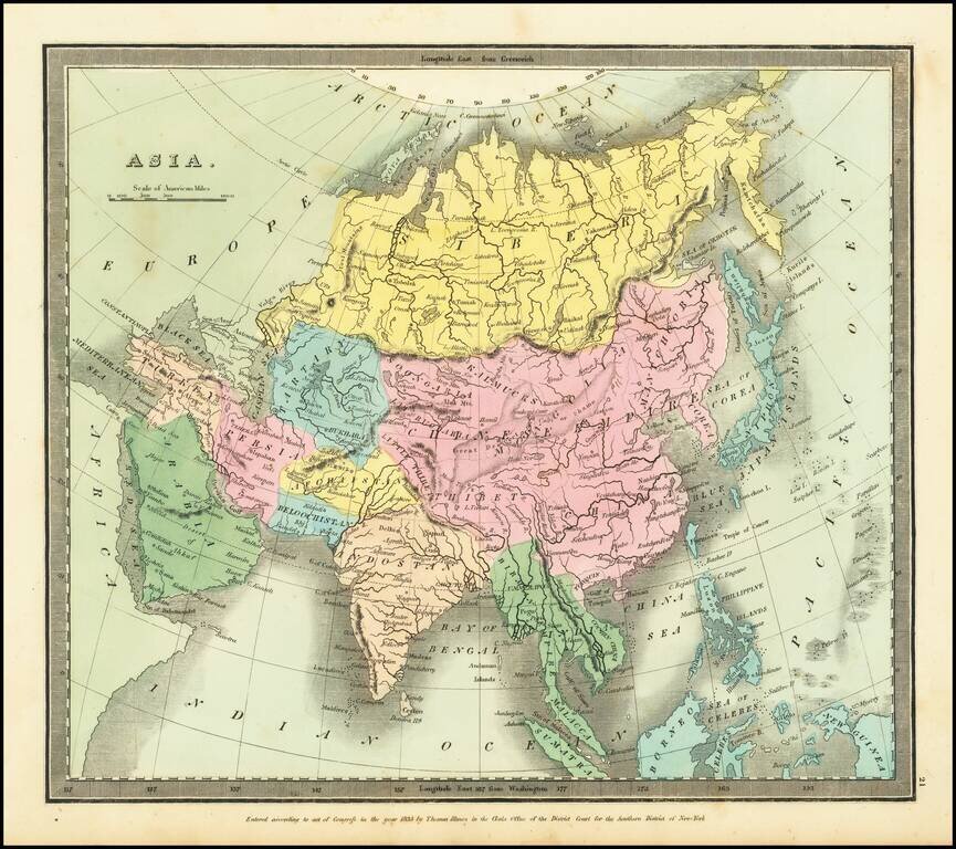
Striking full hand-color example of Burr's map of Asia, which first appeared in David Burr's Universal Atlas, in 1836. Burr's Atlas was perhaps the most elegant American commercially published atlas of its time, utilizing wonderful wash colors and...
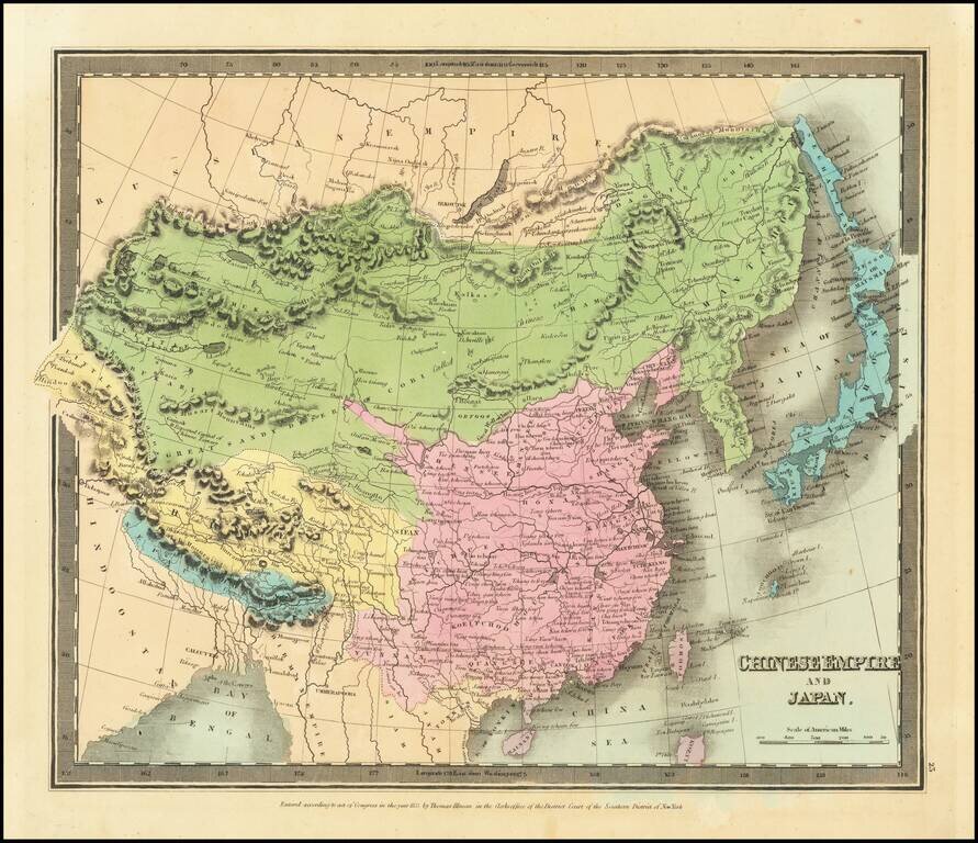
Striking full hand-color example of Burr's map of China, which first appeared in David Burr's Universal Atlas, in 1836. Burr's Atlas was perhaps the most elegant American commercially published atlas of its time, utilizing wonderful wash colors and...
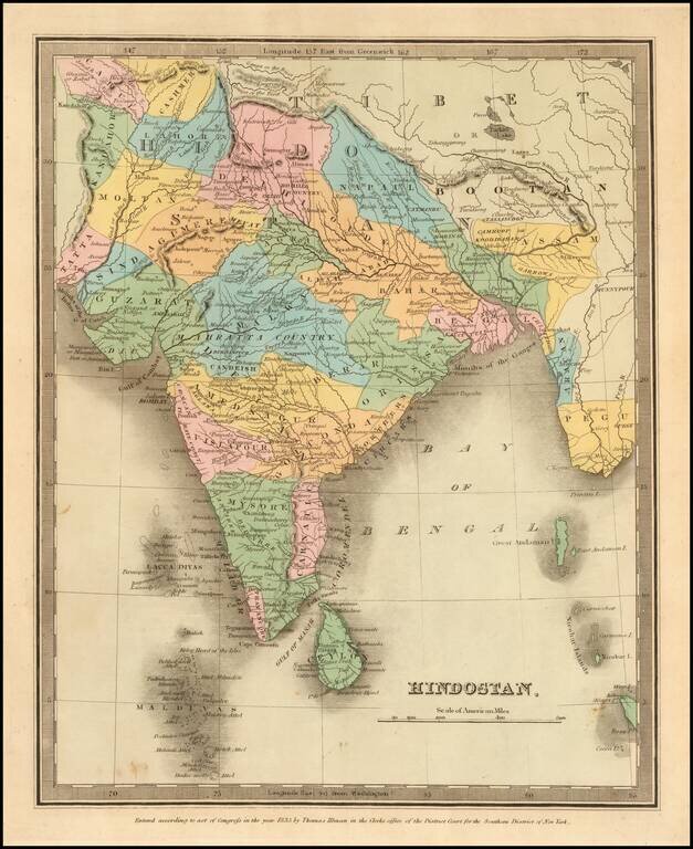
Full color example of the first edition of David Burr's map of India, which appeared in his Universal Atlas, first issued in 1836. Burr's Atlas was perhaps the most elegant American commercially published atlas of its time, utilizing wonderful wash...
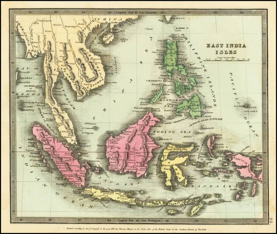
Nice wash color example of David Burr's map of Southeast Asia and the Philippines Burr's Atlas was perhaps the most elegant American commercially published atlas of its time, utilizing wonderful wash colors and elegant engraving style. Burr studied...
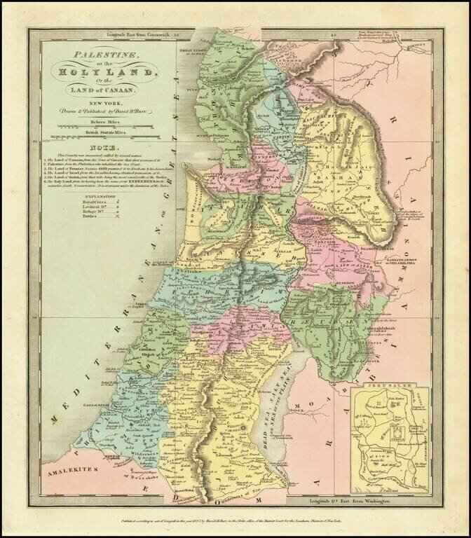
Nice wash color example of David Burr's map of the Holy Land. Includes an inset of the area around Jerusalem and several annotations.
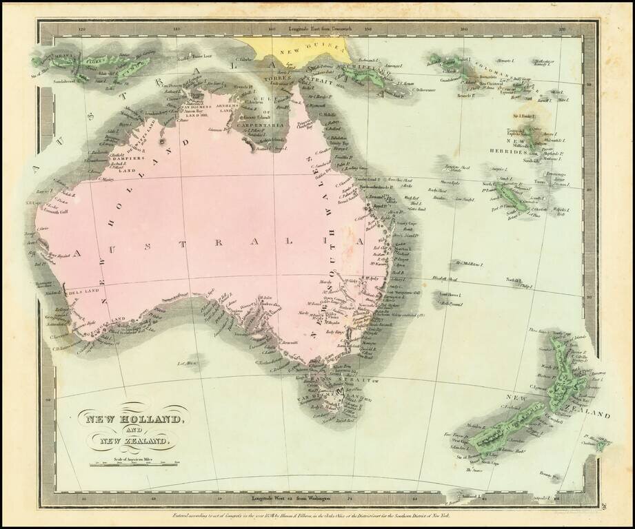
Scarce map of Australia and New Zealand, first published in David Burr's Universal Atlas. Includes a very early and primitive look at the interior of Australia. While the map bears the copyright date of 1834, Rumsey indicates that the atlas was not...