David H. Burr studied law, passing the New York Bar Exam, and then surveying under Simeon DeWitt in New York. His first atlas was an atlas of New York State (1829), the second state atlas to be issued in the US (after Mills’ Atlas of South Carolina in 1826). In the 1830s, he served as the official topographer for the US Post Office, producing a series of rare and highly sought-after large-format state maps. He also created a map of the country’s postal routes, which features roads, canals, and railroads. Burr traveled to London to work with John Arrowsmith; together, they produced the American Atlas in 1839.
Upon his return to the States, Burr was appointed as a draftsman for the House of Representatives, where he worked until ca. 1841. He later worked for the Louisiana Survey and the Florida Survey. By 1850, he was back in Washington D. C., working on the census. In 1852, the Senate named Burr as the draftsman to compile maps from the Federal Surveys. In 1853, Burr traveled to San Francisco, perhaps as part of his work for the Senate. He was then named as the Surveyor General of Utah in 1855. However, he was unpopular there and returned to Washington D. C. by 1870. Burr is widely regarded as one of the most important names in the nineteenth-century American history of cartography.
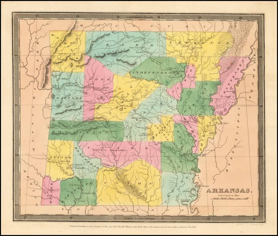
The First Map of Arkansas Territory in its "Statehood" Configuration. Burr's map of Arkansas Territory is the earliest printed map of Arkansas in its final statehood configuration to appear in a commercial atlas. All earlier maps show Arkansas...
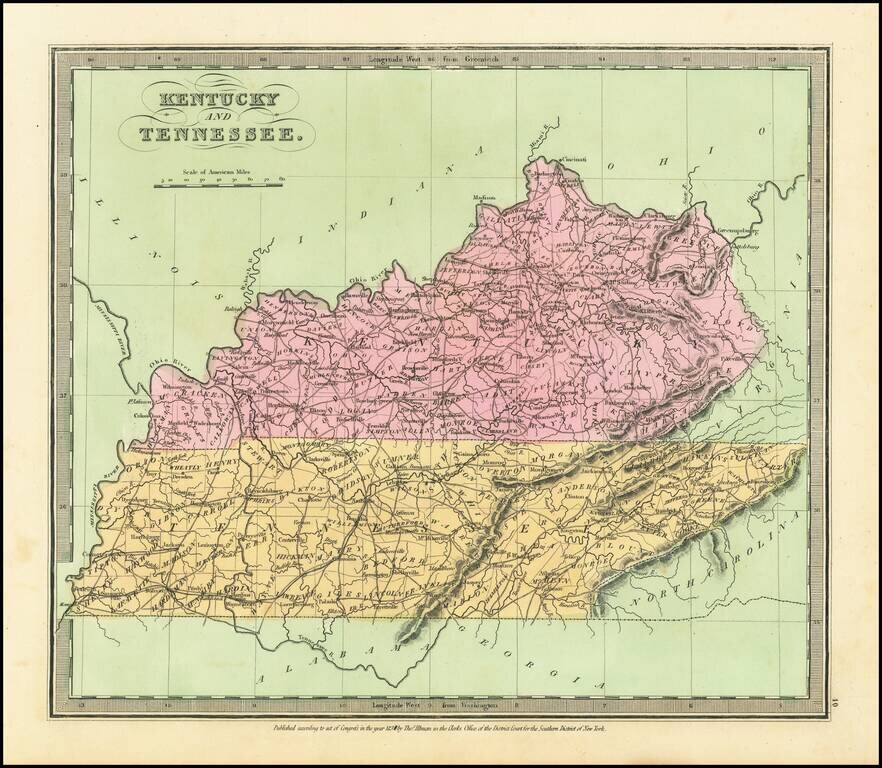
Attractive example of David Burr's scarce map of Kentucky & Tennessee, from his rare Universal Atlas. The map shows counties, towns, roads, rivers, mountains, lakes, forts and other important details. Nice wide margined example of this hard to...
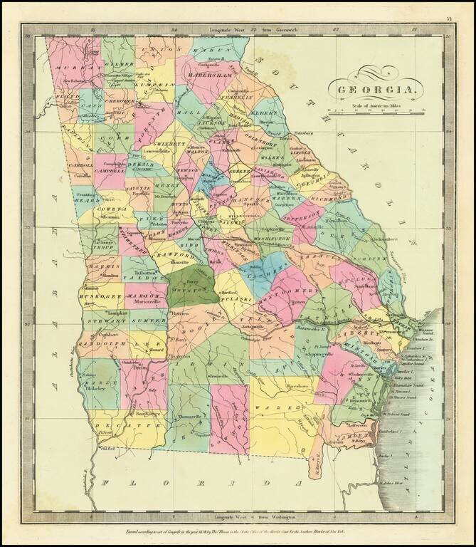
Striking full color example of David Burr's map of Georgia, which first appeared in David Burr's Universal Atlas, in 1836. Burr's Atlas was perhaps the most elegant American commercially published atlas of its time, utilizing wonderful wash colors and...
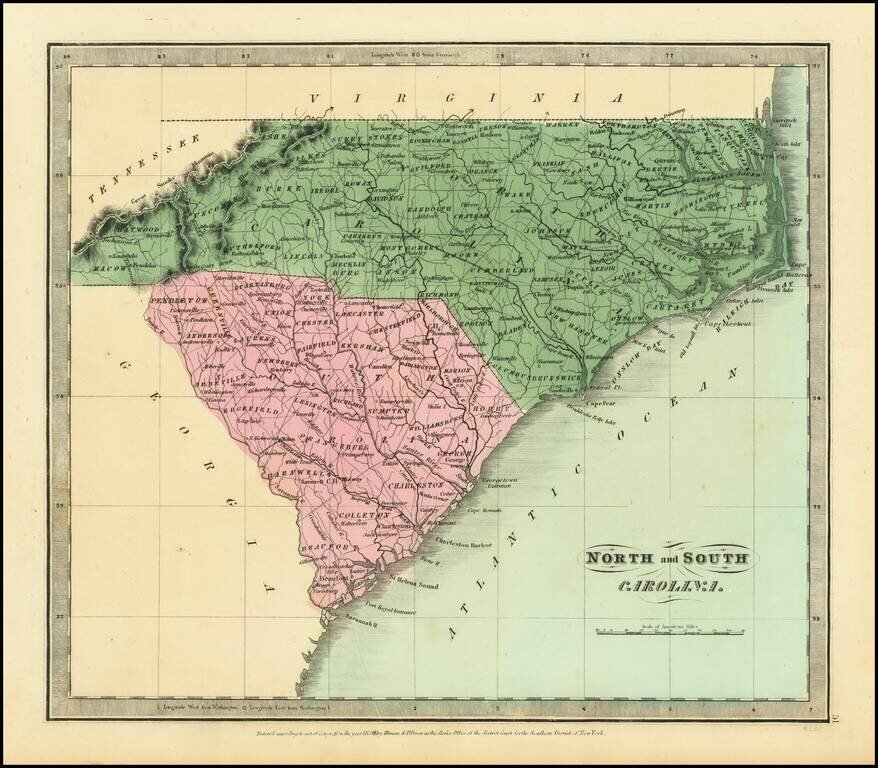
Nice example of the first edition of David Burr's map of the Carolinas, which appeared in his Universal Atlas, first issued in 1836. Shows counties, towns, rivers, roads, courthouses and other details. Burr's Atlas was perhaps the most elegant...
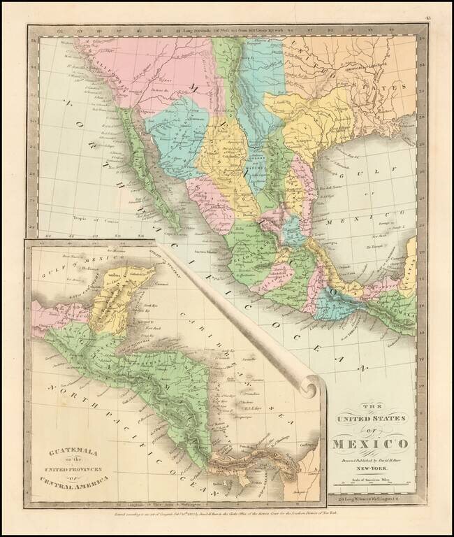
Scarce map of Texas, Upper California, Mexico, etc. from the first edition of David Burr's Universal Atlas. While the map bears the copyright date of 1832, this example is published in 1836. One of the earliest American maps to show Texas in its...
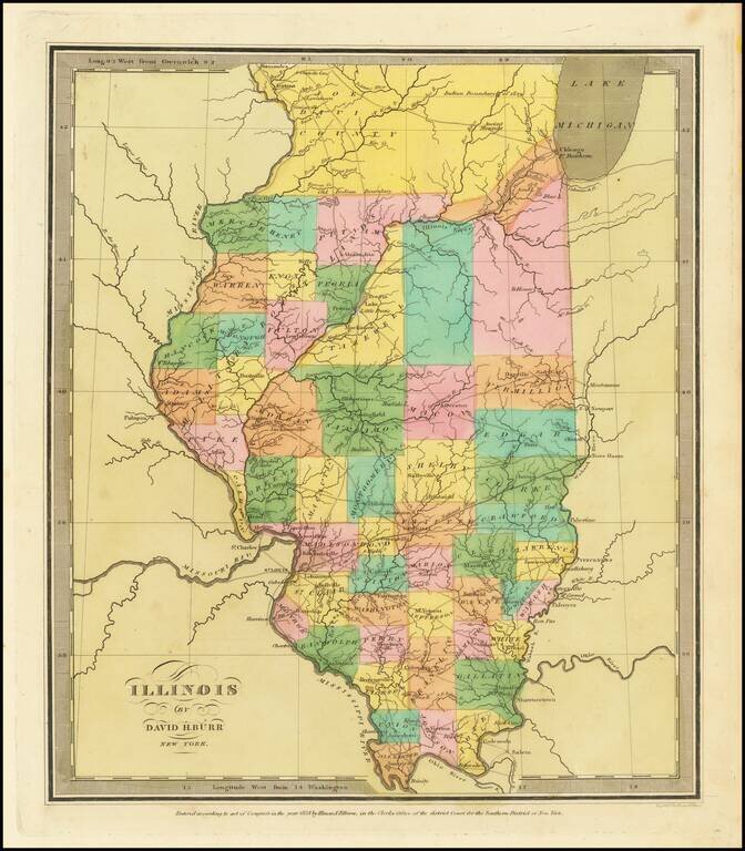
Striking full color example of the first edition of David Burr's map of Illinois, which appeared in his Universal Atlas, first issued in 1836. Includes fascinating primitive counties, including an odd Joe Davis County at the top and a number of...
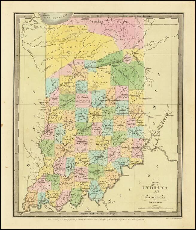
Full color example of the first edition David Burr's map of Indiana, which appeared in his Universal Atlas, first issued in 1836. Includes fascinating primitive counties, including massive regions designated for the Pottawatomies and Miamis Indians,...
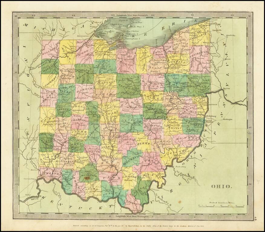
Full color example of the first edition David Burr's map of Ohio, which appeared in his Universal Atlas, first issued in 1836. Burr's Atlas was perhaps the most elegant American commercially published atlas of its time, utilizing wonderful wash colors...
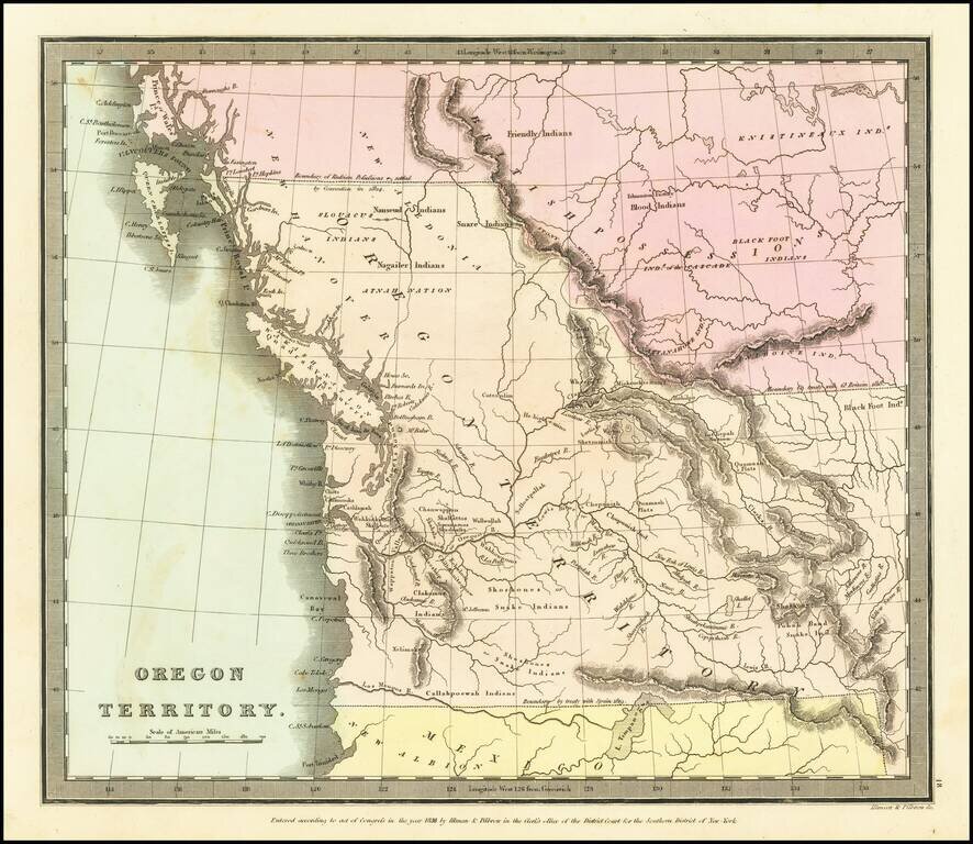
The First Map of Oregon Territory to Appear in a Commercial Atlas Striking example of the first edition of David Burr's map of Oregon Territory, which appeared in Burr's New Universal Atlas, first published in 1835. As is typical of Burr’s style,...
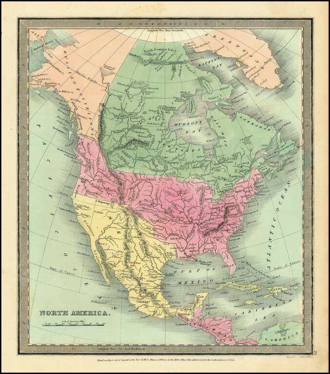
Attractive example of David Burr's scarce map of North America, from his rare Universal Atlas. The cartography of the Northwest and Upper Missouri regions are dominated by information from Lewis & Clark. The map includes a 54-40 or fight...
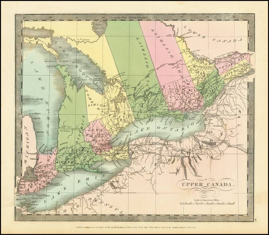
Interesting map of Upper Canada by David Burr, from his New Universal Atlas. Names Toronto on Lake Ontario, and, in the far west, Detroit. The internal districts are named and colored individually.
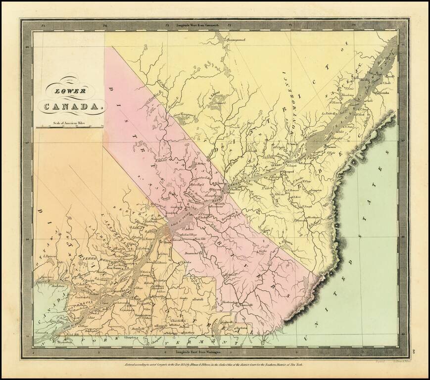
Interesting map of Lower Canada by David Burr, from his New Universal Atlas. The map is centered on the St. Lawrence River. The internal districts are named and colored individually.
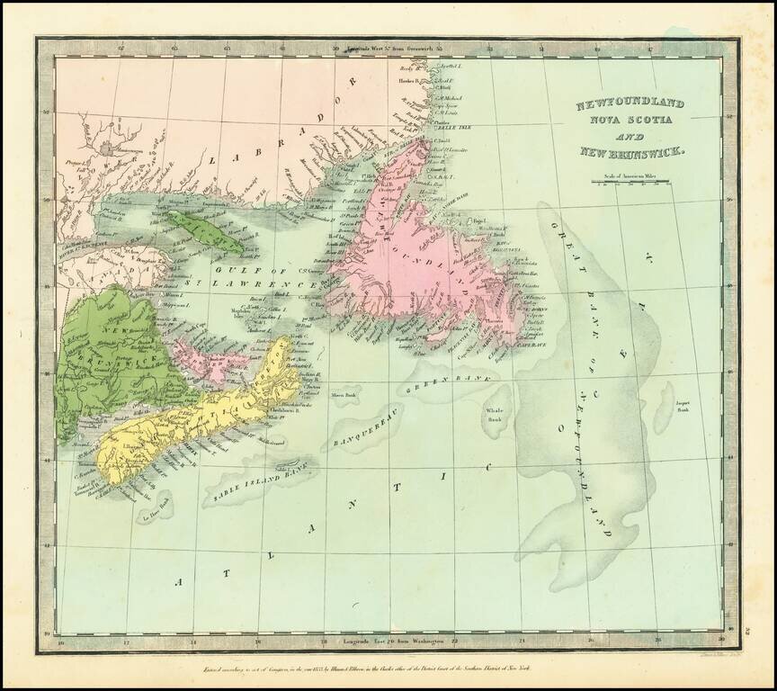
Detailed map of Northeastern Canada, published by David Burr.
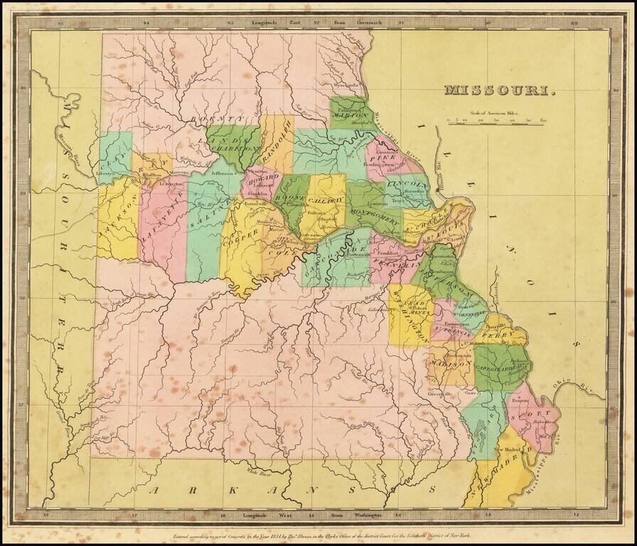
Striking full color example of the first edition of David Burr's map of Missouri, which appeared in his Universal Atlas. Includes fascinating primitive counties, large unnamed counties in the north and south, Bounty Lands above Chariton, etc. The...
The map is quite detailed for its size and includes a fine wash color. Burr's Atlas was perhaps the most elegant American commercially published atlas of its time, utilizing wonderful wash colors and elegant engraving style. Burr studied under Simeon...
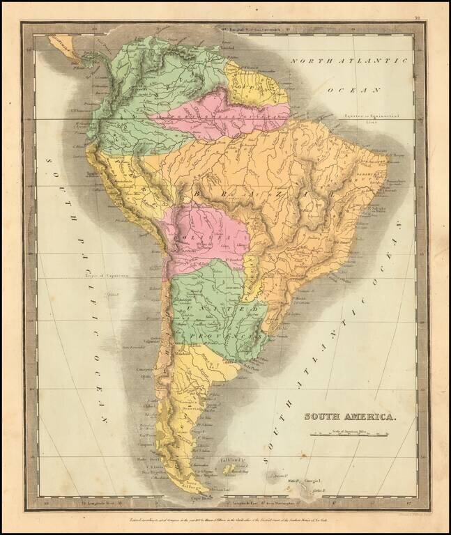
Elegantly colored map of South America, from one of the most interesting early 19th century American map publishers. South America is depicted at the end of its Revolutionary Period, with the Spanish presence now ended. The territorial divisions...