Nicholas Sanson (1600-1667) is considered the father of French cartography in its golden age from the mid-seventeenth century to the mid-eighteenth. Over the course of his career he produced over 300 maps; they are known for their clean style and extensive research. Sanson was largely responsible for beginning the shift of cartographic production and excellence from Amsterdam to Paris in the later-seventeenth century.
Sanson was born in Abbeville in Picardy. He made his first map at age twenty, a wall map of ancient Gaul. Upon moving to Paris, he gained the attention of Cardinal Richelieu, who made an introduction of Sanson to King Louis XIII. This led to Sanson's tutoring of the king and the granting of the title ingenieur-geographe du roi.
His success can be chalked up to his geographic and research skills, but also to his partnership with Pierre Mariette. Early in his career, Sanson worked primarily with the publisher Melchior Tavernier. Mariette purchased Tavernier’s business in 1644. Sanson worked with Mariette until 1657, when the latter died. Mariette’s son, also Pierre, helped to publish the Cartes générales de toutes les parties du monde (1658), Sanson' atlas and the first French world atlas.
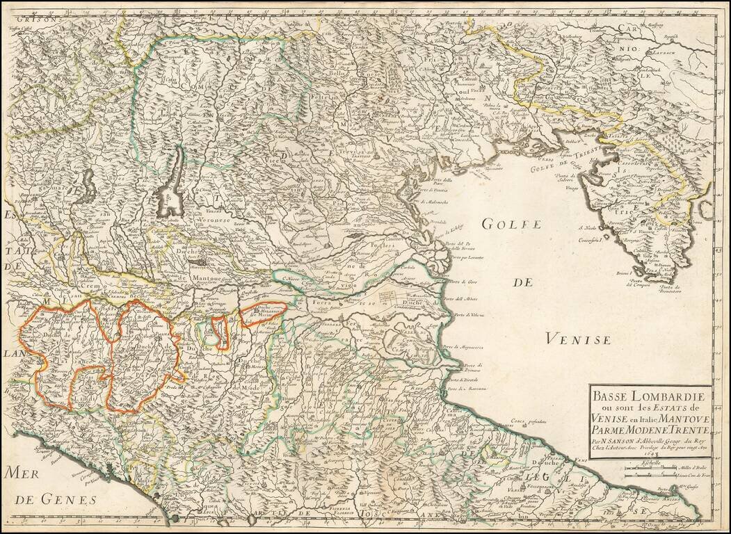
Nicolas Sanson's 1648 double-page engraved map of northeastern Italy, showing Istria and the top of the Gulf of Venice to Genoa and the Lake Regions, centered on the Po River and Venice.
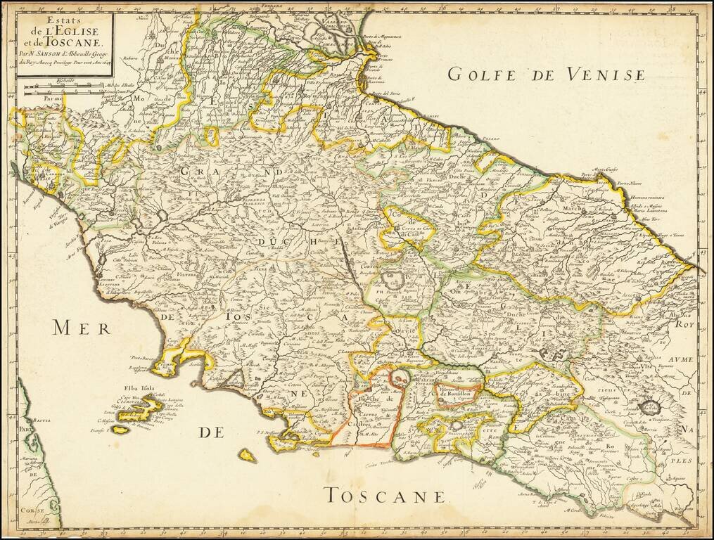
Nicolas Sanson's 1648 double-page engraved map of Tuscany and the Papal States.
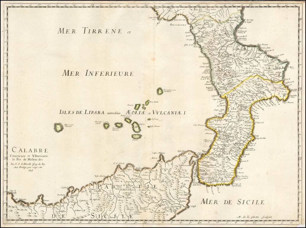
Nicolas Sanson's 1648 double-page engraved map of Calabria, the Strait of Messina, and northern Sicily.
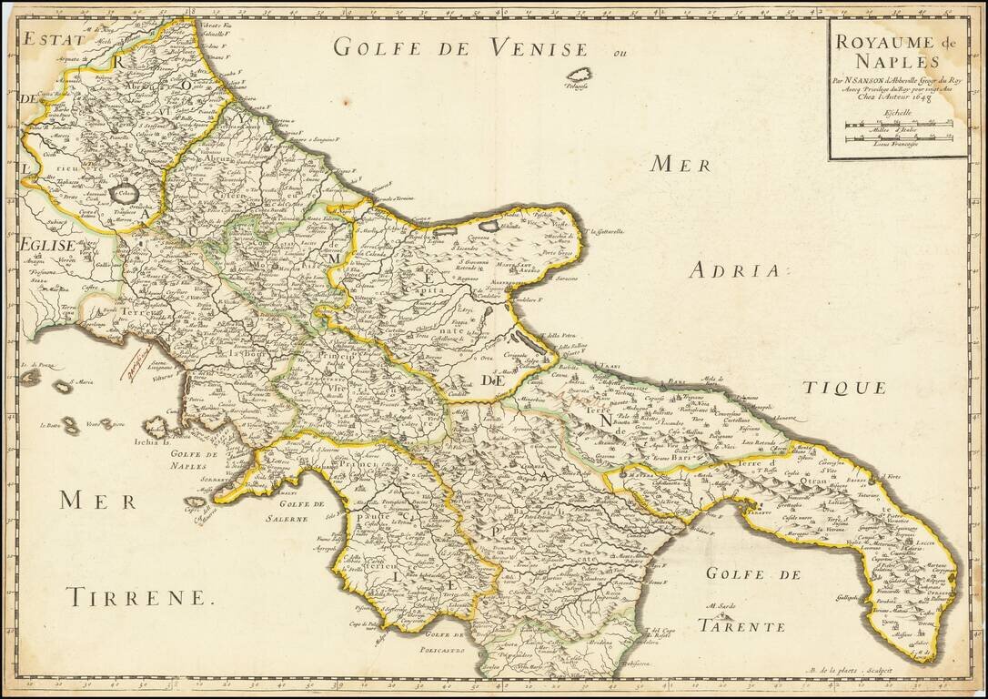
Nicolas Sanson's 1648 double-page engraved map of the Kingdom of Naples.
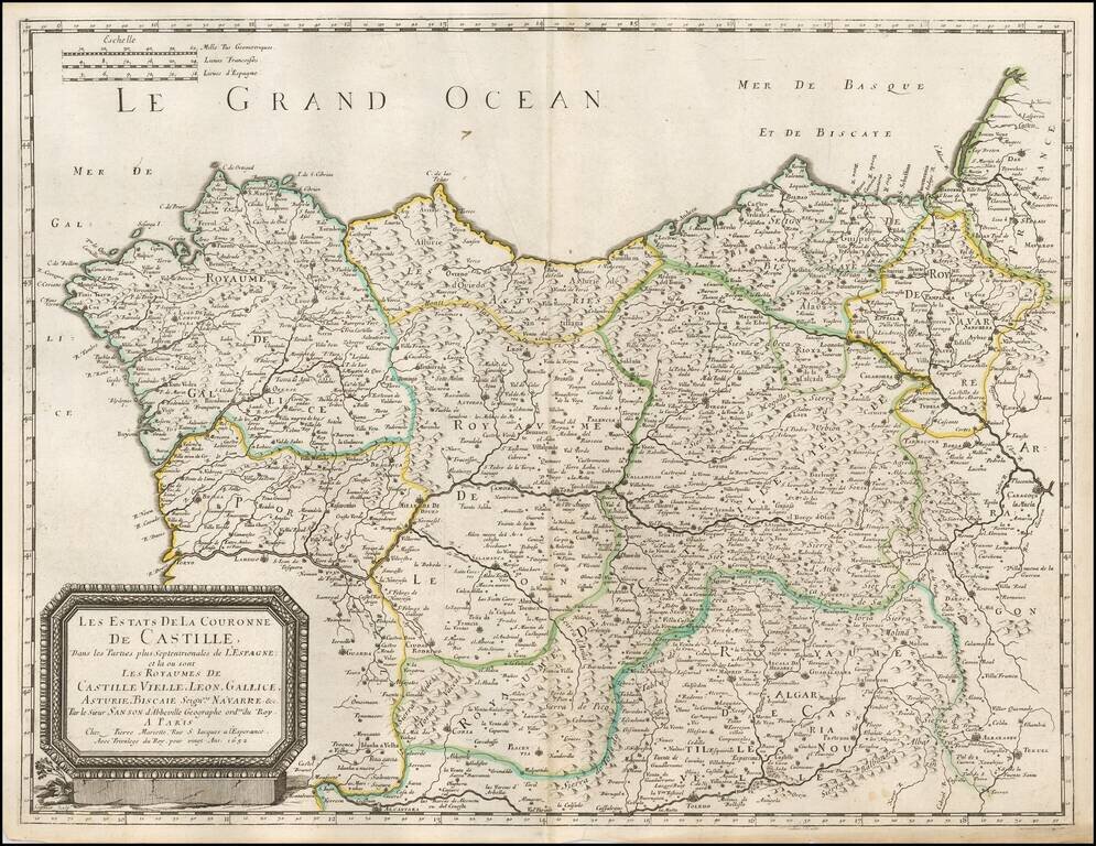
Nicolas Sanson's double-page engraved map of northwestern Spain. The map was published in Paris in 1652.
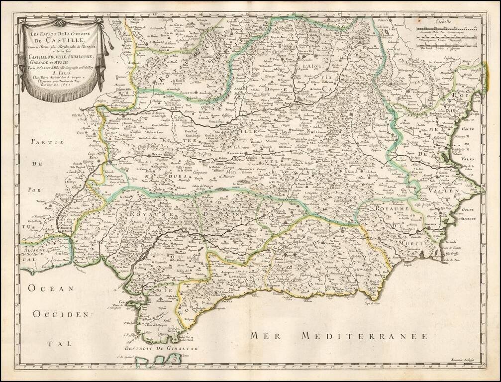
Nicolas Sanson's double-page engraved map of southeastern Spain. The map was published in Paris in 1652.
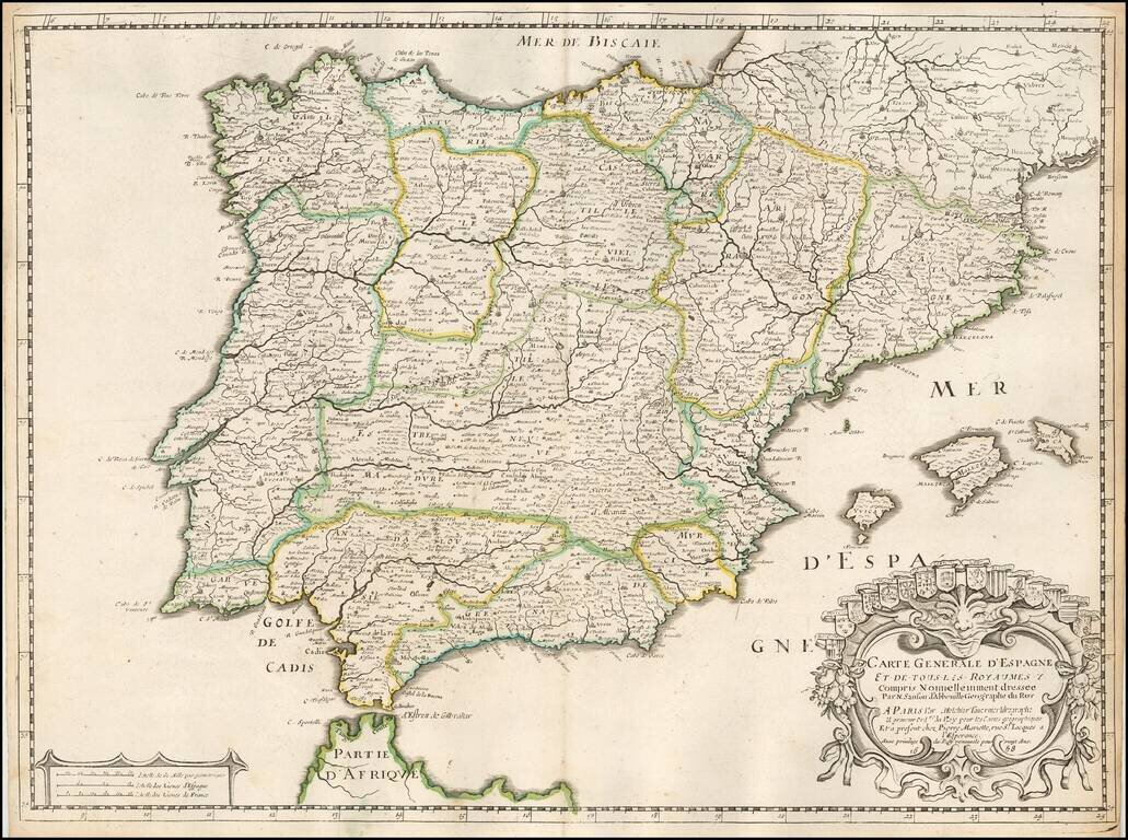
Nicolas Sanson's double-page engraved map of the Iberian Peninsula, with Spain, Portugal, and Balearics. The map was published in Paris in 1658.
![Parte Septentrional do Reyno de Portugal... 1654 [with] Partie Meridional do Reyno de Portugal.... 1654](/map/small/50470.jpg)
Nicolas Sanson's 1654 double-page engraved maps of northern and southern Portugal, with a large sailing vessel in the upper left corner.
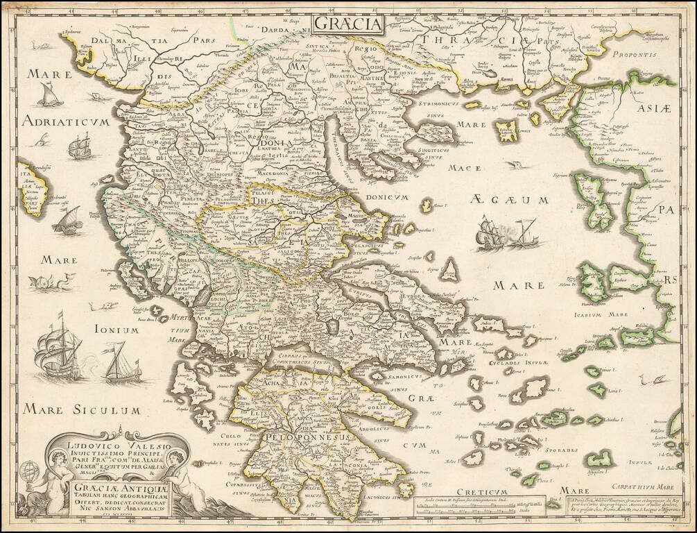
Tavernier and Sanson double-page engraved map of ancient Greece.
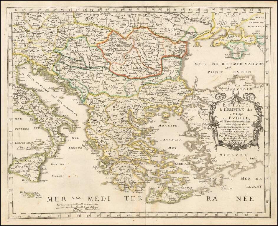
Nicolas Sanson's rare 1655 double-page engraved map of Greece and the Balkans, then the European territory of the Ottoman Empire. The map was subsequently copied by Jaillot and Covens & Mortier, in both one- and two-sheet versions.
![Les Estats de L'Empire des Turqs en Asie . . . . [Includes Cyprus]](/map/small/50415.jpg)
Nicolas Sanson's circa 1650 double-page engraved map of the Ottoman Empire. The map provides a detailed look at the Turkish Empire in the middle of the 17th Century, extending to cover the Eastern Mediterranean and the western part of the Persian...
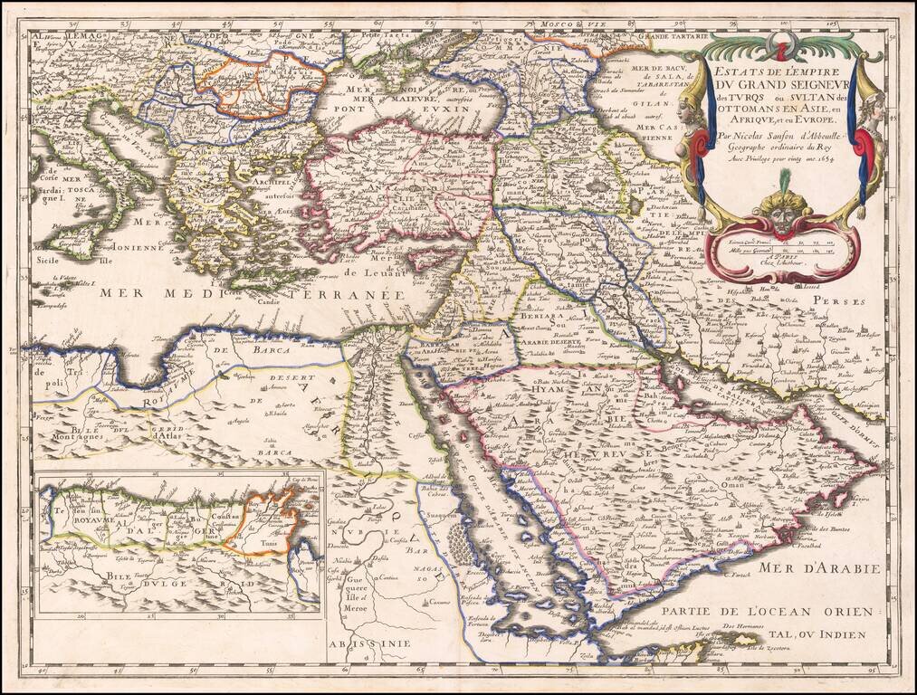
The Ottoman Empire by Nicolas Sanson. Sanson's map shows the powerful Ottoman Empire of the mid-seventeenth century, extending from Italy to the Straits of Hormuz. There is excellent detail from Italy to the Caspian Sea and the Arabian Peninsula. The...
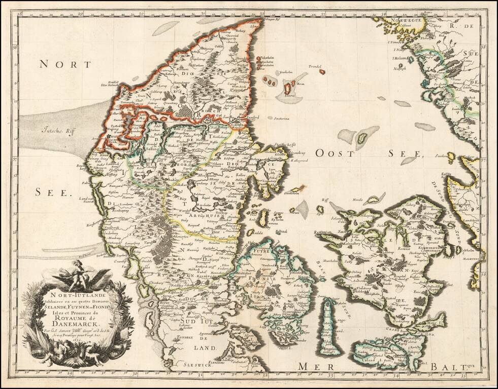
Sanson's 1659 double-page engraved map of Denmark. The map includes a very elaborate cartouche in the lower left corner and is in old outline hand color. Nicolas Sanson (1600-1667) sometimes called Nicolas Sanson d'Abbeville or Sanson d'Abbeville, was...
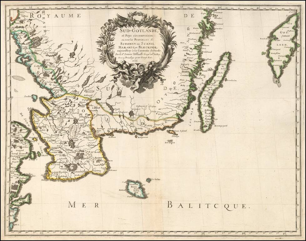
Very nice example of Sanson's 1659 double-page engraved map of southern Sweden. Nicolas Sanson (1600-1667) sometimes called Nicolas Sanson d'Abbeville or Sanson d'Abbeville, was the most important French cartographer of the 17th century. Tooley called...
![Description De La Tartarie tiree en partie de plusiurs Cartes, qui en ont este faictes en parte diverses Relations et de divers Autheurs Arabes . . . 1654 [Korea as an Island]](/map/small/59148.jpg)
Early French map of Tartary, extending from the Caspian to Korey Isle (the Island of Korea). One of the earliest detailed maps of the region published in France. The map was prepared by Pierre Marriete for Sanson's Cartes Generales de Toutes les...
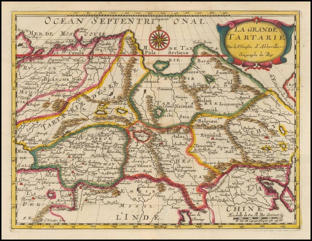
Fine old color example of this fine 17th Century map of Grand Tartaie by Nicolas Sanson. The map extends from the Tartarie Desert and Usbekistan in the west to Corea and Northeastern China.