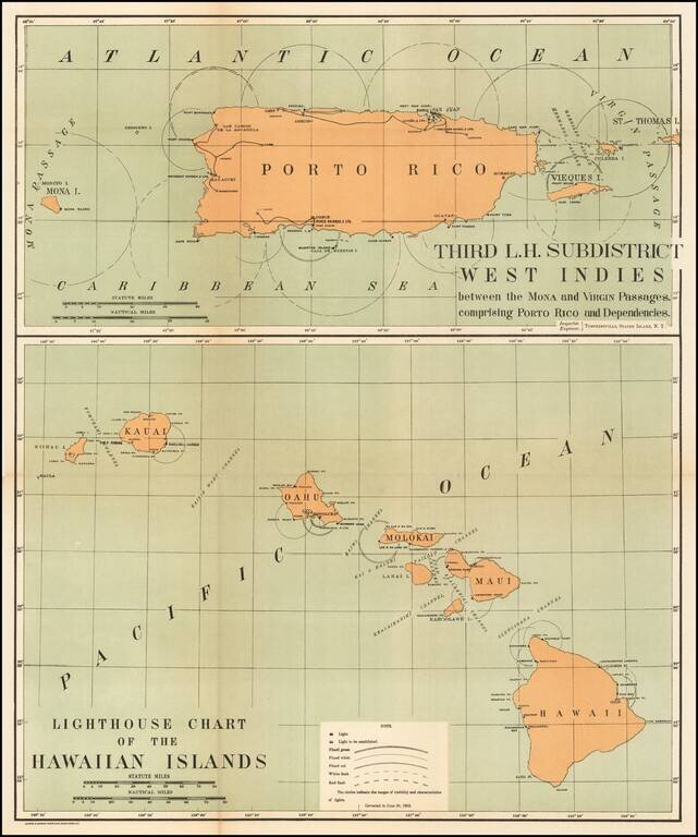
Rare pair of maps showing the lighthouses in Hawaii and the Puerto Rico areas, including proposed light houses, fog lights, light vessels, lighted buoys and a host of other navigational details within the state. This is the first time we have ever...
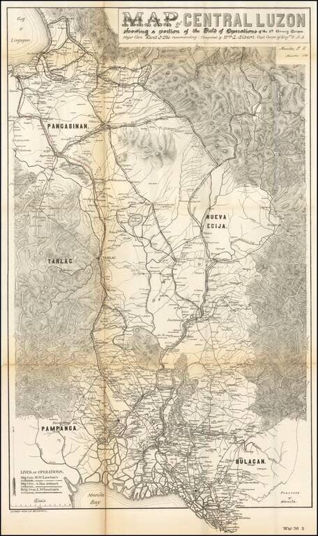
Rare military map showing part of the Island of Luzon, issued at the height of the Philippine-American War, compiled by William L. Sibert of the 8th Army Engineering Corp. The map covers central Luzon, from Manila Bay to Lingayen Gulf. The map shows...