Matthias Quad (1557-1613), a map publisher based in Cologne, was trained in the Netherlands by Johannes van Doetecum, who also worked with the De Jodes. Quad used many De Jode maps as a base to which he added additional information and decorations. Quad was best known for his atlases, which were part of the first boom in atlases best characterized by Abraham Ortelius’ Theatrum Orbis Terrarum. In 1592, Quad released an atlas of Europe that had 38 maps. He expanded it in 1594 to 50 maps. In 1600, he expanded the collection of maps further still, this time to 82 maps, and called the atlas, Geographisch Handtbuch. All three were small in size, allowing them to compete as cheaper alternatives to the larger atlases of Ortelius, Mercator, and the De Jodes. Quad released one other atlas, in 1608, with 86 maps, the Fascilus Geographicus.
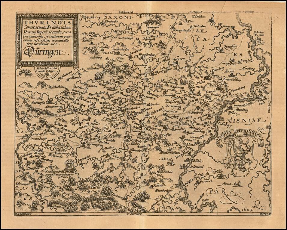
Detailed regional map of Thuringia in Germany. Shows the region between the Werra and Sala Rivers, centered on Erfurt. The present map was produced by two of the primary Cologne School mapmakers, Johann Bussemacher and Matthias Quad. The Cologne...

Detailed map of the Rhine Palatinate Region of Germany, oriented with South at the top. The map is centered on the Rhine River and includes Frankfurt and Mainz near the bottom of the map, along with Worms, Manheim, Stuttgart, Pforzheim and...

Nice example of this scarce map of the river traversed by the Rhine River, between Basel and regions to the North, published in Cologne. The map is oriented with West at the top. The present map was produced by two of the primary Cologne School...
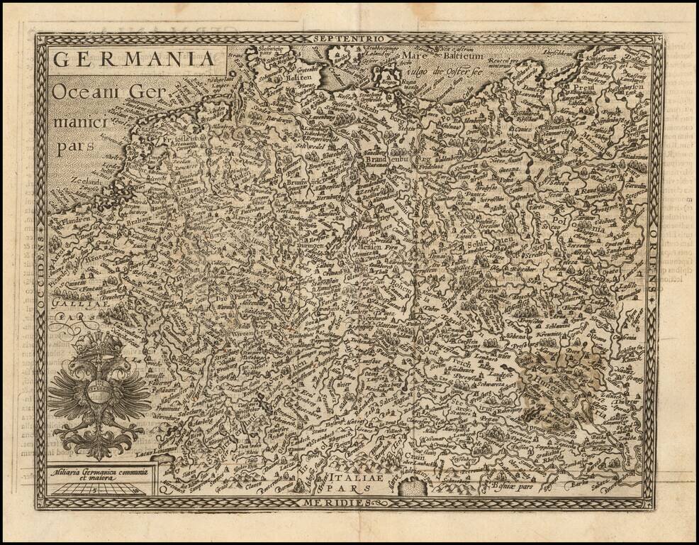
Nice example of this scarce map of the Holy Roman Empire, published in Cologne. The present map was produced by two of the primary Cologne School mapmakers, Johann Bussemacher and Matthias Quad. The Cologne School of cartography, was perhaps the only...

Nice example of this scarce map of the Palatinate of Bavaria, with vignette portrait of "Wilhemus D.G.", published in Cologne. Cities shown include Regensburg, Nuremberg, Ingolstadt, etc. The present map was produced by two of the primary Cologne...
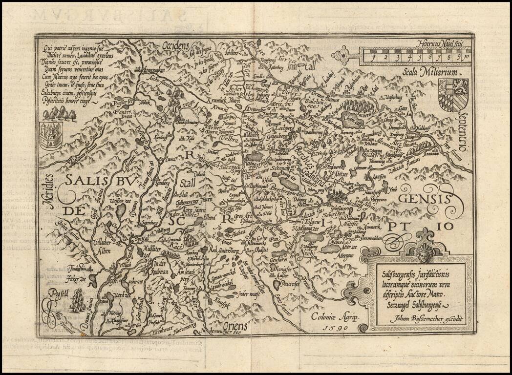
Detailed map of Saltzburg, based upon an earlier map by Markus Setznagel. Setznagel was the son of an official and member of the external council of the city Salzburg, Michael Setznagel. His most important work was the first general map of Salzburg,...
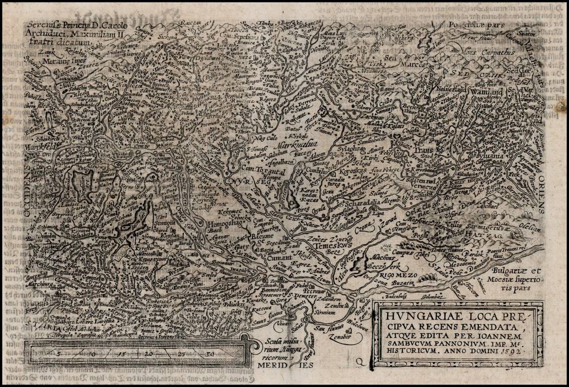
Detailed map of the the region bounded by Vienna in the West and following the course of the Danube to Belgrade. Decorative early region map, centered on Hungary.
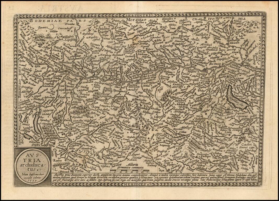
Detailed map of Austria, published in Cologne by Quad and Bussemacher. Matthaus Quad was a German cartographer based in Cologne. The map was engraved by Johannes Bussemacher and appeared in several Geographical works published by Quad and Bussemacher...
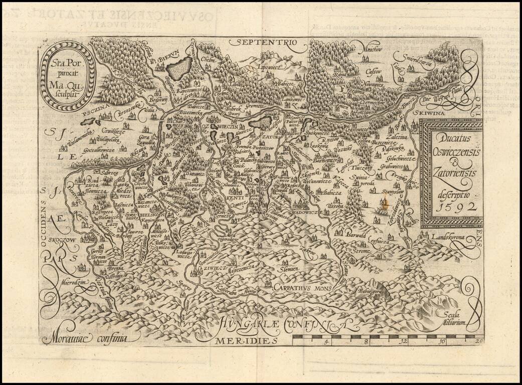
Detailed map of Southern Poland and the from the Wesel River in the north to the Carpathian Mountains in the south, centered on Auschwitz. Matthaus Quad was a German cartographer based in Cologne. The map appeared in several Geographical works...
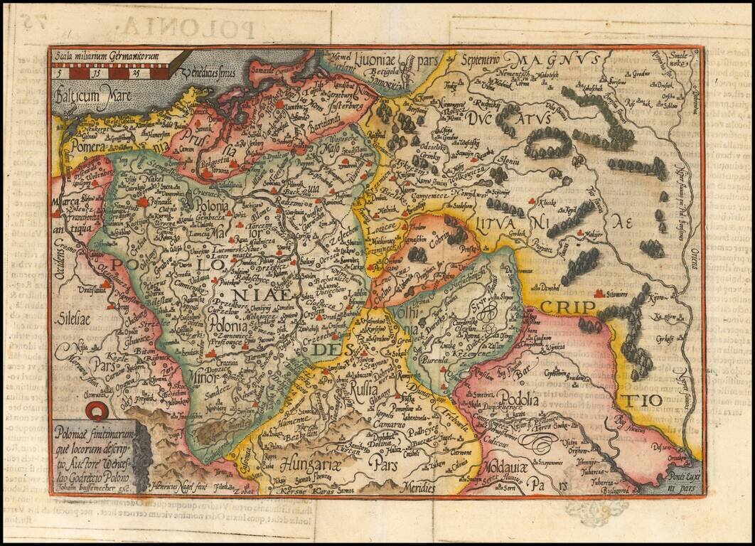
Striking example of Quad's map of Poland, reduced from Ortelius' map. The map is based upon the map of Godrecki, first published in 1558.
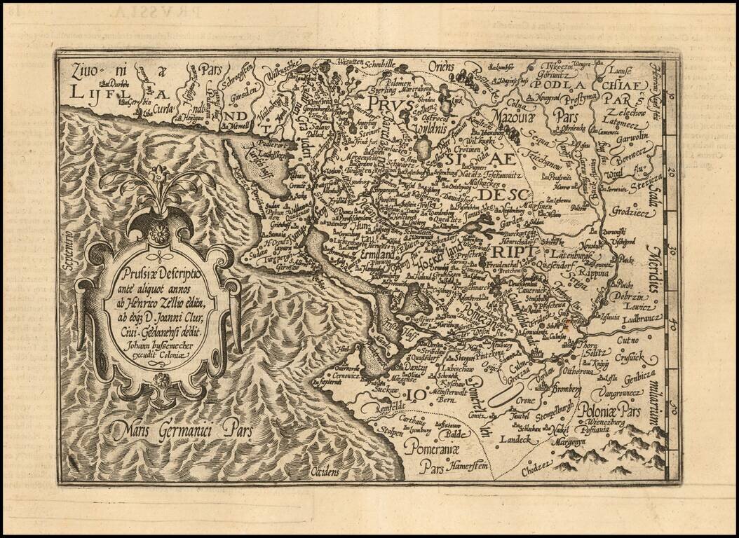
An Early Map of Prussia Detailed map of the region centered on the southern Baltic Coast, reaching inland to the Bug River. Includes a detailed early coverage of the areas around Dantzig, Konnigsberg and the Lithuanian coastline. East is oriented...
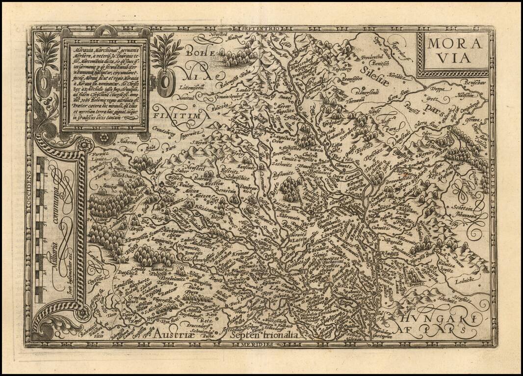
Fine example of Matthias Quad's map of Moravia. One of the few separate maps of Moravia published in the 16th Century.
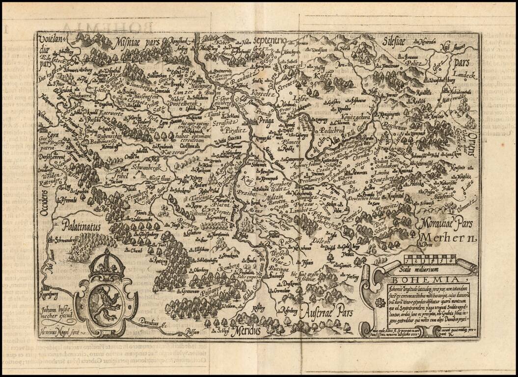
Fine example of Johan Bussemacher's map of Bohemia, engraved by Henricus Nagel. One of the few separate maps of Bohemia published in the 16th Century.
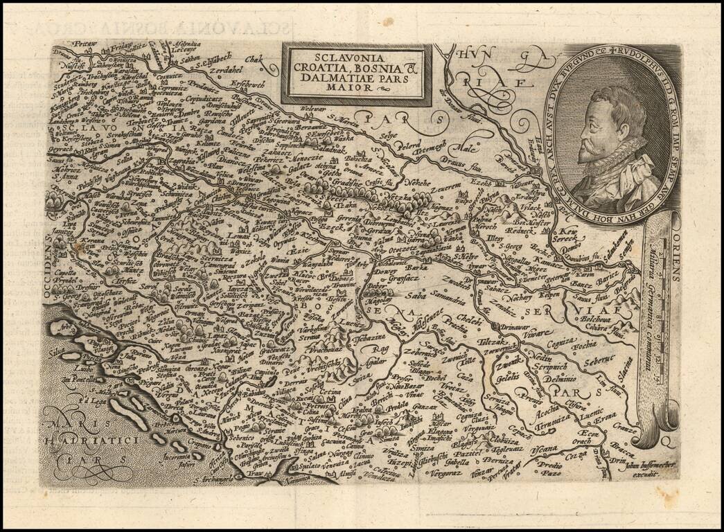
Scarce early map of the region from Slovenia to Serbia, engraved by Johann Bussemacher and published by Quad. The map is centered on Croatia and Bosnia Herzogovina, extending south to Split on the coastline and east to Belgrade. Includes a large...
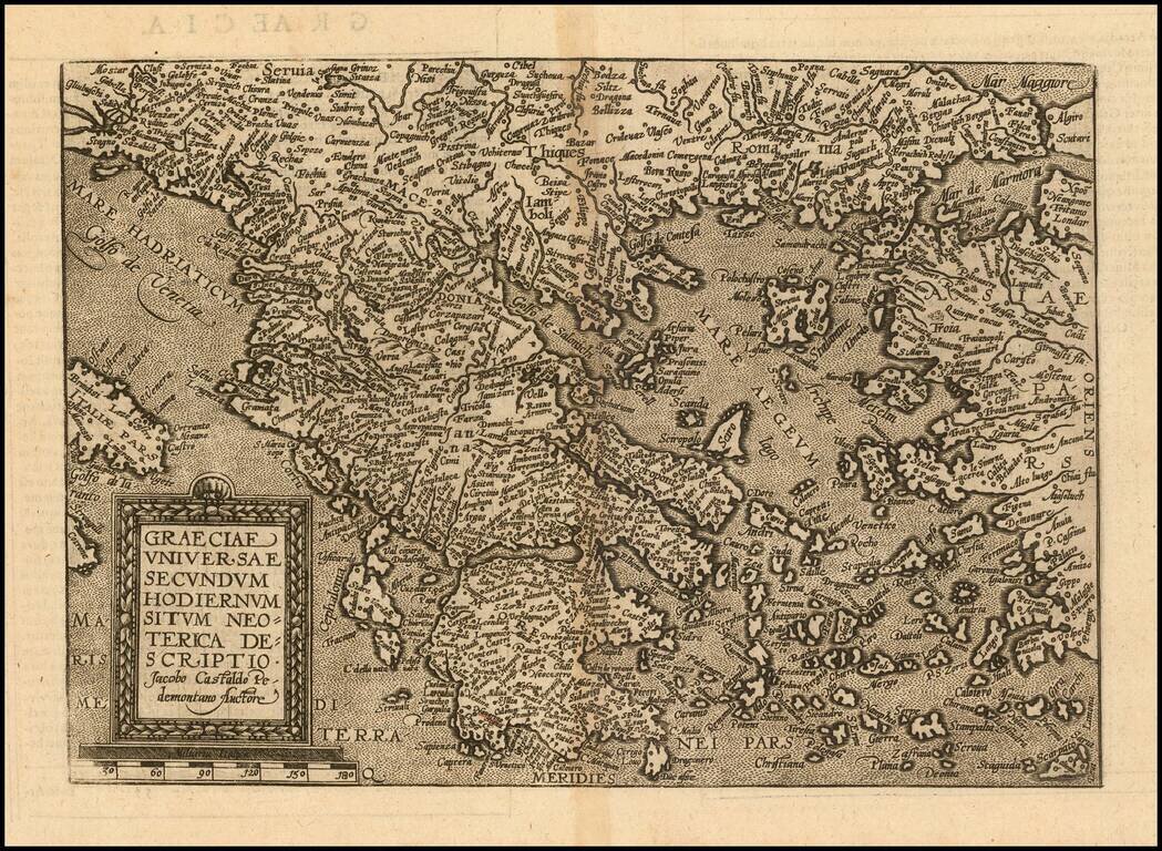
Detailed map of Greece and neighboring regions, based upon Giacomo Gastaldi's map. The map appeared in Quad's Geographische Handtbuch . . . .
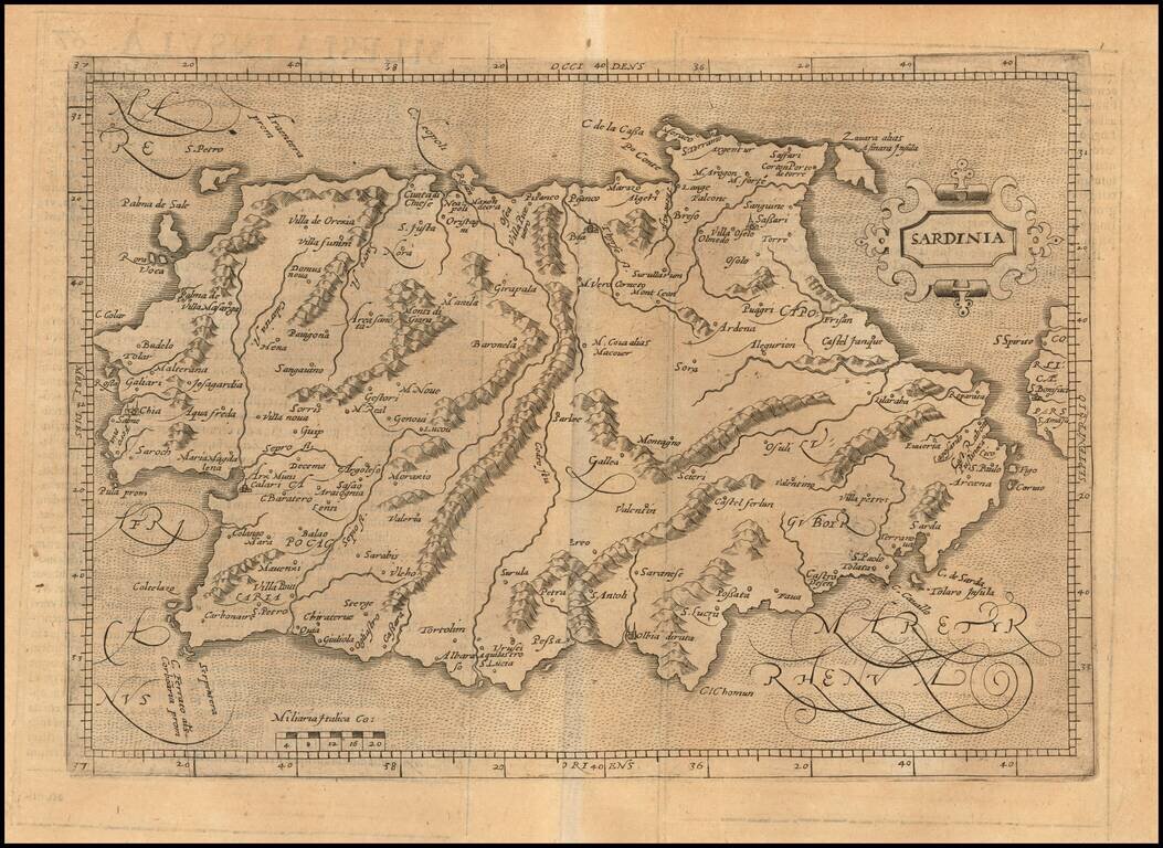
Scarce early map of Sardinia. Matthaus Quad was a German cartographer based in Cologne. The map was engraved by Johannes Bussemacher and appeared in several geographical works published by Quad and Bussemacher at the end of the 16th and beginning of...