![[San Francisco Bay] Plan of Port St. Francisco, in California, Point de Reyes in 37°59' of Latitude North & 124°54' Longitude West](/map/small/67853.jpg)
The Earliest Obtainable Map of San Francisco Bay Highly desirable map of San Francisco from the La Perouse's Voyages, the first obtainable map of San Francisco Bay. During his round the world voyage, La Perouse coasted southward along the California...
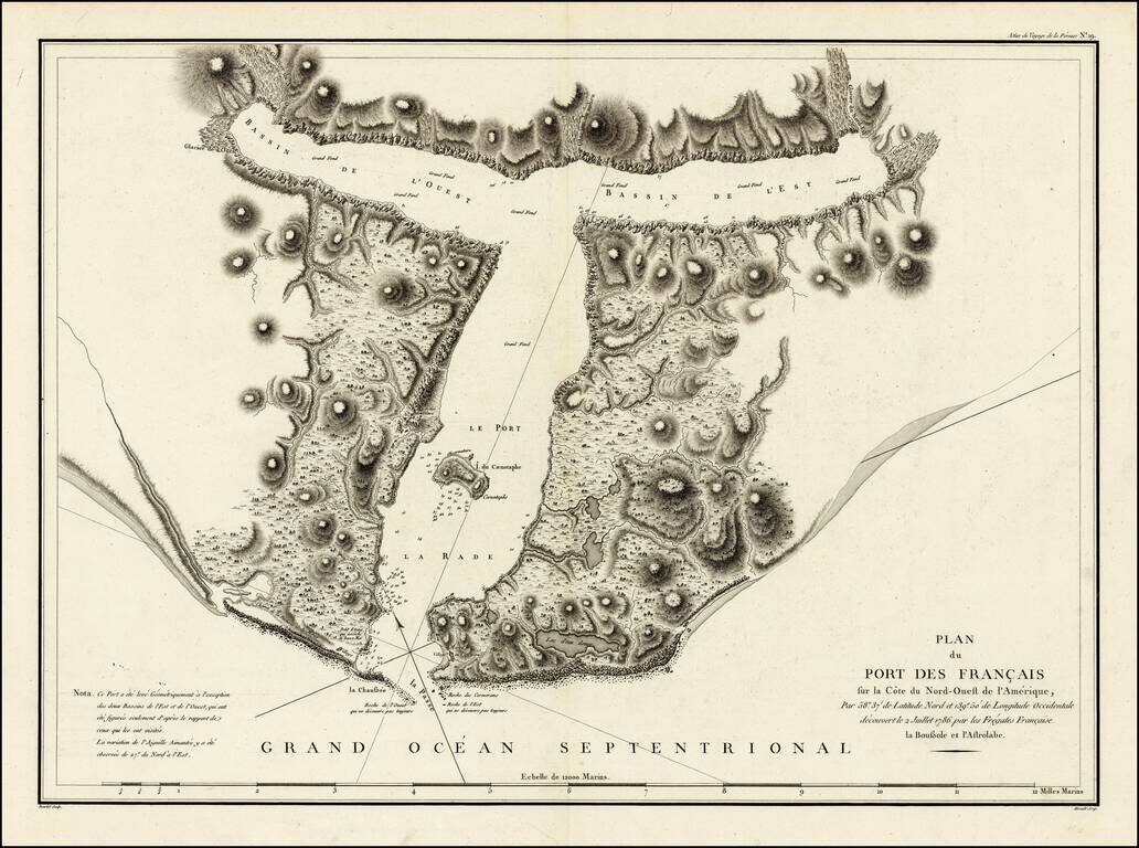
Detailed plan of Port des Francais, from the Atlas Du Voyage De La Pérouse. From the voyages of La Pérouse who set sail from France in 1785 to continue the discoveries of Captain Cook. He was shipwrecked in 1788 and died during the voyage, but his...
![Carte Des Parties Des Iles Sandwich . . . 1786 [with] Carte Des Iles Sandwich . . .](/map/small/52046.jpg)
The Second Mapping of Hawaii / With Comparision To Cook's First Chart Two fascinating charts of the Hawaiian Islands, illustrating the charting of the islands by La Perouse and the compilation of the data from La Perouse and Cook's explorations in the...
![[Vancouver Island] Carte Particuliere de la Cote du Nord-Ouest de l'Amerique reconnue par les Fregates Francaises la Boussole et l' Astrolabe en 1786 2e. Feuille.](/map/small/62141.jpg)
Vancouver Island Before Vancouver! Early sea chart of a portion of the west coast of Vancouver Island, centered on Nootka from the epic voyage of the Jean-François de Galaup, Comte de La Pérouse. This fine map embraces the western coast of...
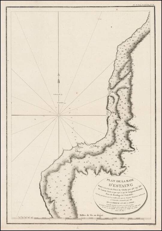
Detailed plan of the Uglegorsk Region, from first official account of the Voyage of La Perouse.
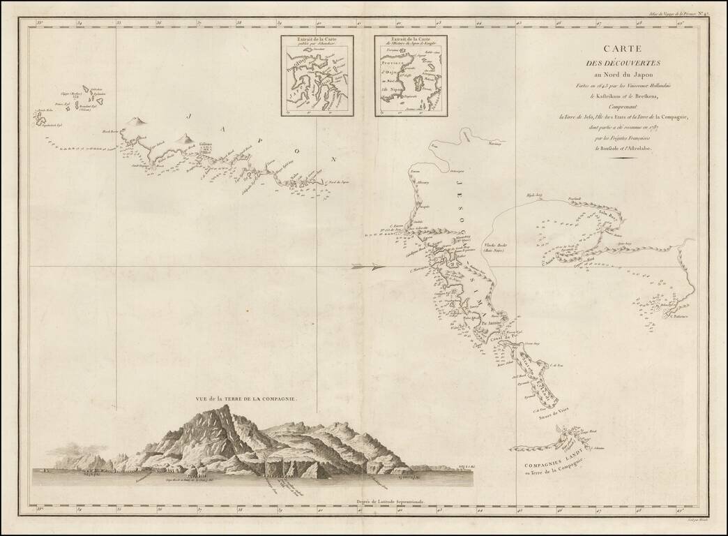
Important Chart of Northern Japan Illustrating Early Dutch Discoveries as Recorded by the Lost La Perouse Expedition Oriented with west at the top, this chart shows the discoveries made by the Dutch ships Kastrikum ( Castricum) and Breskens in 1643...
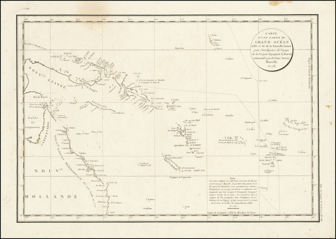
Interesting chart of Eastern Australia and part of the south-western Pacific, showing the routes taken by the Spanish explorer Don Francisco Antonio Maurelle in 1781 along the northern coast of New Guinea and across the Pacific to Fiji and Tonga,...