The Arrowsmiths were a cartographic dynasty which operated from the late-eighteenth century to the mid-nineteenth. The family business was founded by Aaron Arrowsmith (1750-1823), who was renowned for carefully prepared and meticulously updated maps, globes, and charts. He created many maps that covered multiple sheets and which were massive in total size. His spare yet exacting style was recognized around the world and mapmakers from other countries, especially the young country of the United States, sought his maps and charts as exemplars for their own work.
Aaron Arrowsmith was born in County Durham in 1750. He came to London for work around 1770, where he found employment as a surveyor for the city’s mapmakers. By 1790, he had set up his own shop which specialized in general charts. Arrowsmith had five premises in his career, most of which were located on or near Soho Square, a neighborhood the led him to rub shoulders with the likes of Joseph Banks, the naturalist, and Matthew Flinders, the hydrographer.
Through his business ties and employment at the Hydrographic Office, Arrowsmith made other important relationships with Alexander Dalrymple, the Hudson’s Bay Company, and others entities. In 1810 he became Hydrographer to the Prince of Wales and, in 1820, Hydrographer to the King.
Aaron Arrowsmith died in 1823, whereby the business and title of Hydrographer to the King passed to his sons, Aaron and Samuel, and, later, his nephew, John. Aaron Jr. (1802-1854) was a founder member of the Royal Geographical Society (RGS) and left the family business in 1832; instead, he enrolled at Oxford to study to become a minister. Samuel (1805-1839) joined Aaron as a partner in the business and they traded together until Aaron left for the ministry. Samuel died at age 34 in 1839; his brother presided over his funeral. The remaining stock and copper plates were bought at auction by John Arrowsmith, their cousin.
John (1790-1873) operated his own independent business after his uncle, Aaron Arrowsmith Sr., died. After 1839, John moved into the Soho premises of his uncle and cousins. John enjoyed considerable recognition in the geography and exploration community. Like Aaron Jr., John was a founder member of the RGS and would serve as its unofficial cartographer for 43 years. Several geographical features in Australia and Canada are named after him. He carried the title Hydrographer to Queen Victoria. He died in 1873 and the majority of his stock was eventually bought by Edward Stanford, who co-founded Stanford’s map shop, which is still open in Covent Garden, London today.
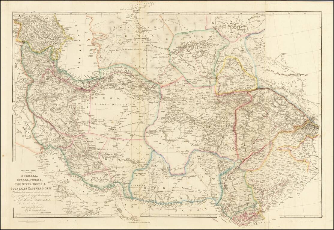
Fine example of Arrowsmith's map of the Iran and Pakistan, published by John Arrowsmith. The map illustrates the routes of Lieutenant Alexander Burnes through the region. Sir Alexander Burnes KT FRS (1805 – 1841) was a British explorer and diplomat...
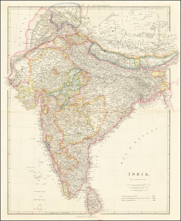
Striking example of Arrowsmith's map of India. The map appeared in Arrowsmith's London Atlas, one of the most popular English atlases of the mid-19th Century.
![Asiatic Archipelago [Early Singapore Inset]](/map/small/66879.jpg)
First State! Nice example of John Arrowsmith's map of the Asiatic Archipelago, including a large inset map of Singapore. Centered on the Philippines and Borneo, the map shows a number of different seasonal passages through the region to Hong Kong and...
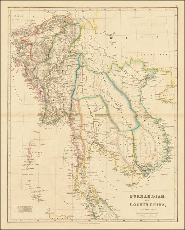
Interesting, detailed antique map of Southeast Asia published by John Arrowsmith in London in 1832. The map is noteworthy for its political delineations, including the following states: Empire of Anam Camboja Siam Lao Burmah
![Asiatic Archipelago [Early Singapore Inset]](/map/small/64854.jpg)
Nice example of John Arrowsmith's map of the Asiatic Archipelago, including a large inset map of Singapore. Centered on the Philippines and Borneo, the map shows a number of different seasonal passages through the region to Hong Kong and Macao. The...
![[Africa] (2 maps - Ancient & Modern)](/map/small/70579.jpg)
Interesting pair of maps of Africa, showing the ancient and modern features. The pair of maps was prepared by Arrowsmith in an atlas intended to provide a comparison of ancient and modern regions.
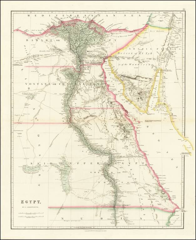
Fine example of John Arrowsmith's map of Egypt, from his London Atlas. Includes significant details along the Nile, caravan and trade routes, etc. Interesting notes include "Desert of Moving Sands," "Djewaby Arabs" and "Camel Breeders for the Esneh...
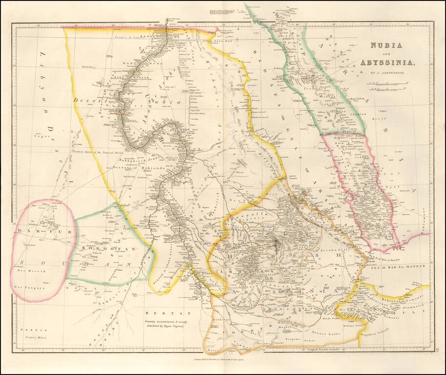
An attractive map of the region centered on the Red Sea and the upper Nile, starting at the first cataract. The map extends to Somalia, Sudan, and Darfur in the west and to Yemen and the Sea of Bab-El-Mandeb in the east. Numerous towns, mountains,...
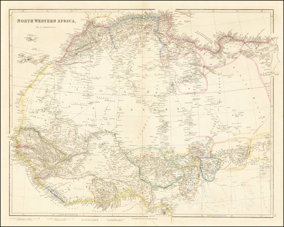
Detailed map of north and west Africa, published by John Arrowsmith in his London Atlas. The map is dominated by the Sahara Desert. In the Sahara, map is cris-crossed with early trading routes, oasises, and the location of Desert Wells.
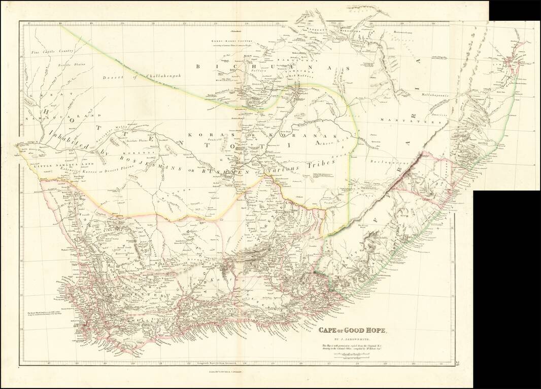
Early Appearances of Durban and Victoria. Fine example of the 1836 state of Arrowsmith's map of the Cape of Good Hope, one of the earliest maps to show Durban ("D'Urban") and Victoria. Lydiana appears, now a suburb of Pretoria. One of the best maps...
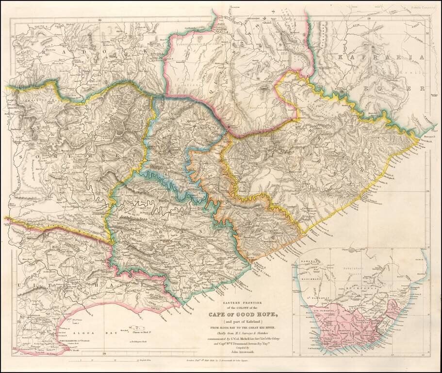
Highly detailed map of the Eastern Frontier of the Colony of the Cape of Good Hope, published by John Arrowmsith in London. Fine example of John Arrowsmith's meticulous style and remains one of the finest nineteenth century maps of the area. The map...
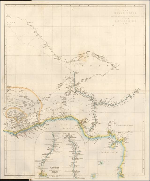
Fine large format map of the Course of the Niger River, published by John Arrowsmith in London. H.D. Trotter was the leader of an expedition up the Niger River, as part of a delegation of British Officers, including William Allen (1793–1864), under...
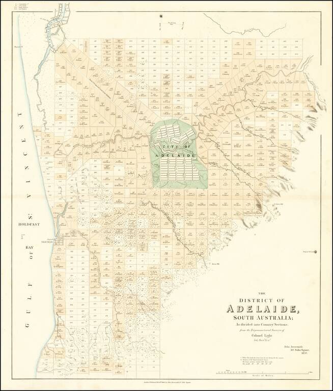
The First Map of Adelaide Rare cadastral map of the area around Adelaide, published by John Arrowsmith. The map illustrates Adelaide and the region surrounding, centered on the 'City of Adelaide', covering an area from Port Adelaide in the north...
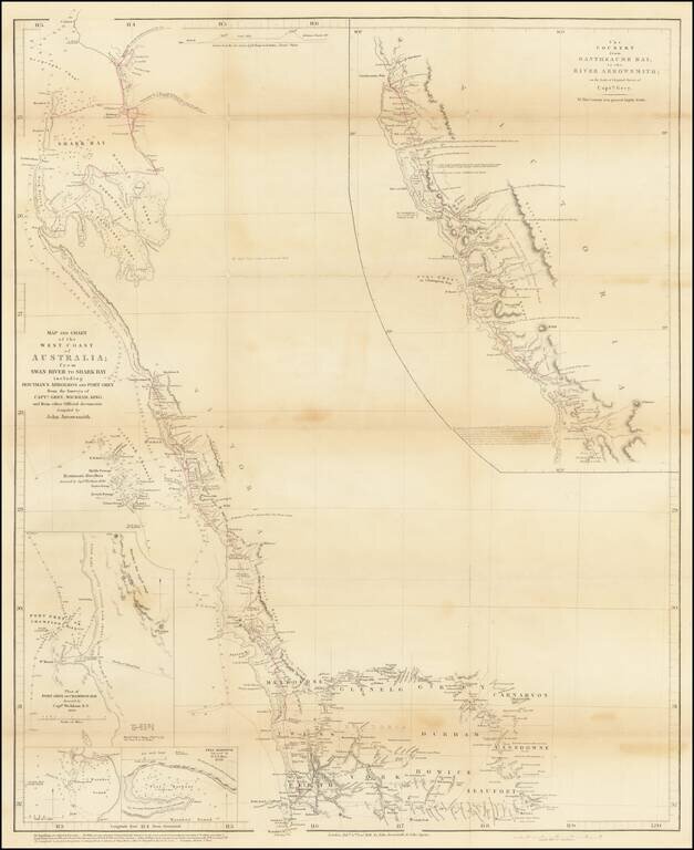
Striking, Intricate Arrowsmith Map of Western Australia with Details from Recent Explorations By The Future Prime Minister of New Zealand Finely-detailed map of Western Australia by London’s premier cartographer of exploration, John Arrowsmith. The...
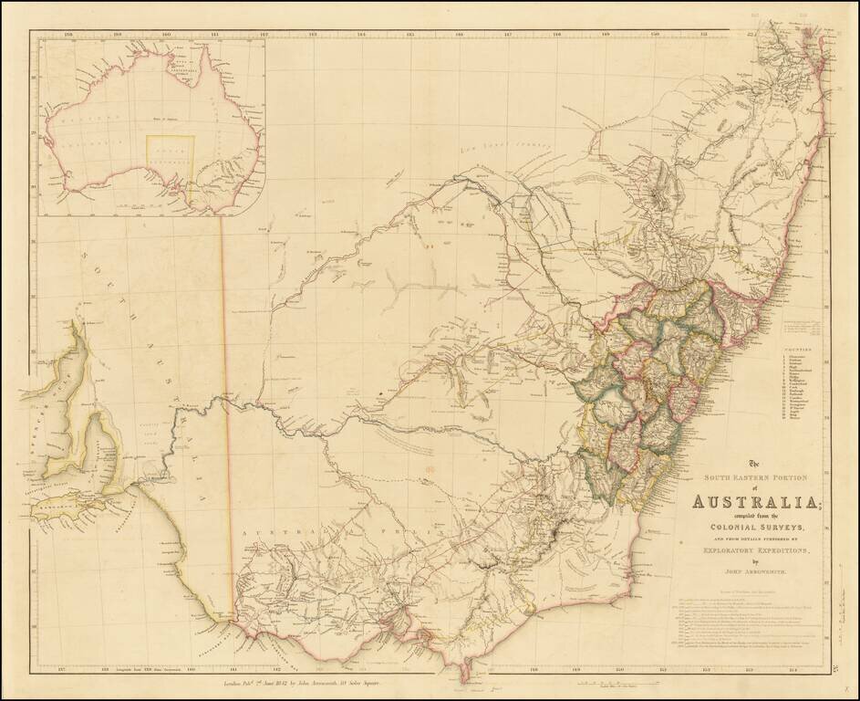
Finely detailed map of the Southeastern part of Australia, by John Arrowsmith. This is the second of the two maps which would be utilized to illustrate the extraordinary growth of this part of Australia during the early period of the Australian Gold...
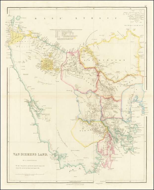
Fine example of Arrowsmith's map of Tasmania, and one of the earliest separate maps of the island. Abel Tasman (1609? - 1659), a Dutch navigator, discovered the island in 1642 and named it Van Diemen's Land. At the time, Van Diemen's Land was still a...