The Arrowsmiths were a cartographic dynasty which operated from the late-eighteenth century to the mid-nineteenth. The family business was founded by Aaron Arrowsmith (1750-1823), who was renowned for carefully prepared and meticulously updated maps, globes, and charts. He created many maps that covered multiple sheets and which were massive in total size. His spare yet exacting style was recognized around the world and mapmakers from other countries, especially the young country of the United States, sought his maps and charts as exemplars for their own work.
Aaron Arrowsmith was born in County Durham in 1750. He came to London for work around 1770, where he found employment as a surveyor for the city’s mapmakers. By 1790, he had set up his own shop which specialized in general charts. Arrowsmith had five premises in his career, most of which were located on or near Soho Square, a neighborhood the led him to rub shoulders with the likes of Joseph Banks, the naturalist, and Matthew Flinders, the hydrographer.
Through his business ties and employment at the Hydrographic Office, Arrowsmith made other important relationships with Alexander Dalrymple, the Hudson’s Bay Company, and others entities. In 1810 he became Hydrographer to the Prince of Wales and, in 1820, Hydrographer to the King.
Aaron Arrowsmith died in 1823, whereby the business and title of Hydrographer to the King passed to his sons, Aaron and Samuel, and, later, his nephew, John. Aaron Jr. (1802-1854) was a founder member of the Royal Geographical Society (RGS) and left the family business in 1832; instead, he enrolled at Oxford to study to become a minister. Samuel (1805-1839) joined Aaron as a partner in the business and they traded together until Aaron left for the ministry. Samuel died at age 34 in 1839; his brother presided over his funeral. The remaining stock and copper plates were bought at auction by John Arrowsmith, their cousin.
John (1790-1873) operated his own independent business after his uncle, Aaron Arrowsmith Sr., died. After 1839, John moved into the Soho premises of his uncle and cousins. John enjoyed considerable recognition in the geography and exploration community. Like Aaron Jr., John was a founder member of the RGS and would serve as its unofficial cartographer for 43 years. Several geographical features in Australia and Canada are named after him. He carried the title Hydrographer to Queen Victoria. He died in 1873 and the majority of his stock was eventually bought by Edward Stanford, who co-founded Stanford’s map shop, which is still open in Covent Garden, London today.
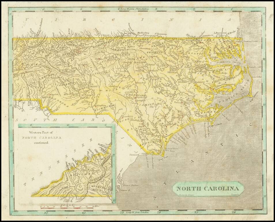
Early map of North Carolina. Early county names and configurations are shown. "Western Part of North Carolina continued." is shown in an inset map in the lower-left corner.
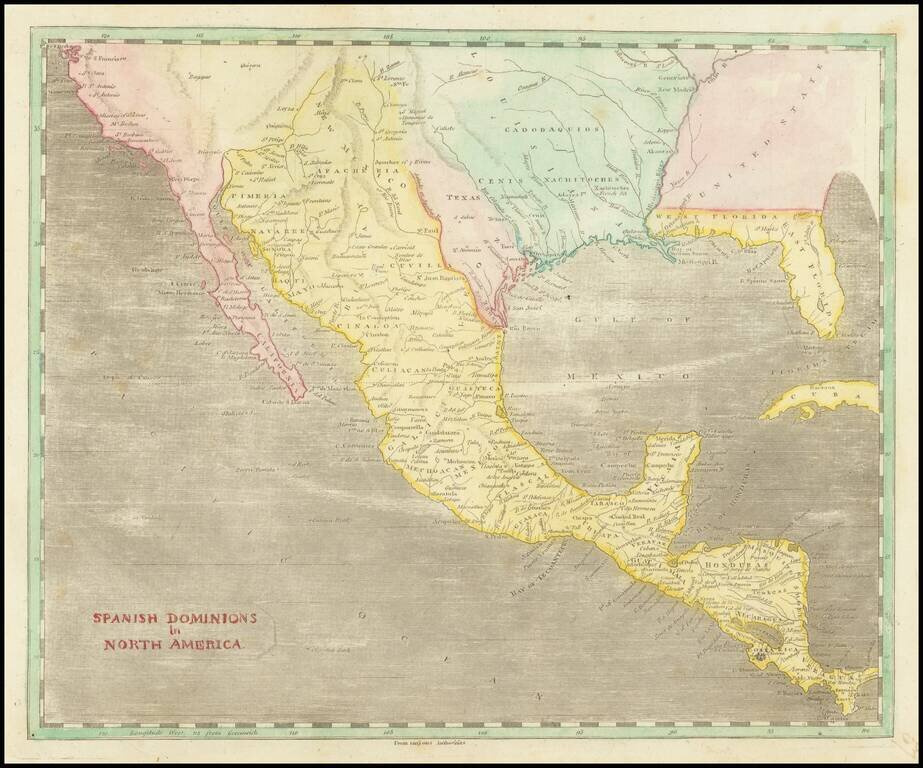
A Fascinating Pre-Louisiana Purchase Map of Texas and the Southwest Scarce early map of Mexico, Upper California, Texas and Louisiana Territory. The map extends on the west coast from San Francisco to Cabo San Lucas, with a detailed account of the...
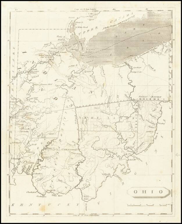
One of the First Printed Maps of Ohio -- Published Just Months After Ohio Statehood Important early map of Ohio from Arrowsmith & Lewis' New and Elegant General Atlas. The map appeared only months after Ohio became a state on March 1, 1803. The...
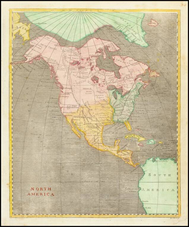
A Fascinating Pre-Louisiana Purchase Map of North America Scarce early map of North America, shortly before the Louisiana Purchase. An interesting time period, immediately preceding the reports of Alexander von Humboldt and Zebulon Pike, in the year...
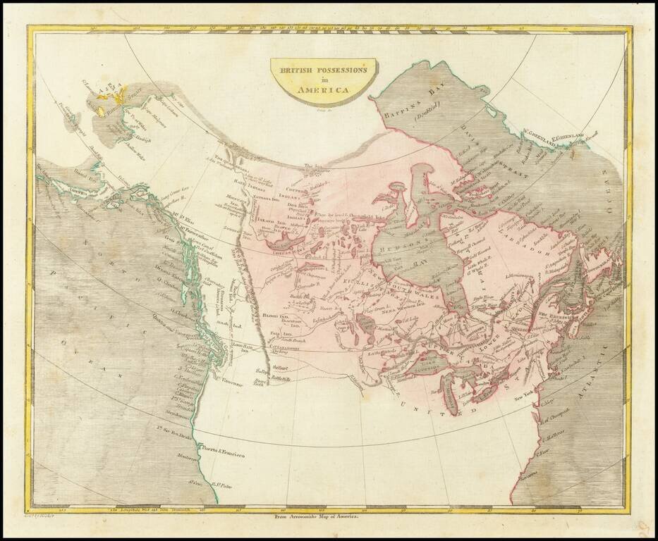
Scarce engraved map of Canada, published in Philadelphia in 1804. Shows a potential land bridge from Russia to Alaska. Speculates about the existence of the Northwest Passage.
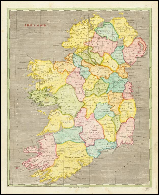
Early American-published engraved map of Ireland, part of the joint effort at atlas publishing between Arron Arrowsmith and Samuel Lewis.
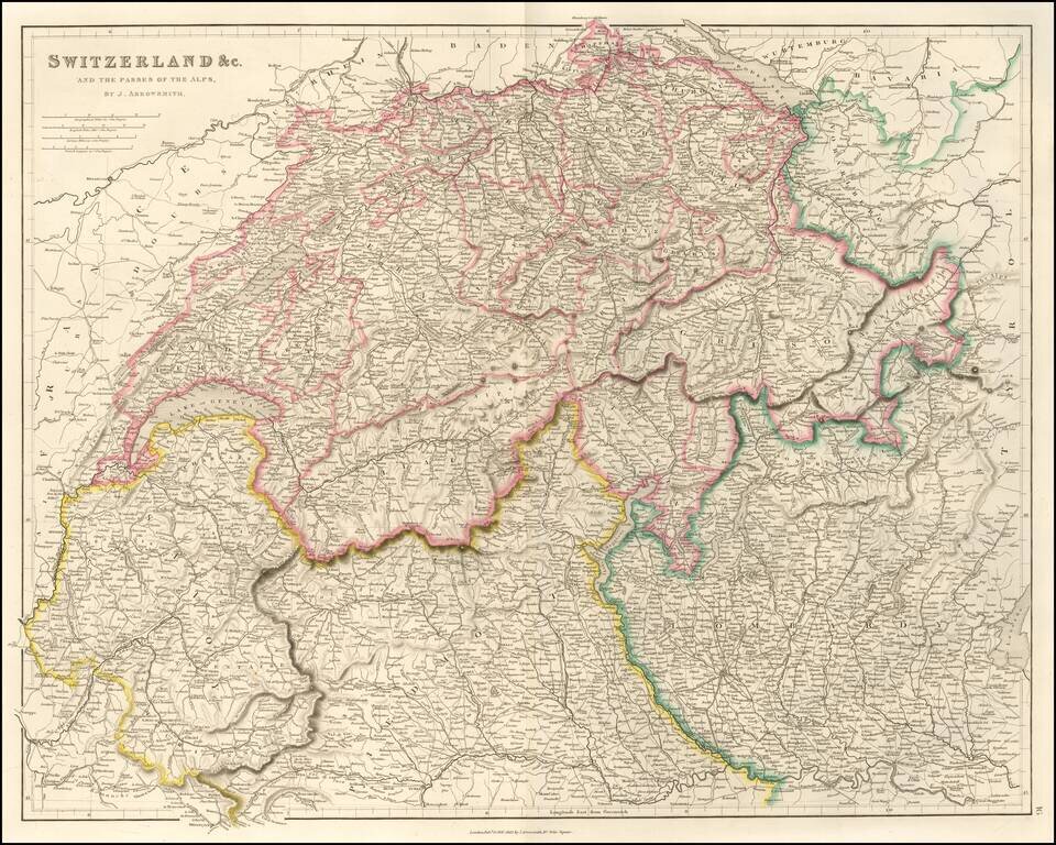
Finely detailed map of Switzerland published by John Arrowsmith, London's leading mapmaker of the mid 19th Century. The map shows towns, roads, rivers, mountains, cantons and a host of other details.
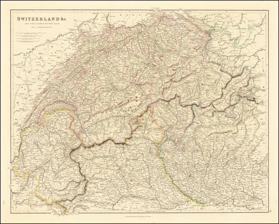
Finely detailed map of Switzerland published by John Arrowsmith, London's leading mapmaker of the mid 19th Century. The map shows towns, roads, rivers, mountains, cantons and a host of other details.
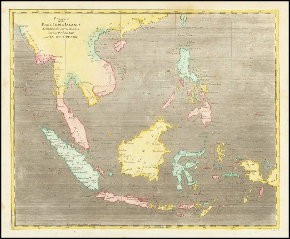
Early map of Southeast Asia. A nice example, from Arrowsmith & Lewis's New & Elegant Atlas, an early collaboration between American mapmaker Samuel Lewis and British mapmaker Aaron Arrowsmith.
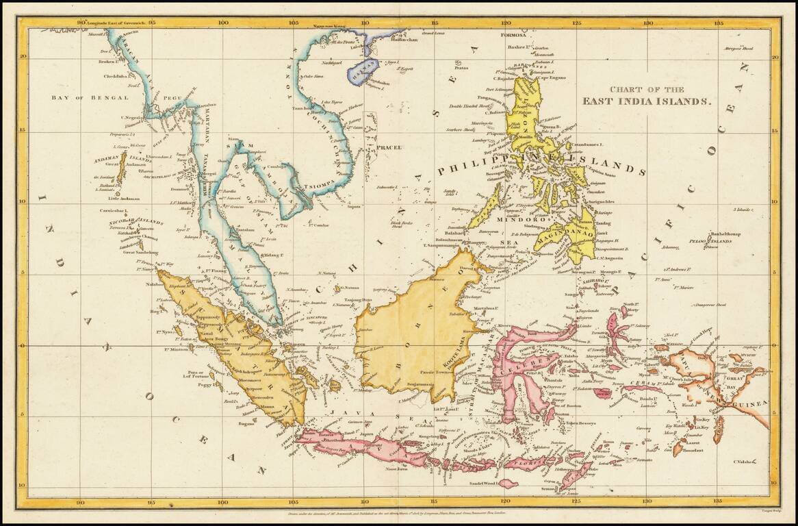
Detailed map of the Philippine Islands and Southeast Asia, published in London in 1805. The map is centered on the China Sea, with a fine detailed presentation of the Philippines. The Straits of Sincapore is noted, as is the Dutch Factory on the...
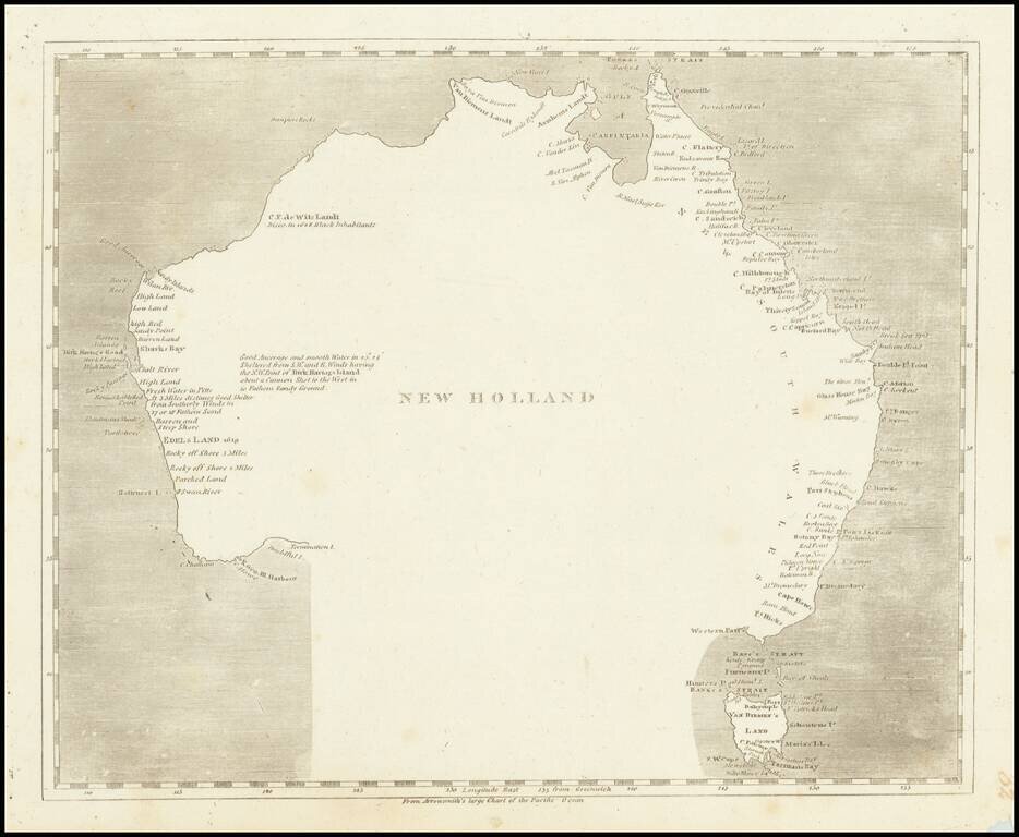
Engraved map of Australia featuring a curious interpretation of the southern coastline. This simple map shows Van Diemen's Land as an Island, reflecting the knowledge after Flinders, but is completely devoid of coastal features in the south and...