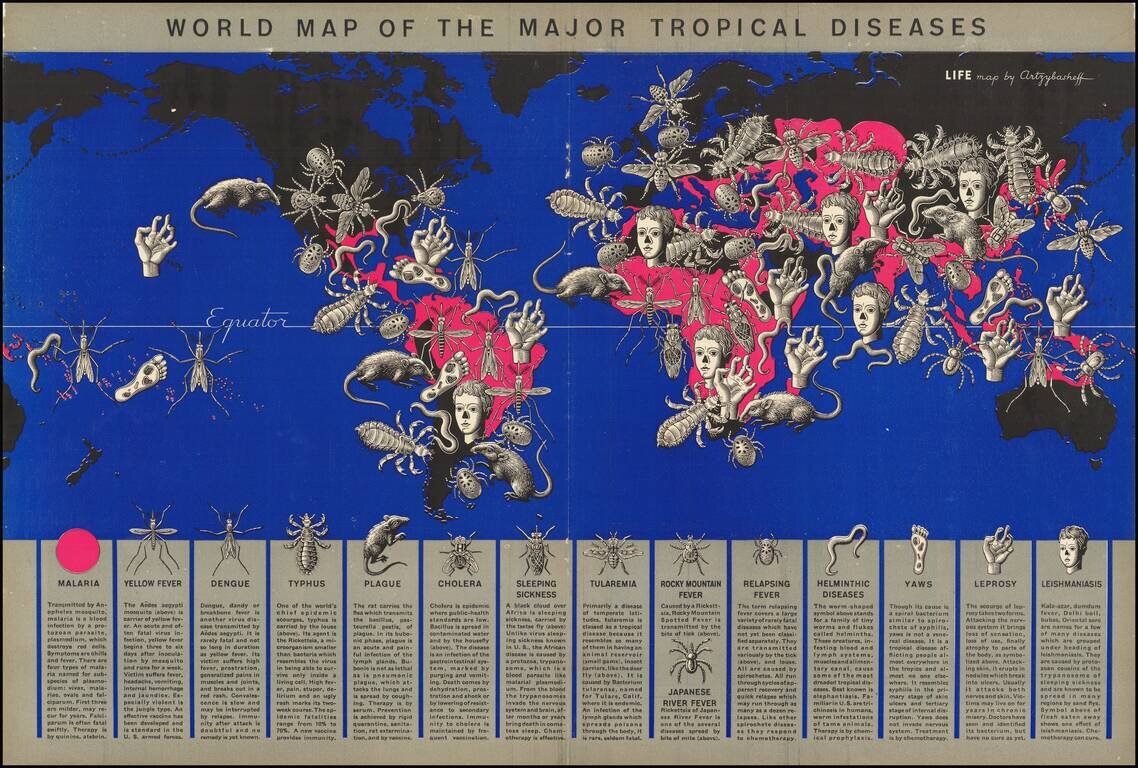
Tropical Disease Pictorial Map. A world map by a well-known artist of the time (Boris Artsybasheff) illustrating an article on tropical diseases. The use of ominous pictorial symbols for 15 diseases, combined with the size and location of the symbols...

Excellent "NavWar" pictorial map of the North Atlantic and Western European Theaters during World War II. The map is a very effective persuasive piece, which sweeping arcs depicting Allied naval power in the Atlantic combined with its air power over...
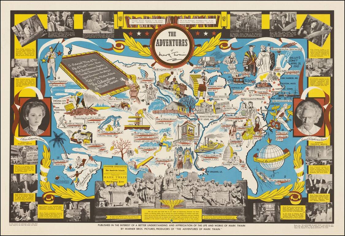
Decorative pictorial map telling the story of Mark Twain, published by Warner Brothers, in conjunction with its release of the movie of the same title. "The Adventures of Mark Twain" was a 1944 biographical film produced by Warner Brothers. The text...

Rare vintage pictorial map of the United States, by Edward McCandish, published by Hagstrom Company under the Bill Whiffletree trademark. An earlier edition of the map was published in 1926; this edition, easily differentiated by the inclusion of the...
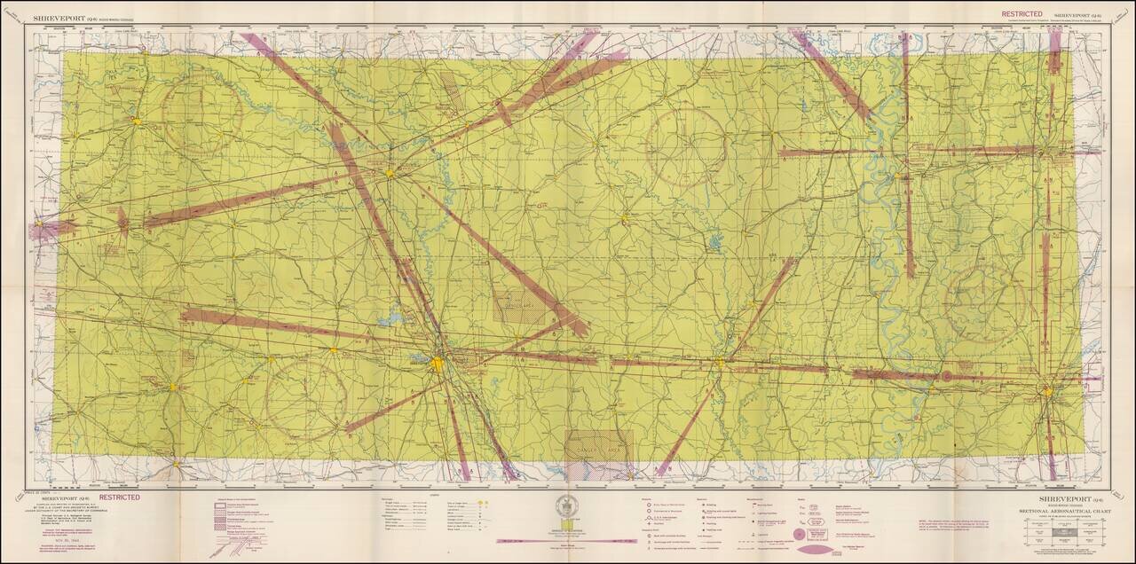
Restricted World War II Aviation Map Detailed aeronautical map of the Shreveport, Louisiana region. The chart is a font of information about civil and military aviation during WWII. It was intended for civil aviators flying by visual navigation and...

Restricted World War II Aviation Map Detailed aeronautical map of the Mobile, Alabama area. The chart is a font of information about civil and military aviation during WWII. It was intended for civil aviators flying by visual navigation and so...
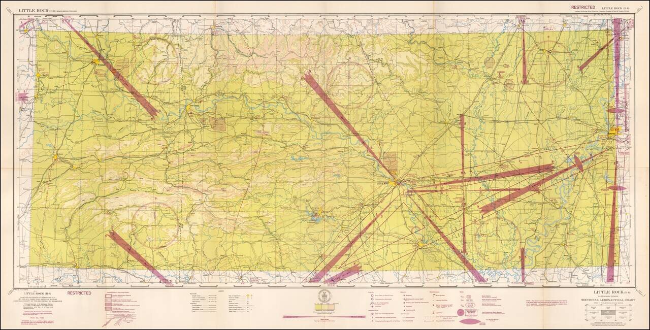
Restricted World War II Aviation Map Detailed aeronautical map of the Little Rock, Arkansas region. The chart is a font of information about civil and military aviation during WWII. It was intended for civil aviators flying by visual navigation and...
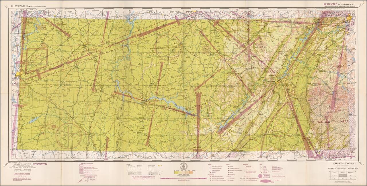
Restricted World War II Aviation Map Detailed aeronautical map of the Chattanooga, Tennessee area. The chart is a font of information about civil and military aviation during WWII. It was intended for civil aviators flying by visual navigation and...
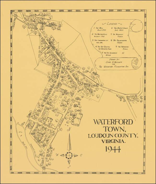
Interesting pictorial map of Waterford Town, Virginia, drawn by Clare B. Metzger for The Waterford Foundation. The present map is based the official map of the town, commissioned in 1875. The Acts of 1875 provided that the Waterford council should...
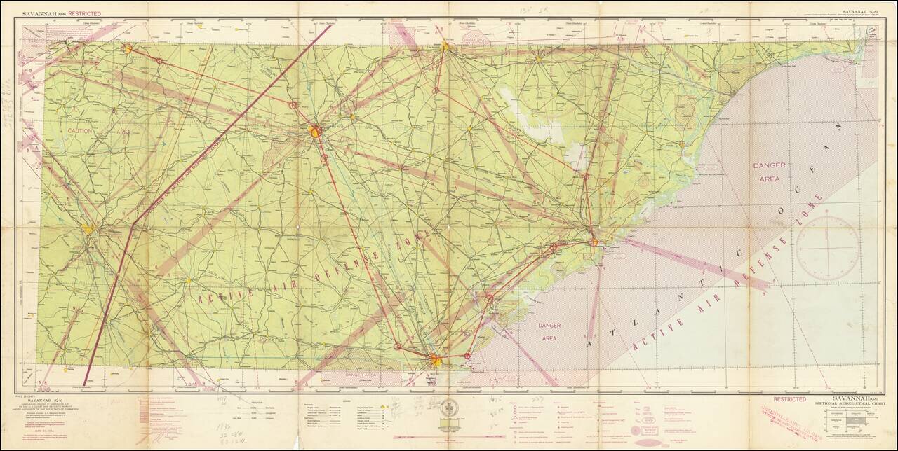
Restricted World War II Aviation Map -- Greenville, Army Air Base Artifact. Detailed aeronautical map of the Savannah area. The present example bears the stamp of the Greenville Army Air Base, Office of Base Operations Officer, Greenville, SC. (Later...
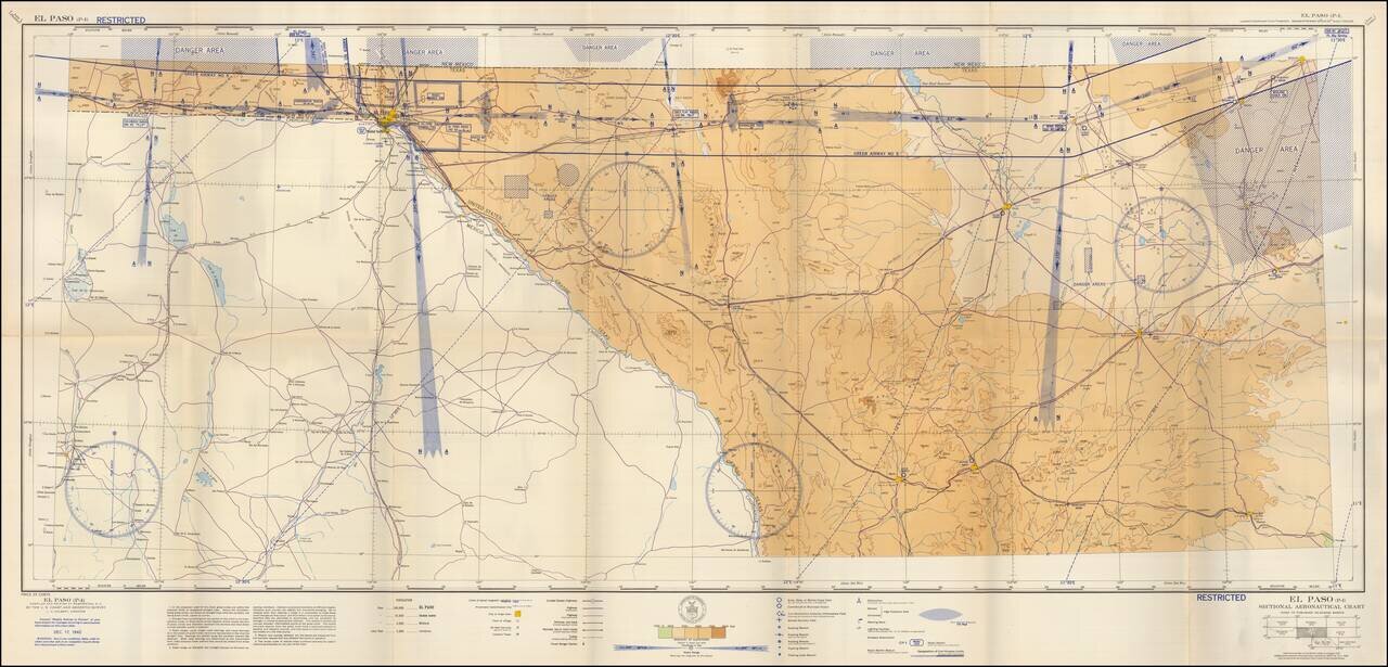
Restricted World War II Aviation Map Detailed aeronautical map of the El Paso Region, extending east to Odessa and Midland, and south to Marfa, Alpine and Sanderson, Texas. The chart is a font of information about civil and military aviation during...
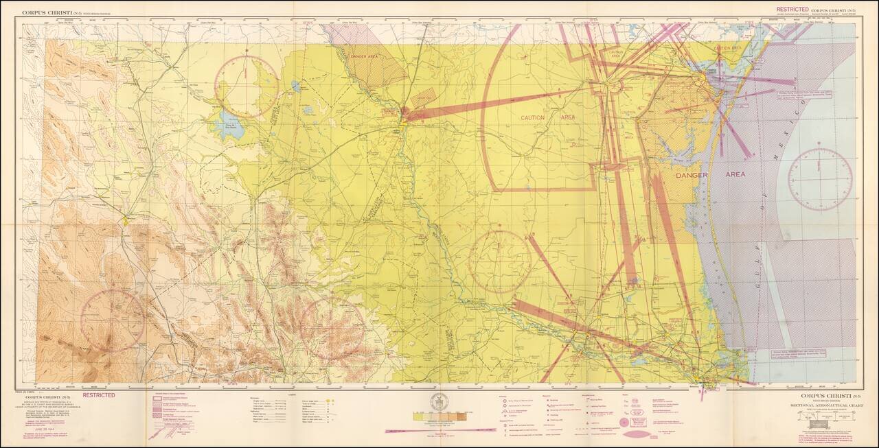
Restricted World War II Aviation Map Detailed aeronautical map of the Corpus Christi region. The chart is a font of information about civil and military aviation during WWII. It was intended for civil aviators flying by visual navigation and so...
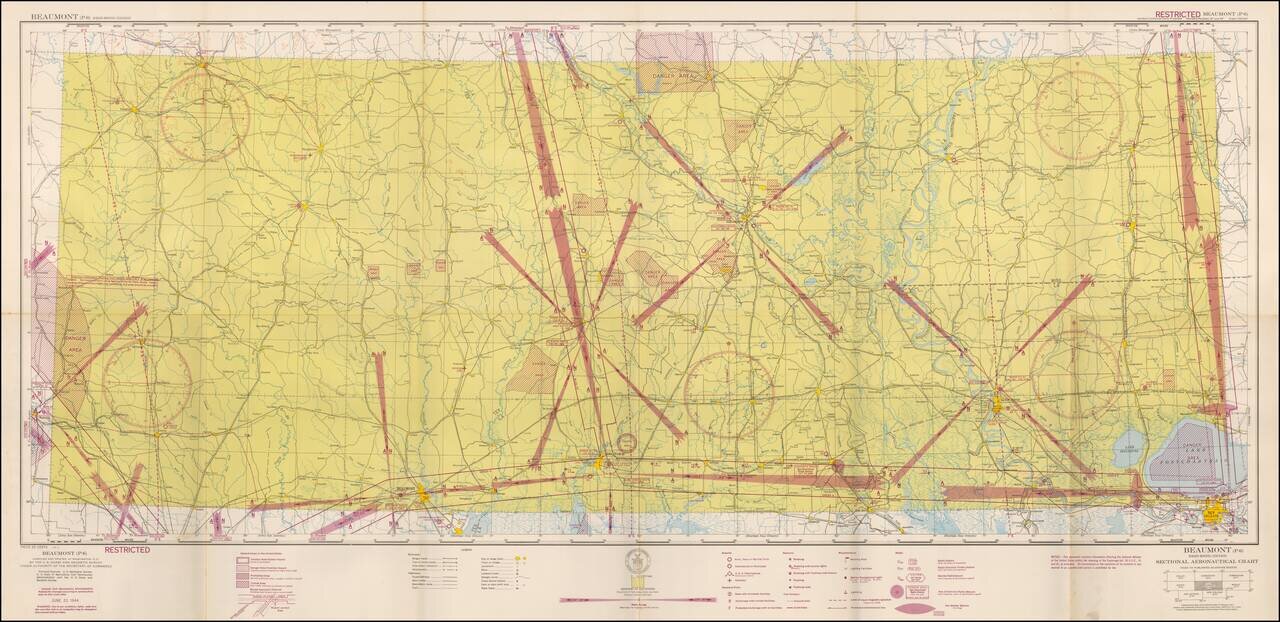
Restricted World War II Aviation Map Detailed aeronautical map of the Beaumont Region. The chart is a font of information about civil and military aviation during WWII. It was intended for civil aviators flying by visual navigation and so includes...
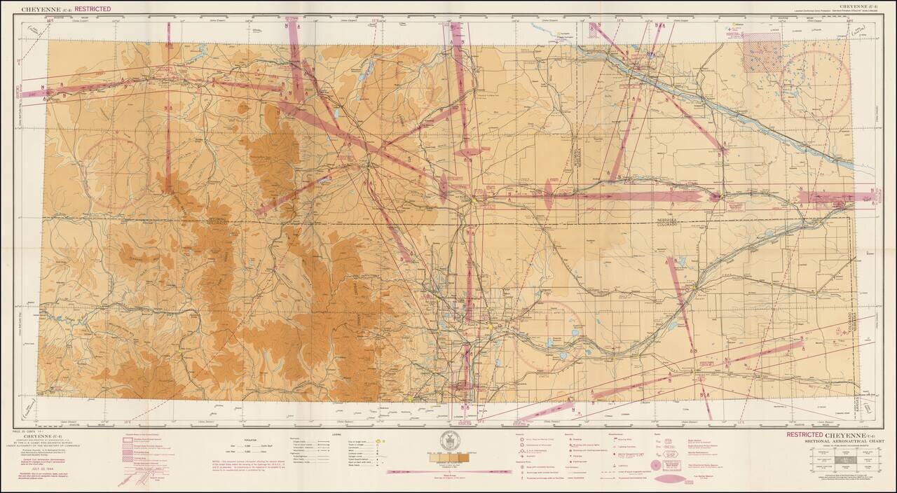
Restricted World War II Aviation Map Detailed aeronautical map of the Cheyenne, Wyoming region. The chart is a font of information about civil and military aviation during WWII. It was intended for civil aviators flying by visual navigation and so...
![[WWII War Bonds] As Bond Away Finishes Its Tour](/map/small/63461.jpg)
Fourth Air Force Aviation Engineers Camouflage Bond Show -- Northern California 1944 Rare promotional pamphlet and map, supporting the sale of bonds to support the war effort. Issued in the winter of 1944, the map illustrates the different places...
![[Restricted Military Map of San Diego] The City of San Diego Including The Cities of Chula Vista Coronado El Cajon La Mesa National City . . .](/map/small/69860.jpg)
Restricted Military Map of San Diego Restricted Armed Forces edition of this World War II era map of San Diego, published by the Automobile Club of Southern California. As noted below the map, the map was "issued for the exclusive use of the Armed...