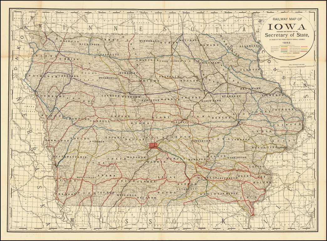
Finely detailed railroad map of Iowa, published for the Iowa State Legislature by Rand McNally & Co. The map illustrates 9 color coded railroads, including: Burlington, Cedar Rapids and Northern Central Iowa Railway Illinois Central RR...
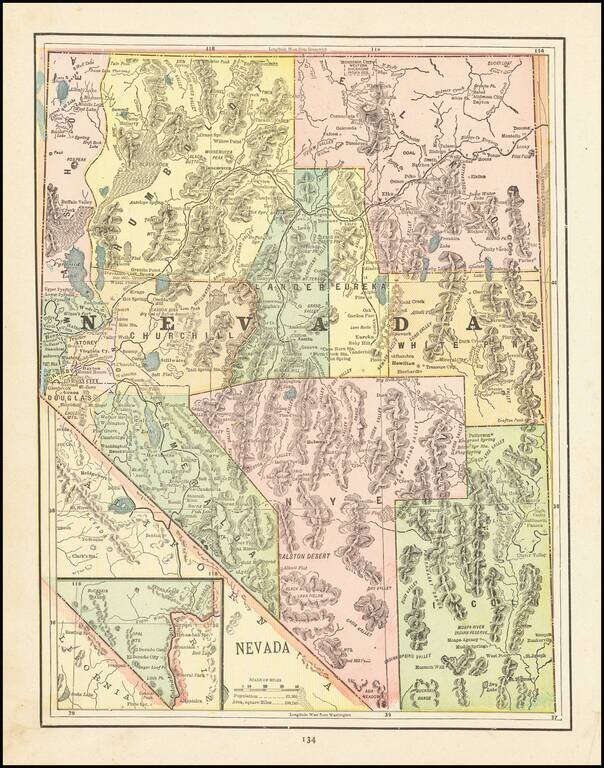
Detailed map of Nevada, colored by Counties, showing Indian Reservations, forts, Military Reserves, mines, forests, towns, railroads, railroad stations, post offices, rivers, forts and other places of interest. A nice late 19th Century map, printed...
![[California & Nevada] California and Nevada Northern Half / California and Nevada Southern Half](/map/small/69248.jpg)
Remarkable large 2 sheet Railroad Map of California & Nevada, published by George Cram. Includes a list of about 20 Railroads, including some very rare names, including: Carson & Colorado RR Chino Valley RR Coronado RR (Narrow Gauge...
![[Yellowstone National Park]](/map/small/37103.jpg)
Highly detailed early map of Yellowstone National Park, which accompanied the Annual Report of the Superintendent of Yellowstone National Park for 1892. A note at the top of the map provides a key for identifying the roads which existed prior to 1891...
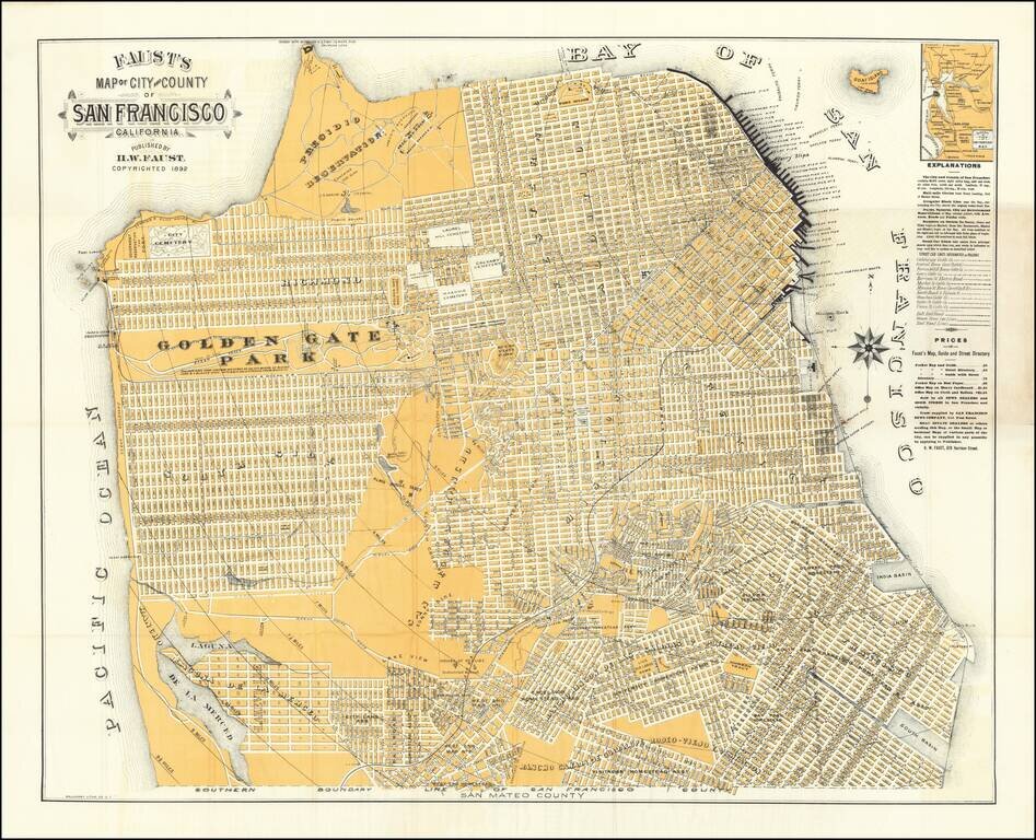
Nice example of this early edition of Faust's map of San Francisco, one of the most striking maps of the period, surrounded by promotional information for local merchants, etc. Faust's map provides a highly detailed look at San Francisco at the end of...
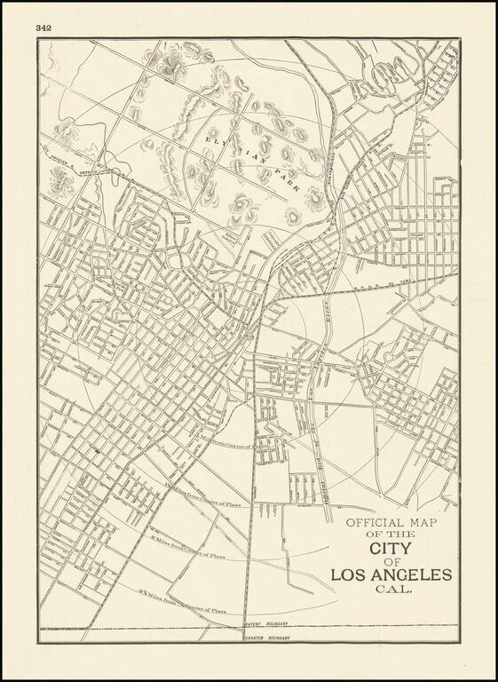
Scarce early Cram map of Los Angeles, one of the earliest obtainable separately issued maps of Los Angeles, most likely from the Atlas of the Pacific Coast. The city is shown at a much earlier stage in its development than Cram's later map of Los...
![[San Diego & San Diego Bay]](/map/small/45945.jpg)
Scarce map of the San Diego Bay & Vicinity, prepared during the time period when San Diego was actively soliciting the US Government to consider San Diego for future military installations. The names of many of the original landowner's of the...
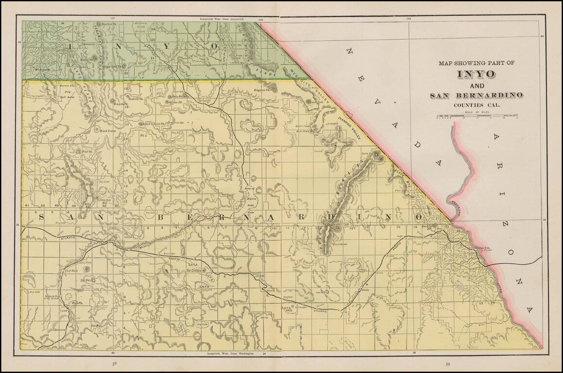
Scarce regional map of San Bernardino County and part of Inyo County. Many small towns, railroads, rivers, mountains, Indian Villages,railway stations, mines, and other details are shown. One of the few detailed separate maps of the region to appear...
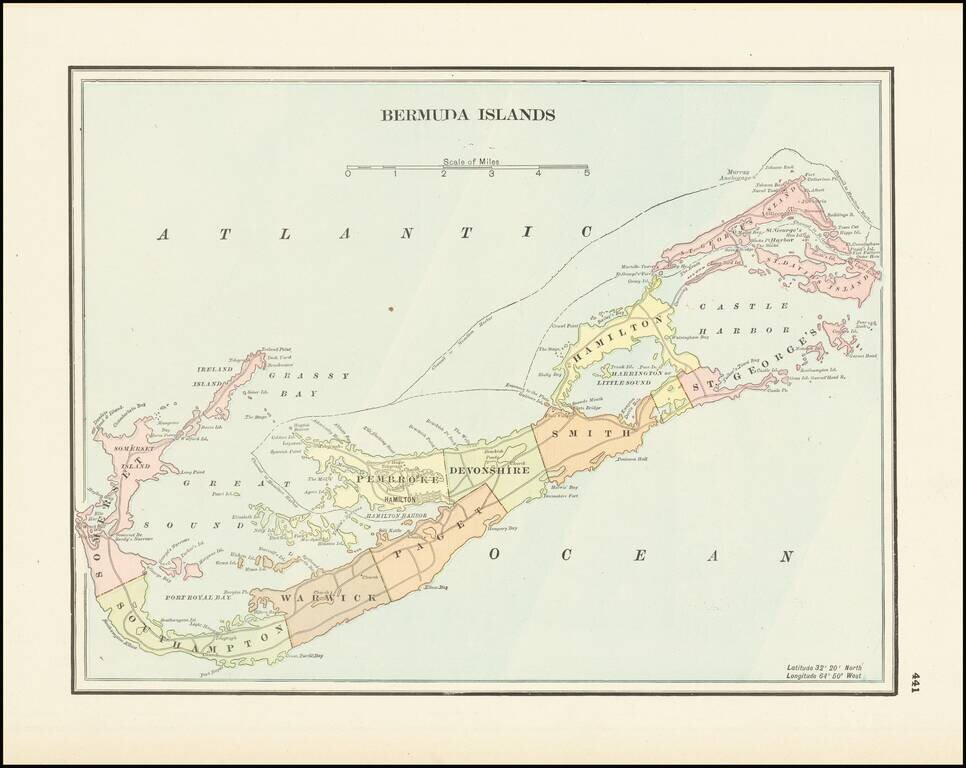
Detailed late 19th Century map of Bermuda, colored by parishes. Shows towns, roads, rivers, points, bays, inlets and a number of other features.
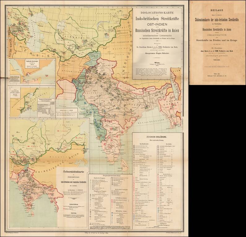
A Comprehensive Map of the Great Game. 4to, original ½ calf over blue paper boards, with original paper title label onlaid. Title, folding table, and large color-lithographed, German-language folding map covering central Asia and India, focusing on...
![[China] 古今地舆全圖 / Full Modern and Ancient Map](/map/small/62437kb.jpg)
A Rare and Important Discovery -- The First Map of China Published For Commercial Use and Sale Mingjie Liu's (刘明杰) (1857 - 1911) important 1892 (Guangxu 18) Qing Era xylographic (woodcut) map of China is the earliest known example of what is...
![支那全圖 Shina zenzu [Comprehensive Map of China]](/map/small/65521.jpg)
Rare Imperial Japanese Army Map of China Finely executed large map of China and Korea published in Tokyo just before the outbreak of the Sino-Japanese War. The map was issued by the Imperial Japanese Army General Staff Office (Sanbō-honbu). The map...