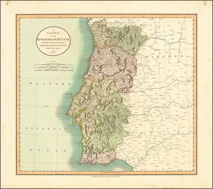
Detailed map of Portugal, hand colored by provinces. Shows roads, rivers, lakes, mountains, islands, etc. One of the best large format English atlas maps of the period.
![A New Map of Turkey In Asia, Divided into its Provinces . . . 1801 [Cyprus]](/map/small/48874.jpg)
Detailed map of Turkey, Asia Minor, Persia, Syria, Iraq, Armenia, etc. Very large Cyprus shown. Colored by provinces. Excellent detail. One of the best large format English atlas maps of the period.
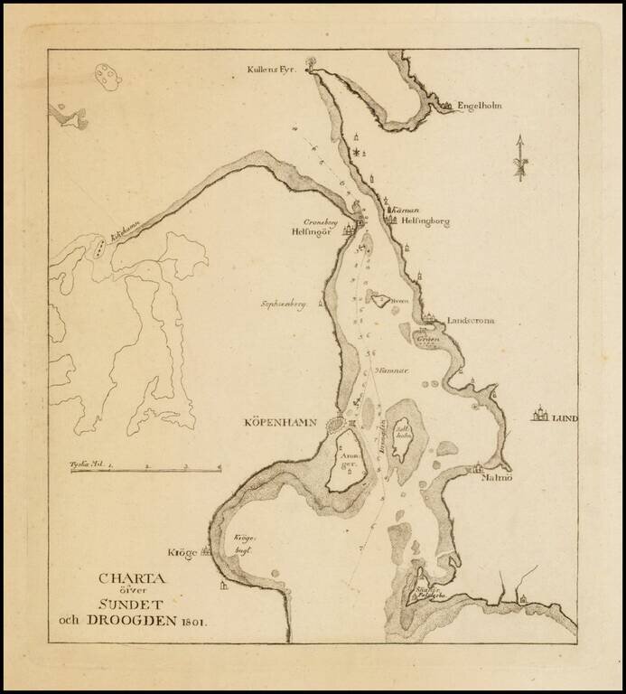
Scarce sea chart the region around Copenhagen, Lund and Malmo.
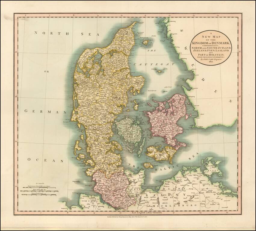
Detailed map of Denmark and neighboring regions, colored by provinces. One of the best large format English atlas maps of the period.
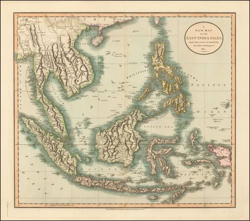
Large detailed map of Southeast Asia, from John Cary's atlas. Extends from Mergui Archipelago, Straits of Malacca and Sumatra to Papua New Guinea, Pelew Islands, and part of Formosa. Extremely detailed.
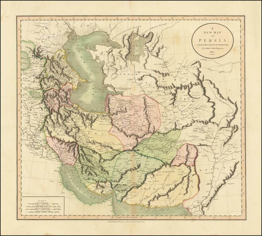
A highly detailed map of Persia, from an early edition of Cary's atlas. This is one of the most decorative and detailed large format maps of the region to appear in an English Atlas and is highly sought after by collectors for its detail and...
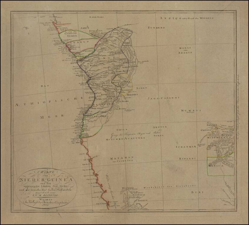
Fascinating German hand-colored engraved map of western central Africa, encompassing the Congo River Basin south to Angola. Congolese peoples are labelled and divided with hand-color into regions, with little detail shown outside of the coast. In the...
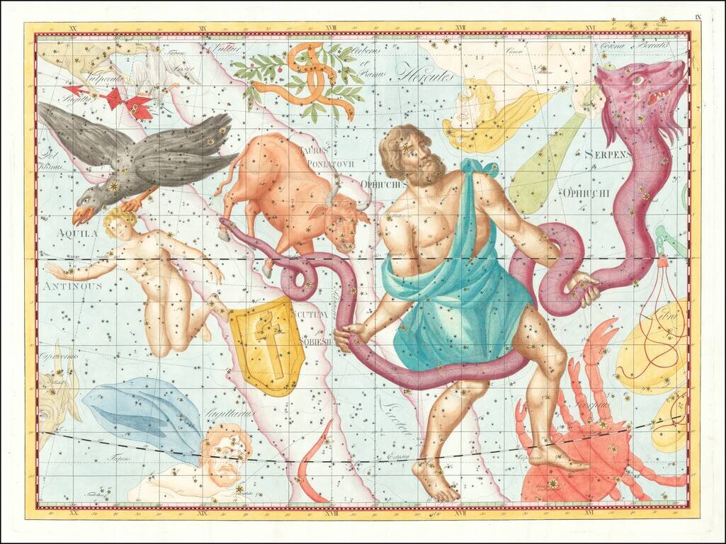
A magnificent hand-colored engraved celestial plate from "the most elaborate atlas of stars and constellations published to date and perhaps the last great star atlas." - David Rumsey Impressive celestial engraving from the large folio 1801 first...
![Hemisphaerium Coeli Boreale Ad Annum 1800 . . . [and] Hemisphaerium C Coeli Australe Ad Annum 1800](/map/small/70652.jpg)
Rare Swedish Edition of Bode's Northern and Southern Celestial Hemispheres Large and highly detailed depiction of the Northern and Southern Celestial Hemisphere, based upon Johann Elert Bode's map dated 1787. The present edition bears the names of...