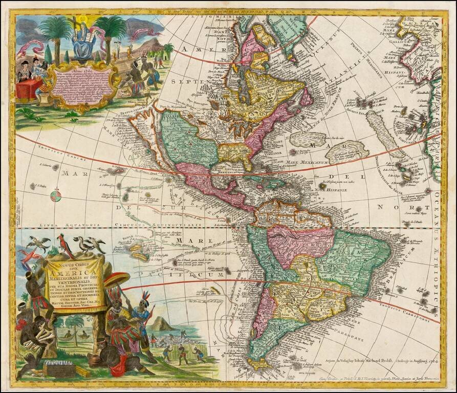
Striking, Richly Engraved Map of the Americas—One of the Last to Feature California as an Island Fine, detailed map of the Americas, with California as an island and two richly illustrated cartouches. This is one of the last maps to be printed with...
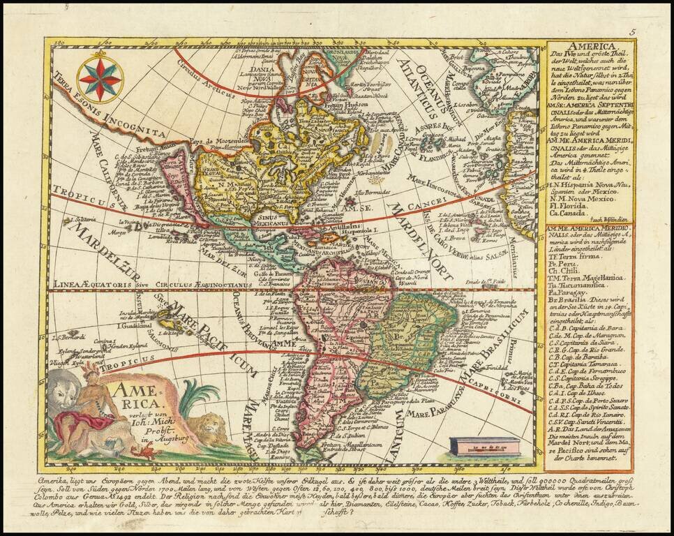
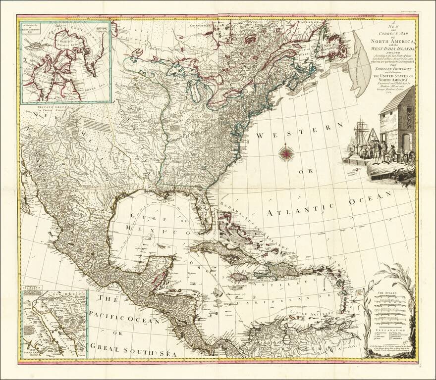
Rare map of America, showing California as an Island. California is shown as an Island, with the extended westward land mass to Asia and the Mississippi River extending to the Straits of Anian. Odd Great Lakes Projection and other interesting...
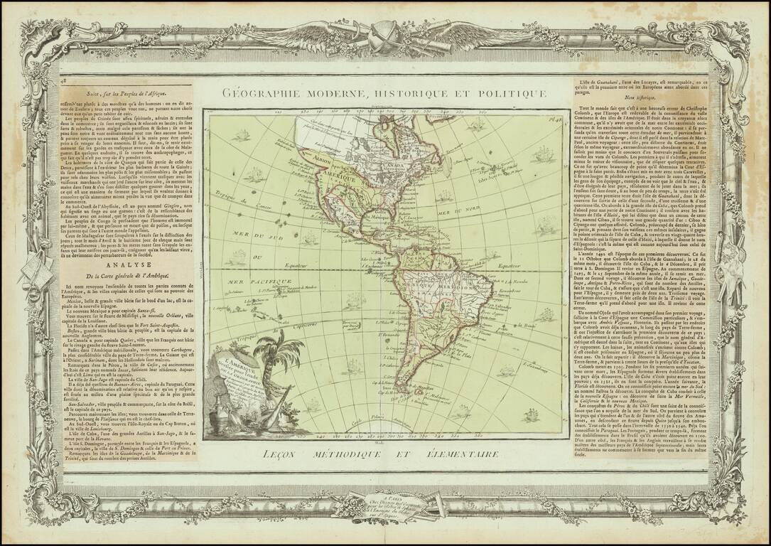
Interesting map of America, published in Paris by Brion de la Tour. The map includes a largely unknown Northwest Coast, River of the West, Straits of Juan De Fuca and other early details. Includes 16 ships and decorative cartouche. Ornate decorative...
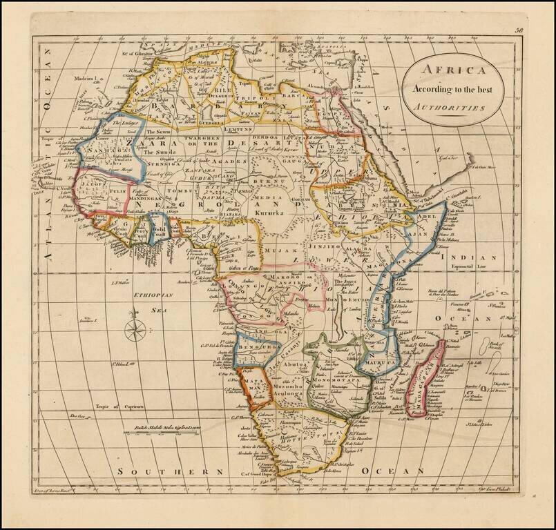
Detailed map of Africa, divided by kingdoms and colonies, many of which are fictional in nature.
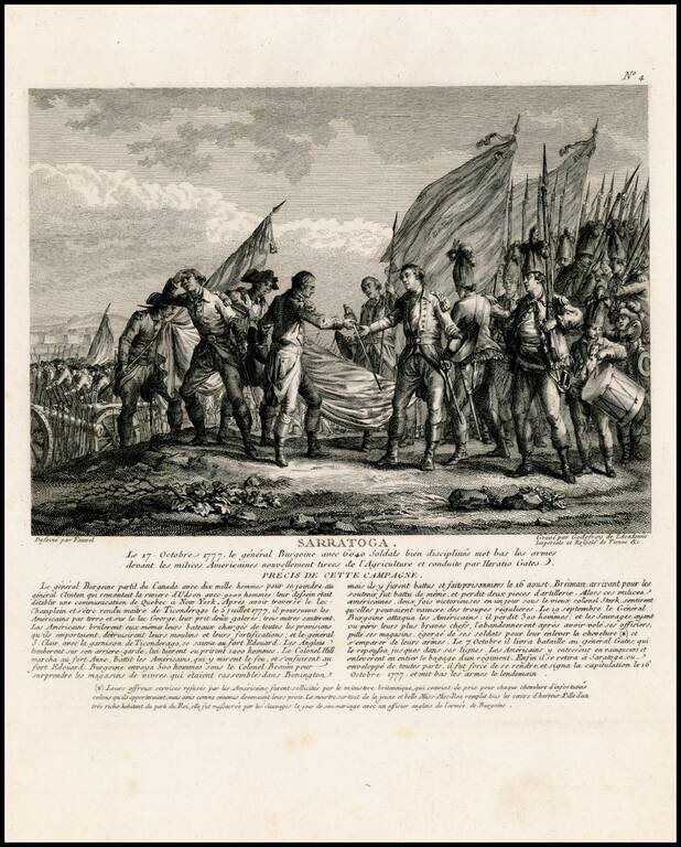
Rare view showing the surrender of General John Burgoyne at the Battle of Saratoga on October 7, 1777, one of the first important American victories during the American Revolution. The view appeared in Nicolas Ponce and Francois Godefroy's Recueil...
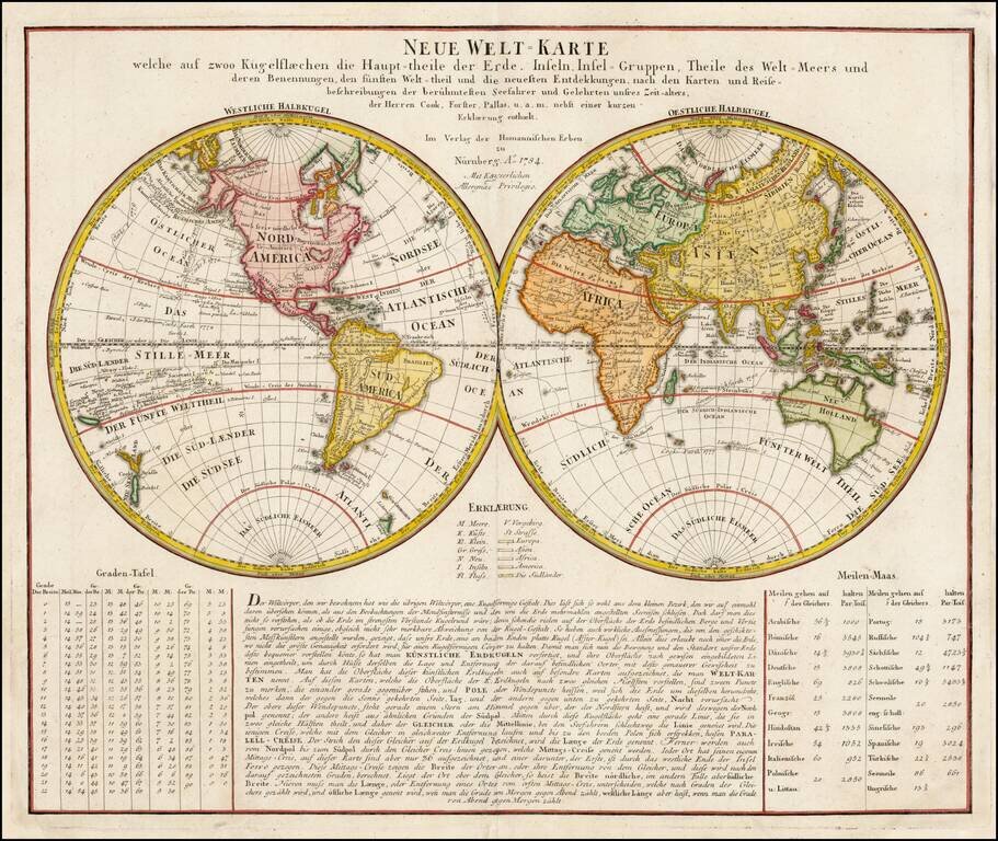
One of the First World Maps to Show Hawaii Double hemisphere map of the world, featuring extensive table and text below, published by Homann Heirs. An early World map to locate Hawaii, the map includes the tracks of Goree's voyage in 1780, Clerke's...
![Stereographic Projection [and] Orthographic Projection on the Plane of the Equator](/map/small/64905.jpg)
Interesting pair of hemispheric projections, illustrating two different styles for depicting the earth.
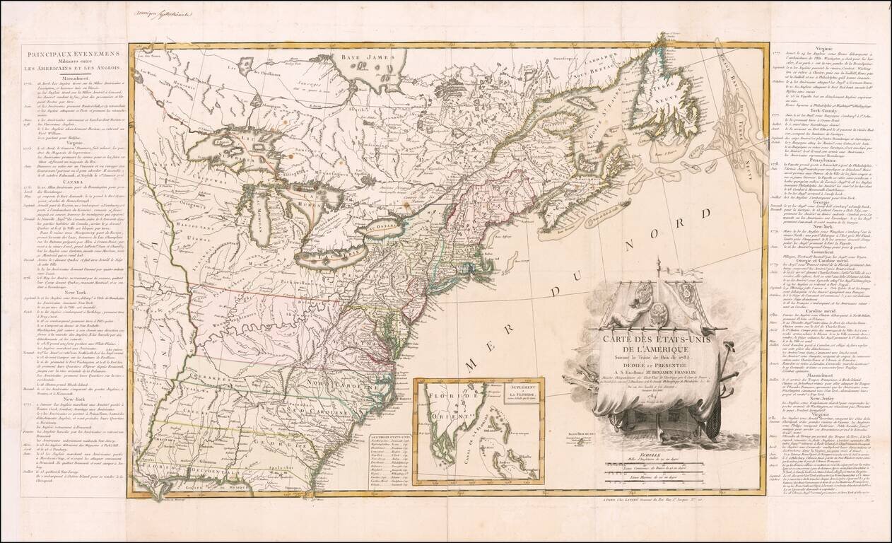
Dedicated to Benjamin Franklin -- The First Map of The United States Published After Ratification of the Treaty of Paris Lattre's map of the United States appeared in June 1784, just two months after the United States gained official independence...
Fine example of Lotter's four-sheet map of the newly formed United States, based upon a map originally published by Bowen & Gibson and later by Jefferys, and Sayer & Bennett. The map is a completely different engraving and includes a striking...
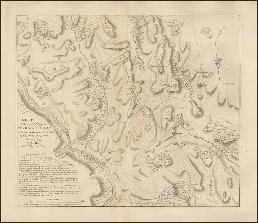
The Very Rare and Authoritative Revolutionary War Plan of the Battle of Germantown The present map showcases the Battle of Germantown, Pennsylvania, an especially dramatic action of the Revolutionary War that occurred on October 4th, 1777, during the...
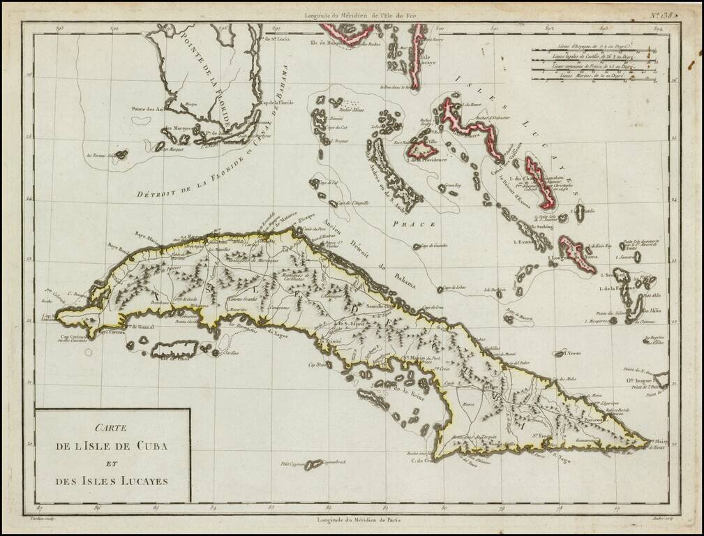
Striking wide margined example of this scarce map of Cuba, the Bahamas and the Southern tip of Florida. The map provides a fine depiction of the Western Caribbean. The dating of this map runs the gamut from 1784 to 1806, but it can be reliably traced...
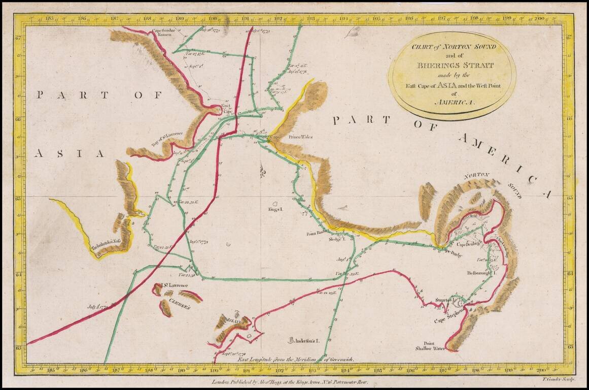
Detailed charting of Cook's exploration of the Northwest Coast of America and the Northeast Coast of Asia. Includes daily tracks and a number of place names, showing the tracks of Cook's Voyage on a daily basis. Cook's Voyage to the region was one of...
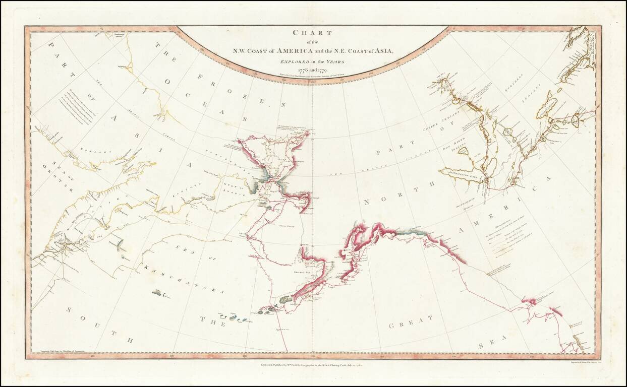
Fine, Famed Map of the North Pacific from Cook’s Third Voyage—First Edition! Rare, first edition of the so-called “lost” chart of Captain James Cook, published in 1784 by William Faden. The map illustrates in great detail the known and...
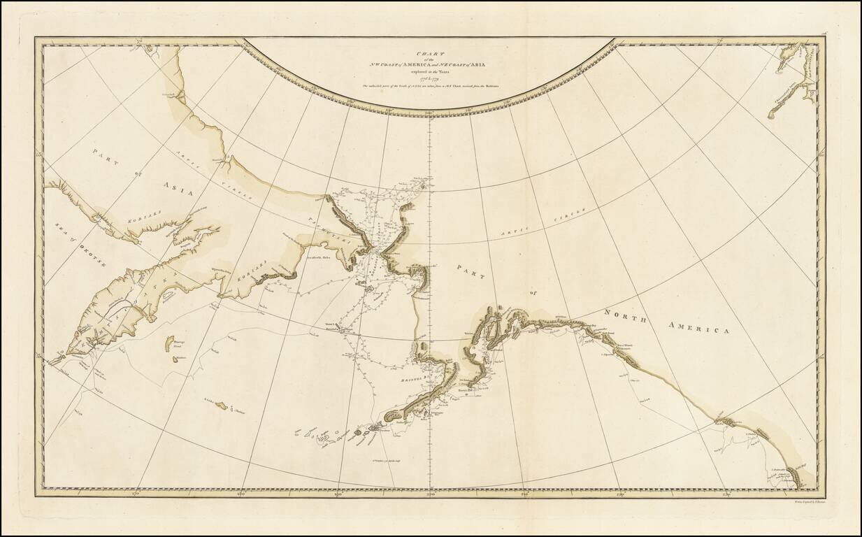
Striking Map of the North Pacific From Cook’s Third Voyage Account Fine example of the map of the Northern Pacific and contiguous coasts of America and Asia, from the official account of Captain James Cook’s third voyage, published in London in...
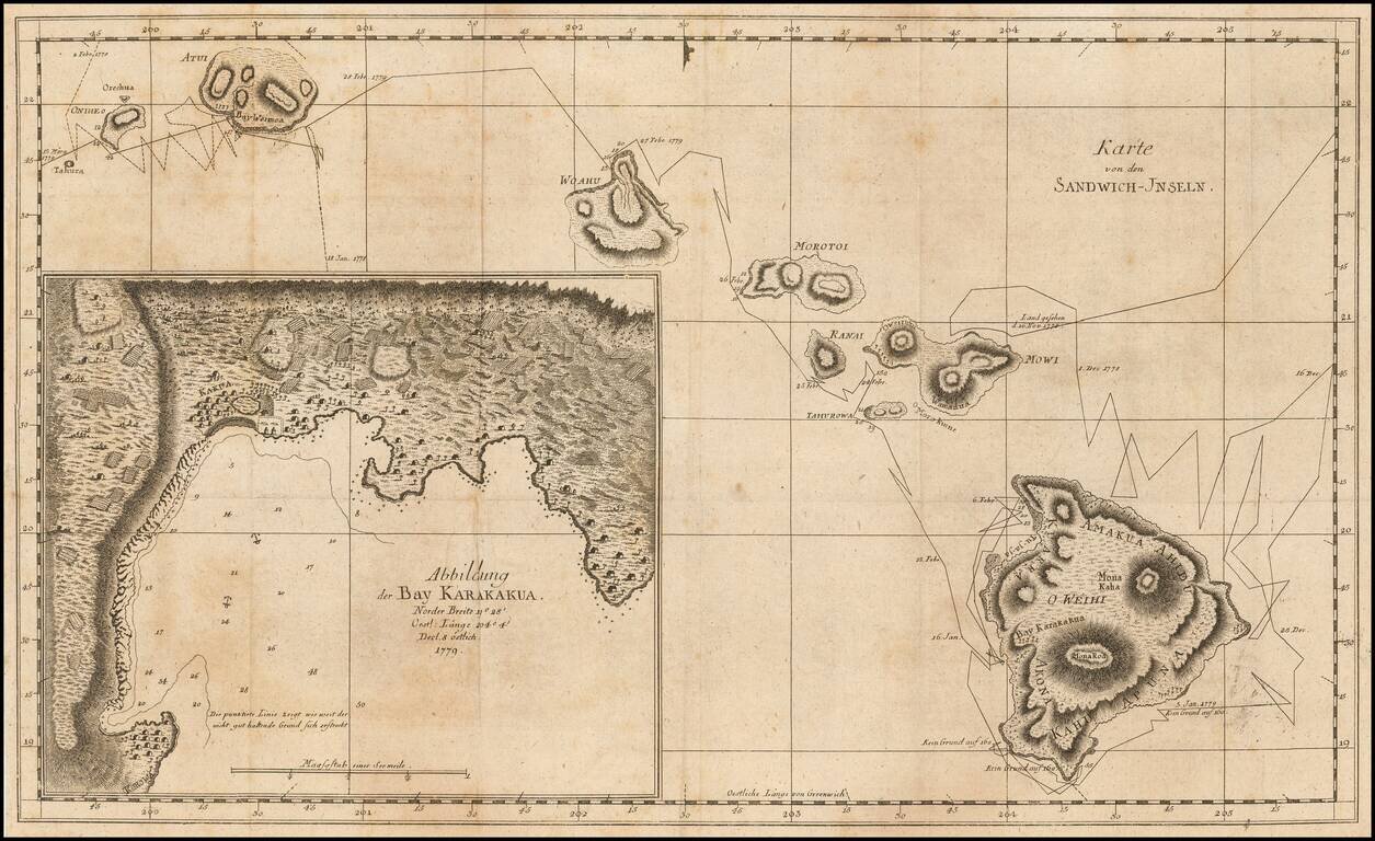
Rare German Edition First Map of Hawaii -- From The Explorations of Captain James Cook Nice example of this very rare German edition of the first map of the Hawaiian Islands, which appeared in the official account of Captain James Cook's Third...
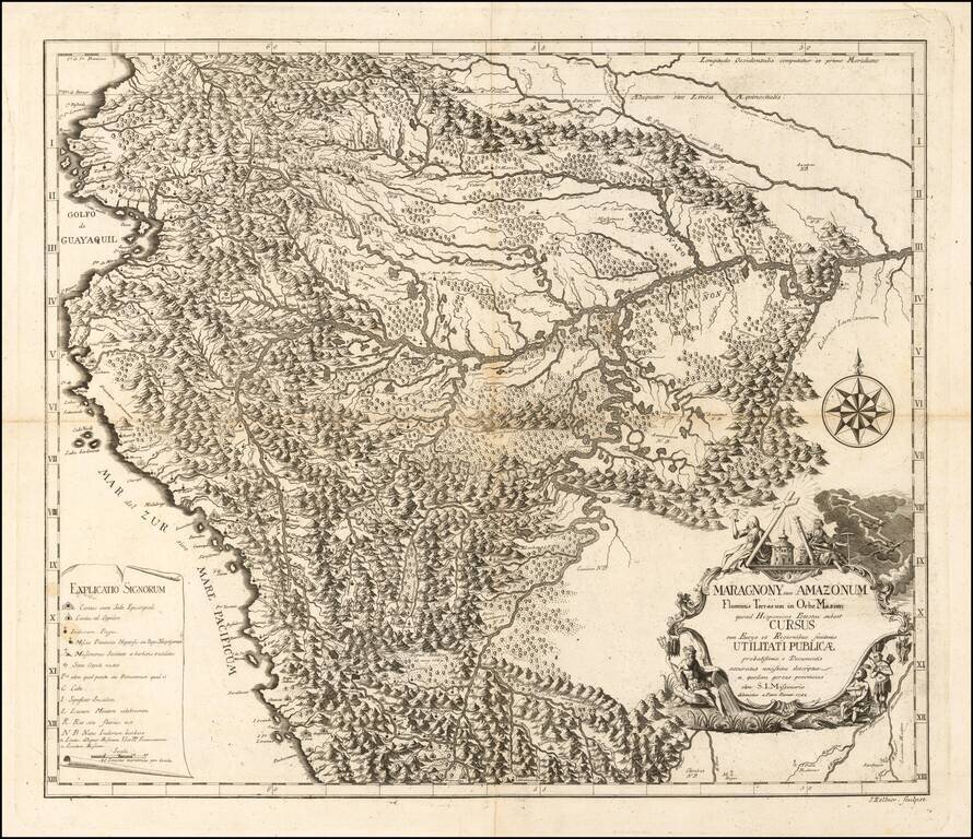
Previously Unknown First State of the Franz Xavier Veigl / Petrus Parcar Map of The Upper Amazon Region - Ecuador - Peru Rare Jesuit map of the Upper Amazon, including a large portion of Ecuador, Peru, northern Bolivia and the Brazilian Amazon State,...