![[Atlantis?] Ristretto Delle Carte presentate all' Academia delle Scienze di Parigi negli anni 1737 e 1752 dal Sig di Buache](/map/small/58667.jpg)
The First Americans Came To America via the Lost Continent of Atlantis?—Rare Italian Map from Work on the Origins of Americans Utilizing The Theories of Philippe Buache Very rare, Italian example of Buache’s theoretical geographic ideas on...
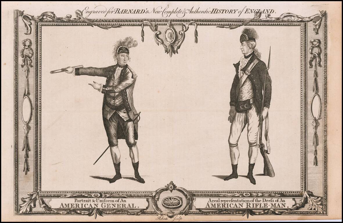
A contemporary depiction of American Revolutionary War figures set within a decorative border, engraved by Roberts. From "Barnard's New Complete & Authentic History of England."
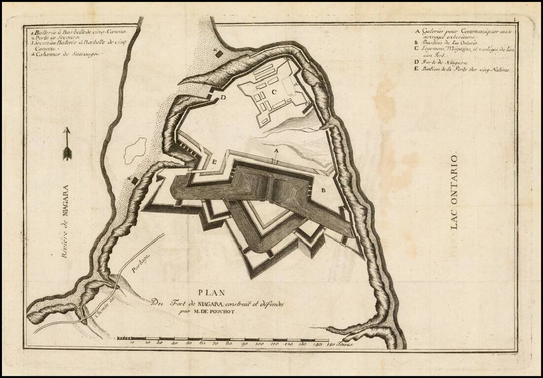
Rare French & Indian War era map of the region between Montreal and Fort Duquesne (Pittsburgh), including all of New York and New Jersey, and most of Pennsylvania. It exhibits a portion of the Theater of War, from Pierre Pouchot's Memoires sur le...
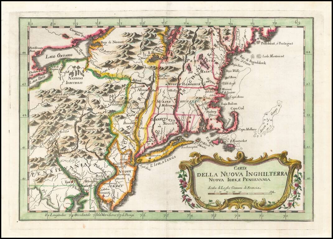
Rare Italian edition of Bellin's map of the Northeast and New England region, from his Teatro Della Guerre Marittima, published in Venice. The map covers the region from the Delaware River and New Jersey in the south to Maine and west to the...
![[Plymouth Bay, Cape Cod Bay, Duxbury Bay]](/map/small/51249.jpg)
Des Barres Chart of Plymouth Bay, Cape Cod Bay and Duxbury Bay Fine detailed sea chart of the area around Plymouth and Duxbury, Massachusetts, and covering Cape Cod Bay, Duxbury Bay and Plymouth Bay, published in London by Des Barres. The map shows...
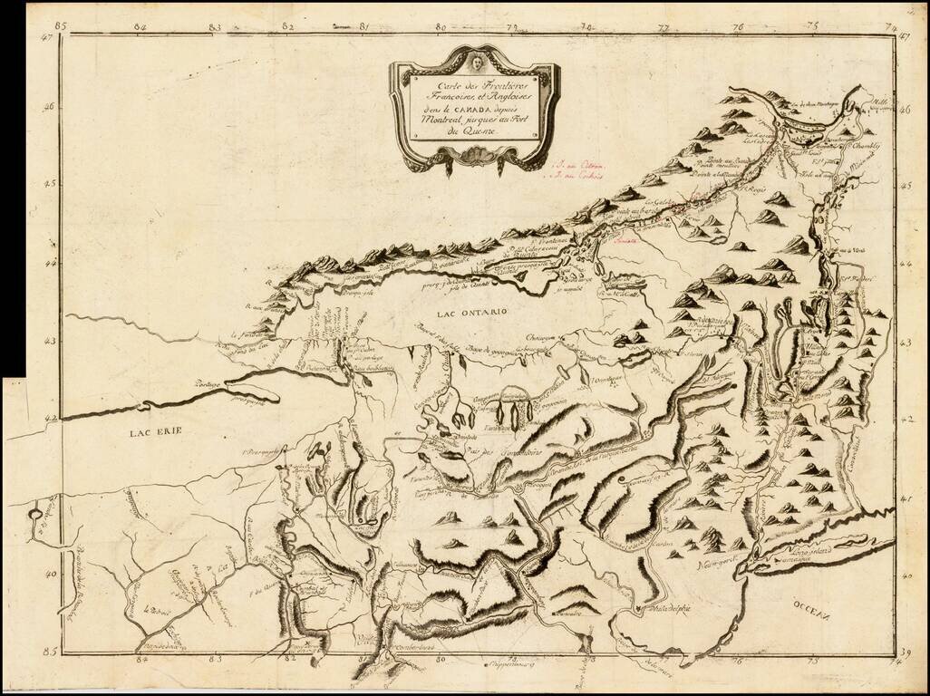
Rare French & Indian War era map of the fortifications at Fort Niagara, from Pierre Pouchot's Memoires sur le derniere guerre de L'Amerique Septentrionale. The map identifies in fine detail the construction and fortification of Fort Niagara, by...
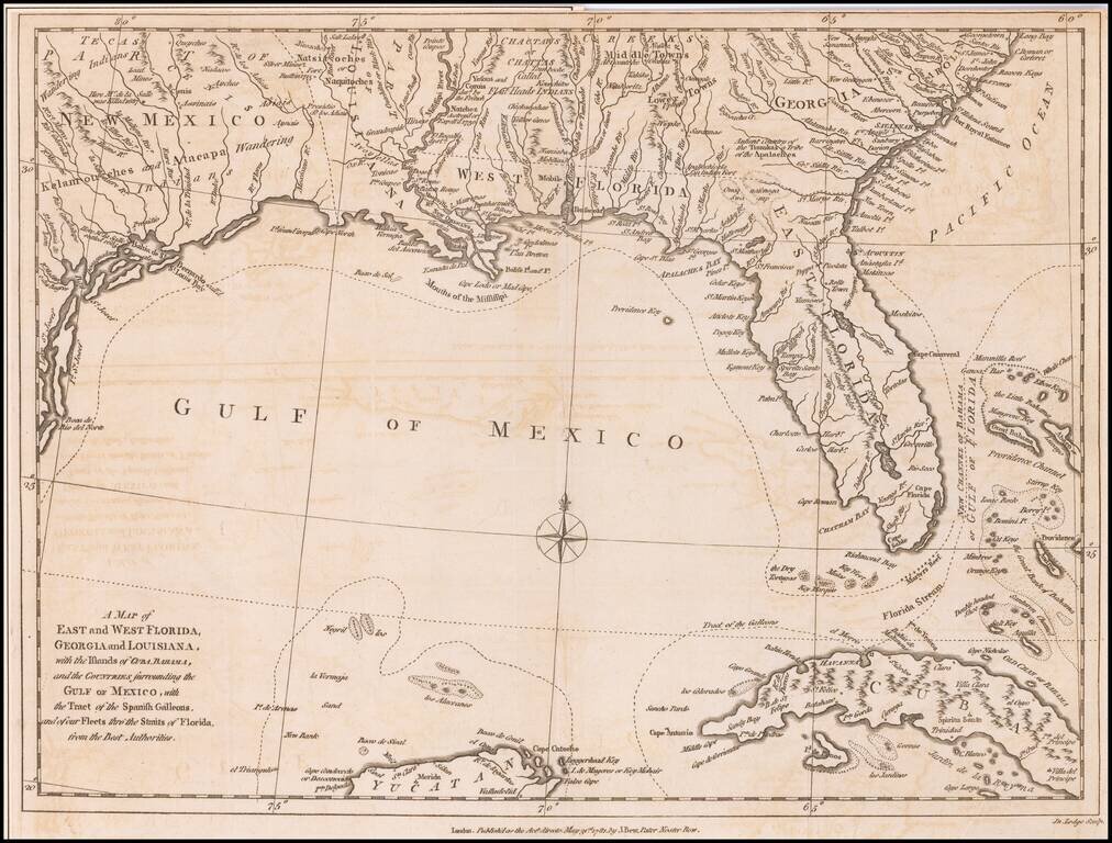
Antique Map of the Southeast United States During The American Revolution. Scarce Revolutionary War period map of the Southeastern part of the British Colonies in North America, Gulf Coast and Caribbean, illustrating the course of the Spanish Galleon...
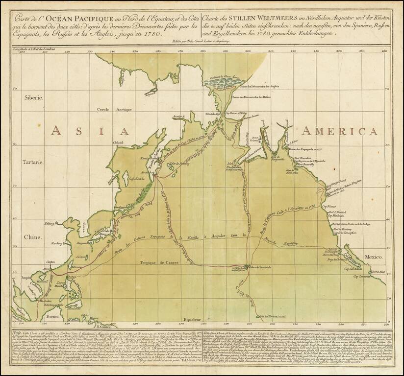
Striking Chart of the Northern Pacific, One of the Earliest to Show Hawai’i Rare chart of the Northern Pacific with the coasts of Asia and America, showing the voyage of the Spanish treasure galleons and Captain Cook’s third voyage. Based on...
![[East Coast of Prince Edward Island - Rollo Bay to Wood Islands]](/map/small/62849.jpg)
Rare chart of the East Coast of Prince Edward Island, centered on Cardigan Bay and Panmure Island. St. John's Island (Isle of St. John) was renamed Prince Edward Island in 1798, after Edward, Duke of Kent. This fine chart appeared in the Atlantic...
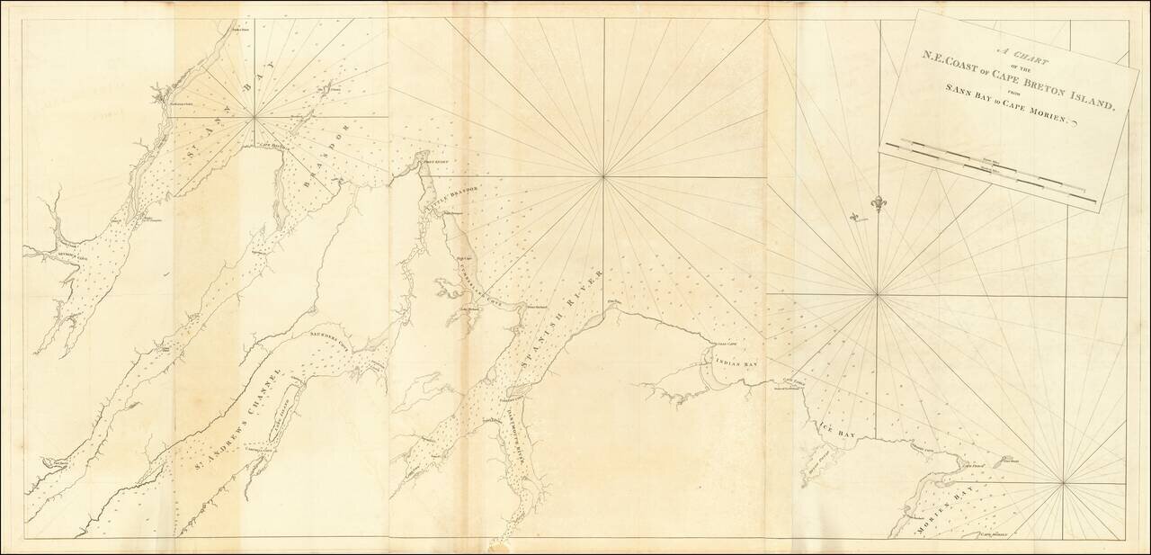
Rare chart of the North East Coast of Cape Breton, from Morien Bay to St Anne's Bay. This fine chart appeared in the Atlantic Neptune by Captain Joseph Frederick Wallet des Barres. The Atlantic Neptune was remarkable, multi-volume set of sea charts...
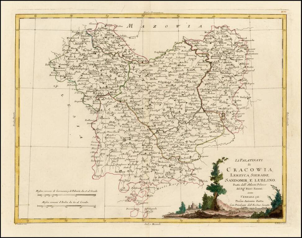
Decorative regional map of part of Poland. Major towns shown include Cracowia, Leczica, Sieradz, Radomisko, Ostzeszow, Lublin, and Sandomirsz. Issued as part of Zatta's Atlante Novissimo.
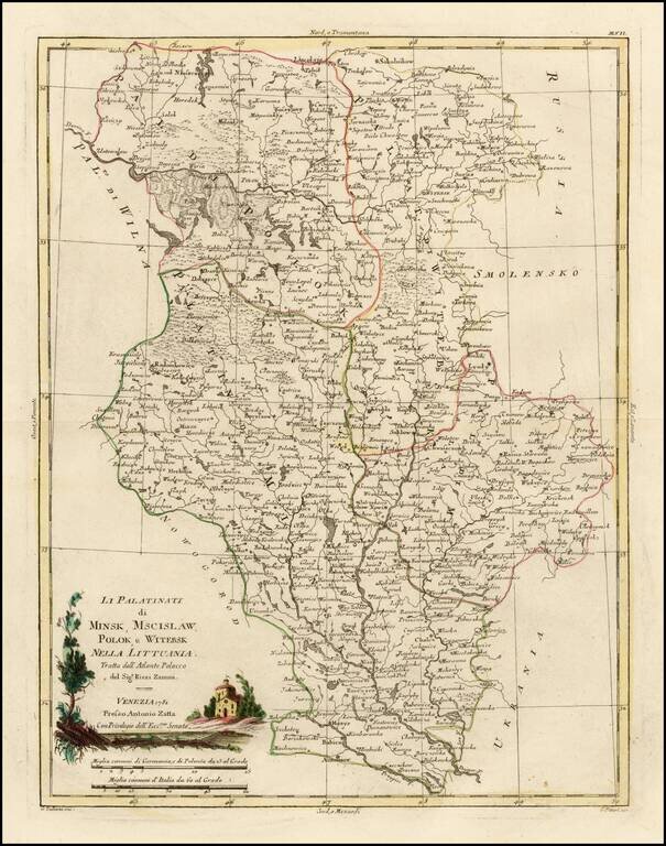
Decorative regional map of several Palatinates in modern day Belarus, centered on the Upper Dniepr River and Upper Dwina River. Issued as part of Zatta's Atlante Novissimo.
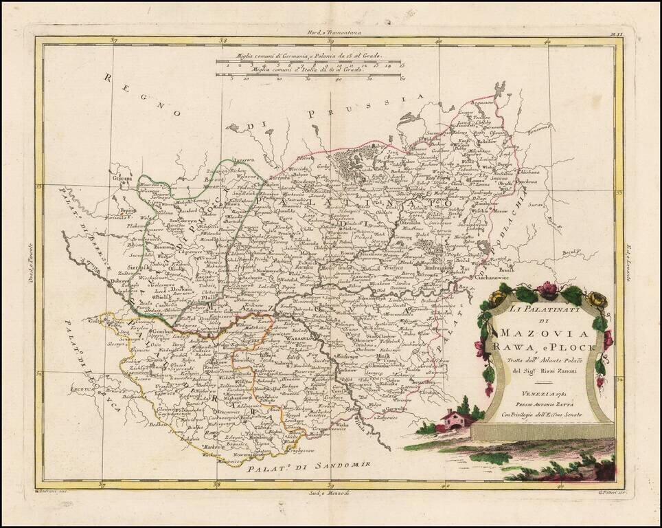
Decorative regional map of part of Poland. Major towns shown include Warsawia, Ieruzalem, Rawa, Lowicz, Ianowa, Nowidor, Radzilow, Nowygrod, Ciechanowiec, Minsk and Biala. Issued as part of Zatta's Atlante Novissimo.
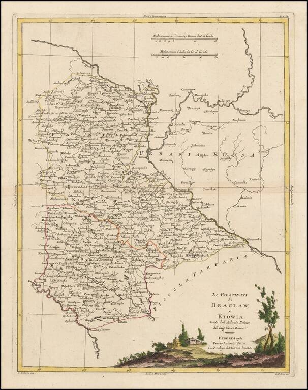
Decorative regional map of several Palatinates in modern day Ukraine and Belarus. The map shows the region east of the Dniester River, centered on Kiev. Issued as part of Zatta's Atlante Novissimo.

Rare highly detailed map of Asia Minor, Cyprus and environs, engraved by Lindeman, for a Dutch edtion of Pococke's Description of the East and Some other Countries, first published in London in 1745. Richard Pococke was born in Southampton and...
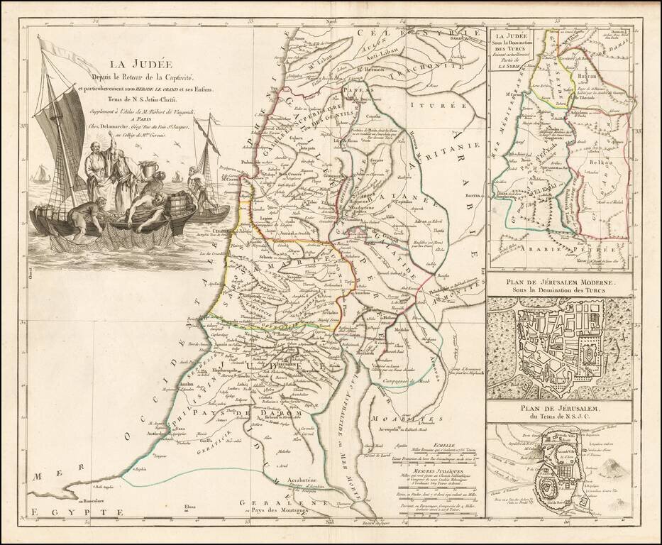
Decorative map of the Holy Land, published in Paris by Delamarche. The map includes large insets of Ancient and Modern Jerusalem and the Holy Land at the time of the domination by the Turks. Large striking cartouche.