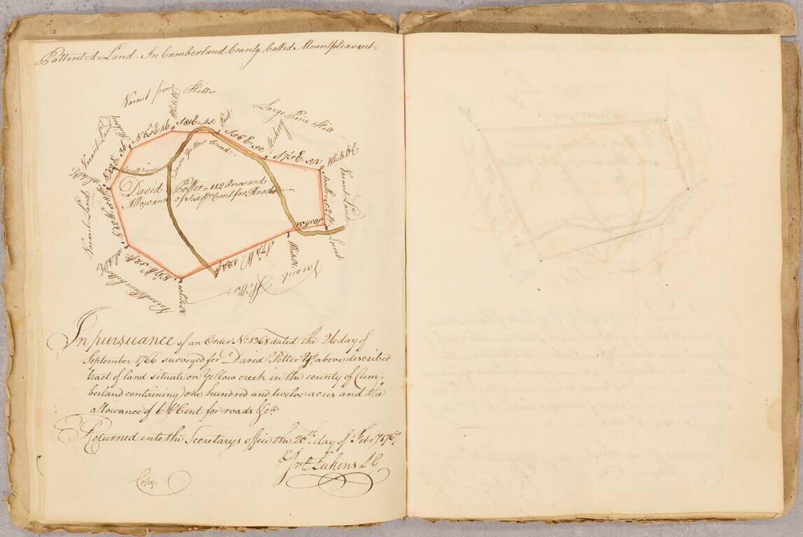
The Real Estate Journal of An Important Philadelphia Colonial Merchant Fascinating small archive, consisting of: James Hunter's Book of Land Draughts (1767 to 1789), consisting of approximately 60 written entries, most of which are finely executed...
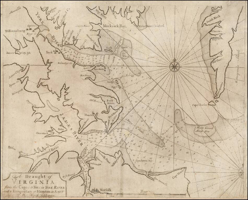
Rare Dublin Edition! Rare Dublin edition of Mark Tidemann's sea char of the region bounded by the York River , Williamsburg, James City Isle, Nansimond River, Elizabeth River, Norfolk, Cape Henry, Cape Charles, and the southern portion of Delaware,...
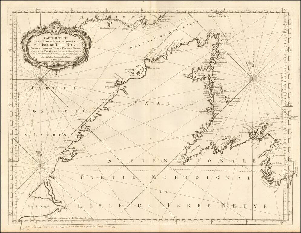
Detailed sea chart of northern part of Newfoundland and the mouth of the St. Lawrence River. The chart was produced by the Depot de la Marine toward the end of the Seven Years War (French & Indian War).
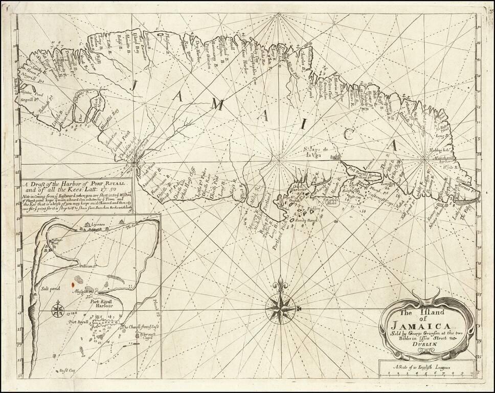
Rare Sea Chart of Jamaica, Published In Dublin! Rare Grierson sea chart of Jamaica, pubished in Dublin. Includes a large inset map of Port Royal. George Grierson (c.1678 - 1753) Scotish born George Grierson was one of the most important...
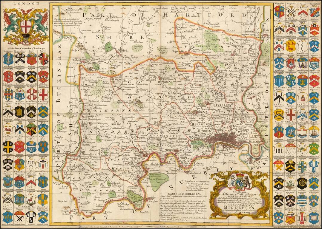
Fine large format map of the County of Middlesex, with London in the lower right corner. Includes 92 small coats of arms of the Free Companies in the county, and two larger decorative cartouches. A large and decorative 18th century map of Middlesex...
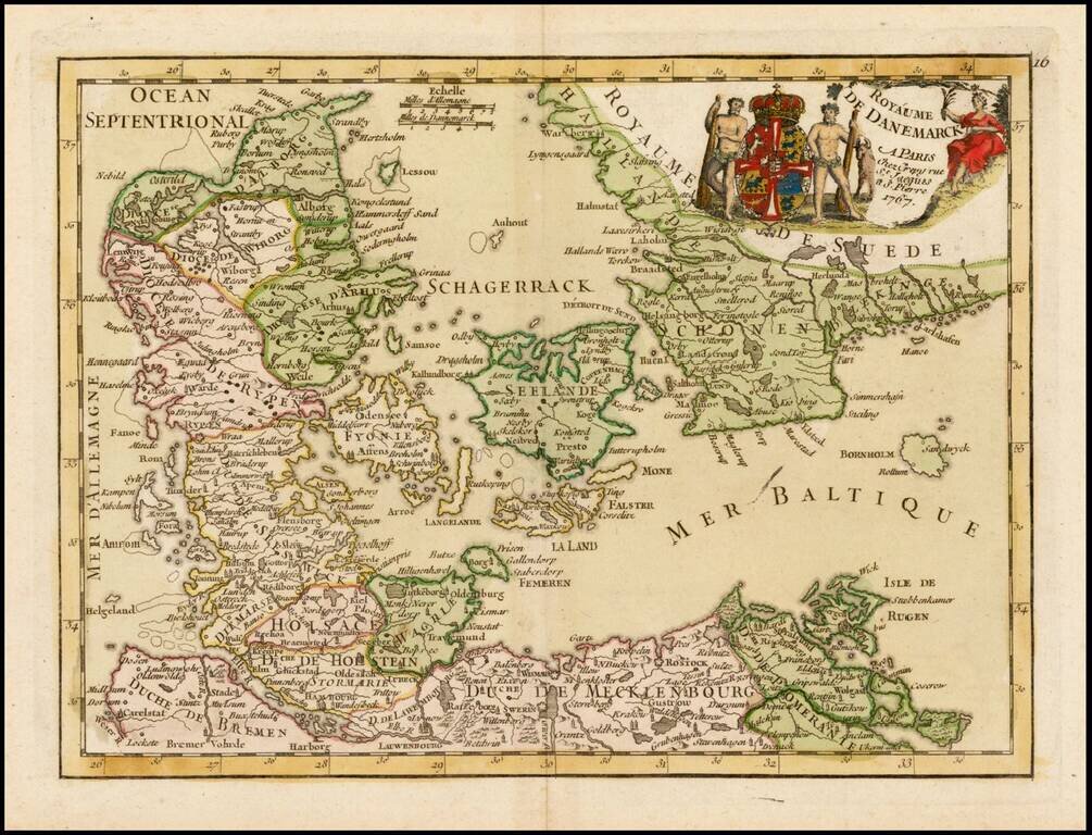
Decorative map of the Kingdom of Denmark, including contiguous parts of modern Sweden.