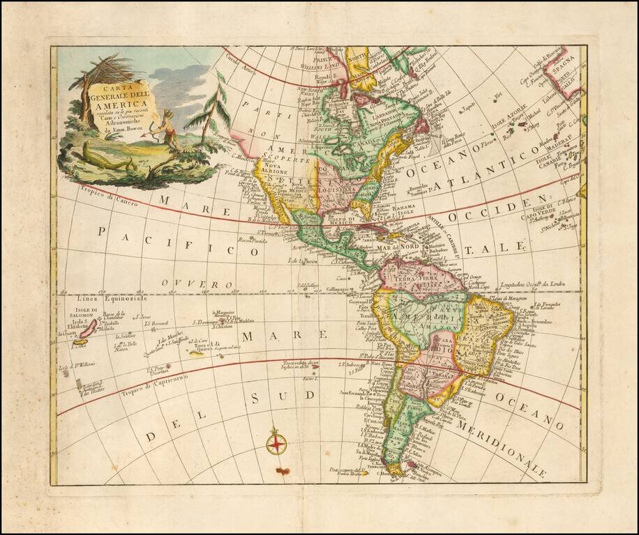
Rare Italian map of America, drawn from the work of Emanuel Bowen. Includes a large decorative cartouche. This is the first time we have ever seen this map.
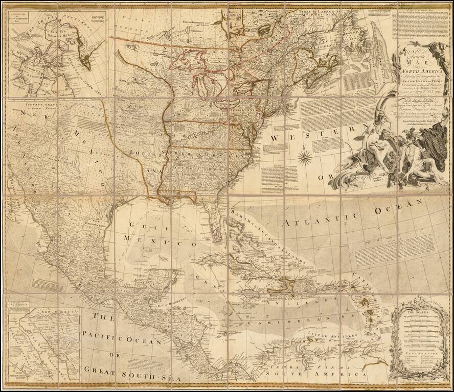
Second State of Bowen & Gibson's Iconic Map of North America Rare separately issued 1763 edition of Bowen & Gibson's important 4-sheet map of North America, one of the most enduring wall maps of North America published in the second half of...
Interesting map of the US and Canada at the end of the French & Indian War, based upon John Mitchell's seminal map of 1755. The map shows the many French and English Forts in the Mississippi and Ohio Valleys, along with numerous Indian Tribes on...
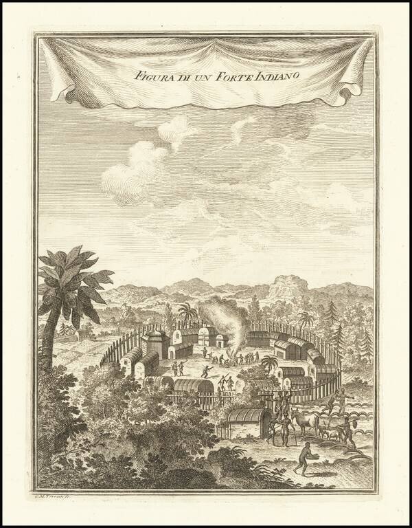
A Pomeiooc Village in Virginia Interesting view of a native American settlement, based upon De Bry. Includes dwellings, domestic animals such as oxen and donkeys [?], palisades, guns or muskets, and council fire. This image is derived from Theodor...
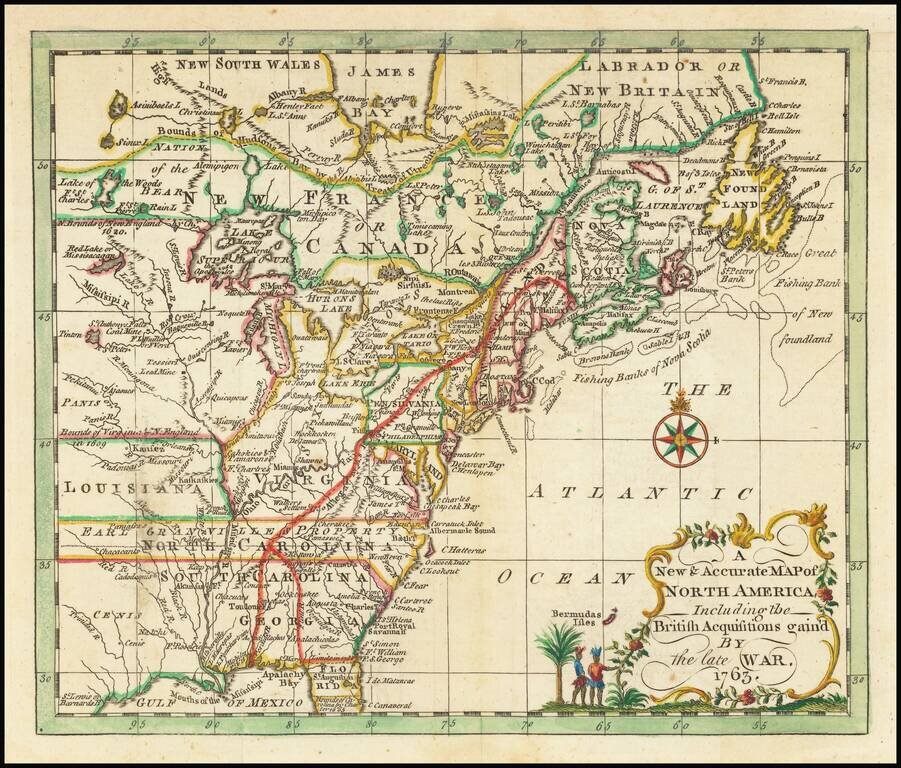
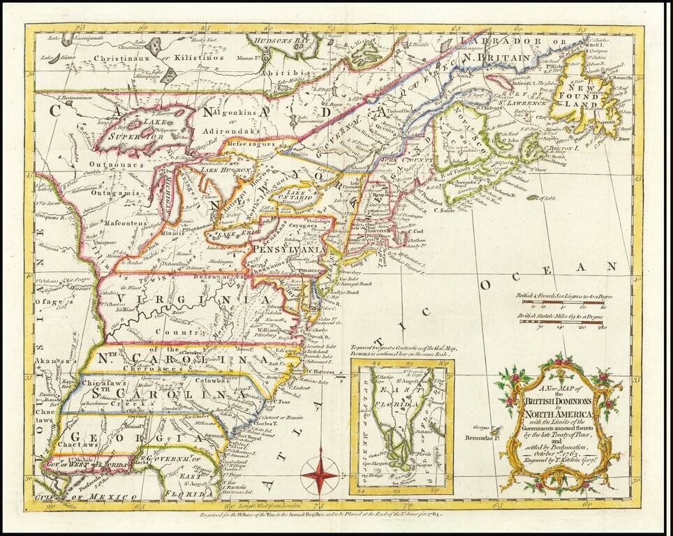
Rare map of the British Colonies in North America, which appeared in Entick's General History of the Late War. North Carolina, South Carolina, Virginia and Georgia all extend to the Mississippi River, with North Carolina noting Earl Granville's...
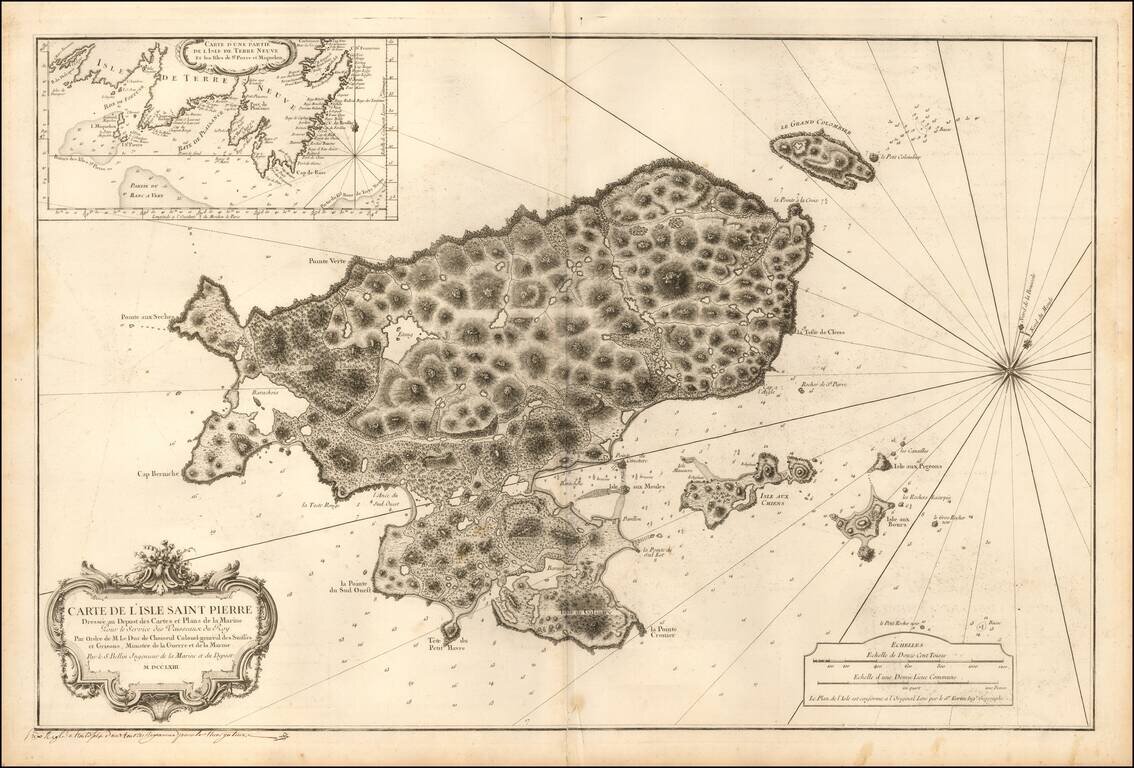
Detailed sea chart of Saint Pierre, one of the small islands in the Grand Banks retained by France under the Treaty of 1783. The chart was produced by the Depot de la Marine toward the end of the Seven Years War (French & Indian War) . Following...
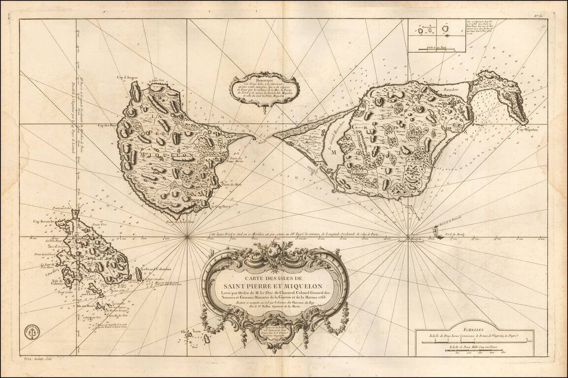
Detailed sea chart of the islands retained by France under the Treaty of 1783. The chart was produced by the Depot de la Marine toward the end of the Seven Years War (French & Indian War). Following the conclusion of the Seven Years' War, the...
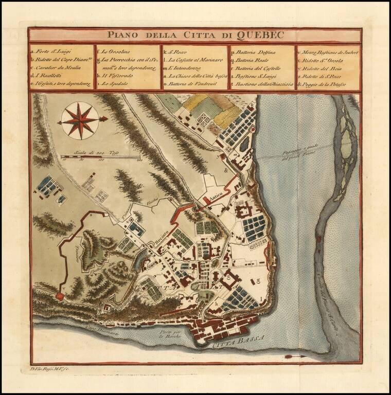
Finely colored plan of the town and fortifications of Quebec. The map illustrates the fortifications, as they existed during the French & Indian War.
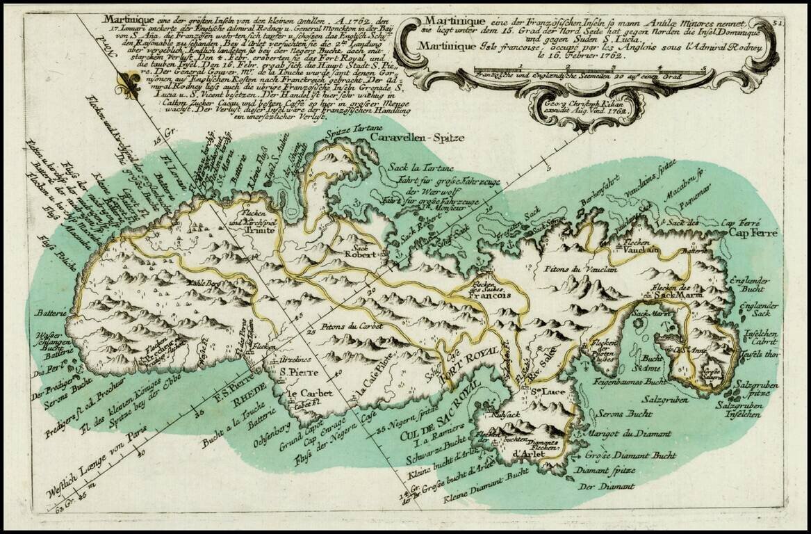
Scarce map of Martinique, showing both coastal and topographical details, from Heiden's Americanische urquelle derer innerlichen kriege des bedrängten Teutschlands. . . The map includes a number of place names and some topographical details. The...
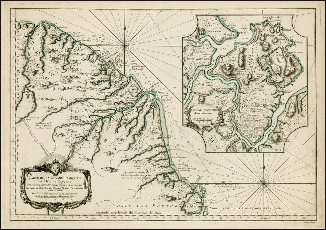
Detailed and well engraved sea chart of French Guiana and the island of Cayenne. The map was pubilshed in 1763 by Bellin (1703-72), a prolific cartographer assigned the Ministry of the French Navy. The chart shows soundings, anchorage's, channels,...
Detailed and well engraved sea chart of French Guiana and the island of Cayenne. The map was pubilshed in 1753 by Bellin (1703-72), a prolific cartographer assigned the Ministry of the French Navy. The chart shows soundings, anchorages, channels,...
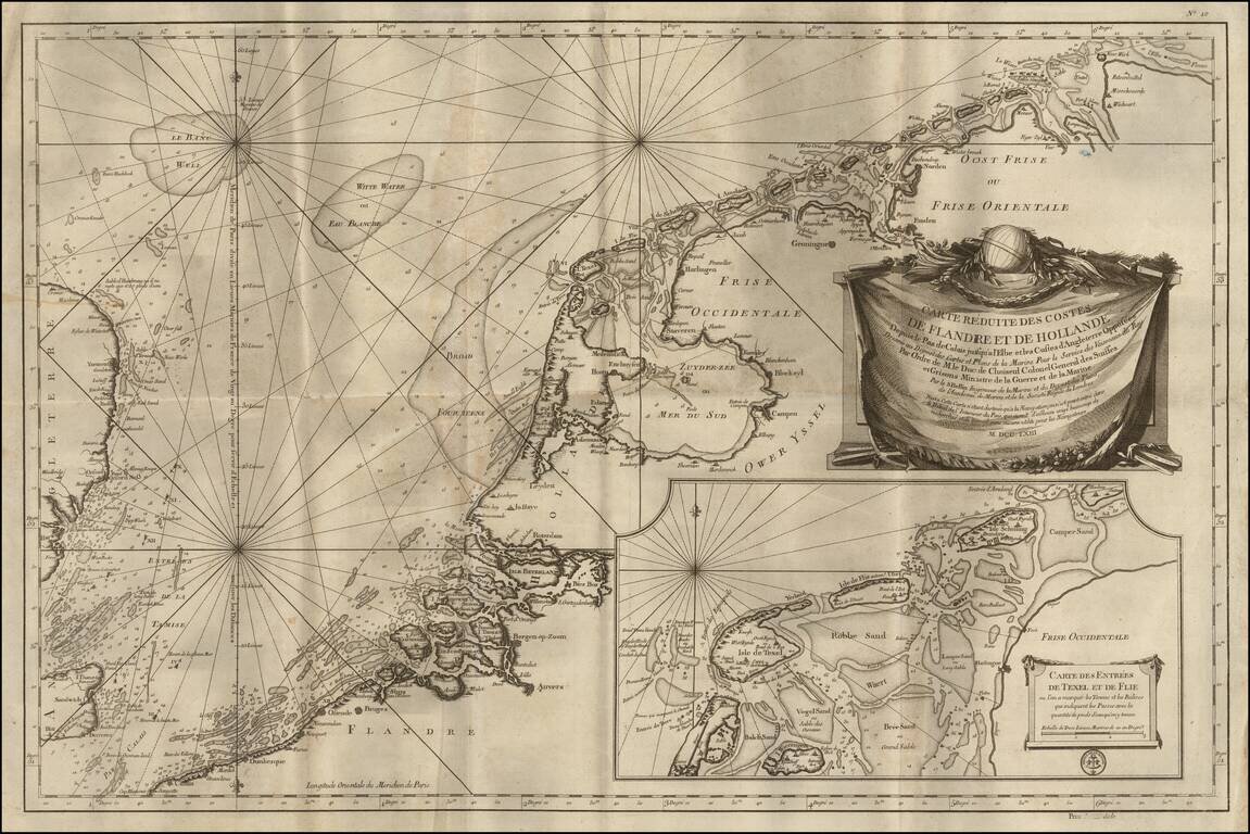
Finely executed sea chart of the coast of the Low Countries and a bit of the opposite coast of England, published by the Depot de La Marine. This would have been one of the best and most up-to-date coastal charts of the region published in the middle...
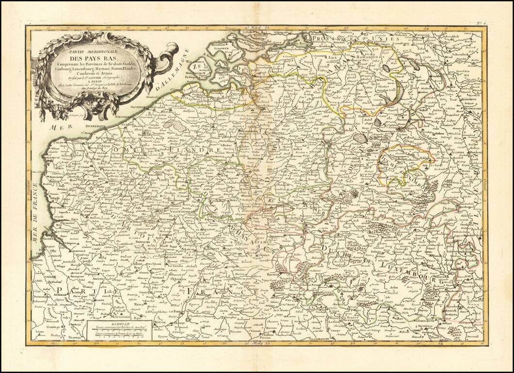
Decorative map of the Southern part of the Low Countries, published in Paris.
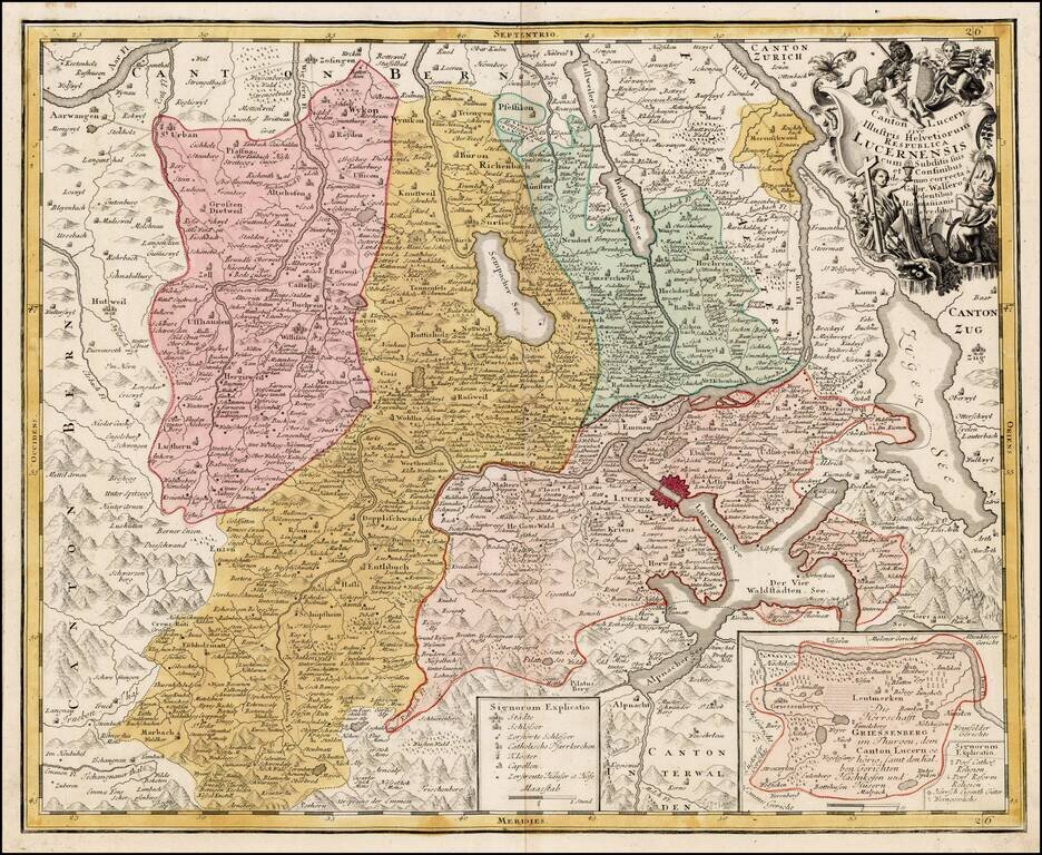
Detailed map of the Kanton of Luzerne in Switzerland with decorative cartouche.
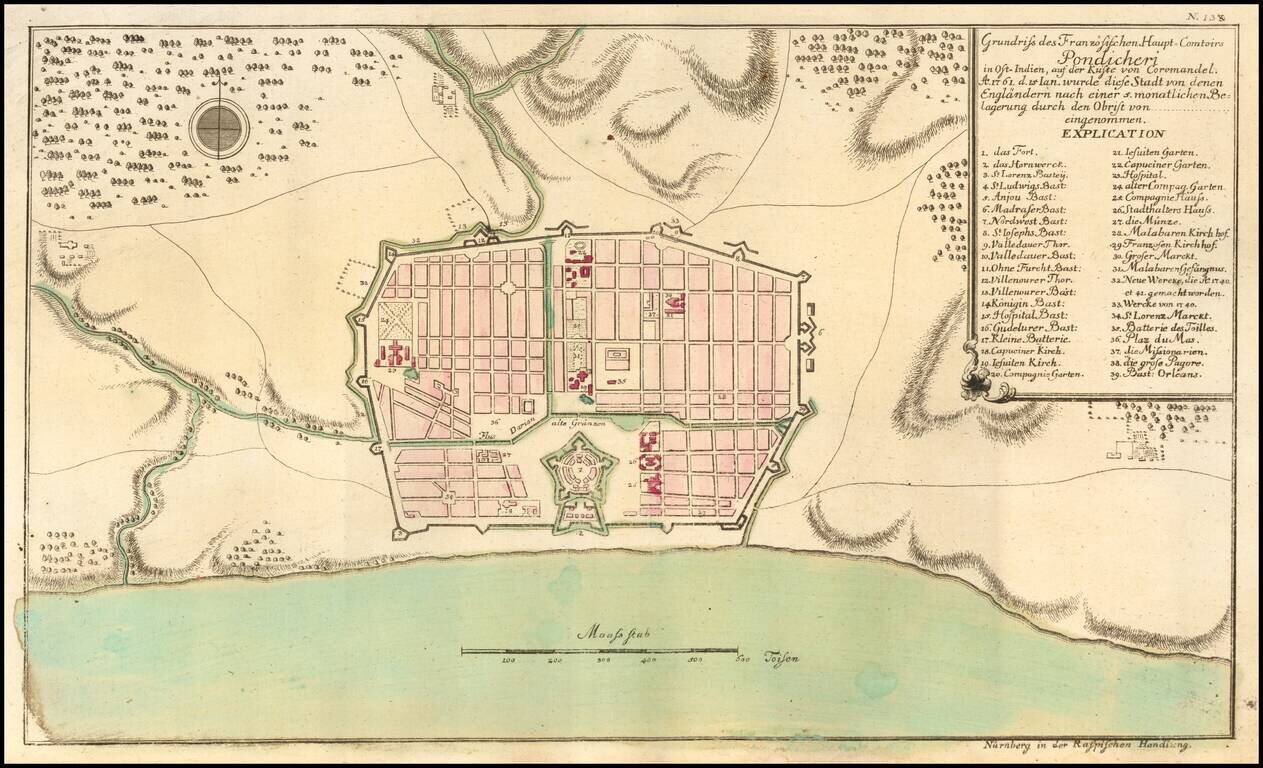
Puducherry at the time of its Capture by the English in 1761 Scarce early plan of the area around Puducherry, from Raspe's Schauplatz des Gegenwaertigen Kriegs... Shows fortifications, the Hospitals, Jesuit Church, Capuchine Church, English Church,...
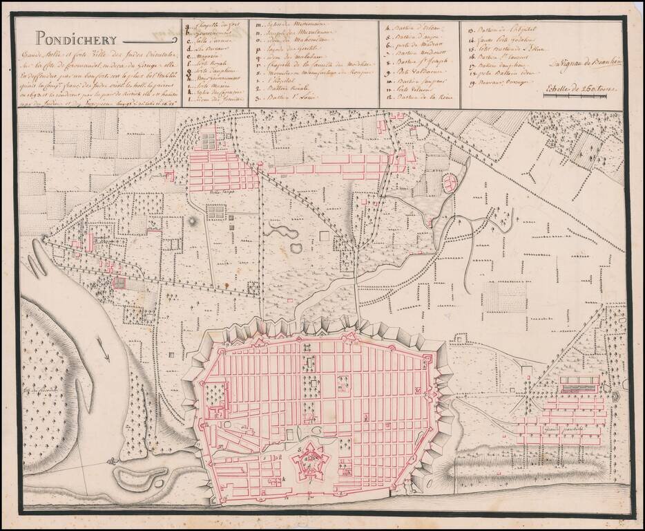
An Early Manuscript Map of Pondicherry Prior To Its Reconstruction After The Seven Years War Finely executed manuscript map of Pudicherry, India, prepared shortly after the French re-took the town after the end of the Seven Years War. Oriented with...