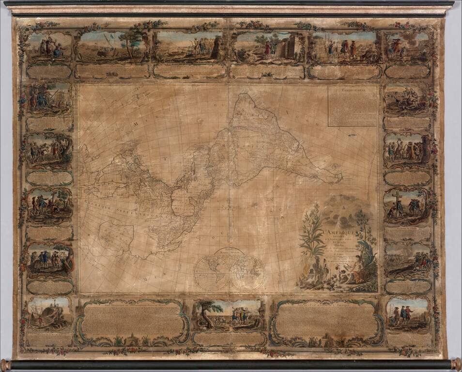
Important 18th Century wall map of America, one of the earliest obtainable printed maps to show the Sea or Bay of the West and the earliest wall map of America to show this configuration. The map is oriented with east at the top, one of only a few...
Fascinating map of America, featuring an unusual northwest coast of America, which includes Martin d'Aguilar's strait which provides for a Northwest Passage via the Great Lakes, via what would likely be the so-called River of the West. The rest of the...
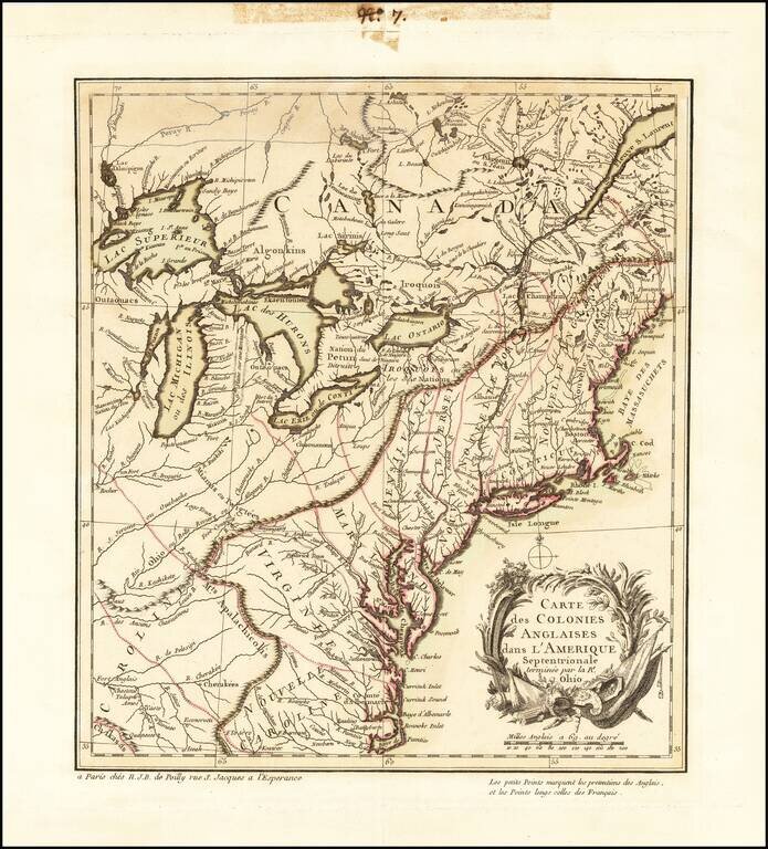
The First French Map of the French and Indian War. A French Reply To Henry Overton's Inflammatory "George Washington" Map. Rare first state of this fascinating broadside map focusing on the recent British and French hostilities in the Ohio Valley,...
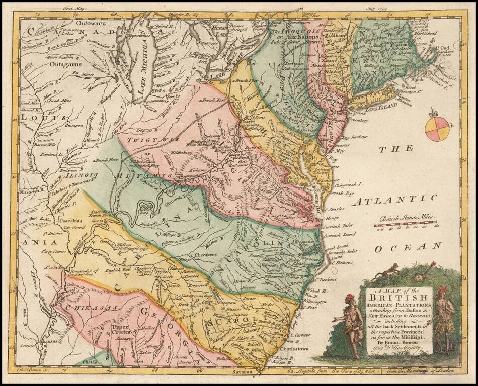
Nice example of this early map of the British Colonies, issued one year prior to the seminal map of John Mitchell. The map is based largely upon the work of D'Anville. The map is quite remarkable for the time period, showing several early Western...
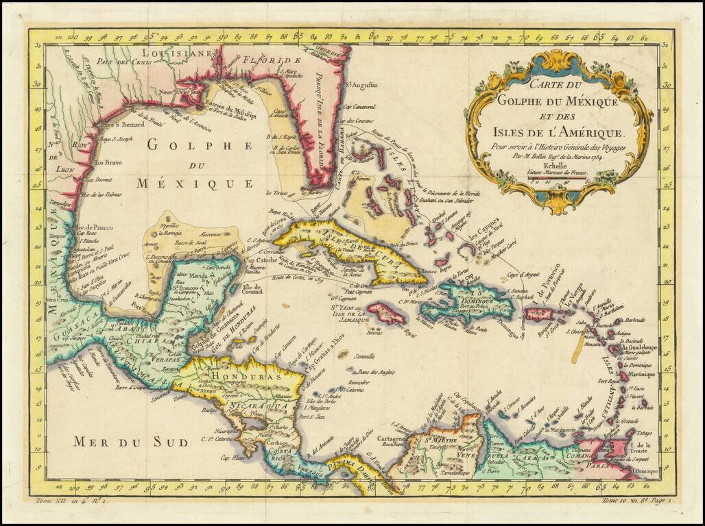
Interesting and detailed map of Florida, the Gulf Coast, Central America, and the Caribbean. The map shows the route of Ponce de Leon when he discovered Florida, Cortez's route in 1519, and that of De Cordova in 1517. The map features a decorative...
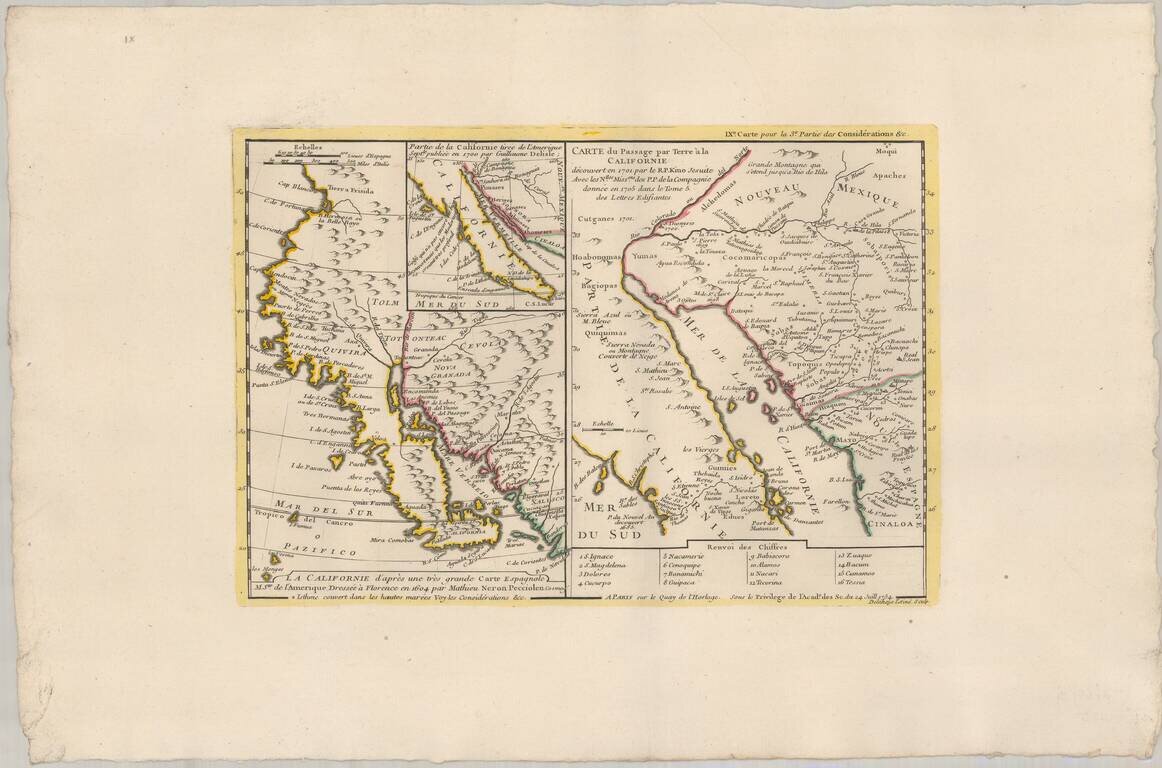
Truly beautiful example of a historically important 18th century map of California. Bauche's mapsheet comprises three mappings of California as a peninsula, following the discoveries of Eusebio Kino, the Italian Jesuit missionary. Bauche includes the...
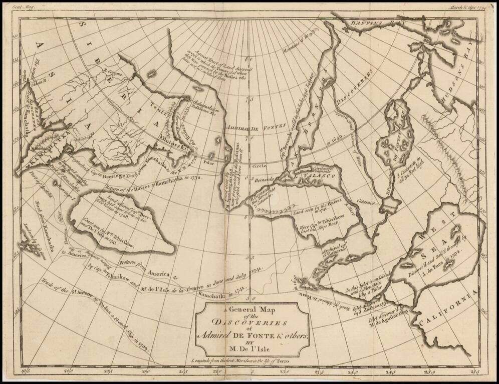
One of the earliest maps illustrating the Sea of the West and the various other cartographical misconceptions associated with De Fonte. Includes tracks and notes from the voyages of Bernarda, Tchirikow, de Aguilar, de Fuca, Behring and various...
![[Saint Croix, Virgin Islands] Tilforladelig Kort over Eylandet St. Croix udi America Saaledes som det ved en acurat udmaaling er befunden med Quarterernes Navne og enhver Plantagies Nummer efter hvilkede udi Matriculen findes Indforte og til enhver Kiobe](/map/small/69471.jpg)
The First Reliable Chorographic Map of St. Croix Rare Danish map of the island of St. Croix, drawn by Jens Michelsen Beck and engraved by O.H. De Lode in Copenhagen. First published in 1754, Beck's map of St. Croix is the first modern map of St....
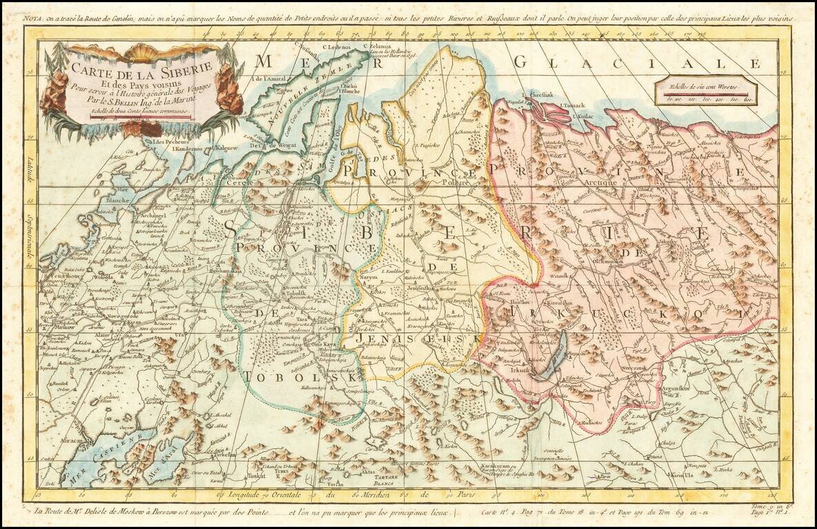
Detailed map of Siberia, extending from the White Sea and the Caspian Sea in the west to Irkuckoi Province, Jakutky on the Lena River and regions just to the east. Centered on the Jenisi River. Nicolas Bellin was the official map maker to the King of...
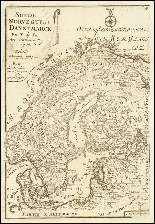
Rare late variant of De Fer's small map of Scandinavia.
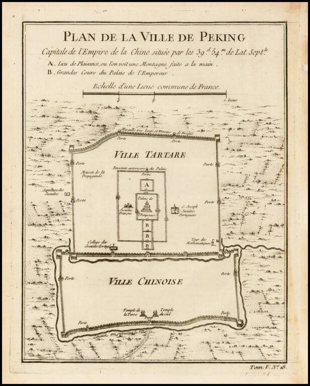
Finely engraved plan showing the walls, gates and inner details of the city of Peking (Beijing). The city is divided into the Ville Tartare and Ville Chinoise, with Emperor's Place and French Jesuit and Portuguese Jesuit missions shown in the Ville...