![[Celestial Atlas] Atlas Coelestis | Atlas Novus Coelestis in Quo Mundus Spectabilis, et in Eodem tam Errantium Quam Inerrantium Stellarum Phoenomena Notabilia, Crica Ipsarum Lumen...](/map/small/66645.jpg)
A Superb Example with Rich Original Hand-Coloring. Engraved allegorical additional title by J.C. Reinsperger after J.J. Preisler, title printed in red and black with engraved vignette, letterpress index, 30 double-page engraved plates all of which in...
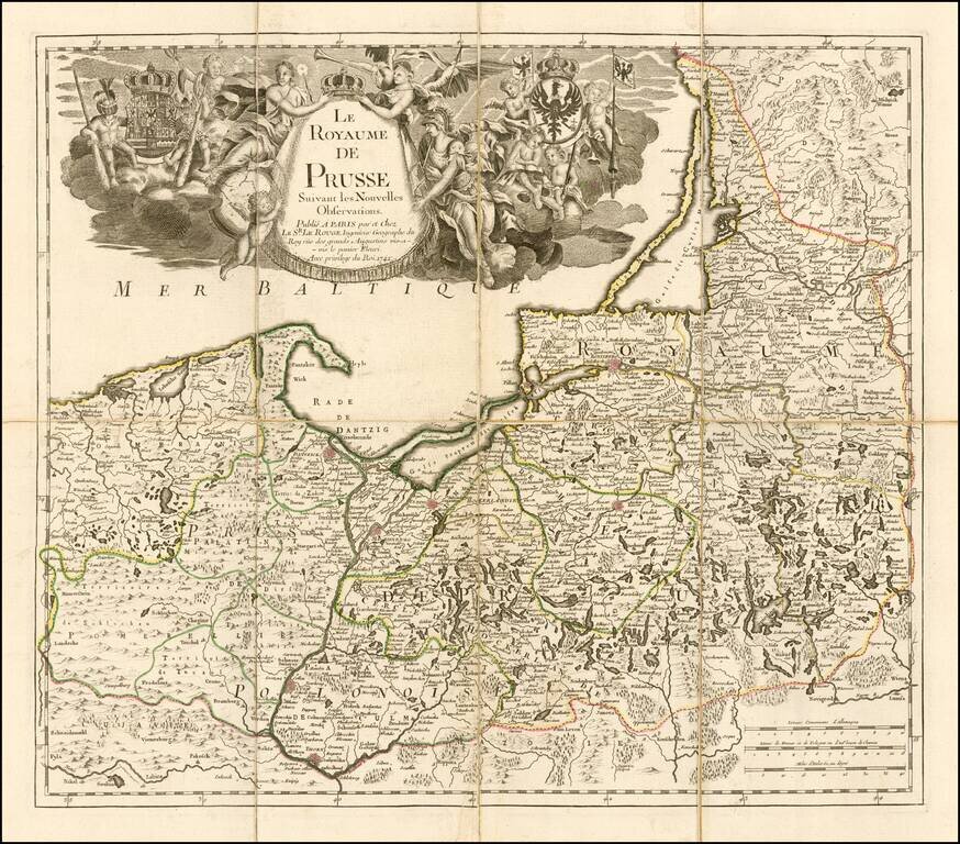
Fine separately issued example of Le Rouge's map of the Kingdom of Prussia, incorporating Poland and the Baltic countries. The map was published two years into the reign of Frederick II (1712-1786) as 'king in Prussia." Includes a fine elegant...
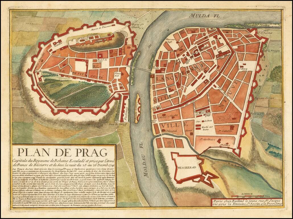
Striking plan of Prague, published in Paris by Jean Baillieul. The map shows French Army taking Prague in December 1741, during the War of Austrian Succession.
![[Bohemia / Czechia] Le Royaume De Boheme Divise en 17 Cercles ou Prectures avec Partie Misnie de Silesie et de Moravie . . . 1742](/map/small/61339.jpg)
Detailed map of Bohemia, centered on Prague. Includes towns, roads, rivers, lakes and a number of other details. A rare late state of the map.

Elaborate celestial model, published in Nuremberg by Doppelmayr. This chart illustrates the satellite systems of Jupiter and Saturn, contrasted with the Earth-Moon system according to the observations of Giovanni Domenico Cassini in Bologna in 1661.