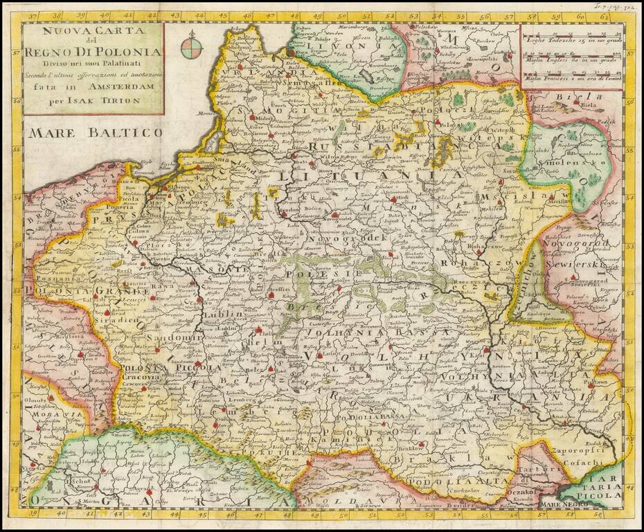
Detailed map of the Kingdom of Poland, extending to Ukrainia and the Black Sea. The present example is the first edition of the map, pre-dating the use of the map in the Italian edition of Salmon's Geography. The two states can be differentiated by...
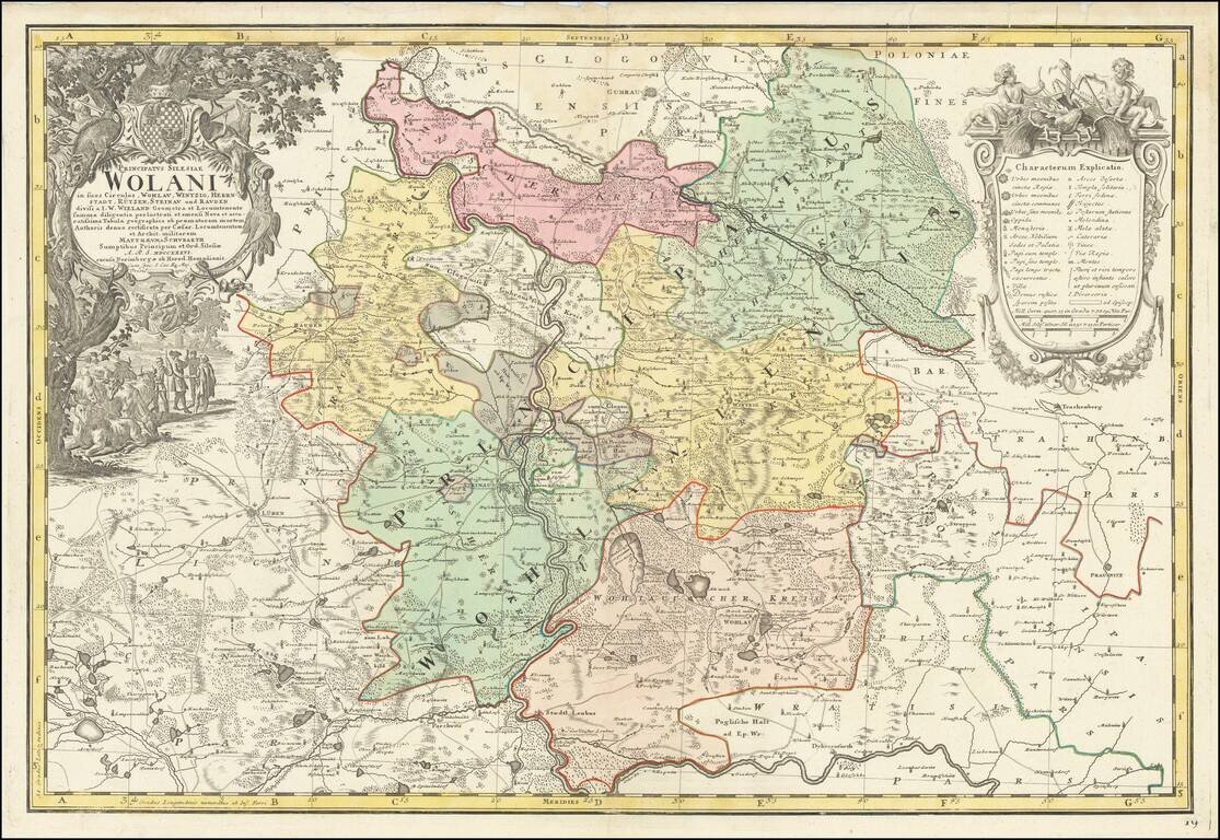
Fine large map of part of Wohlau, Parchwitz, Lüben and Herrnstad, the northwestern part of Breslau, originally drawn by Johann Wolfgang Wieland (?-1736) and Mattheus von Schubarth (1723-1758). The map is dissected by the Oder River, The Atlas...
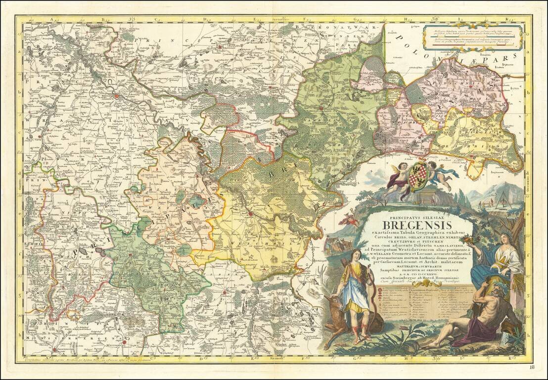
Fine large map of part of the Northern part of Silesia, originally drawn by Johann Wolfgang Wieland (?-1736) and Mattheus von Schubarth (1723-1758). The map is dissected by the Oder River, The Atlas Silesiae, was a large scale atlas of Silesia,...
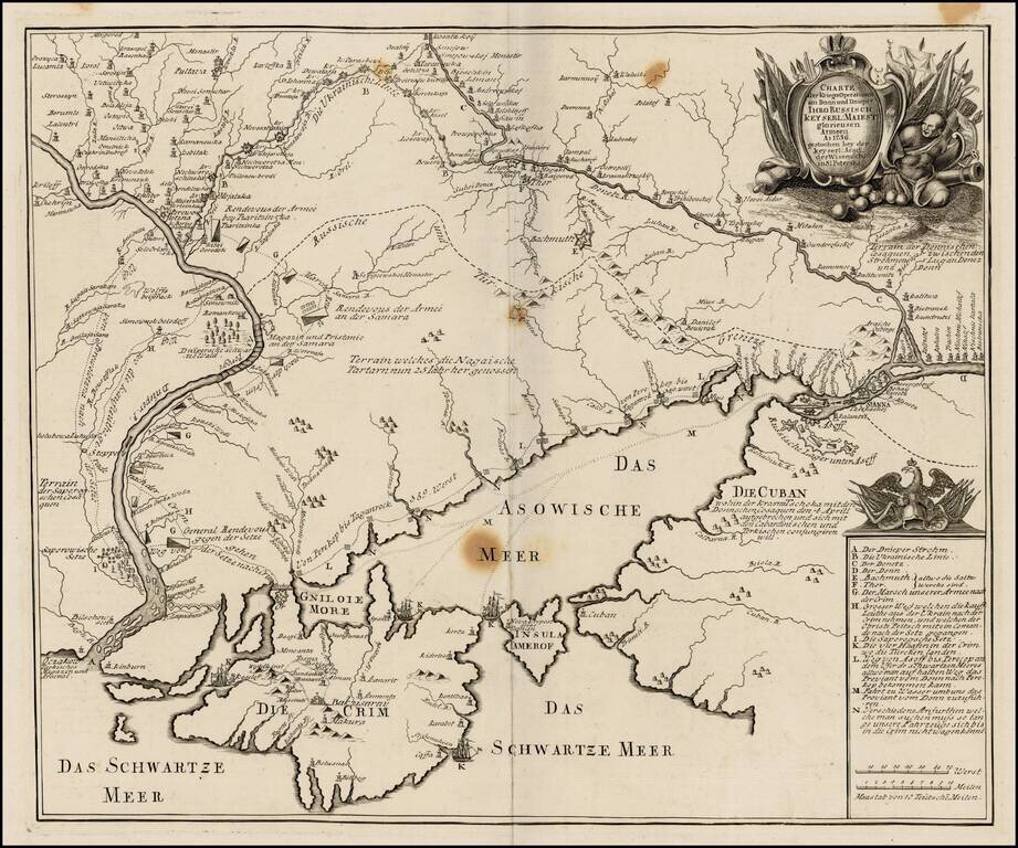
Very rare separately published map of the southern part of Ukraine, published by the Royal Academy in St. Petersburg. The map provides a detailed account of the battles between the Russian and Turkish Armies. The map was later copied in Augsburg by...
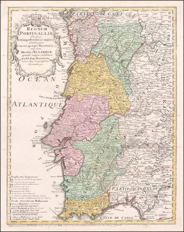
Detailed map of Portugal and the Algarve, first published by Johann Baptist Homann in 1736. The map is colored by provinces, showing towns, rivers, mountains, harbors, roads, etc. Very large title cartouche with figures and a coat of arms.